| Pages:
1
2 |
David K
Honored Nomad
        
Posts: 65236
Registered: 8-30-2002
Location: San Diego County
Member Is Offline
Mood: Have Baja Fever
|
|
Quote: Originally posted by 4x4abc  | Quote: Originally posted by David K  | Lacy, yes.
You guys are really good today!!
TW, that's what was left of the Flying Sportsman Lodge pier, made famous on the cover of Ray Cannon's 1966 book, Sea of Cortez.
|
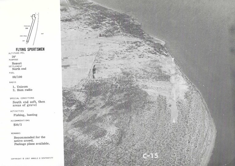
can you post a copy of the page about Flying Sportsmen Lodge airport in the Senterfitt book? Would like to figure out the direction.
|
Of course!
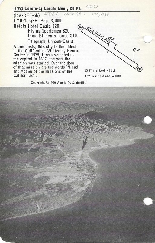
I was surprised it was not in the 1972 edition, but by then the municipal airport, south of town, was paved, nearby the resort.
In the 1969 edition pages (some were included in my 1972 edition), the municipal dirt airport was north of town and had already closed the Flying
Sportsman runway.
So, we go to the 1967 edition to see the original runway, just south of the resort, and parallel to the coast, more or less...
Note the pier near the top of the photo, as it was directly in front of the Lodge. The white arrows point out the ends of the runway, mid-lower right
of image close to the shoreline...
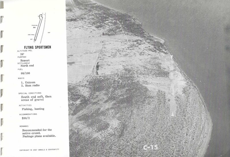
Will you show on Google Earth where the runway would be, today?
|
|
|
David K
Honored Nomad
        
Posts: 65236
Registered: 8-30-2002
Location: San Diego County
Member Is Offline
Mood: Have Baja Fever
|
|
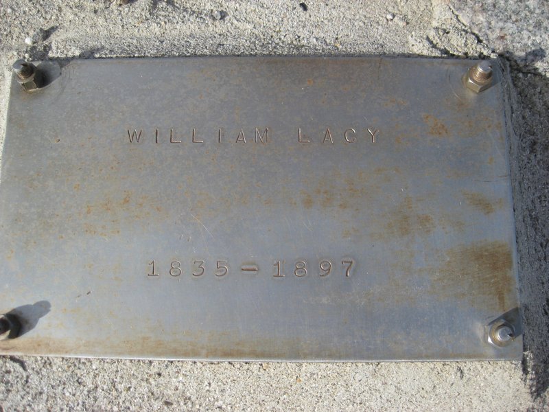
Here is the history of Molino de Lacy (originally named Molino de San Francisquito), near Puerto de San Francisquito (what today we call Punta Final
Resort): William Lacy Story (Molino de Lacy founder)
|
|
|
4x4abc
Ultra Nomad
    
Posts: 4430
Registered: 4-24-2009
Location: La Paz, BCS
Member Is Offline
Mood: happy - always
|
|
working on it
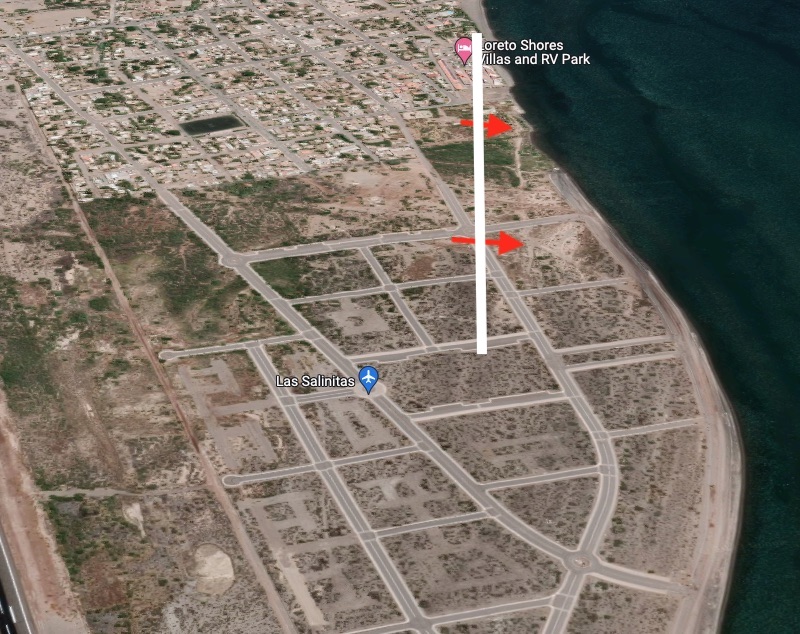
can you please show the page for the old municipal Loreto airport?
Harald Pietschmann
|
|
|
David K
Honored Nomad
        
Posts: 65236
Registered: 8-30-2002
Location: San Diego County
Member Is Offline
Mood: Have Baja Fever
|
|
You bet!
|
|
|
StuckSucks
Super Nomad
   
Posts: 2358
Registered: 10-17-2013
Member Is Offline
|
|
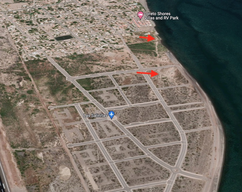
Perhaps here?
|
|
|
David K
Honored Nomad
        
Posts: 65236
Registered: 8-30-2002
Location: San Diego County
Member Is Offline
Mood: Have Baja Fever
|
|
Looks good to me!
I wonder if Harald is able to plot the other one?
|
|
|
4x4abc
Ultra Nomad
    
Posts: 4430
Registered: 4-24-2009
Location: La Paz, BCS
Member Is Offline
Mood: happy - always
|
|
nope - here:
[Edited on 2-2-2023 by 4x4abc]
Harald Pietschmann
|
|
|
4x4abc
Ultra Nomad
    
Posts: 4430
Registered: 4-24-2009
Location: La Paz, BCS
Member Is Offline
Mood: happy - always
|
|
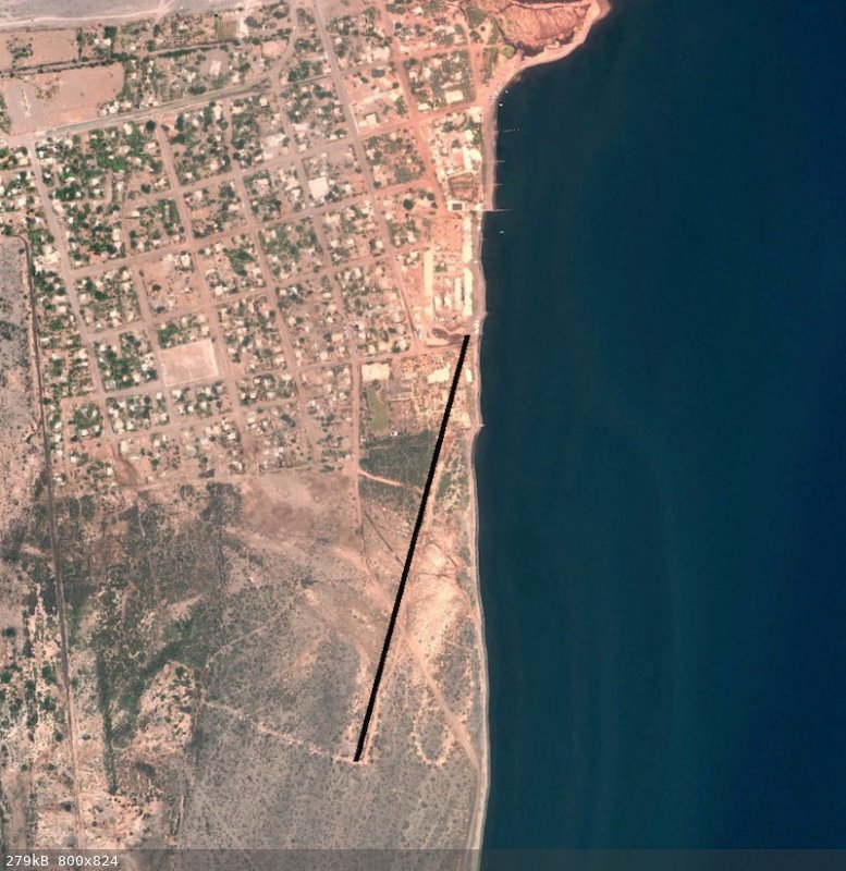
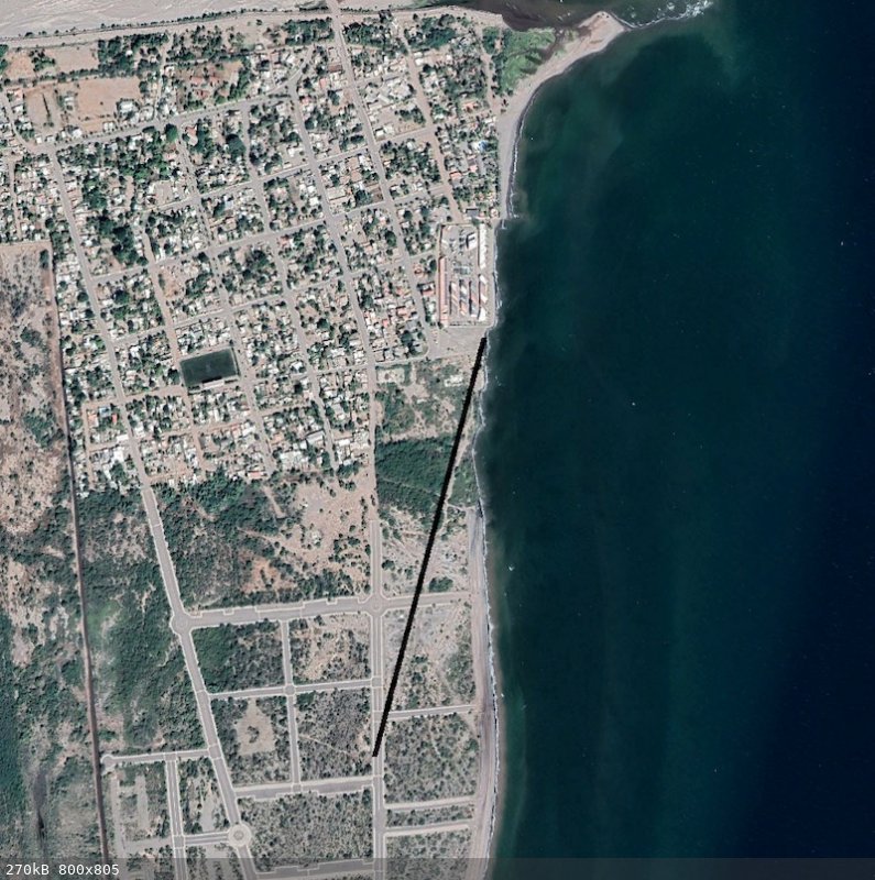
OK - Flying Sportsmen airstrip
I used the oldest 2006 Google Earth image first
the 1967 Senterfitt Baja map shows the airstrip at 20 - 28 (200 degrees north)
could not find the length, but the layout below should be pretty close with 1,650 ft
with the more current Google Earth image it looks like this:
Harald Pietschmann
|
|
|
4x4abc
Ultra Nomad
    
Posts: 4430
Registered: 4-24-2009
Location: La Paz, BCS
Member Is Offline
Mood: happy - always
|
|
the old Loreto Municipal airport was difficult
at least I had the length of 4,224 ft and the aerial image
here is how it would look like today
notice another smaller airstrip to the left
it's on the topo maps, but I don't know its purpose
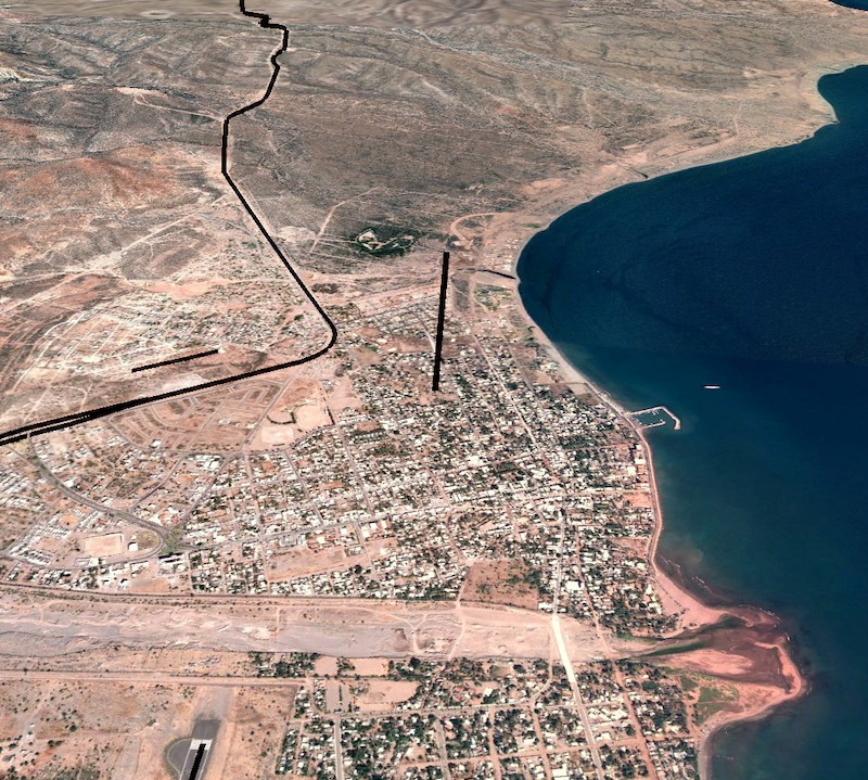
and here are all 4 former and present airfields together:
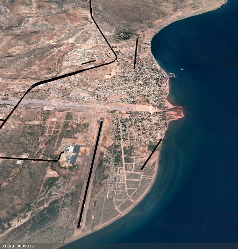
Harald Pietschmann
|
|
|
JZ
Select Nomad
      
Posts: 12613
Registered: 10-3-2003
Member Is Offline
|
|
Looking at these images, I just realized, of all the times I've been out on a boat around Loreto I've never seen a plane coming in to land.
|
|
|
David K
Honored Nomad
        
Posts: 65236
Registered: 8-30-2002
Location: San Diego County
Member Is Offline
Mood: Have Baja Fever
|
|
Great work Harald!
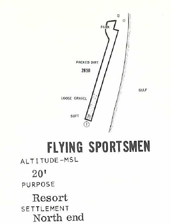
The Flying Sportsmen's runway length is given, in tiny text, on the left side of the runway diagram.
Also, each runway is shown on the Senterfitt map of 1967 (click twice for super-zoom): 1967 Airports of Baja Map
Both Loreto airports are shown. The first number for an airport is the elevation (feet). The second number is the runway length (in 100s of feet). It
shows the Flying Sportsmen as 20---28 (20 feet ASL, 2800 ft. runway.
|
|
|
4x4abc
Ultra Nomad
    
Posts: 4430
Registered: 4-24-2009
Location: La Paz, BCS
Member Is Offline
Mood: happy - always
|
|
Quote: Originally posted by David K  | Great work Harald!
The Flying Sportsmen's runway length is given, in tiny text, on the left side of the runway diagram.
|
the resolution on BajaNomad does not allow for any detection of small numbers
Harald Pietschmann
|
|
|
Almost
Junior Nomad

Posts: 30
Registered: 1-18-2022
Member Is Offline
|
|
Quote: Originally posted by JZ  | Looking at these images, I just realized, of all the times I've been out on a boat around Loreto I've never seen a plane coming in to land.
|
Sundays usually around midday are a good time for that. The beach at the SE end of the runway is where we usually run our dog and they come in
directly over us. The bird-bangers start going off, my dog freaks and you know a plane is coming in shortly.
|
|
|
David K
Honored Nomad
        
Posts: 65236
Registered: 8-30-2002
Location: San Diego County
Member Is Offline
Mood: Have Baja Fever
|
|
Not a problem... see below.
In following editions, Arnold made the text much bigger! I can't imagine while flying, trying to read those figures! HA!!
here you go:
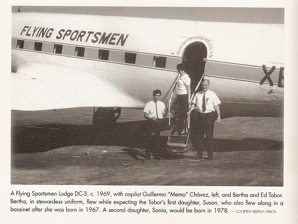
Here's the plane Ed Tabor landed there, full of fishermen from the U.S.:
|
|
|
4x4abc
Ultra Nomad
    
Posts: 4430
Registered: 4-24-2009
Location: La Paz, BCS
Member Is Offline
Mood: happy - always
|
|
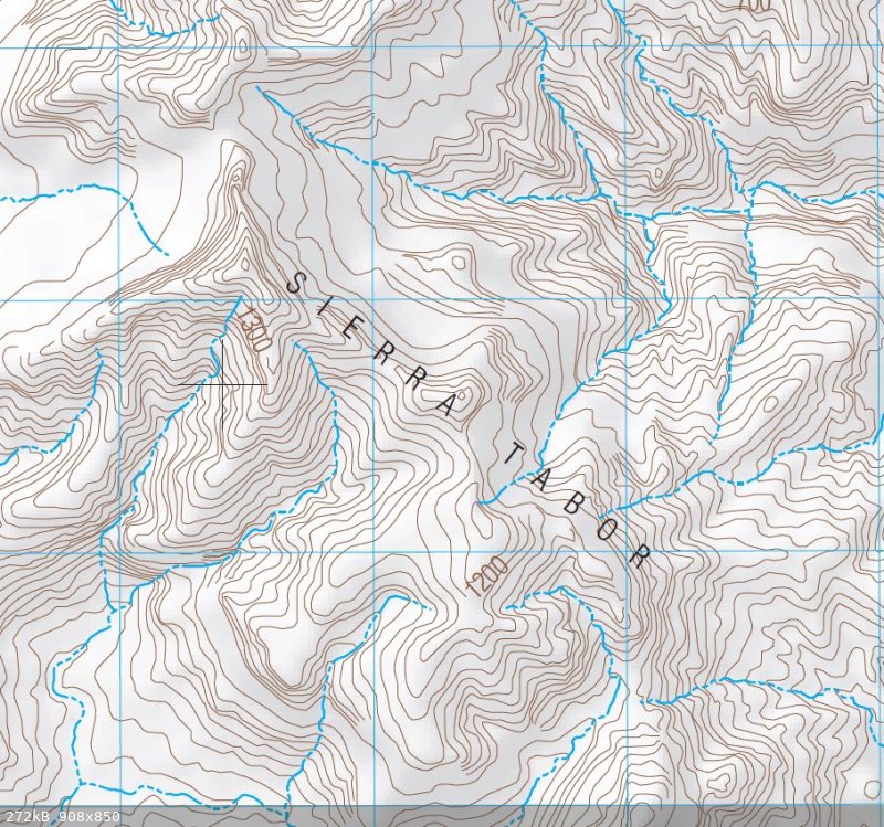
as soon as I saw the name Ed Tabor I thought:
Cañon Tabor
Cerro Tabor
Sierra Tabor
the guy wasn't only flying around
Harald Pietschmann
|
|
|
David K
Honored Nomad
        
Posts: 65236
Registered: 8-30-2002
Location: San Diego County
Member Is Offline
Mood: Have Baja Fever
|
|
His impact on Loreto becoming a destination was HUGE!
I think my dad flew down with him at least twice, before we began driving down, in 1965.
|
|
|
| Pages:
1
2 |

