mcfez
Elite Nomad

Posts: 8678
Registered: 12-2-2009
Location: aka BN yankeeirishman
Member Is Offline
|
|
La-Roca and surrounding area
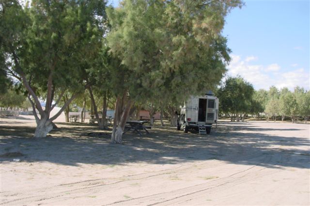
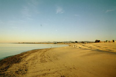
Heading south from San Felipe at K32ish......the town of La-Roca (I believe). Having pass this place many times...stopping in only once. It's roughly
the mid point here to Puertecitos. Good place for a break down!
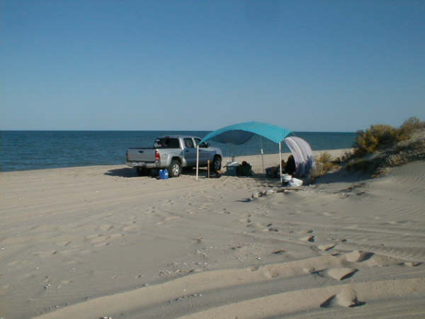
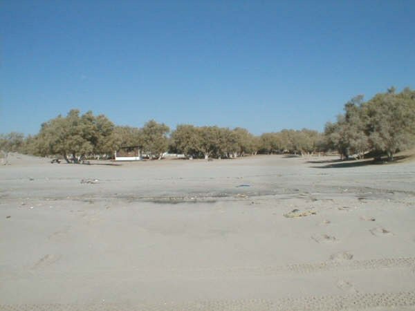
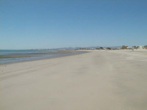
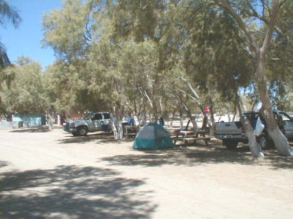
Nearby beaches.....are Tahitian sand beach heads with turquoise blue waters. Many many campsites at k21ish to K50's. This area is really something for
the beach front fun. You'll see a vast array of offered campsites. We just keep pulling into these places till we see a "wow" factor...and then stay.
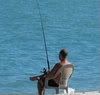
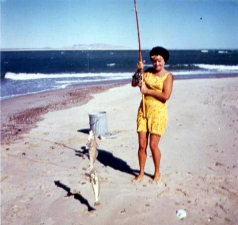
Oh...did I say surf fishing anywhere in here is great. Best is sunrise/sundown.
DavidK's shell beach is nearby...he will allow you to enter :-)
Sulfur mine area is really great....6 miles or so off the highway. Go there...find a yellow rock...add a match to it...and the rock catches fire! No
kidding. K28 ish...there is a sign off the highway marking the turn off.
Valley of the Giants....right outside of South Felipe pass the last new developments. $5 gets you in. See the big boys of Baja. Cactus I am talkin'
about.
Now...La-Roca.
You have a tire repair shop off the highway. You can get help 24/7 there
Police Department behind left of the hardware store.
New joint they got. I did notice police presence has increased big time from here to Puertecitos....beware!
Two restaurants. Limited open sign (week ends). Never ate at either. Perhaps our BN's here can add to this.
Market. Ice. Drink. Propane. Limited food. You can't die in this town from starvation.
Doctor ...at night. Dr. Abasolo has been a fixture in San Felipe for 20 years. He was formally the Chief of Staff at the St. James Infirmary. He comes
here at night. So I was told. Will confirm this in March since I helped buy Dr. Abasolo's front door to his clinic. He is a nice guy. Rotary Club
loves him.
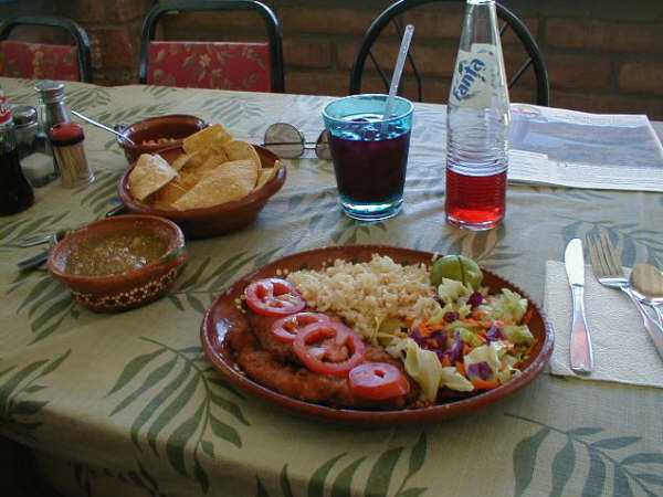
Ammiel Market is what I want to really say a word about.
If you LOVE chile rellenos....what a secret this place is...was! For $3.50 one gets a chile relleno, rice , beans. They rock! I order three sets just
for me. Oink I say. Oink!
Restroom...ask for it..it's in their living quarters and is perfectly okay to use. Eat outside...lots of incoming folks lost on the highway...you can
be Mr and Mrs MapQuest for a while. I have included their menu on the link below. Oh...she will make you coffee too...it aint bad if I say so.
I got pictures of the owner bring in ice from San Felipe. Flops the chunks into non working freezers...wraps with blankets...and stays good for days.
Only in Baja.....
http://picturehosting.com/gallery.php?u=McFez&g=La-Roca
[Edited on 10-30-2010 by mcfez]

Old people are like the old cars, made of some tough stuff. May show a little rust, but good as gold on the inside.
|
|
|
Russ
Elite Nomad
Posts: 6742
Registered: 7-4-2004
Location: Punta Chivato
Member Is Offline
|
|
Profound...?
Bahia Concepcion where life starts...given a chance!
|
|
|
mcfez
Elite Nomad
Posts: 8678
Registered: 12-2-2009
Location: aka BN yankeeirishman
Member Is Offline
|
|
| Quote: | Originally posted by Russ
Profound...? |

Old people are like the old cars, made of some tough stuff. May show a little rust, but good as gold on the inside.
|
|
|
bajalou
Ultra Nomad
Posts: 4459
Registered: 3-11-2004
Location: South of the broder
Member Is Offline
|
|
When we looked at the first post there was nothing but the line stating-
[Edited on 10-30-2010 by mcfez]
No text, no picture. - but now they are in evidence.
No Bad Days
\"Never argue with an idiot. People watching may not be able to tell the difference\"
\"The trouble with doing nothing is - how do I know when I\'m done?\"
Nomad Baja Interactive map
And in the San Felipe area - check out Valle Chico area |
|
|
David K
Honored Nomad
Posts: 65549
Registered: 8-30-2002
Location: San Diego County
Member Is Offline
Mood: Have Baja Fever
|
|
LA ROCA and Eduardo... and Colonia Delicias eats!
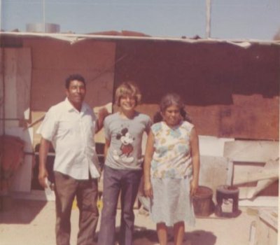
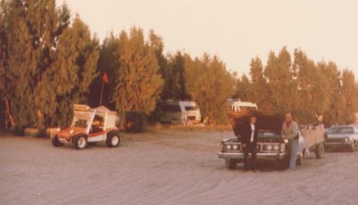
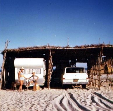
La Roca was a tourist camp with lots leased for vacation homes/ trailers started by a man named 'Eduardo' in the early 1970's...
Eduardo would walk the mile or so north to Nuevo Mazatlan and join 'Luis' (owner of Nuevo Mazatlan) for some tequila drinking... which caused Luis'
wife 'Felicitas' to leave him! This is the story told to me about 1974.
Here is Luis, me (14) and Felicitas in July, 1972:
Here's my map of the area in 1972:

Then in 1973:
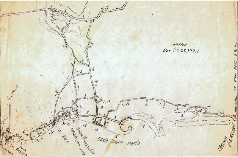
As you can see, I drew the beach between Laguna Percebu and Bahia Santa Maria as an island, because there was no access road I could find driving
around in our dune buggy or my Honda trail bike (how I mapped all the roads, as it had an odometer). This was why I always called it Shell Island...
It was in 1978 when I finally was shown the way to get onto the island by some guys camping out there... I walked across the lagoon to meet.
================================================
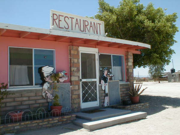
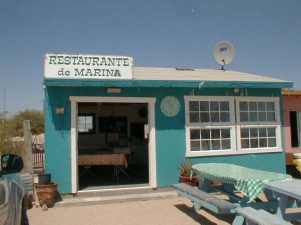
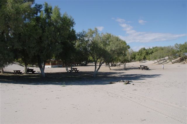
The new town today that is at Km. 35 is Colonia (or Ejido) Delicias, and is a bit south of the La Roca road, next to the El Vergel road... It has good
food at 3 restaurants that are either open certain days or certain hours... and never all at once it would seem!
Here are some photos from June, 2006...
CHELO'S:


MARINA'S:

Breakfast of Chorizo and eggs.
The newer place is ANICETO'S which is named after the founder of Bahia Santa Maria, Aniceto Madueña.
Oh, and 'SHELL ISLAND' is accessed at Km. 26... if the tide isn't too high. Nomads, everyone is welcome... 4WD and low air pressure needed!
|
|
|
mcfez
Elite Nomad
Posts: 8678
Registered: 12-2-2009
Location: aka BN yankeeirishman
Member Is Offline
|
|
Thanks for that extra input DavidK.
Bahia Santa Maria is the camp with the large trees ....house at the entrance on the leftside?
You were a cute kid back then...what happened ?
Old people are like the old cars, made of some tough stuff. May show a little rust, but good as gold on the inside.
|
|
|
BajaWarrior
Super Nomad
Posts: 2307
Registered: 9-27-2006
Location: Mission Bay, San Diego. Playa Hermosa, San Felipe.
Member Is Offline
Mood: Anxious to get south
|
|
| Quote: | Originally posted by mcfez
Thanks for that extra input DavidK.
Bahia Santa Maria is the camp with the large trees ....house at the entrance on the leftside?
You were a cute kid back then...what happened ? |
The campo with the trees IS Campo Nuevo Mazatlan and Bahia Santa Maria is the campo on the small Bahia about a mile to the north.
Haven't had a bad trip yet....
|
|
|
David K
Honored Nomad
Posts: 65549
Registered: 8-30-2002
Location: San Diego County
Member Is Offline
Mood: Have Baja Fever
|
|
Bahia Santa Maria/ Playa Hermosa area


|
|
|
David K
Honored Nomad
Posts: 65549
Registered: 8-30-2002
Location: San Diego County
Member Is Offline
Mood: Have Baja Fever
|
|
Here is a Nuevo Mazatlan bird's eye view map I drew when I was 14...

|
|
|
David K
Honored Nomad
Posts: 65549
Registered: 8-30-2002
Location: San Diego County
Member Is Offline
Mood: Have Baja Fever
|
|
| Quote: | Originally posted by mcfez
Thanks for that extra input DavidK.
Bahia Santa Maria is the camp with the large trees ....house at the entrance on the leftside?
You were a cute kid back then...what happened ? |
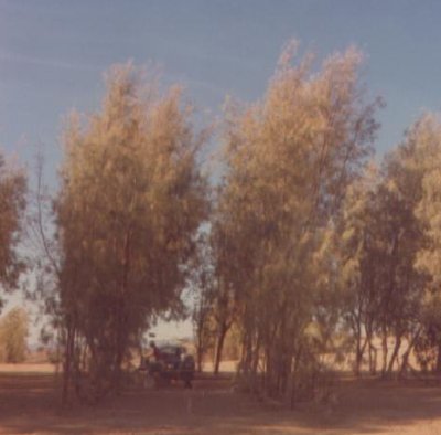
The trees at Nuevo Mazatlan were planted by Luis Castellanos Moreno beginning about 1970... they grew like weeds and offer amazing shade and repell
insects.
In 2006:
In 2004:

Beach in front:
In 1977:
In 1973:
In 1967 (before trees), Luis built tall cabanas on the beach:
The fishing was outstanding... every cast was a double hook up of CORBINA... this is at the bay that would be called Bahia Santa Maria some years
later (nobody there in '67).
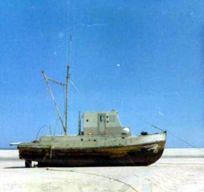
After the big chubasco of '67, this shrimp boat was washed way in the back bay/ salt flats just north of Bahia Santa Maria. It never got out... and
slowly vanished over the next 20 years.
|
|
|
SFLowTide
Junior Nomad
Posts: 30
Registered: 5-6-2010
Location: Elk Grove, CA/Km 31
Member Is Offline
Mood: Waiting On The Sun
|
|
| Quote: | Originally posted by BajaWarrior
| Quote: | Originally posted by mcfez
Thanks for that extra input DavidK.
Bahia Santa Maria is the camp with the large trees ....house at the entrance on the leftside?
You were a cute kid back then...what happened ? |
The campo with the trees IS Campo Nuevo Mazatlan and Bahia Santa Maria is the campo on the small Bahia about a mile to the north.
|
There is one large Salt Pine on the beach at La Mision (km31). It is between my house and my neighbour to the south. You have to remember there are
many camps between Bahia Santa Maria and Nuevo Mazatlan. It wasn't long ago that it went: 1. Percebu, 2. Bahia Santa Maria/Playa Hermosa, 3. La
Roca/Nuevo Mazatlan, 4. Coloradito and then Puertecitos and that was it. This was even after the newer, closer to the beach route, was built. Its
hard to believe that this is going to be a main thoroughfare from Mex. 1 to Mex. 5. Que lástima...
|
|
|
mcfez
Elite Nomad
Posts: 8678
Registered: 12-2-2009
Location: aka BN yankeeirishman
Member Is Offline
|
|
| Quote: | Originally posted by SFLowTide
| Quote: | Originally posted by BajaWarrior
| Quote: | Originally posted by mcfez
Thanks for that extra input DavidK.
Bahia Santa Maria is the camp with the large trees ....house at the entrance on the leftside?
You were a cute kid back then...what happened ? |
The campo with the trees IS Campo Nuevo Mazatlan and Bahia Santa Maria is the campo on the small Bahia about a mile to the north.
|
There is one large Salt Pine on the beach at La Mision (km31). It is between my house and my neighbour to the south. You have to remember there are
many camps between Bahia Santa Maria and Nuevo Mazatlan. It wasn't long ago that it went: 1. Percebu, 2. Bahia Santa Maria/Playa Hermosa, 3. La
Roca/Nuevo Mazatlan, 4. Coloradito and then Puertecitos and that was it. This was even after the newer, closer to the beach route, was built. Its
hard to believe that this is going to be a main thoroughfare from Mex. 1 to Mex. 5. Que lástima... |
This highway plan has been modified. It will pass Elk Grove 
Old people are like the old cars, made of some tough stuff. May show a little rust, but good as gold on the inside.
|
|
|
David K
Honored Nomad
Posts: 65549
Registered: 8-30-2002
Location: San Diego County
Member Is Offline
Mood: Have Baja Fever
|
|
| Quote: | Originally posted by SFLowTide
| Quote: | Originally posted by BajaWarrior
| Quote: | Originally posted by mcfez
Thanks for that extra input DavidK.
Bahia Santa Maria is the camp with the large trees ....house at the entrance on the leftside?
You were a cute kid back then...what happened ? |
The campo with the trees IS Campo Nuevo Mazatlan and Bahia Santa Maria is the campo on the small Bahia about a mile to the north.
|
There is one large Salt Pine on the beach at La Mision (km31). It is between my house and my neighbour to the south. You have to remember there are
many camps between Bahia Santa Maria and Nuevo Mazatlan. It wasn't long ago that it went: 1. Percebu, 2. Bahia Santa Maria/Playa Hermosa, 3. La
Roca/Nuevo Mazatlan, 4. Coloradito and then Puertecitos and that was it. This was even after the newer, closer to the beach route, was built. Its
hard to believe that this is going to be a main thoroughfare from Mex. 1 to Mex. 5. Que lástima... |
Yup... and I remember it before there was a Bahia Santa Maria or La Roca!
Just south of Nuevo Mazatlan, where it is called El Sahuaro now... some Americans maitained a cabin on the hill above that big salt pine there... The
Lemke (sp?) family and they drove red Jeep Gladiator Pickups... They owned a grocery store in the L.A. area.
|
|
|
Jaybo
Nomad
Posts: 240
Registered: 12-7-2009
Location: NW Oregon
Member Is Offline
Mood: Praying for Baja!
|
|
David,
I'm curious as to what made you want to map everything at that age? Did it start as a school project or were you just obsessed to knowing where
everything was? 
|
|
|
David K
Honored Nomad
Posts: 65549
Registered: 8-30-2002
Location: San Diego County
Member Is Offline
Mood: Have Baja Fever
|
|
| Quote: | Originally posted by Jaybo
David,
I'm curious as to what made you want to map everything at that age? Did it start as a school project or were you just obsessed to knowing where
everything was? |
That is a great question!
I fell in love with Baja right away... it lead to a love of other related activities: rock collecting, hiking, four wheeling, desert exploring,
history, photography, travel writing... and yes, CARTOGRAPHY (map making)...
Drawing a map of a place kept it alive for me... I could look upon a map and be back there, if only in my mind... I have always had maps of Baja on my
walls... Mike McMahan's and others.
I was and still am totally impressed with the work done by Howard Gulick for the Lower California Guidebook... since I was 7 or 8, I would read from
it as my dad drove our Jeep down Baja. That was a unusual thing for a little kid to enjoy doing, I guess?
Anyway, I kept perfecting my mapping skills... and almost each trip south would take notes and mileages and compass directions... The area south of
San Felipe was my primary project, as it was (and is) our favorite area.
The construction of Hwy. 1 in 1973 was very interesting to me and I took tons of notes that summer when we drove to Loreto... I was 15, and I
self-published those notes into my first Baja guidebook 'Baja and the Transpeninsular Highway'.
IT WAS FUN FOR ME! The book was on a TV show in San Diego and I was written
about in the local paper... I sold every one I made... and finally stopped making them well into 1974, long after the highway was finished (I added
update notes to it)... Sold at two bookstores in Escondido. The book was on a TV show in San Diego and I was written
about in the local paper... I sold every one I made... and finally stopped making them well into 1974, long after the highway was finished (I added
update notes to it)... Sold at two bookstores in Escondido.
The oldest map I can find that I drew is from 1967, when I was 9 or 10... the area around Nuevo Mazatlan, naturally!
|
|
|