| Pages:
1
2 |
David K
Honored Nomad
        
Posts: 65408
Registered: 8-30-2002
Location: San Diego County
Member Is Offline
Mood: Have Baja Fever
|
|
Yes, thanks Paul... I have revised the San Felipe map to show that... the newer one was shown in another post.
|
|
|
Russ
Elite Nomad
     
Posts: 6742
Registered: 7-4-2004
Location: Punta Chivato
Member Is Offline
|
|
Good work Amigo
Oh, I use to be able to drag and drop those maps to my computer but these I couldn't?
[Edited on 7-10-2018 by Russ]
Bahia Concepcion where life starts...given a chance!
|
|
|
norte
Super Nomad
   
Posts: 1163
Registered: 10-8-2008
Member Is Offline
|
|
There is no such place with the formal name of "shell Island".
|
|
|
David K
Honored Nomad
        
Posts: 65408
Registered: 8-30-2002
Location: San Diego County
Member Is Offline
Mood: Have Baja Fever
|
|
You are correct! 
The same thing with 'Shell Beach', 'The Widowmaker', 'Scorpion Bay', 'Shipwrecks', and on and on...
"The barrier island between Percebu and Bahia Santa Maria" was just too much to say, so I came up with "Shell Island", in 1978! 
|
|
|
David K
Honored Nomad
        
Posts: 65408
Registered: 8-30-2002
Location: San Diego County
Member Is Offline
Mood: Have Baja Fever
|
|
Quote: Originally posted by Russ  | Good work Amigo
Oh, I use to be able to drag and drop those maps to my computer but these I couldn't?
[Edited on 7-10-2018 by Russ] |
They are all posted in the Road Conditions forum. http://forums.bajanomad.com/viewthread.php?tid=88771
If you can't grab them from there, I can email you the files.
|
|
|
bajamary1952
Nomad
 
Posts: 204
Registered: 9-29-2016
Location: Ensenada
Member Is Offline
|
|
David...Thanks SO MUCH for providing these updated maps & markers. I travel a lot in Baja alone with my dog so these are really helpful
considering there are so few map resources (even in Spanish). They will be very useful on my upcoming fall trips.
|
|
|
Russ
Elite Nomad
     
Posts: 6742
Registered: 7-4-2004
Location: Punta Chivato
Member Is Offline
|
|
Thanks. Book marked it
Bahia Concepcion where life starts...given a chance!
|
|
|
David K
Honored Nomad
        
Posts: 65408
Registered: 8-30-2002
Location: San Diego County
Member Is Offline
Mood: Have Baja Fever
|
|
Quote: Originally posted by bajamary1952  | | David...Thanks SO MUCH for providing these updated maps & markers. I travel a lot in Baja alone with my dog so these are really helpful
considering there are so few map resources (even in Spanish). They will be very useful on my upcoming fall trips. |
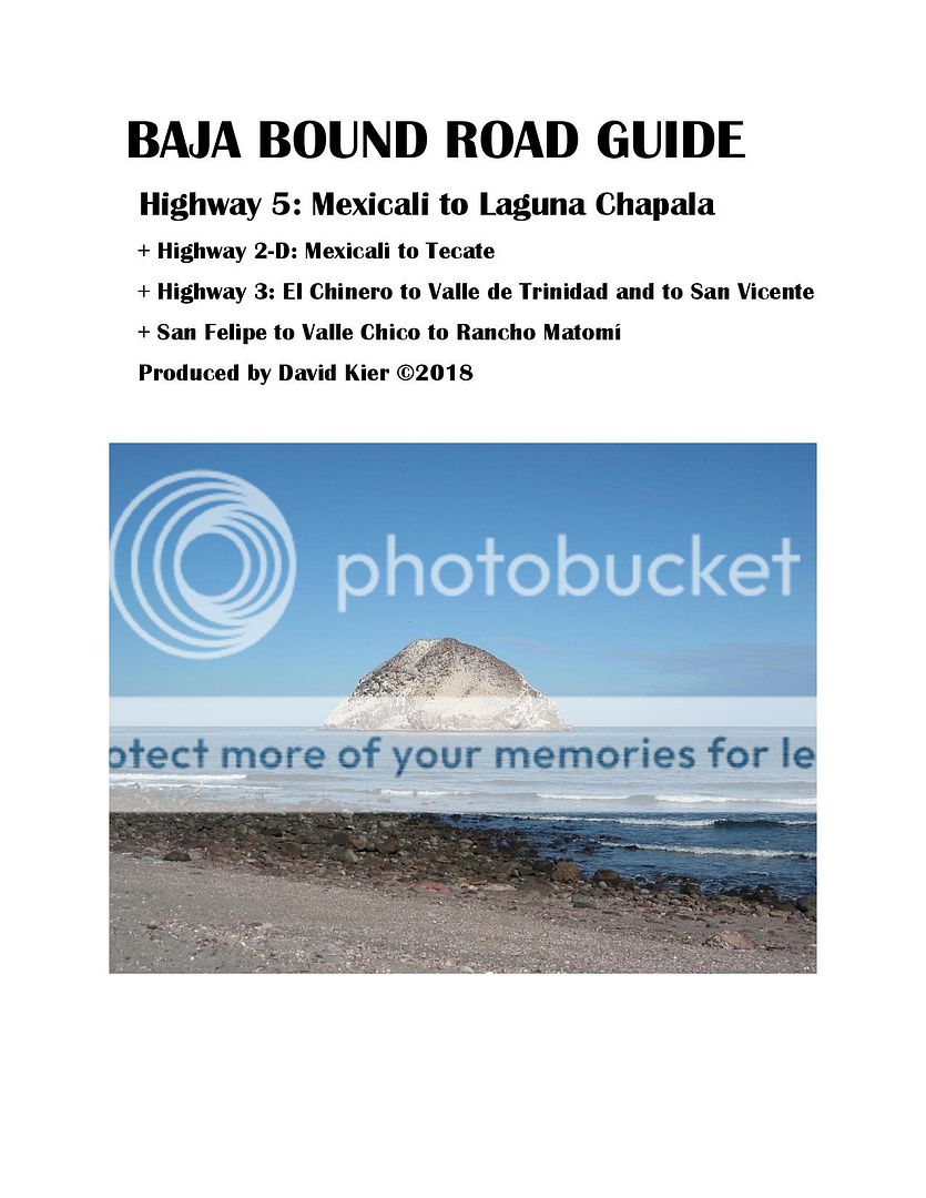
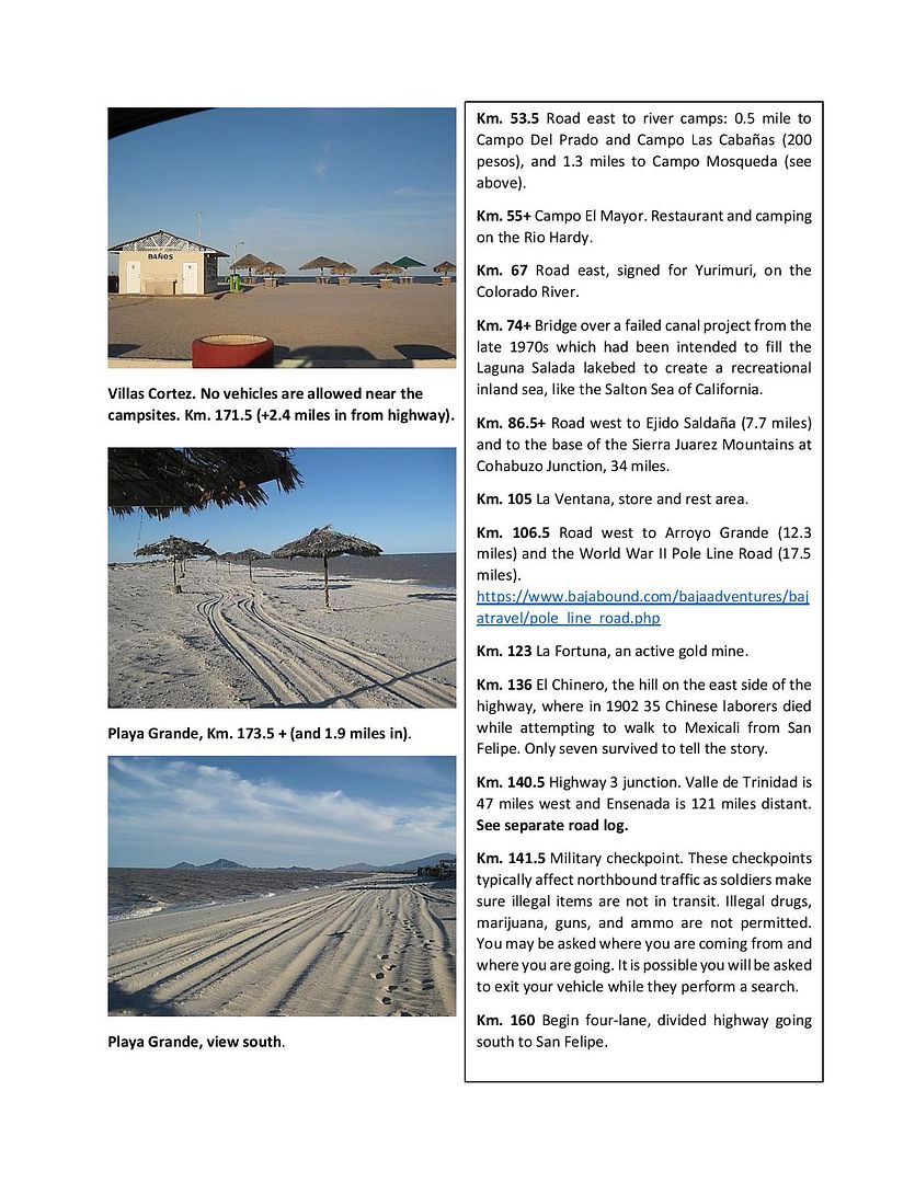
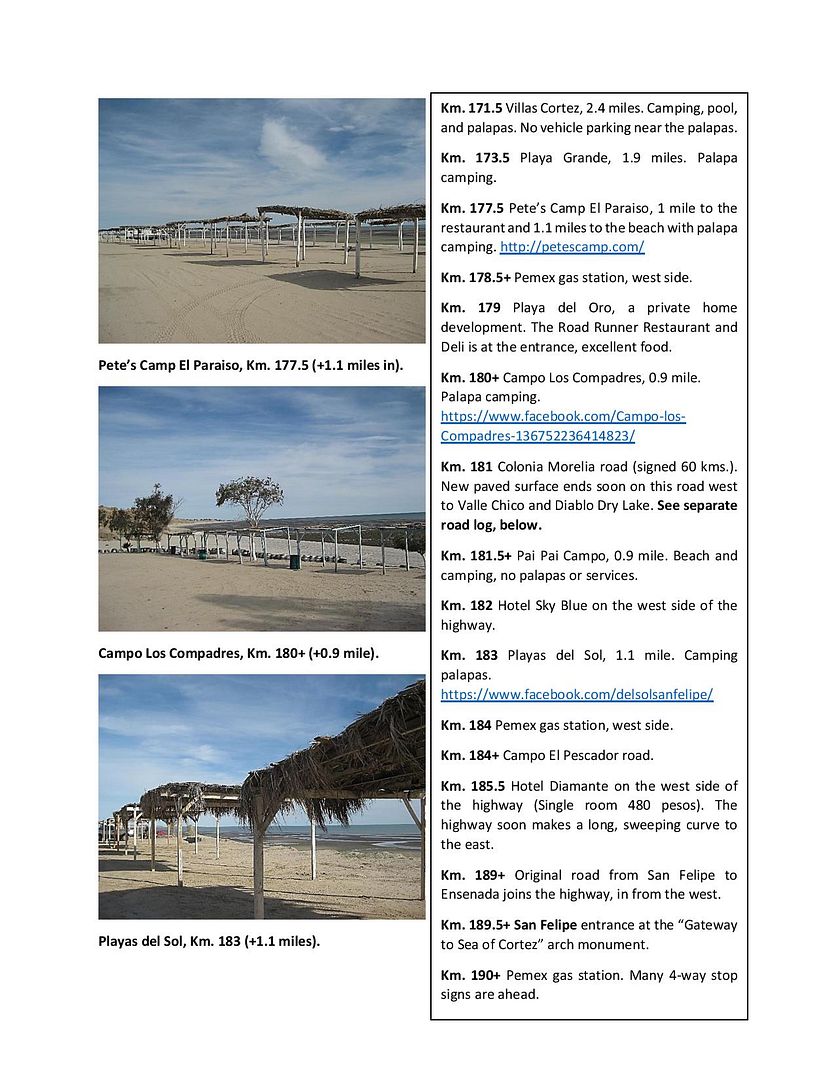
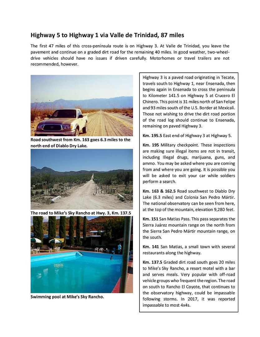
My pleasure. I hope that you will be able to utilize the road logs in the guide, as well. The publishing of it is in the works.
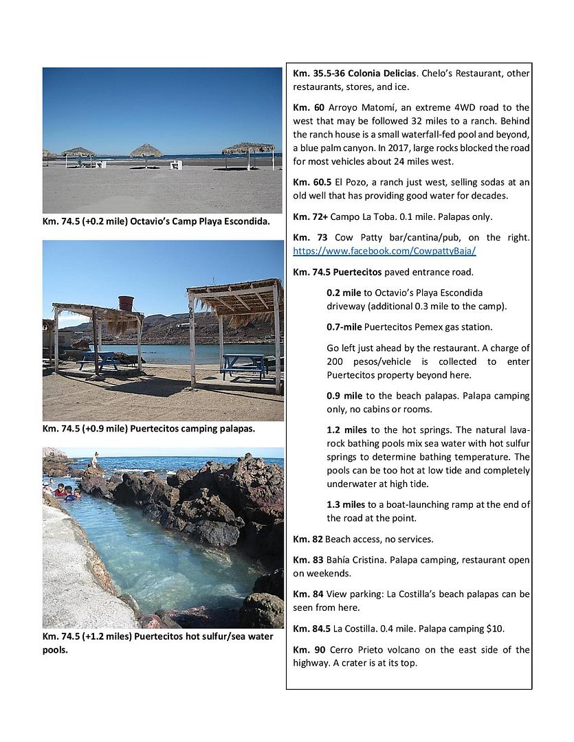
Here are some sample pages (not necessarily the final edited or updated version, just worksheets):
|
|
|
Cliffy
Senior Nomad
  
Posts: 994
Registered: 12-19-2013
Member Is Offline
|
|
Way better than the old AAA maps and guide book!!!! :-) :-)
You chose your position in life today by what YOU did yesterday
|
|
|
David K
Honored Nomad
        
Posts: 65408
Registered: 8-30-2002
Location: San Diego County
Member Is Offline
Mood: Have Baja Fever
|
|
Thank you... with a life of reading and loving Baja guidebooks, I knew what would be most useful and easy to use. The full guidebook as it is now is
115 pages (8.5x11) and covers all the main roads and many side trips of interest. It is full of photos placed next to or near the text about the place
shown. A printed version may be in black & white because of the high cost of color. An online version will be like you see above and you can print
it as you wish to take with you.
The guide is made so that it can easily be added to or modified for changes or additions. I have already made edits to reflect the passing of Pancho
at San Rafael, the paved road completed to Bahía Tortugas, and any other news I become alerted to. That allows the online version to be as fresh as
possible. I traveled over 12,000 miles last year researching for this guide and the GPS map we have, as well. Those research trips are all shared here
on Baja Nomad as 'TRIP #1-7' trip reports of 2017. One area I have not yet covered for the guide is the Sierra Juarez (Laguna Hanson) and the west
half of Hwy. 3 side trips. So much Baja... so little time!
|
|
|
David K
Honored Nomad
        
Posts: 65408
Registered: 8-30-2002
Location: San Diego County
Member Is Offline
Mood: Have Baja Fever
|
|
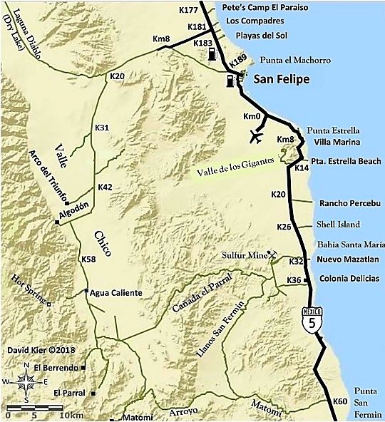
Here is the newer version of the map with paved road to Km. 10:
|
|
|
PaulW
Ultra Nomad
    
Posts: 3113
Registered: 5-21-2013
Member Is Offline
|
|
Now it agrees with the older map or is there really only one map now?
Nice maps. I am glad you can update them quickly.
|
|
|
David K
Honored Nomad
        
Posts: 65408
Registered: 8-30-2002
Location: San Diego County
Member Is Offline
Mood: Have Baja Fever
|
|
I have posted it before. This thread is on San Quintin map so the San Felipe map here wasn't updated. All 30 of my maps are in there own thread in the
Road Conditions forum. It isn't real quick or easy to change them, but possible.
|
|
|
| Pages:
1
2 |

