TMW
Select Nomad
      
Posts: 10659
Registered: 9-1-2003
Location: Bakersfield, CA
Member Is Offline
|
|
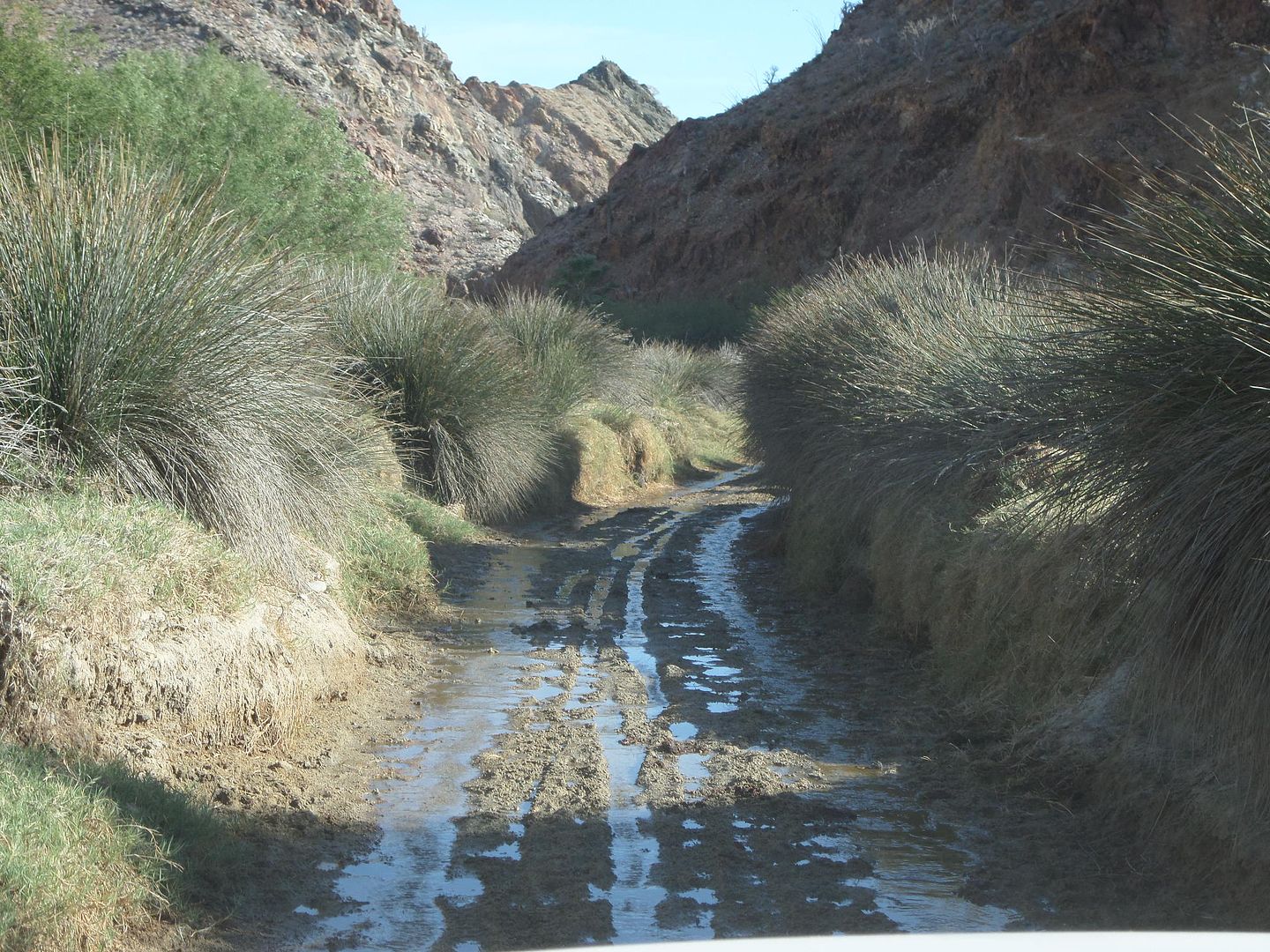
Another Game of Where is it.
All are below Gonzaga Bay and north of Loreto.
1
2
3
4
5
|
|
|
David K
Honored Nomad
        
Posts: 65361
Registered: 8-30-2002
Location: San Diego County
Member Is Offline
Mood: Have Baja Fever
|
|
Nice selection, Tom. I think I am only certain on a couple of them! I will let the gang go for it before guessing on those.
|
|
|
4x4abc
Ultra Nomad
    
Posts: 4443
Registered: 4-24-2009
Location: La Paz, BCS
Member Is Offline
Mood: happy - always
|
|
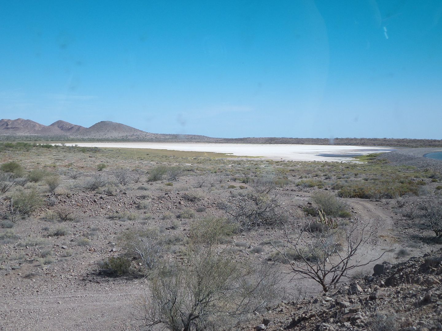
#3 could be Salina La Trinidad
#5 is Valle Encantada (Calamajue)
strong selection Tom!
Harald Pietschmann
|
|
|
TMW
Select Nomad
      
Posts: 10659
Registered: 9-1-2003
Location: Bakersfield, CA
Member Is Offline
|
|
Yes on both. 5 was taken in April of 2014.
|
|
|
David K
Honored Nomad
        
Posts: 65361
Registered: 8-30-2002
Location: San Diego County
Member Is Offline
Mood: Have Baja Fever
|
|
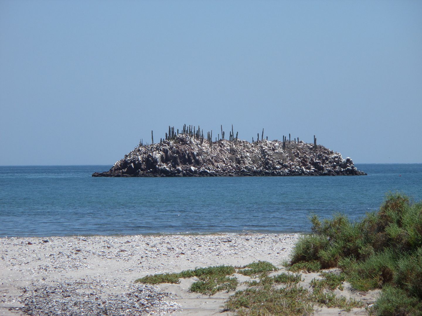
#4 looked very familiar... Here it is in 2009:

|
|
|
advrider
Super Nomad
   
Posts: 1916
Registered: 10-2-2015
Member Is Offline
|
|
The last looks like the wash by Coco's, frog canyon, Can't think of the correct name?
|
|
|
David K
Honored Nomad
        
Posts: 65361
Registered: 8-30-2002
Location: San Diego County
Member Is Offline
Mood: Have Baja Fever
|
|
Harald already answered that one, Calamajué Canyon. Of interest, this was 'Hwy 5' in the 1960s and 1970s... To around 1983 when a new graded road was
built form Laguna Chapala to Puerto Calamajué, crossing the old Hwy 5 route near where Coco's Corner would be established.
|
|
|
chippy
Super Nomad
   
Posts: 1769
Registered: 2-2-2010
Member Is Offline
|
|
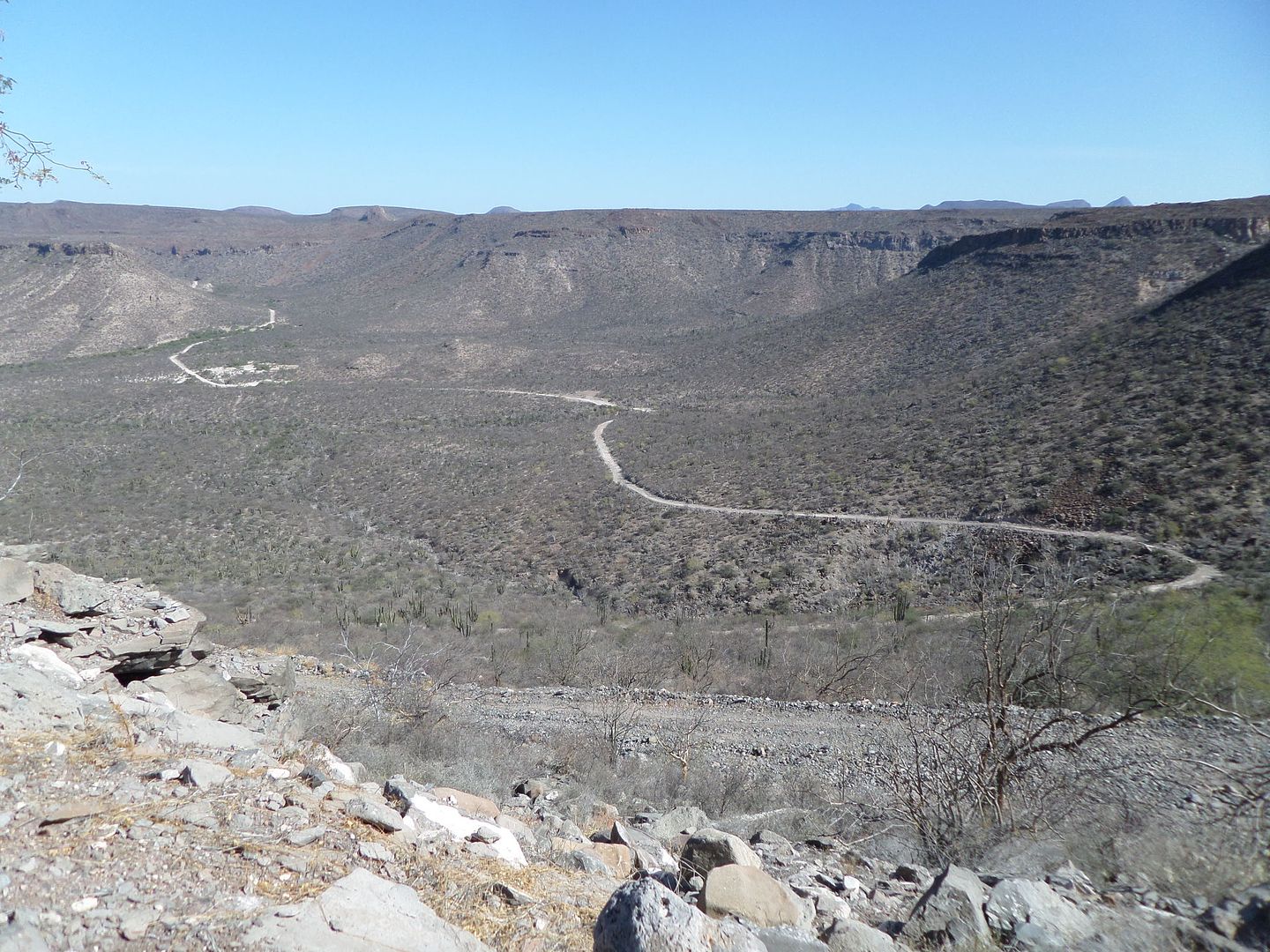
#2 looks like the road from Comondu to San Javier?
|
|
|
advrider
Super Nomad
   
Posts: 1916
Registered: 10-2-2015
Member Is Offline
|
|
My guess too!
|
|
|
4x4abc
Ultra Nomad
    
Posts: 4443
Registered: 4-24-2009
Location: La Paz, BCS
Member Is Offline
Mood: happy - always
|
|
right!
The cal pit is clearly visible
by the way, the new Google Earth images made some previously obscured structures close to the kiln visible
Harald Pietschmann
|
|
|
TMW
Select Nomad
      
Posts: 10659
Registered: 9-1-2003
Location: Bakersfield, CA
Member Is Offline
|
|
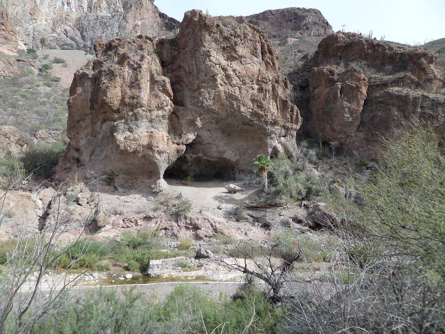
You are correct for number 2. I think David knows where #4 is.
Number 1 will be pretty hard for most. It use to have a road by it across the front that was wiped out between 2010 and 2012, I forget which. Road was
never rebuilt. The road in, which is rough in places, stops at a Ranch about a mile before the cave. There are paintings on the walls in the cave. The
bypass road around it only goes to a few ranches then deadends except for horses and a few good motorcycle riders. Blanca has been on the bypass road.
|
|
|
David K
Honored Nomad
        
Posts: 65361
Registered: 8-30-2002
Location: San Diego County
Member Is Offline
Mood: Have Baja Fever
|
|
Ok...
#4 is in Bahia Las Animas, near the fish camp. M
I am curious about #1.
|
|
|
David K
Honored Nomad
        
Posts: 65361
Registered: 8-30-2002
Location: San Diego County
Member Is Offline
Mood: Have Baja Fever
|
|
Zooming in, I see the ruins of a wall or dam, below the cave. Looking forward to learning where this is.
|
|
|
TMW
Select Nomad
      
Posts: 10659
Registered: 9-1-2003
Location: Bakersfield, CA
Member Is Offline
|
|
You are correct for #4.
#1 is about a mile east of Rancho San Juan de las Pilas. We stayed at the ranch overnight and Jesus took us to the cave to see the paintings. The trip
report I did from 2014 is here.
http://forums.bajanomad.com/viewthread.php?tid=73500
The bypass road comes down from the north about a mile or two further east and goes by a couple of ranches ending at Rancho Las Tunas which is west of
Mission Guadalupe. Les and Blanca where taken to Las Tunas back in 2014.
|
|
|
David K
Honored Nomad
        
Posts: 65361
Registered: 8-30-2002
Location: San Diego County
Member Is Offline
Mood: Have Baja Fever
|
|
Quote: Originally posted by TMW  | You are correct for #4.
#1 is about a mile east of Rancho San Juan de las Pilas. We stayed at the ranch overnight and Jesus took us to the cave to see the paintings. The trip
report I did from 2014 is here.
http://forums.bajanomad.com/viewthread.php?tid=73500
The bypass road comes down from the north about a mile or two further east and goes by a couple of ranches ending at Rancho Las Tunas which is west of
Mission Guadalupe. Les and Blanca where taken to Las Tunas back in 2014.
|
Your trip reports with photos and maps are great Tom!
Here is the area of San Juan de las Pilas for the gang to see the area these great places are:
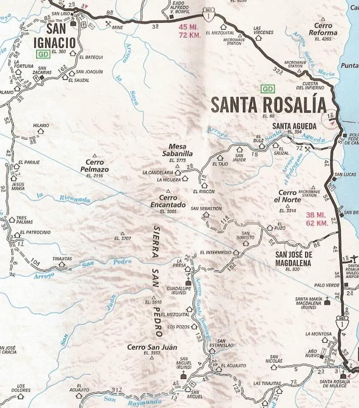
Located along Arroyo San Pedro, midway between El Patrocinio and Mission Guadalupe... about where the blue o is in Pedro, on the arroyo.
|
|
|
TMW
Select Nomad
      
Posts: 10659
Registered: 9-1-2003
Location: Bakersfield, CA
Member Is Offline
|
|
San Juan de las Pilas is near the left Las Tunas marked in green, on the San Pedro arroyo center of the map.
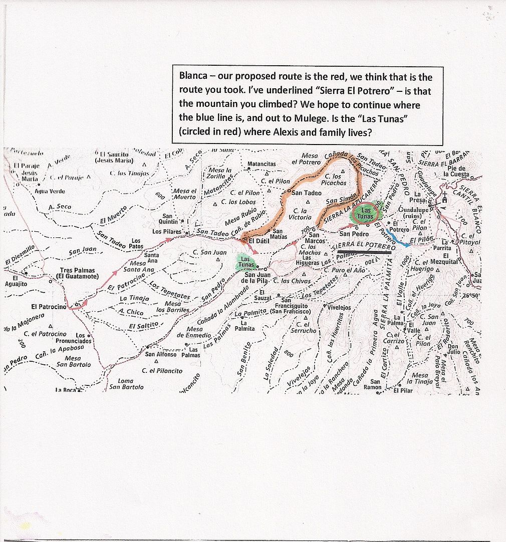
[Edited on 1-3-2019 by TMW]
|
|
|

