4x4abc
Ultra Nomad

Posts: 4455
Registered: 4-24-2009
Location: La Paz, BCS
Member Is Offline
Mood: happy - always
|
|
forgotten Santa Rosalia cemetery
does anyone have any information on the Arroyo Providencia cemetery in Santa Rosalia?
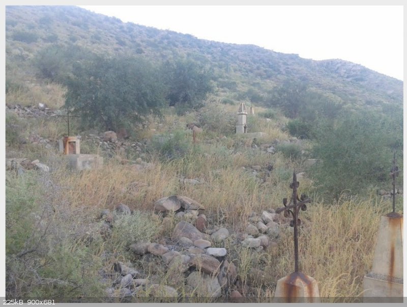
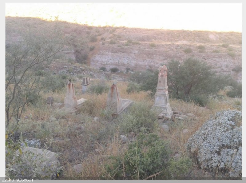
images by ibo moreno
Harald Pietschmann
|
|
|
David K
Honored Nomad
Posts: 65550
Registered: 8-30-2002
Location: San Diego County
Member Is Offline
Mood: Have Baja Fever
|
|
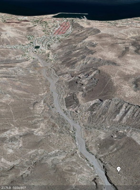
Showing us a satellite map of it and the town together would be nice!
|
|
|
4x4abc
Ultra Nomad
Posts: 4455
Registered: 4-24-2009
Location: La Paz, BCS
Member Is Offline
Mood: happy - always
|
|
27°18'46.35"N, 112°17'27.93"W

Harald Pietschmann
|
|
|
4x4abc
Ultra Nomad
Posts: 4455
Registered: 4-24-2009
Location: La Paz, BCS
Member Is Offline
Mood: happy - always
|
|
here are all 3 cemeteries

Harald Pietschmann
|
|
|
David K
Honored Nomad
Posts: 65550
Registered: 8-30-2002
Location: San Diego County
Member Is Offline
Mood: Have Baja Fever
|
|
Excellent Harald!
|
|
|
4x4abc
Ultra Nomad
Posts: 4455
Registered: 4-24-2009
Location: La Paz, BCS
Member Is Offline
Mood: happy - always
|
|
I have another one on my list that suspiciously looks like a cemetery
it is right next to a mine - maybe they buried the poor no-names there
27°19'46.43"N, 112°19'37.57"W

Harald Pietschmann
|
|
|
watizname
Senior Nomad
Posts: 792
Registered: 8-7-2009
Member Is Offline
|
|
Wow, not meant as a hy-jack, but these photos really show the vulnerability of the town to flooding.

I yam what I yam and that\'s all what I yam.
|
|
|
4x4abc
Ultra Nomad
Posts: 4455
Registered: 4-24-2009
Location: La Paz, BCS
Member Is Offline
Mood: happy - always
|
|
well, when the French built the houses they kept a main water channel to the south open (free of houses) and an emergency water flow to the north.
Since humans love to live where the neighbors live - there are houses now everywhere.
Harald Pietschmann
|
|
|
JZ
Select Nomad
Posts: 14760
Registered: 10-3-2003
Member Is Offline
|
|
How long were the French there?
|
|
|
4x4abc
Ultra Nomad
Posts: 4455
Registered: 4-24-2009
Location: La Paz, BCS
Member Is Offline
Mood: happy - always
|
|
1884 til 1954 - 70 years
I mentioned to a friend one year that in my opinion Santa Rosalia had the most beautiful women
He could not stop laughing
According to him, Santa Rosalia has the most women that are not women
Ha!
Harald Pietschmann
|
|
|
David K
Honored Nomad
Posts: 65550
Registered: 8-30-2002
Location: San Diego County
Member Is Offline
Mood: Have Baja Fever
|
|
I wrote an article about the Santa Rosalia history along with the pre-fab church designed by Eiffel story: https://www.bajabound.com/bajaadventures/bajatravel/eiffel_c...
|
|
|
4x4abc
Ultra Nomad
Posts: 4455
Registered: 4-24-2009
Location: La Paz, BCS
Member Is Offline
Mood: happy - always
|
|
your article triggers more questions
why is the town called Santa Rosalia even though the official church designation is Santa Barbara?
the black beaches?
likely not from the volcano
more likely the leftover from the copper processing
the hills of black stuff in town are witness of that
much of it was dumped into Arroyo El Purgatorio
from there it washes into the ocean

Harald Pietschmann
|
|
|
David K
Honored Nomad
Posts: 65550
Registered: 8-30-2002
Location: San Diego County
Member Is Offline
Mood: Have Baja Fever
|
|
The town came long before the church (see the article for dates).
They named the town after the nearby mission at Mulegé.
Yes, the black sand is from mine activity but it can still remind one of the nearby volcanoes.
[Edited on 7-8-2019 by David K]
|
|
|
4x4abc
Ultra Nomad
Posts: 4455
Registered: 4-24-2009
Location: La Paz, BCS
Member Is Offline
Mood: happy - always
|
|
Santa Rosalia was founded in 1885
the church was built 1897
Santa Rosalia has no colonial roots
no rancho, no village, no fish camp - nada
Harald Pietschmann
|
|
|
David K
Honored Nomad
Posts: 65550
Registered: 8-30-2002
Location: San Diego County
Member Is Offline
Mood: Have Baja Fever
|
|
You got it!
 
|
|
|


