Paulina
Ultra Nomad

Posts: 3813
Registered: 8-31-2002
Location: BCN
Member Is Offline
|
|
San Juan Mine Valley, passing through
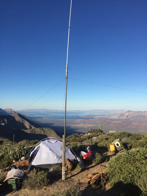
Back in November, 2017, we passed through the San Juan Mine valley on our way from Rancho San Gregorio to the top of the Sierra la Libertad range
above Bahia de Los Angeles. We were heading up to work radio communications for BFGoodrich for the Score Baja 1000, guided by Guillermo Villavicencio.
It took us seven hours from the ranch to the top of the mountain.
I didn't take many photos of the valley, nor did we visit the San Juan mine on this trip. The valley had been mentioned in other threads, so I wanted
to share what few photos I have.
We loaded the mules at the ranch in an open area across from Guillermo's house.
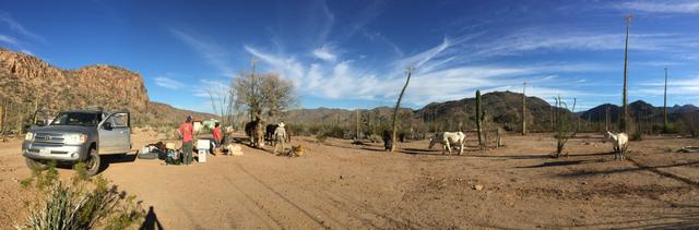
The trail leaving the ranch was easy to begin with, Guillermo leading the way by foot.
I rode, my husband Dern and Guillermo's wife Betty chose to walk the first 4ish hours.
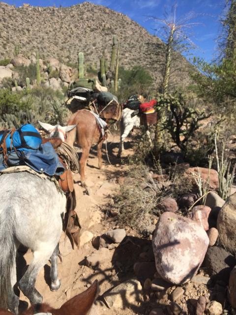
After about 5 hours of walking/riding we had come this far. The ranch is not visible, but located at the start of the range, way off in the distance.
From this vantage point we could look back and see the canyon we had traveled through. Some cow trails, making our own trails, thick cactus and bush,
deep sandy washes, steep hill climbs, one near miss when a mule loaded with gear slipped off the side. Because it was stopped by a large rock and
ponied to another horse, Guillermo was able to scramble down and right the mule and get her back up to the trail. I guess I am mentioning this because
it was not an easy hike to get this far.
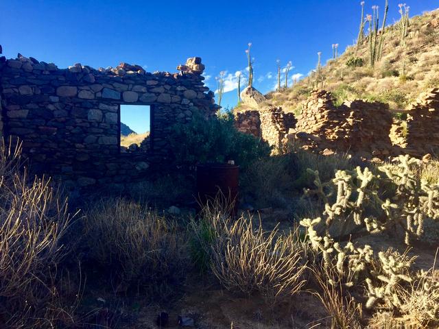
Once we reached the top of the climb, which was the south/western edge of the valley we came to the rock house structures.
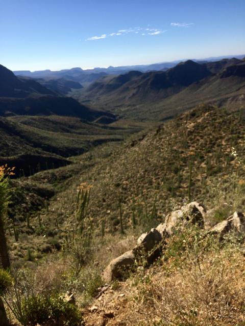
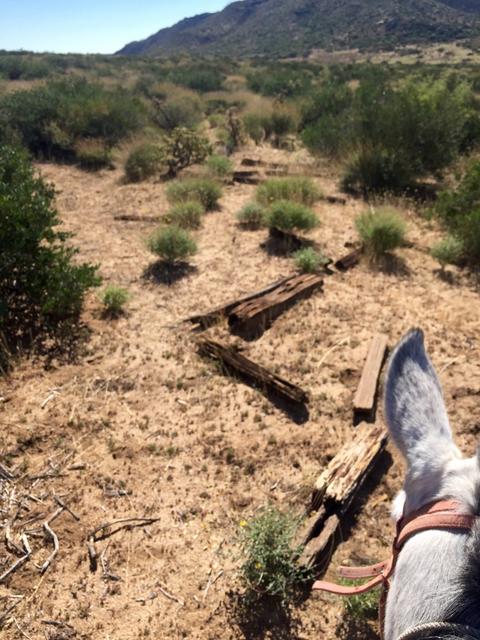
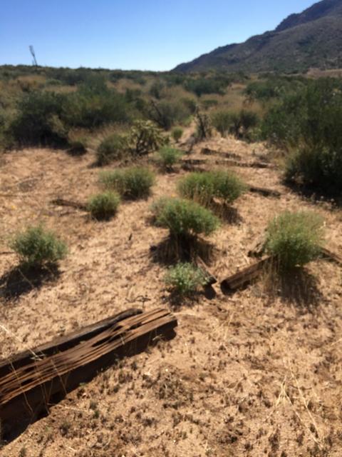
The valley is huge. It was beautiful and so green! As we rode/hiked across it we saw signs of mountain lion and a large four point deer. There are
railroad ties lying across the valley floor. There are oar carts and train carts, unfortunately I didn't take photos of those as I had packed my phone
away.
This photo was taken from our destination point above the valley floor. I'm posting to show it's size. Dern is looking down at the mines with his
binoculars.
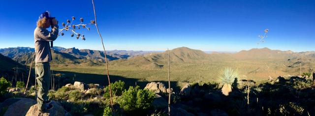
From our location we could look down on the Las Flores valley and the Sea of Cortez on the other side.
From the Ranch to the Rock house I'm estimating that it was a six hour journey via mule and hiking. When we do this again, November 2020, we will all
be riding, probably shaving off some time. Depending on Guillermo's ranch work schedule we may take more time after the race to explore the valley and
San Juan mine. I will definitely take photos.
(Prior to Hurricane Odile, Dern did this same trip but was able to drive his Toyota over a good portion of the hike. He estimated that it took only
three hours to hike to the top of the sierra then. Odile really changed the topography of the route.)
P>*)))>{
\"Well behaved women rarely make history.\" Laurel Thatcher Ulrich
|
|
|
David K
Honored Nomad
Posts: 65550
Registered: 8-30-2002
Location: San Diego County
Member Is Offline
Mood: Have Baja Fever
|
|
Wonderful post!
Can you believe it, but Captain Muñoz landed his plane up there in the valley... I think it was to show Erle Stanley Gardner the mining town ruins?
Neal Johns and friends began to drive up there but a mechanical issue stopped them as they had arranged for José of San Borja to take them on a mule
trip to El Aguaje, above/ beyond San Gregorio.
LarryC did a nice post on going up there and has photos of the mine and inside it, too.
|
|
|
4x4abc
Ultra Nomad
Posts: 4455
Registered: 4-24-2009
Location: La Paz, BCS
Member Is Offline
Mood: happy - always
|
|
for reference:
Attachment: Mina San Juan.kmz (8kB)
This file has been downloaded 356 times
Harald Pietschmann
|
|
|
|


