| Pages:
1
2
3
4 |
bajagerman
Nomad

Posts: 129
Registered: 9-11-2013
Location: Hamburg / Germany
Member Is Offline
|
|
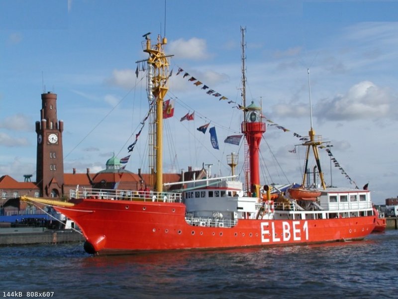
Until about 1990, all lighthouses and light ships were still equipped with staff who carried
out the necessary work. During this time I was often on lightships, especially on the lightship Elbe 1.
This ship had its position in the Elbe estuary and showed ships the correct approach to the river Elbe.
I have often calibrated the radio direction finder on vessels at the river Elbe or in the North Sea.
After this work, I was brought to the fire ship together with the Elbe pilot by a service ship.
I went back with the next ship that are going to Hamburg. All lightships on the German coasts were
converted to automatic operation, I helped by planning and commissioning a radio link for remote
control between the central station and the ship.
Ultimately, all lighthouses and light ships along the German coast were switched to fully automatic and
remote-controlled operation. That worked very well with the lighthouses on land but sometimes not well
with the light ships.The reason for this was that in bad weather you couldn't get on board to fix errors.
The Elbe 1 position in the mouth of the Elbe was very important for navigating the fairway.
This lightship was not allowed to be longer out of order to guarantee a safe approach.
Another solution to the problem had to be found.
Year 1983 I introduced the first civil GPS receiver in Germany.In Germany and other countries I have
given many introductory courses on this new technology. Together with my team, we have developed a
navigation system for the sea based on this new technology. The main problem was the lack of nautical
charts in the WGS 84 format used by the GPS. World Geodetic System 84 is a global map format which
shows the correct position all over the world. Each nation had its own map date at that time. Here in
Germany, the ED map date was in use. In order to use GPS with ED maps, we have created an electronic
system which converts WGS 84 permanently into ED. Our first navigation system worked with nautical charts in ED date format.
The nautical chart was stretched in a frame. Underneath, we had constructed a mechanism which shone a
light point from below onto the card. This point of light was controlled by the converter in ED format.
This first navigation system has been continuously developed over the years.
Nowadays, all nautical charts are created in WGS 84 and are typically used directly on a monitor.
After these navigation systems worked well, lightships were no longer needed. All lightships along the
German coast were withdrawn, scrapped or used for other purposes. My special lightship Elbe 1 will
continue to be maintained by volunteer men as a museum ship.

With the exhibition truck, equipped with a lot of navigation and communication equipment,
I drove through Germany and demonstrated the new navigation system.
|
|
|
bajagerman
Nomad
Posts: 129
Registered: 9-11-2013
Location: Hamburg / Germany
Member Is Offline
|
|

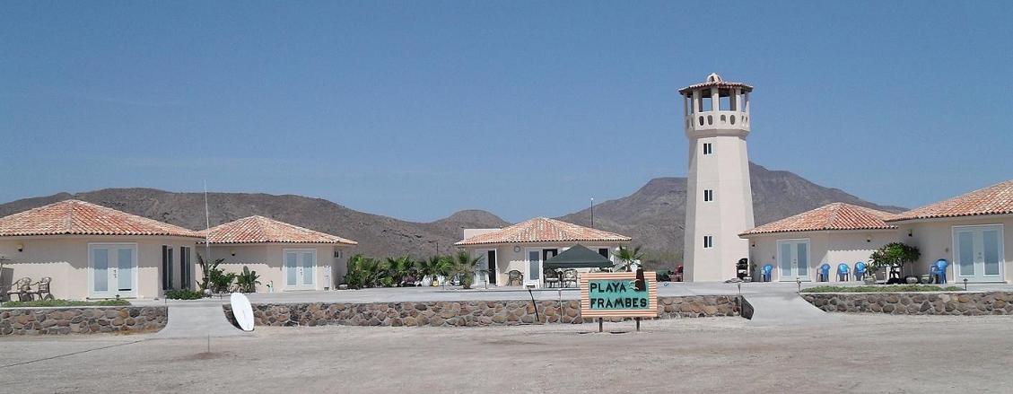
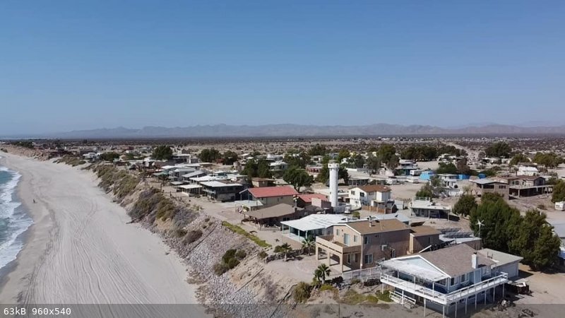
The tower with the beacon, behind it the antenna for the navigation signal can be seen.
|
|
|
bajagerman
Nomad
Posts: 129
Registered: 9-11-2013
Location: Hamburg / Germany
Member Is Offline
|
|
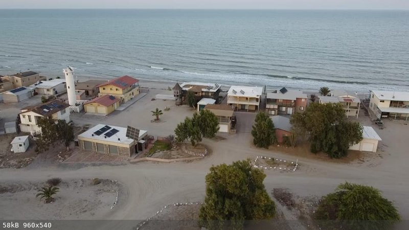
The Elbe 1 light ship is now used as a museum ship but is also used for events and trips with guests.
A selection was made from various projects that I have carried out in different countries in order
to create a book from them. Under the link www.seefunk-gmdss.de you can see a short description
for each article in connection with one or two pictures. The descriptions are in German but you
can easily read it with Google Translator. A description of the project on the Baja California
at Las Barrancas can be seen with two pictures under the heading "Solar Energy Project Sonntlan".
|
|
|
4x4abc
Ultra Nomad
Posts: 4455
Registered: 4-24-2009
Location: La Paz, BCS
Member Is Offline
Mood: happy - always
|
|
in my search for more lighthouses I came across this arrow in the mountains of Isla Santa Margarita near Puerto Cortes.
What could it mean?
The light tower is at the bottom of the image
24°27'30.20"N, 111°48'11.32"W
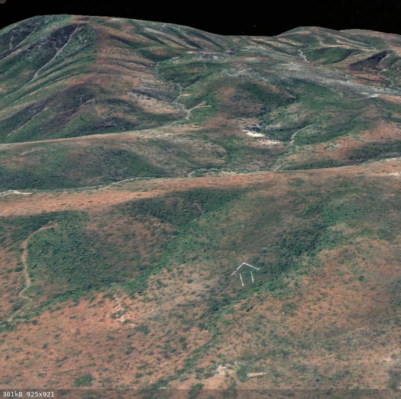
Harald Pietschmann
|
|
|
David K
Honored Nomad
Posts: 65519
Registered: 8-30-2002
Location: San Diego County
Member Is Offline
Mood: Have Baja Fever
|
|
It means, "Go This Way" !  
|
|
|
Bob and Susan
Elite Nomad
Posts: 8813
Registered: 8-20-2003
Location: Mulege BCS on the BAY
Member Is Offline
Mood: Full Time Residents
|
|
in the usa those are all over...air mail
the planes followed them
|
|
|
4x4abc
Ultra Nomad
Posts: 4455
Registered: 4-24-2009
Location: La Paz, BCS
Member Is Offline
Mood: happy - always
|
|
followed the arrow into the mountains - found a mine that I not mapped yet
cool!
has a dozed road going there - not just burro trails
Harald Pietschmann
|
|
|
geoffff
Senior Nomad
Posts: 715
Registered: 1-15-2009
Member Is Offline
|
|
David, I've been there many times! It's one of my favorite camping spots heading south. Punta Morro Santo Domingo.


|
|
|
David K
Honored Nomad
Posts: 65519
Registered: 8-30-2002
Location: San Diego County
Member Is Offline
Mood: Have Baja Fever
|
|
From the El Vergel Facebook page: https://www.facebook.com/groups/salvadorcastro2000/
|
|
|
bajaric
Senior Nomad
Posts: 678
Registered: 2-2-2015
Member Is Offline
|
|
Twin candystripes --
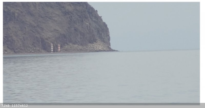
Edit: No guesses? Isla El Muerto aka Isla Miramar. The older lighthouse was replaced a couple of years ago but left standing.
[Edited on 3-6-2022 by bajaric]
|
|
|
gueribo
Nomad
Posts: 469
Registered: 10-16-2014
Member Is Offline
|
|
Very nice thread . . . thanks all, for the photos.
|
|
|
| Pages:
1
2
3
4 |