| Pages:
1
2 |
defrag4
Senior Nomad

Posts: 536
Registered: 2-5-2011
Member Is Offline
|
|
1947 AAA Baja Roadtrip report
Fellow baja lover shared this article with me, she said she found it while shuffling through her fathers old papers. Pretty awesome!
http://s000.tinyupload.com/index.php?file_id=046798477976050...


|
|
|
StuckSucks
Super Nomad
Posts: 2376
Registered: 10-17-2013
Location: Pacific Plate
Member Is Offline
|
|
We have it very easy these days! A fun read -- following along in my mind where the road crissed and crossed the peninsula.
And we whine about potholes in the road.
|
|
|
David K
Honored Nomad
Posts: 65551
Registered: 8-30-2002
Location: San Diego County
Member Is Offline
Mood: Have Baja Fever
|
|
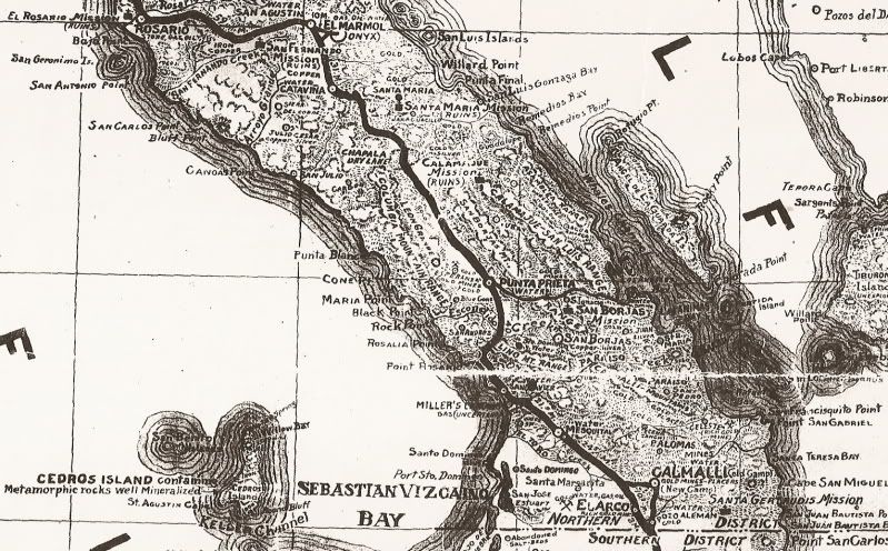
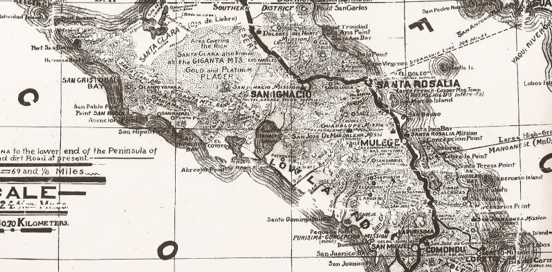
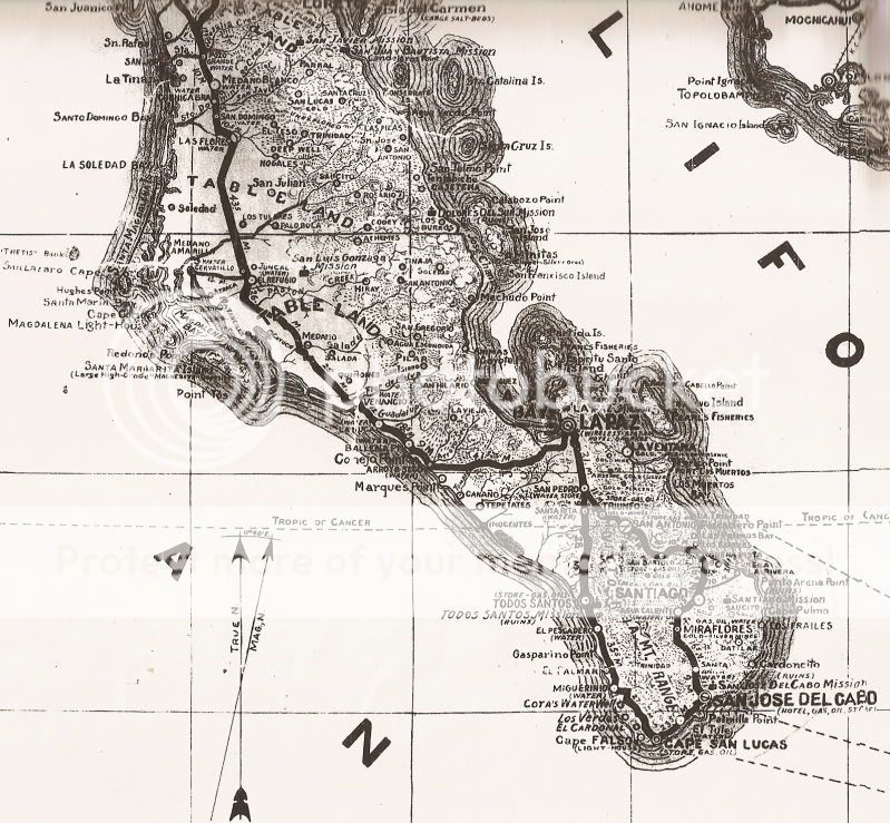
Thank you very much defrag4. History only happens once and when you can save it and share it with others, well, it is all that more enjoyable.
Here is a 1941 road map and log with the heavy black line being the main road (not a paved road):
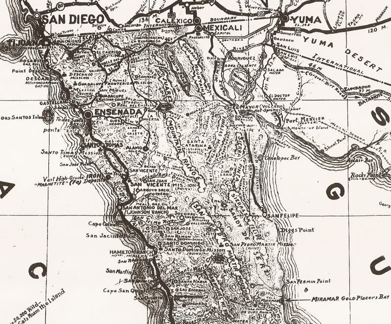
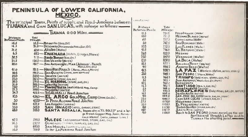
Before 1971, the main road went through Comondú, not Loreto... which was on a dead end road then. Note the many places the word "Unexplored" appears.
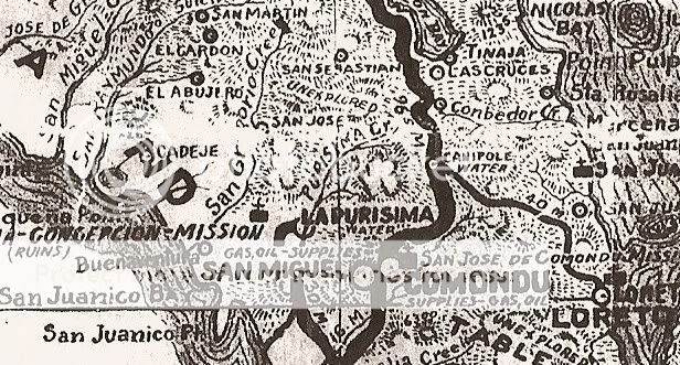
Here is a close up of a part of the map:
|
|
|
TMW
Select Nomad
Posts: 10659
Registered: 9-1-2003
Location: Bakersfield, CA
Member Is Offline
|
|
Excellent stuff, love it.
|
|
|
Mexitron
Ultra Nomad
Posts: 3397
Registered: 9-21-2003
Location: Fort Worth, Texas
Member Is Offline
Mood: Happy!
|
|
Awesome glimpse into the past, thanks for sharing!
|
|
|
4x4abc
Ultra Nomad
Posts: 4455
Registered: 4-24-2009
Location: La Paz, BCS
Member Is Offline
Mood: happy - always
|
|
David,
do you have a scan with better resolution?
Harald Pietschmann
|
|
|
David K
Honored Nomad
Posts: 65551
Registered: 8-30-2002
Location: San Diego County
Member Is Offline
Mood: Have Baja Fever
|
|
Be more specific as to what you want to see, and I will try to help.
|
|
|
4x4abc
Ultra Nomad
Posts: 4455
Registered: 4-24-2009
Location: La Paz, BCS
Member Is Offline
Mood: happy - always
|
|
I would like to see image 1-4 in higher resolution
like the quality of Comondu1941
[Edited on 3-20-2019 by 4x4abc]
Harald Pietschmann
|
|
|
David K
Honored Nomad
Posts: 65551
Registered: 8-30-2002
Location: San Diego County
Member Is Offline
Mood: Have Baja Fever
|
|
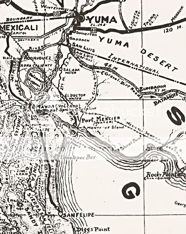
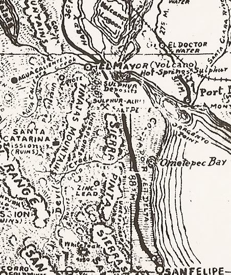
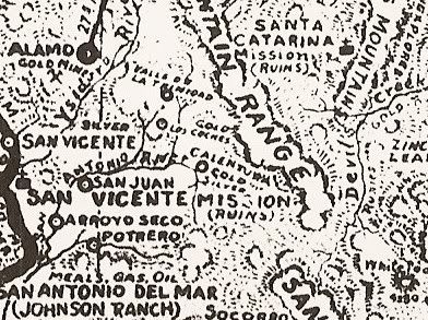
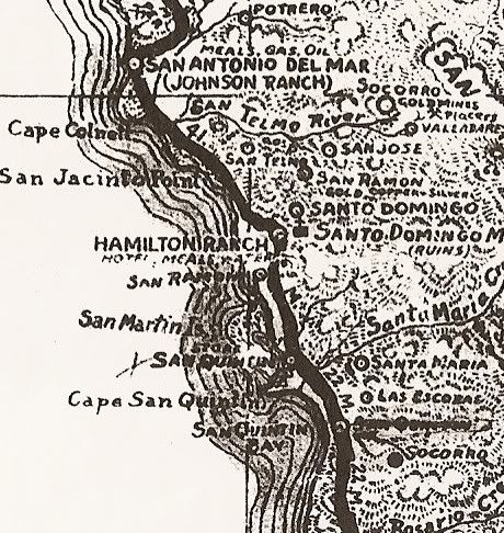
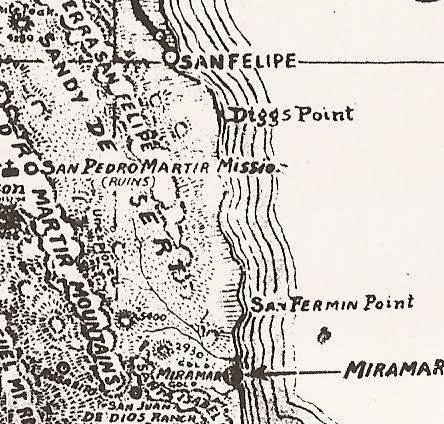
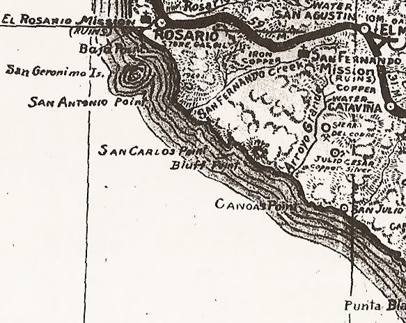
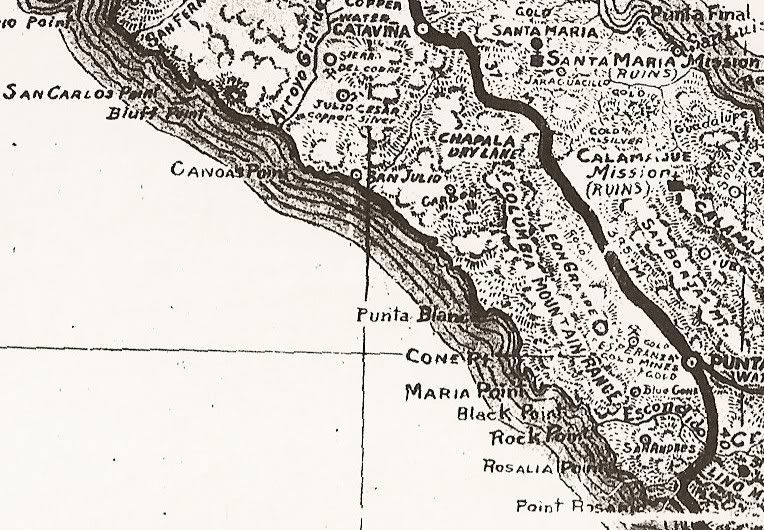
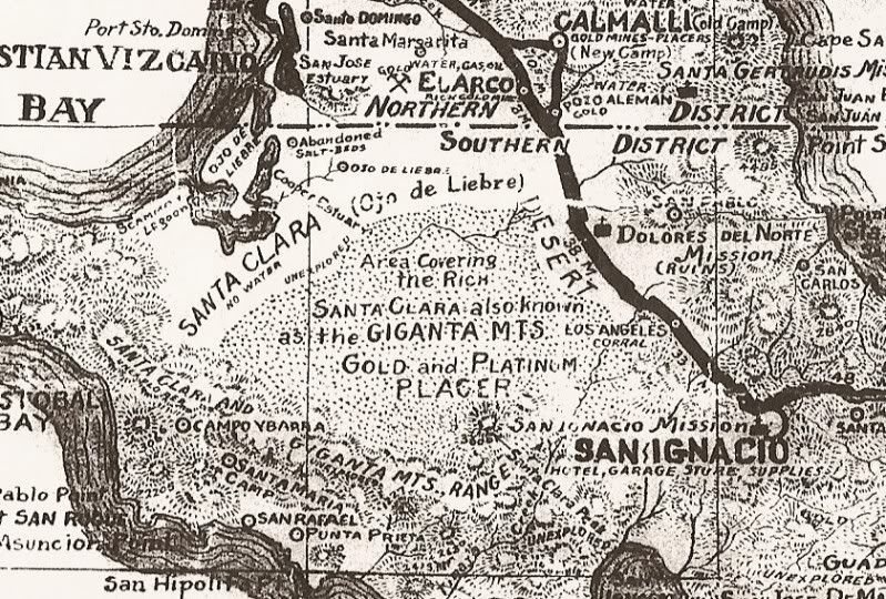
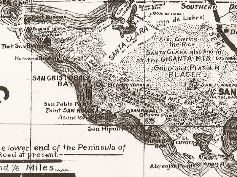
That Comondu was simply a zoom in from the upper ones... Here are a few more zoom ins:
Colorado Delta:
Pole Line Rd area:
Valle de Trinidad area:
San Quintín area:
San Felipe South:
El Rosario South:
El Mármol area:
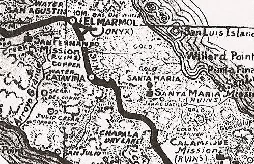
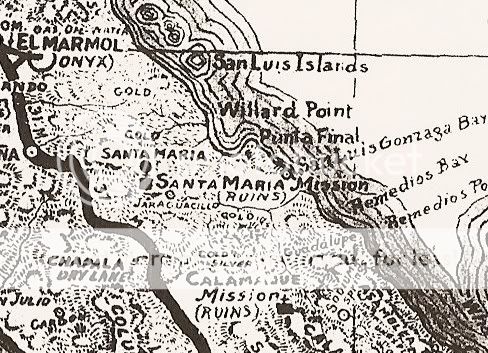
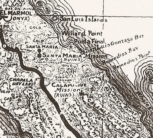
Mission Santa María & Calamajué area:
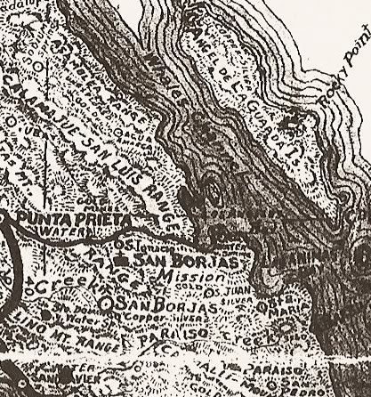
San Borja area:
Seven Sisters:
Vizcaíno Desert:
Bahía Asunción area:
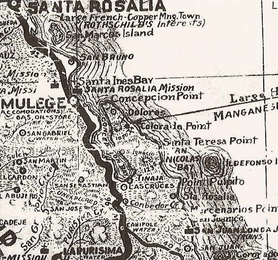
Santa Rosalía area:
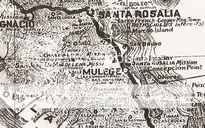
Concepción Bay area:
Comondú area:
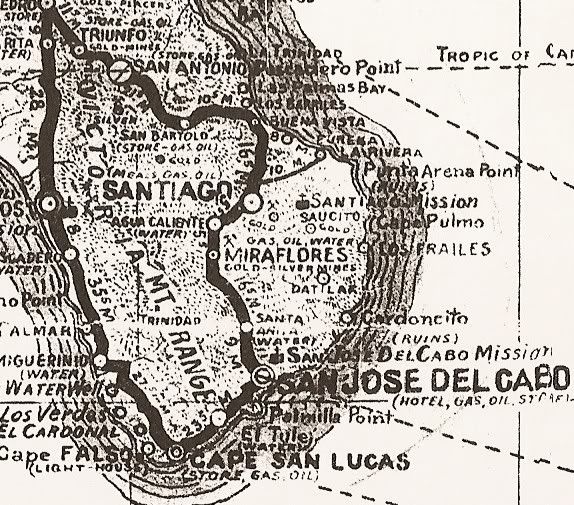
Los Cabos:
|
|
|
4x4abc
Ultra Nomad
Posts: 4455
Registered: 4-24-2009
Location: La Paz, BCS
Member Is Offline
Mood: happy - always
|
|
much better, David!
Harald Pietschmann
|
|
|
David K
Honored Nomad
Posts: 65551
Registered: 8-30-2002
Location: San Diego County
Member Is Offline
Mood: Have Baja Fever
|
|
The 4 larger area maps are pretty high resolution (file size) so, if you just enlarge your screen zoom (hold down Alt and press +) you can zoom into
an area of interest enough to see it well and it doesn't go too blurry.
|
|
|
fishbuck
Banned
Posts: 5318
Registered: 8-31-2006
Member Is Offline
|
|
Wow. That is cool.
Can you imagine...
I would love to know who was flying in Baja then and what kind of planes.
Wow!
"A ship in harbor is safe, but that is not what ships are built for." J. A. Shedd.
A clever person solves a problem. A wise person avoids it. – Albert Einstein
"Life's a Beach... and then you Fly!" Fishbuck
|
|
|
4x4abc
Ultra Nomad
Posts: 4455
Registered: 4-24-2009
Location: La Paz, BCS
Member Is Offline
Mood: happy - always
|
|
do you use a scanner?
Harald Pietschmann
|
|
|
David K
Honored Nomad
Posts: 65551
Registered: 8-30-2002
Location: San Diego County
Member Is Offline
Mood: Have Baja Fever
|
|
Yes... not easy with wide, rolled paper maps!
|
|
|
4x4abc
Ultra Nomad
Posts: 4455
Registered: 4-24-2009
Location: La Paz, BCS
Member Is Offline
Mood: happy - always
|
|
how about the old road south of Cataviña?
any pics?
Harald Pietschmann
|
|
|
David K
Honored Nomad
Posts: 65551
Registered: 8-30-2002
Location: San Diego County
Member Is Offline
Mood: Have Baja Fever
|
|
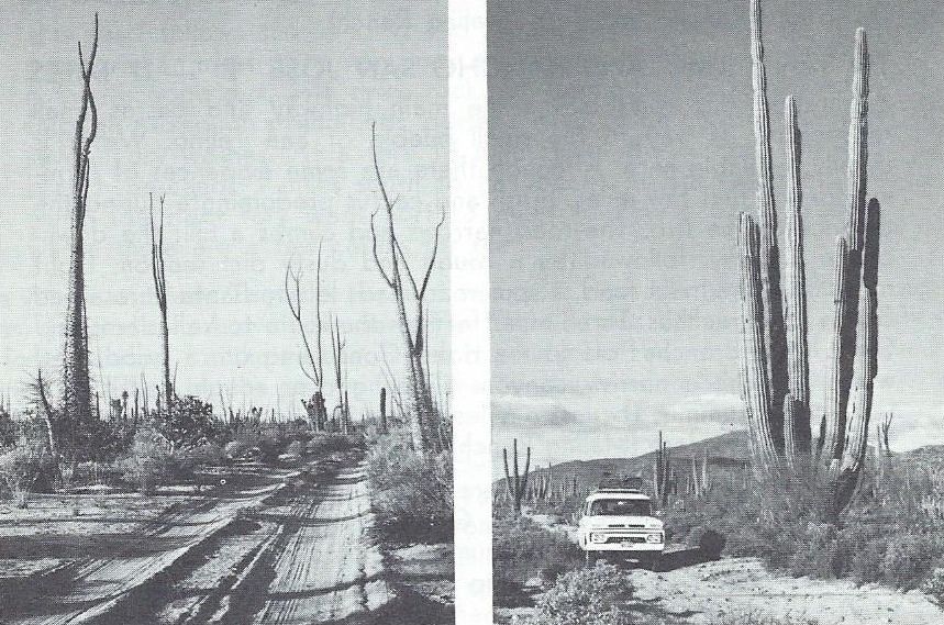
It was just a well-worn pair of ruts. If you ever did come upon another vehicle, one would need to pull fully off the road so the other could get
by... Hwy. 1, before 1973!
Here are a pair of photos from an old Auto Club book showing Highway 1, 1964 edition.
|
|
|
David K
Honored Nomad
Posts: 65551
Registered: 8-30-2002
Location: San Diego County
Member Is Offline
Mood: Have Baja Fever
|
|
Here is 'Highway 1', 21 miles south of El Rosario, as it was shown in the 1970 book 'Baja' by Doug Richmond.
|
|
|
David K
Honored Nomad
Posts: 65551
Registered: 8-30-2002
Location: San Diego County
Member Is Offline
Mood: Have Baja Fever
|
|
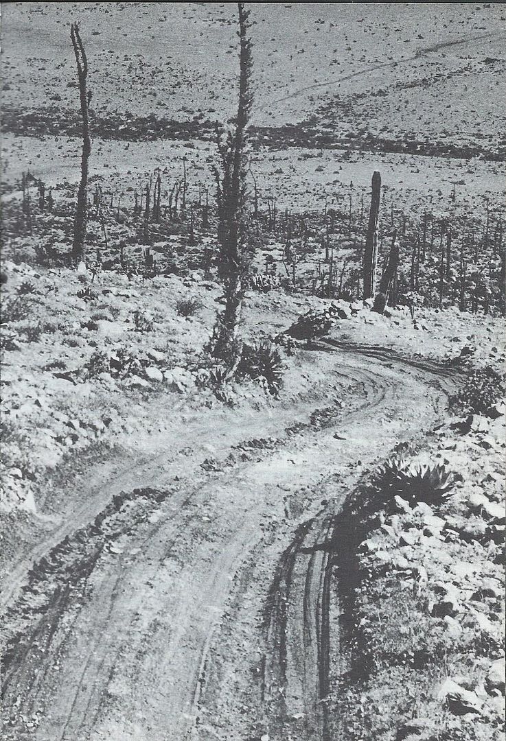
The arroyo near (today's) Cataviña, also from Doug's 1970 book:
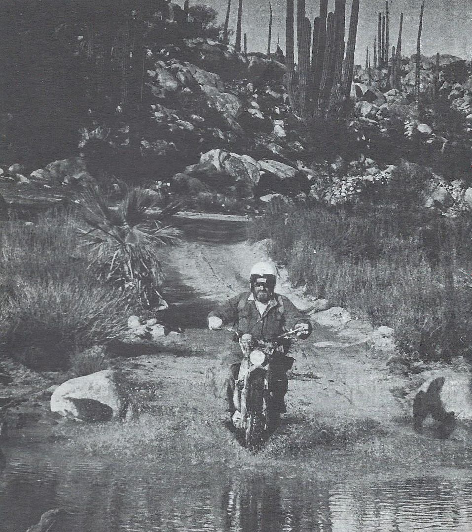
Cataviña was an abandoned site in the 1960s and early 70s. Rancho San Luis and Santa Ynez were the hot spots nearby. The modern Cataviña was born
with the highway constructed through here in the Summer of 1973 as a site for one of the Paradors (rest stops) and El Presidente Hotels... plus an RV
camping park, cafeteria, showers, gas station.
|
|
|
gueribo
Nomad
Posts: 469
Registered: 10-16-2014
Member Is Offline
|
|
Great report and a cool find.
|
|
|
4x4abc
Ultra Nomad
Posts: 4455
Registered: 4-24-2009
Location: La Paz, BCS
Member Is Offline
Mood: happy - always
|
|
still trying to make sense of the 1930's road around Rancho Canipolé
the remnants on the ground show different than the maps
I know the scale is not that accurate, but some vitals are missing
Harald Pietschmann
|
|
|
| Pages:
1
2 |


