Nick_SD
Newbie
Posts: 2
Registered: 7-21-2019
Member Is Offline
|
|
San Diego to San Juanico via the Low Road
I recently returned from a 9 day run (07/12/19-07/20/19) down to San Juanico, and wanted to document the trip (in a very qualitative sense!) in case
it helps other travelers.
I have a 2006 Tacoma Prerunner (2wd) with a camper shell that is essentially stock, with the addition of some Bilsteins. We loaded the boards and the
gear to head down to Scorpion Bay for a recent run of south swells.
The first thing of note was that I blindly followed maps.me through Tijuana, where it kept routing me onto the Libre Highway 1, instead of the Cuota
(tolled) road. No big deal, but we did hit a bunch of early morning traffic. Note, after course correcting we found that they weren't collecting money
at the tolls, and volunteers had taken over the stalls and were asking for donations (some of the signs, but not all, mentioned firefighters).
There was a 30 minute + wait at Santo Tomas for road construction. It was interesting to watch a mini economy bloom in that short time, with people
selling everything from beverages to birds.
The drive through Catavina was riveting. Man, it's hot there this time of year! We spent the night in San Ignacio, with our travel time from SD
clocking in around 12.5 hours, factoring in a few stops (Tacos Los Poblanos in San Quinitin). The Federale check point at San Ignacio was the most
thorough (both ways) of our trip, taking about 20 minutes on our journey south.
After chatting with some people heading north I gambled that the North Road** was worthy of a try, even though I was nervous about my 2wd limitation.
Note, we did this trip 3 days short of a full moon, and based on some previous threads I wasn’t sure how serious of an issue this was going to be. I
followed the maps.me track pretty faithfully, with my overarching principle being "follow the most used/most recently used tracks". I think I
understand the short comings of this/these approaches, but proceeded anyways as we had some just-in-case gear with us.
After airing down at the end of the paved road, we followed the tracks towards El Datil. There was a pretty serious amount of soft sand leading into
town, and I could easily see things getting dicey if I were forced to slow down or move off the road.
The flats after El Datil were dark, but not muddy. Some soft sand greeted us after the flats, but from there on it was a few very minor river
crossings and some grated roads into San Juanico.
In San Juanico I heard various offerings about the road conditions ranging from "best I've ever seen the North Road" to "holy chit that road sucks
now". One guy said he got stuck for ~12 hours on the way in! Kinda hard to sift through the line up chatter for nuggets of truth tho, so take it for
what it is.
On the way back, things had changed pretty noticeably south of El Datil. The sand on this side of down was much more packed this time around. There
was a pretty persistent marine layer in this area for the week or so we were at San Juanico, so this could account for the additional moisture,
although I can't say for sure. The sand on the north side of El Datil was still pretty soft.
Besides that, the stop-and-go traffic getting into Ensenda was pretty brutal on a Saturday.
Overall, a fantastic trip in a magical part of the world. Can't wait to go back!
** I took the flats, or the low road, in. I heard many people arguing about the names of the roads down there, and am simply following the names put
forth on the map found here: http://forums.bajanomad.com/viewthread.php?tid=89230
[Edited on 7-22-2019 by Nick_SD]
|
|
|
StuckSucks
Super Nomad
   
Posts: 2369
Registered: 10-17-2013
Location: Pacific Plate
Member Is Offline
|
|
Fun read, thanks! Have any photos to share?
Award-winning first post!
|
|
|
David K
Honored Nomad
        
Posts: 65412
Registered: 8-30-2002
Location: San Diego County
Member Is Offline
Mood: Have Baja Fever
|
|
Interesting that you took the low road (Salina road) after reports were posted that the high road was regraded and the preferred route (in Aug. 2018).
Why did you chance the low road in a 2WD?
Thank you for the report... and yes, any photos?
|
|
|
Nikno
Junior Nomad

Posts: 90
Registered: 7-12-2019
Member Is Offline
|
|
I have driven that road 6 times in the past two years and the conditions haven't changed significantly. The main factor is soft sand in about 3
sections which comes and goes. I'm guessing hot dry winds carry sand in and it builds up. Once it has been driven over a few times and as you
mentioned with some added moisture, it starts to firm up again.
The most recent time (June 2019) there was a 2WD passenger van in our caravan which got stuck 3 times. Shovel and Maxxtracks was enough to get moving
again. We eventually aired down a bit more (Hard to do when the tires are so small) and changed drivers and then made it through without anymore
issues.
No matter what I still prefer that route to the high road or ranch road as some people call it. The salt flats are way smoother, allow for faster
driving and way lower likely hood of a flat. I have not driven through there after major flooding and that would definitely be a time to avoid it.
|
|
|
Nick_SD
Newbie
Posts: 2
Registered: 7-21-2019
Member Is Offline
|
|
Thanks for the responses.
I chanced the low road as it wasn't clear to me a priori if this was the lesser of the two evils. This ignorance also partially motivated this post,
as I now have learned that I should have taken the other route! Maybe that'll help someone else.
I was basically using a combination of this forum, youtube, and friend's accounts to get a bit of insight into what I was in for. I think I had
confused the accounts of "knee deep moon dust" and difficulty of navigation around the ranch up there with the current state of affairs there (for
example I didn't know the road was regraded - must have missed this/misread this). In my opinion the dynamic nature of Baja is what makes it so
awesome and exciting, and difficult/dangerous for beginners.
Live and learn and be grateful I'm not living on a salt flat full time.
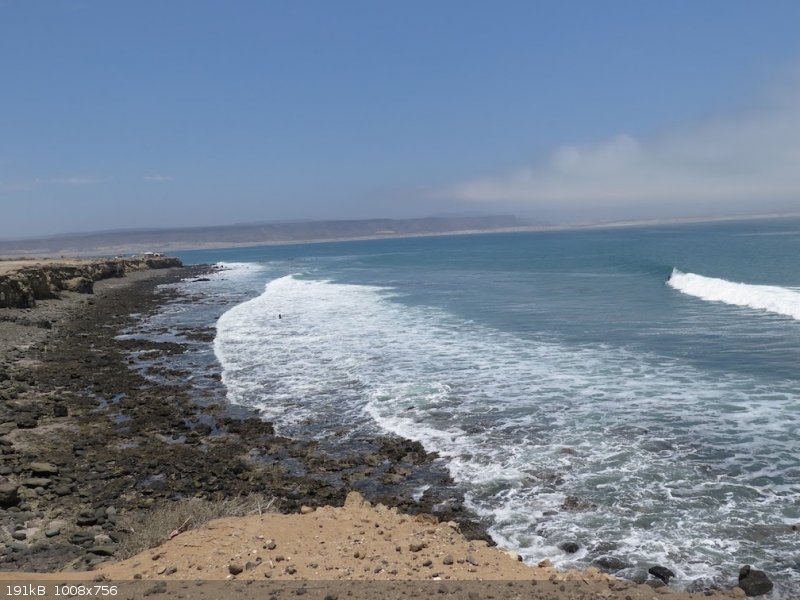
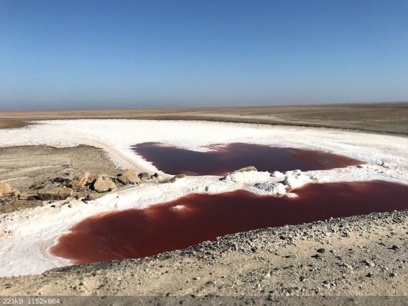
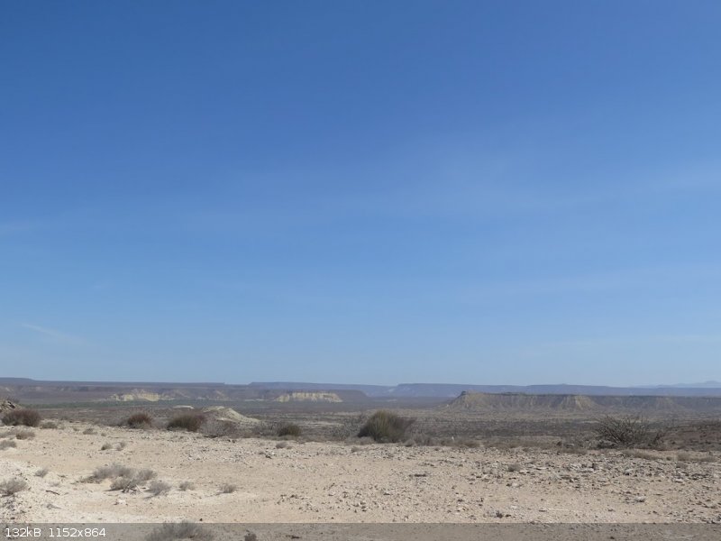
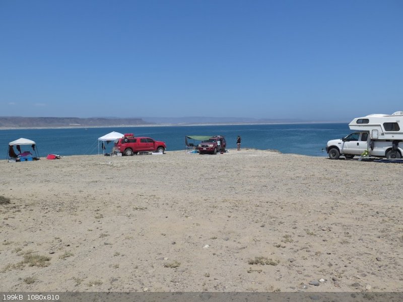
Anyways, pictures.
   
|
|
|
Mulege Canuck
Nomad
 
Posts: 393
Registered: 11-27-2016
Member Is Offline
|
|
I have never tired the upper route. We take the lower salt flat route and camp on the skinny peninsula past Campo Delgadito. It is an amazing spot
if the wind is not howling. Locals are really friendly. They thought we were lost when we drove through “ town” in our camper.
|
|
|
drzura
Nomad
 
Posts: 320
Registered: 7-1-2006
Member Is Offline
|
|
Nice read and pictures. Thanks Nick. 
|
|
|
bajafam
Senior Nomad
  
Posts: 654
Registered: 9-6-2009
Location: Northeast AZ, Bahia Asuncion, BCS :)
Member Is Offline
Mood: DLTBGYD
|
|
I love that you added the taco stop by name. We are also huge fans of Los Poblanos, though we haven't taken the 1 in years. I can still taste though
little bites of heaven, probably the only meat I yearn for since going veggie two years ago!
We're also keen on the low roads, as we're up for an adventure, not a Sunday cruise. Looks like your "risky" choice paid off.
|
|
|

