David K
Honored Nomad

Posts: 65563
Registered: 8-30-2002
Location: San Diego County
Member Is Offline
Mood: Have Baja Fever
|
|
Baja 5-25: Missions & More. PART 5 (El Mármol/ El Volcán)
Continued from Part 4: https://forums.bajanomad.com/viewthread.php?tid=101817
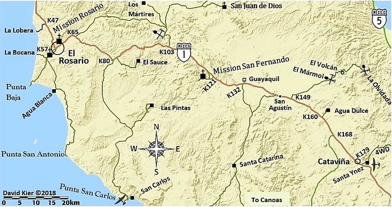
We return to Mex 1, the Transpeninsular Highway (built through here in the summer of 1973... I was there) and continue southbound from Km. 121 to Km.
149, the signed road to the east for El Mármol (15 kms./ 9.3 mi.). This is a nearly level, easy drive for most vehicles.
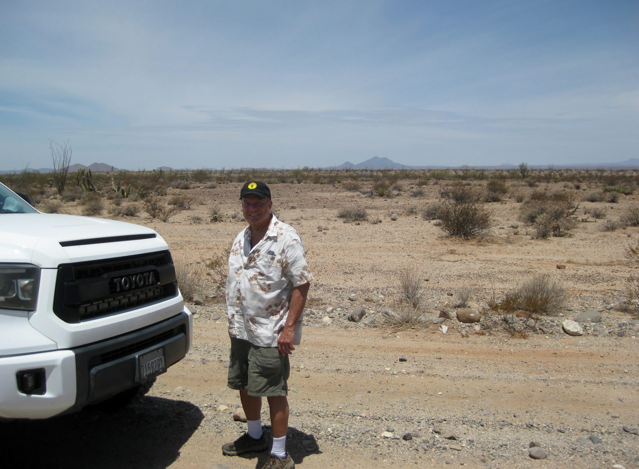
About half-way in, I stop and ask Dave to take a photo of me to compare to one my friend (in 1975) took, when I was 17 and going to El Mármol. I did
not have the older photo in my hands to match... forgetting that we were on Starlink and I could have just brought it up from my VivaBaja.com Old
Photos album:
1975:

2025:
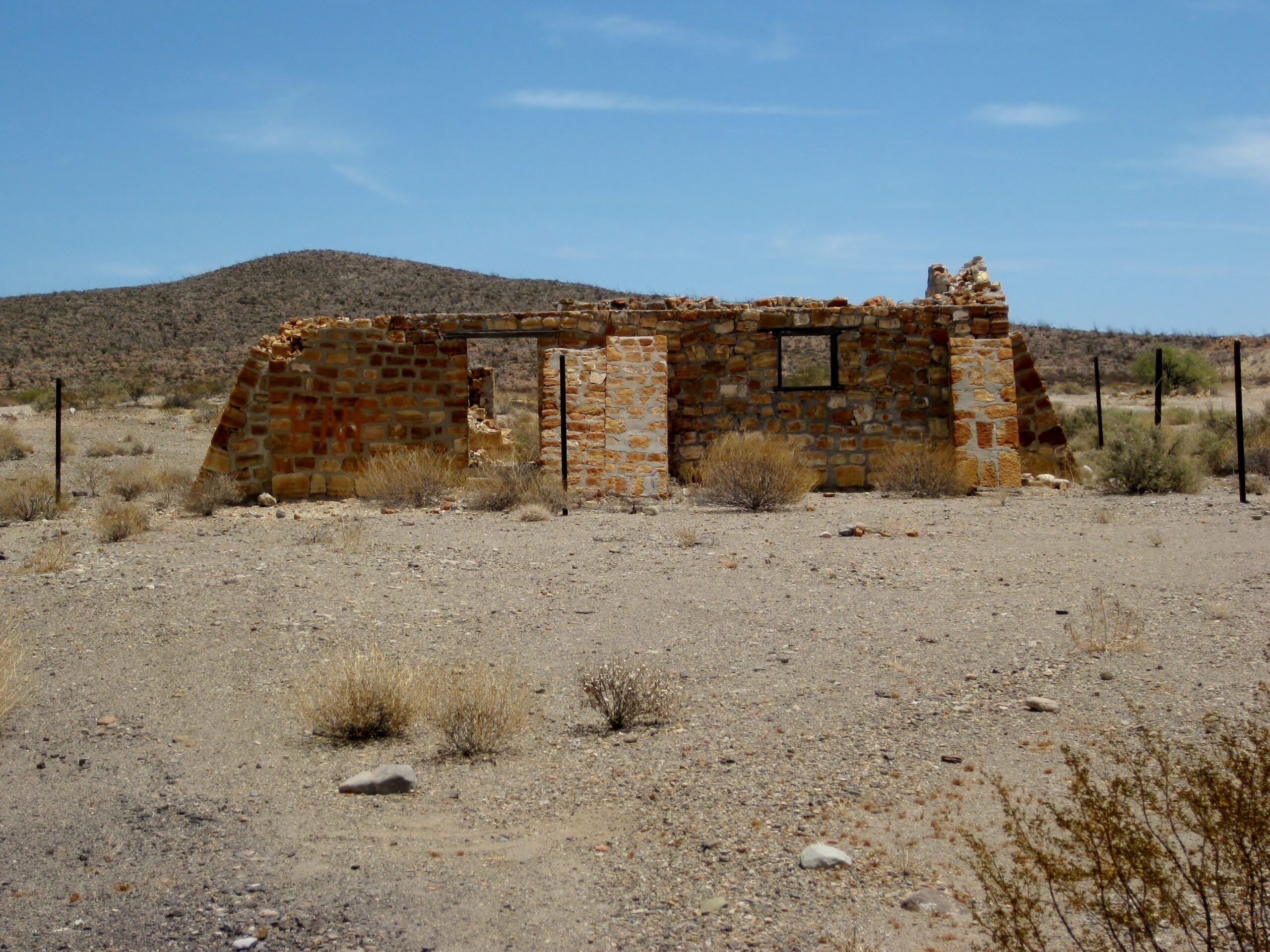
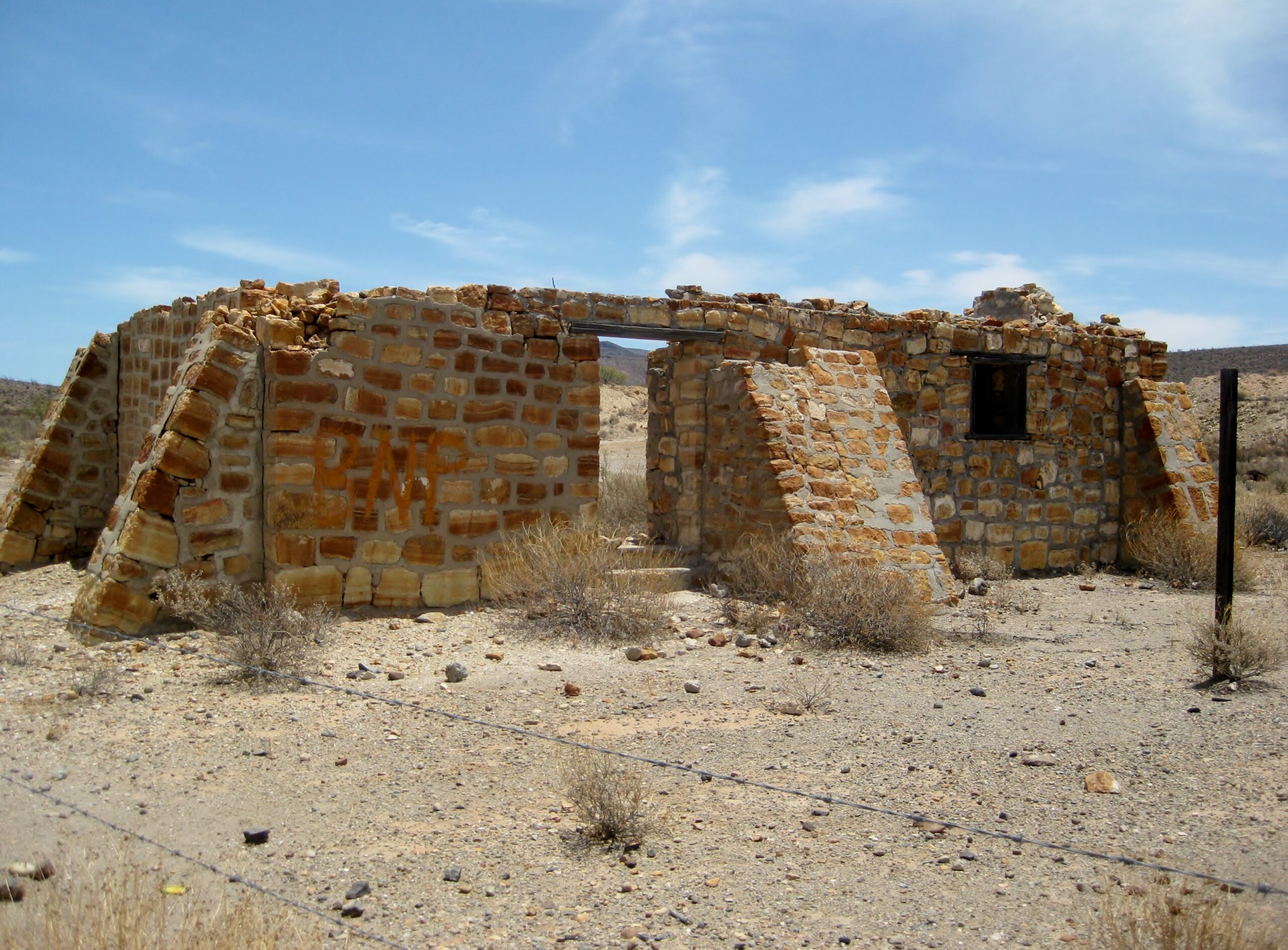
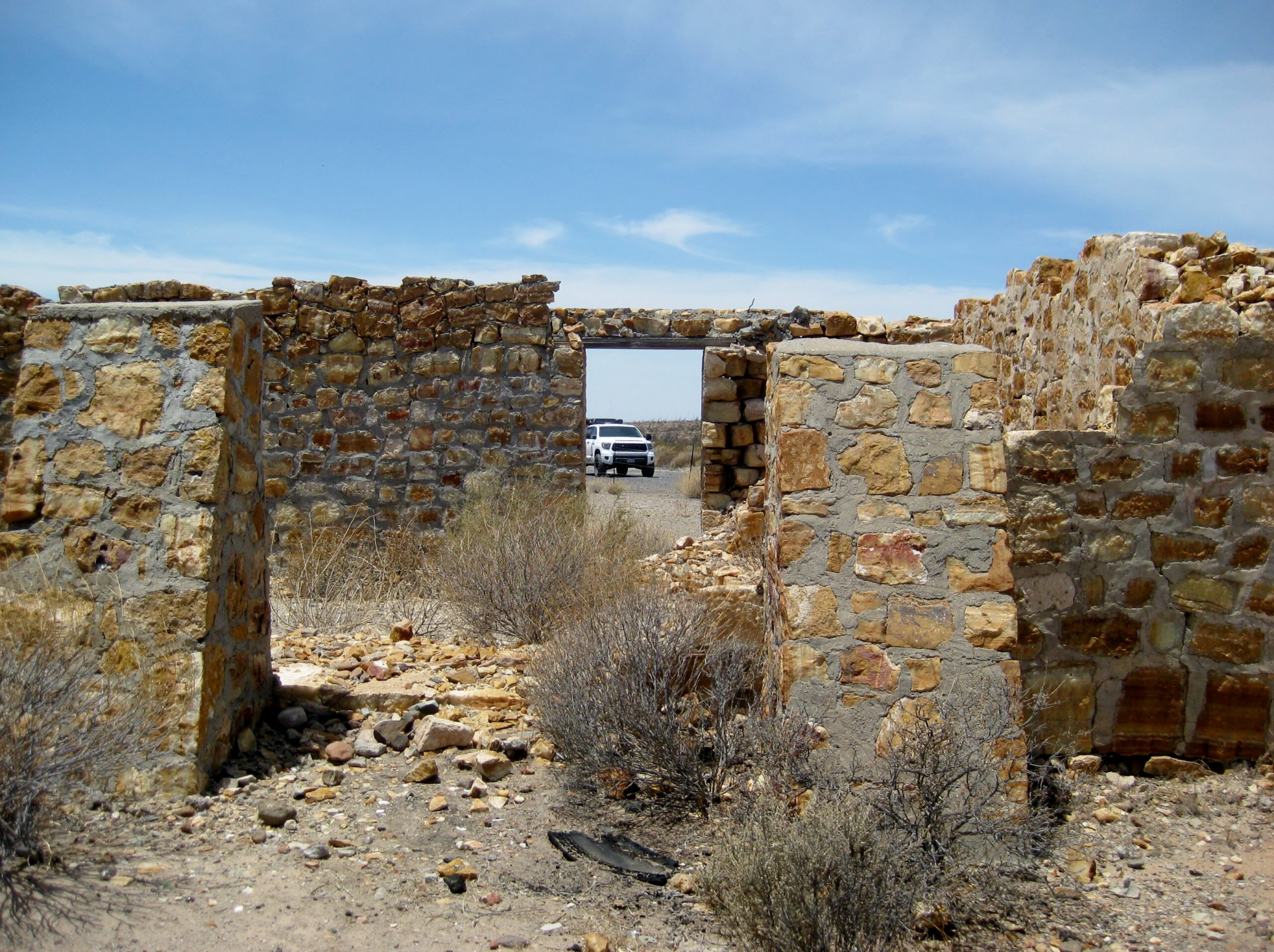
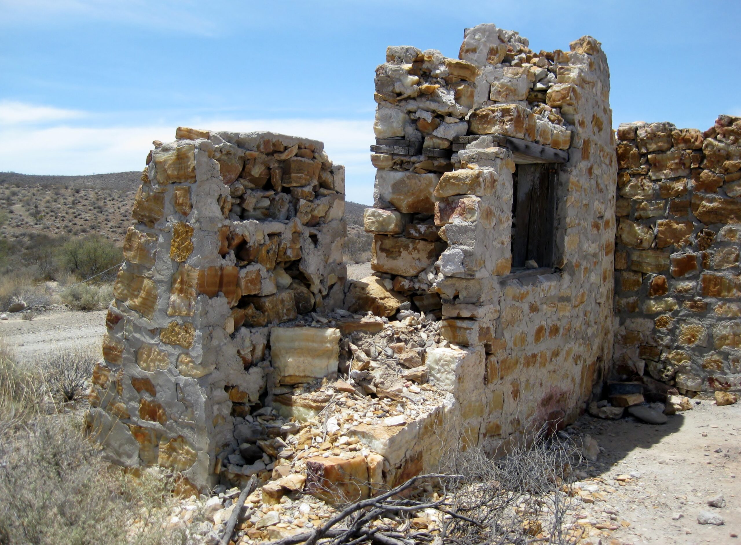
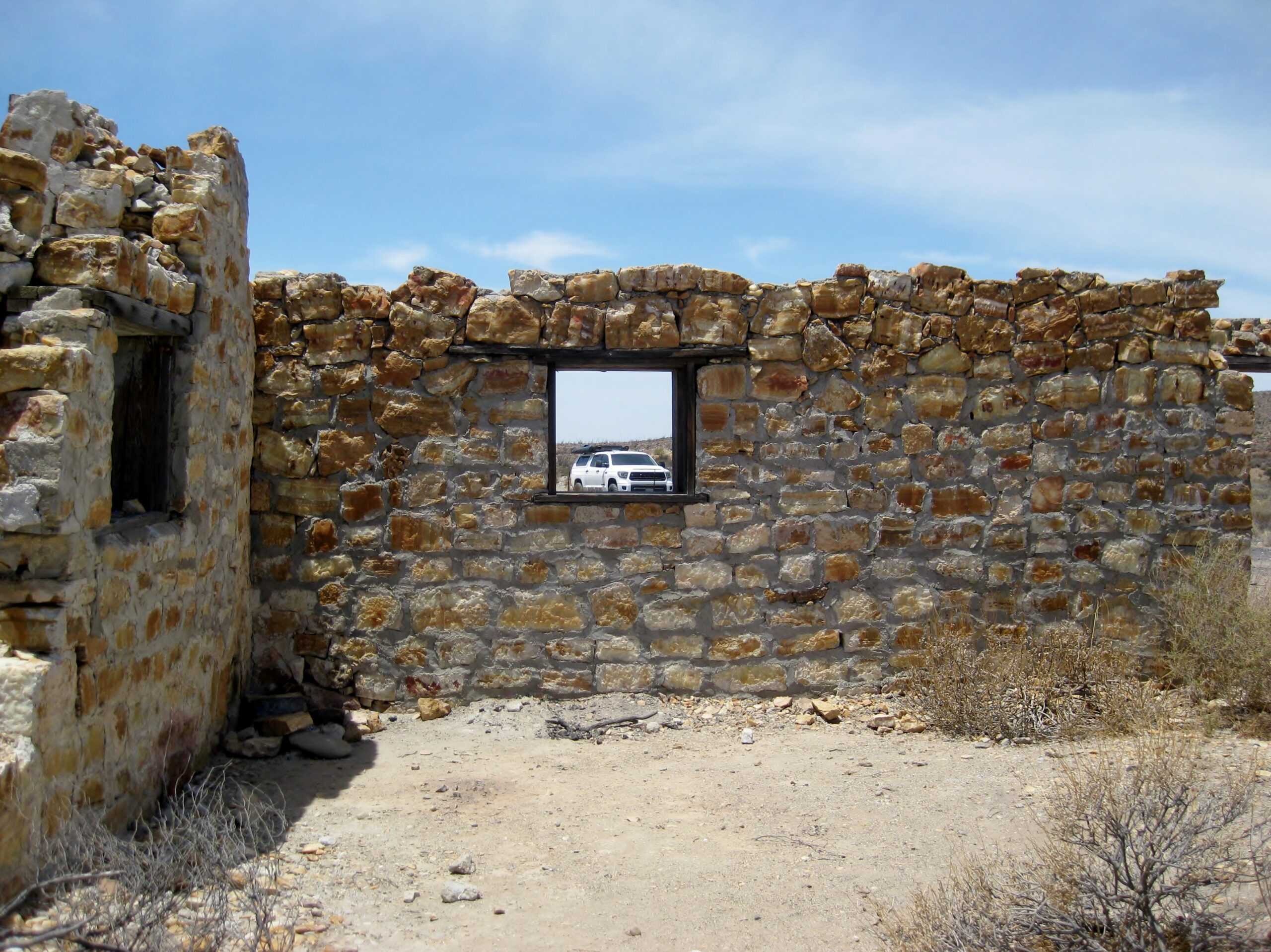
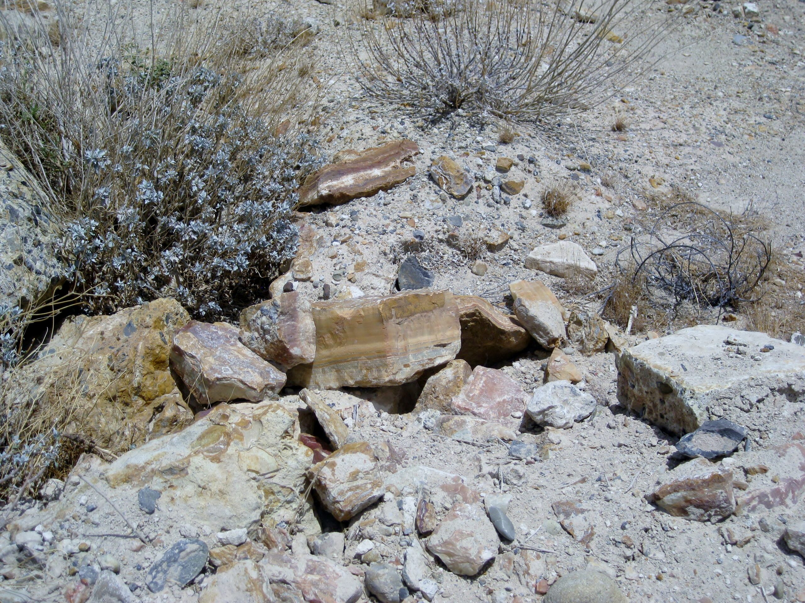
EL MÁRMOL ONYX SCHOOL and QUARRY
I wrote about El Mármol after an earlier visit there with the history: https://www.bajabound.com/bajaadventures/bajatravel/the_onyx...
In 1952 (Mike McMahan photos):


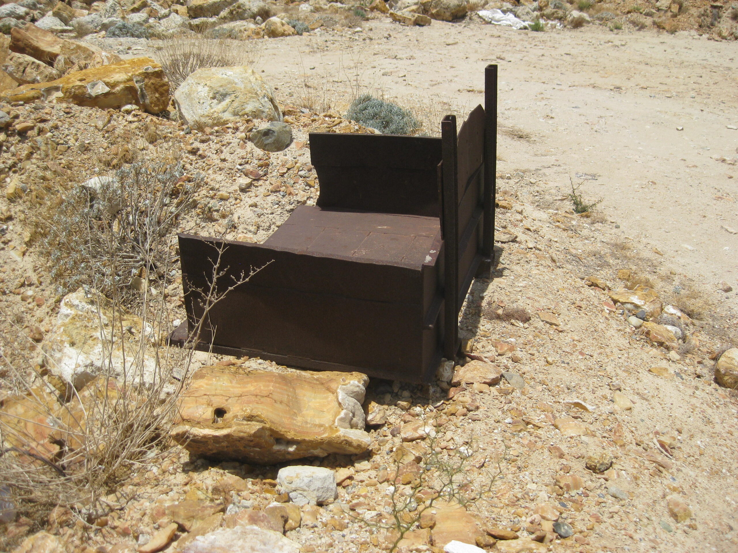

There is a new fence protecting the schoolhouse and the entire onyx quarry with the right fork before the schoolhouse gated closed. This must be to
stop the loading of onyx by just anyone? This also prevents using the older south road, back to Mex 1, which you can see climbing the hill.
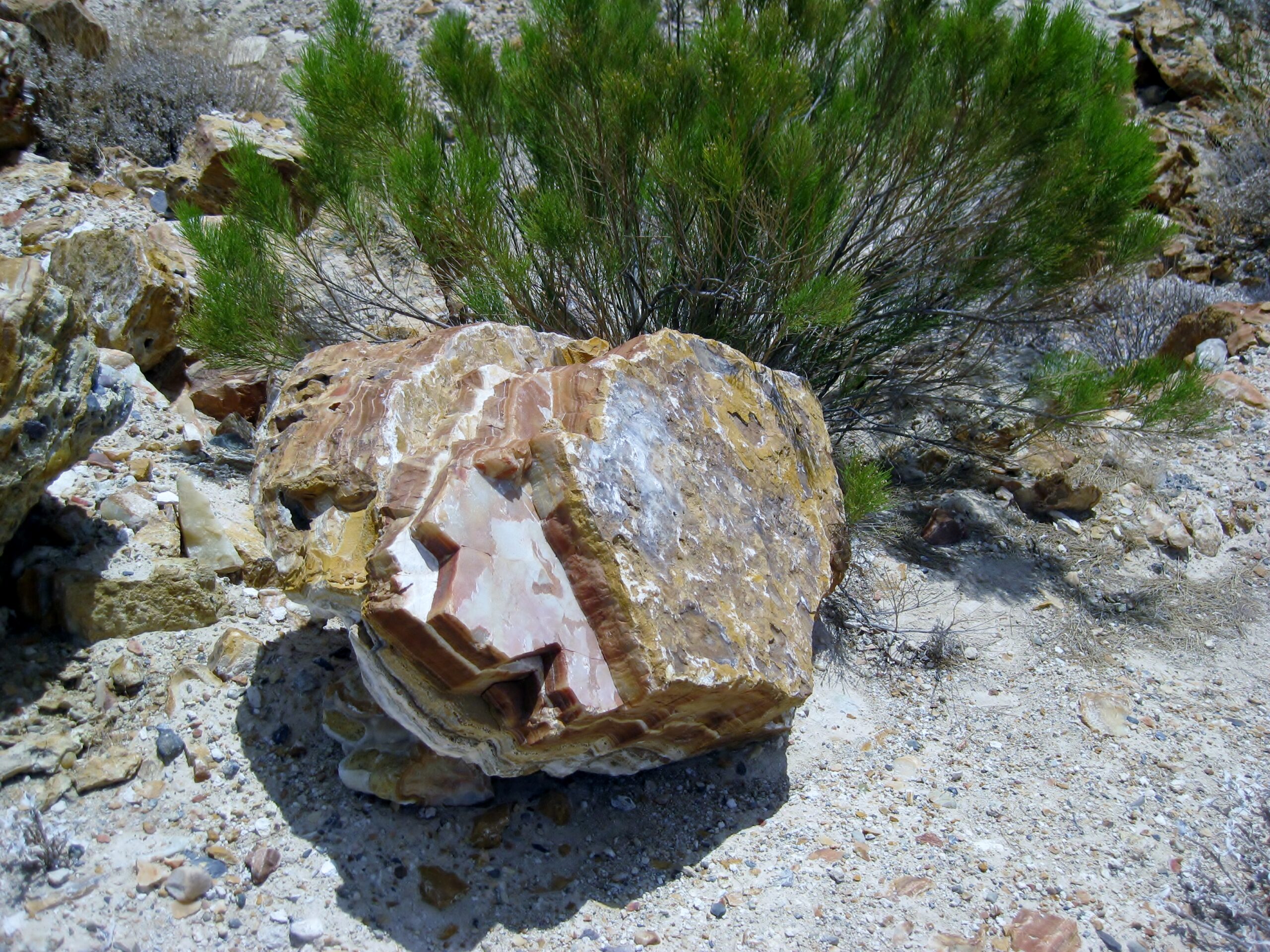
On to El Volcán, Baja's cold-water geyser and soda springs, where onyx is being created!
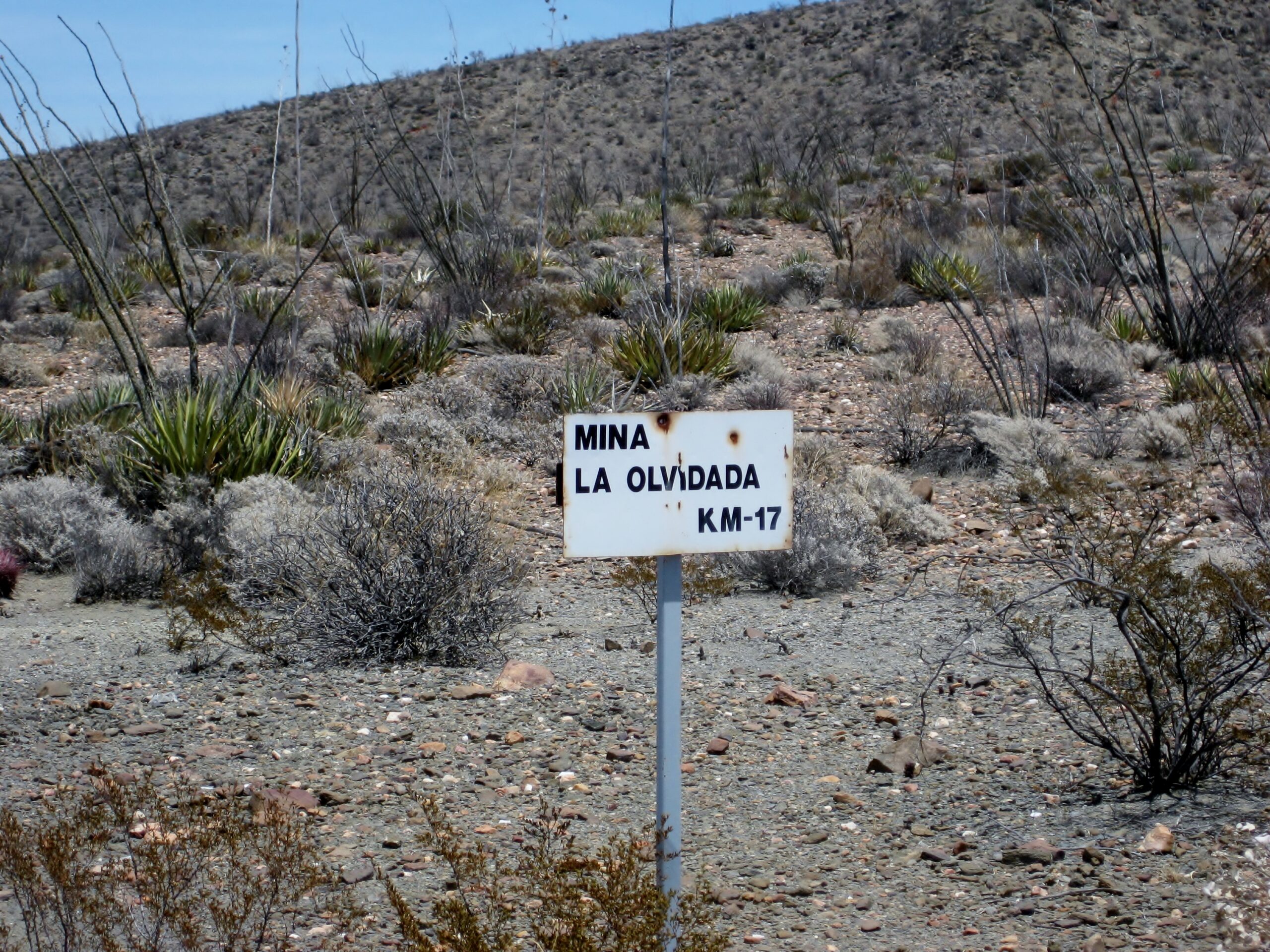
A new feature since my last time on this road (2011) are these distance signs to the La Olvidada barite mine, 10 kms beyond Arroyo el Volcán. The
road was graded for the mine trucks and only seems to be active periodically, as the need for barite (used in oil well drilling) arises. Going back
out, the kilometers are given back to Mex 1.
After the road forks right, two miles from the schoolhouse, there is a long down grade and maybe only 4x4s and buggies should attempt. Dave was a bit
nervous, but I assured him the Toyota would have no problem! He was glad having Starlink to summon help if we broke down way back there.
Four miles from the schoolhouse, the road enters Arroyo el Volcán (mislabeled as Arroyo Zamora on some maps). Here you turn off to the right and
drive as far as you can to begin the short walk.
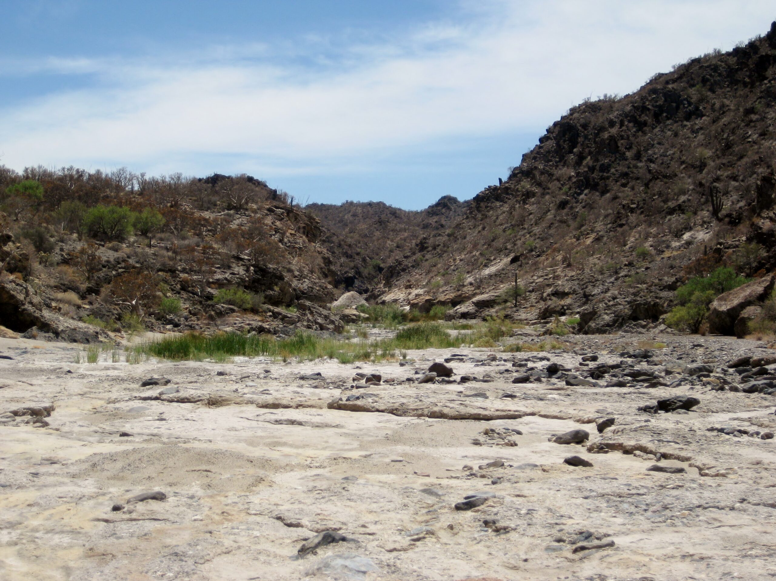
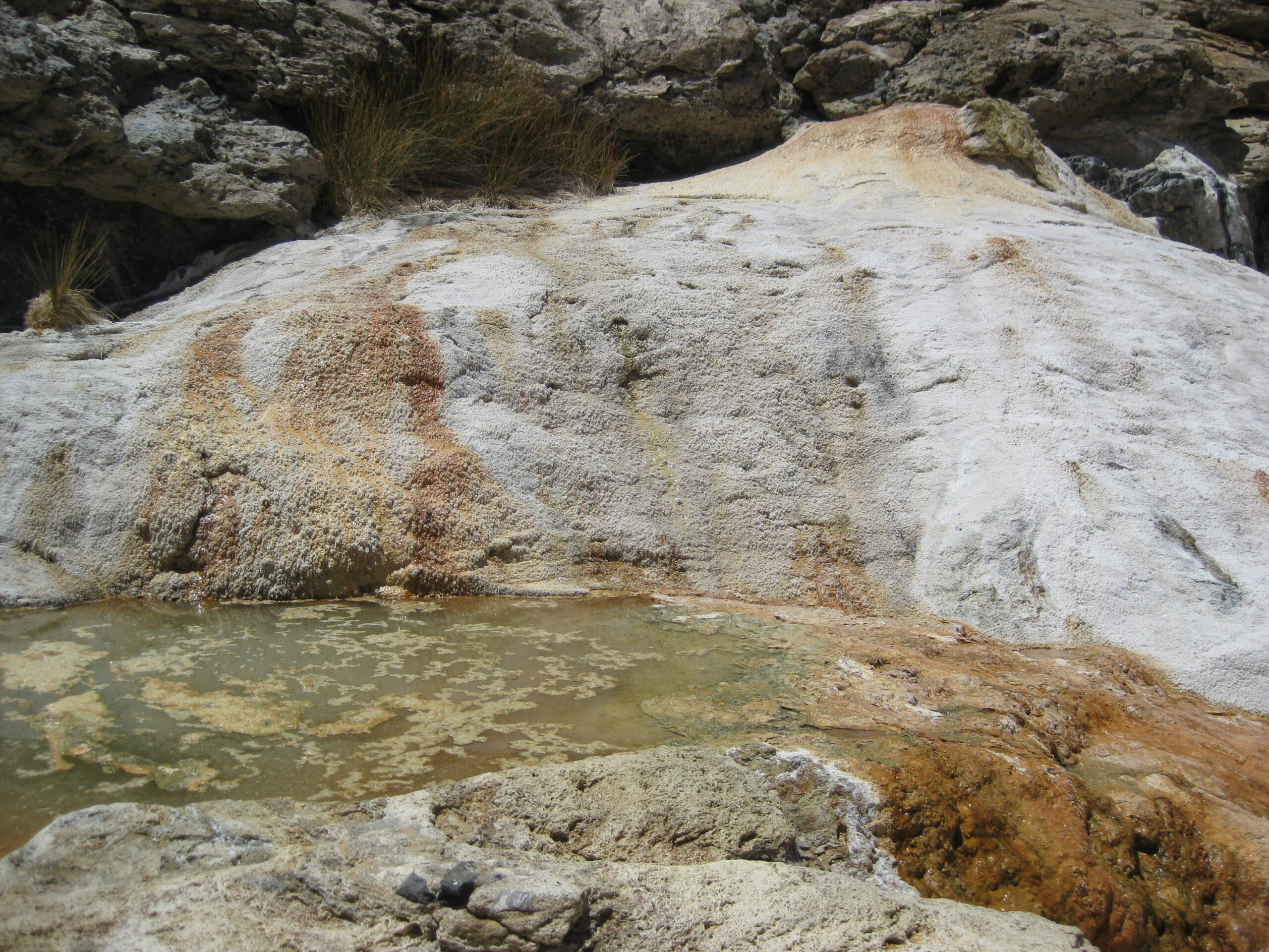
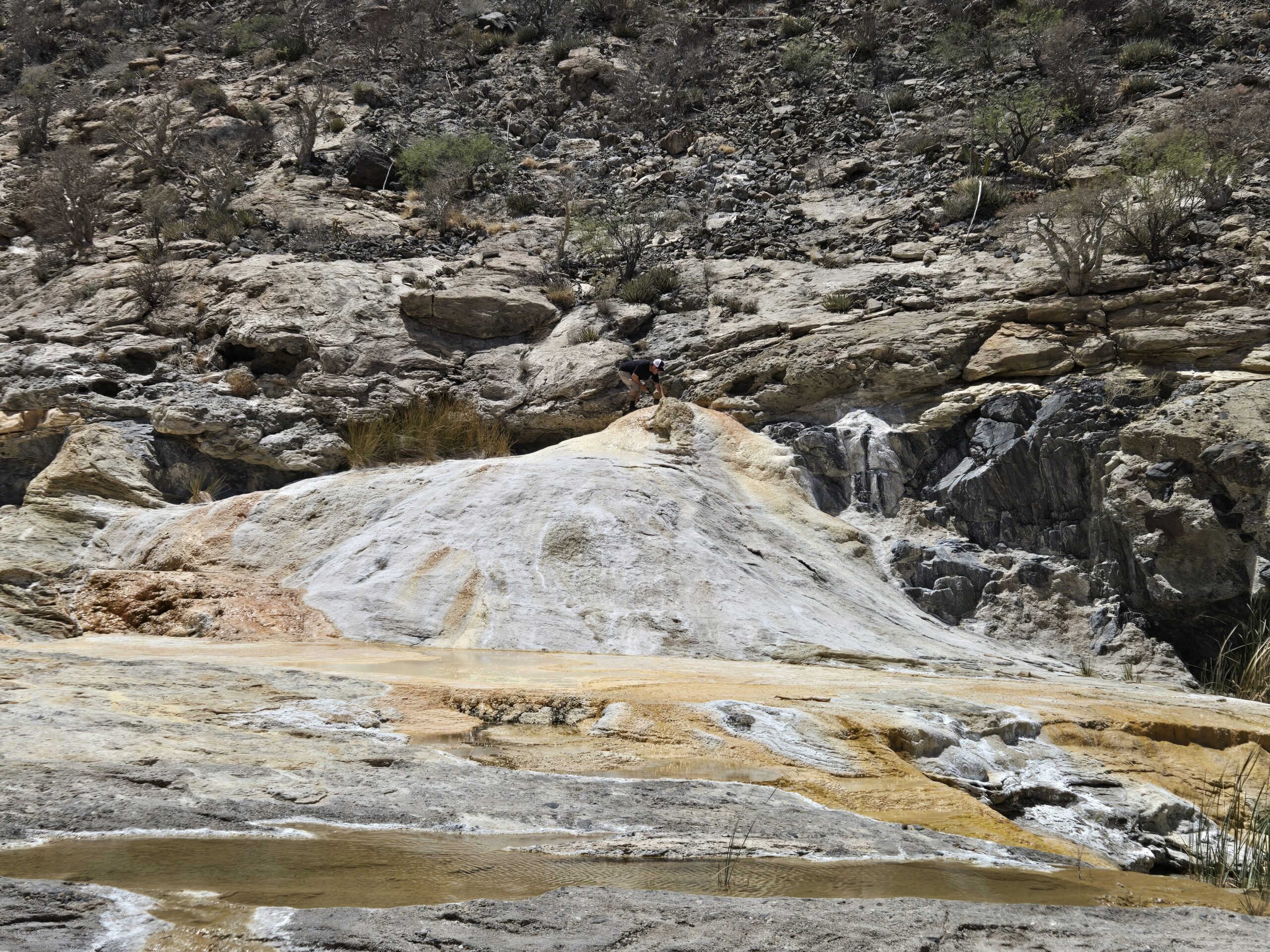
The view to El Volcán from near the parking spot. The white dome that is easily seen is called an onyx dome and was the previous geyser location. The
current one is to the right and against the side of the arroyo cliff.
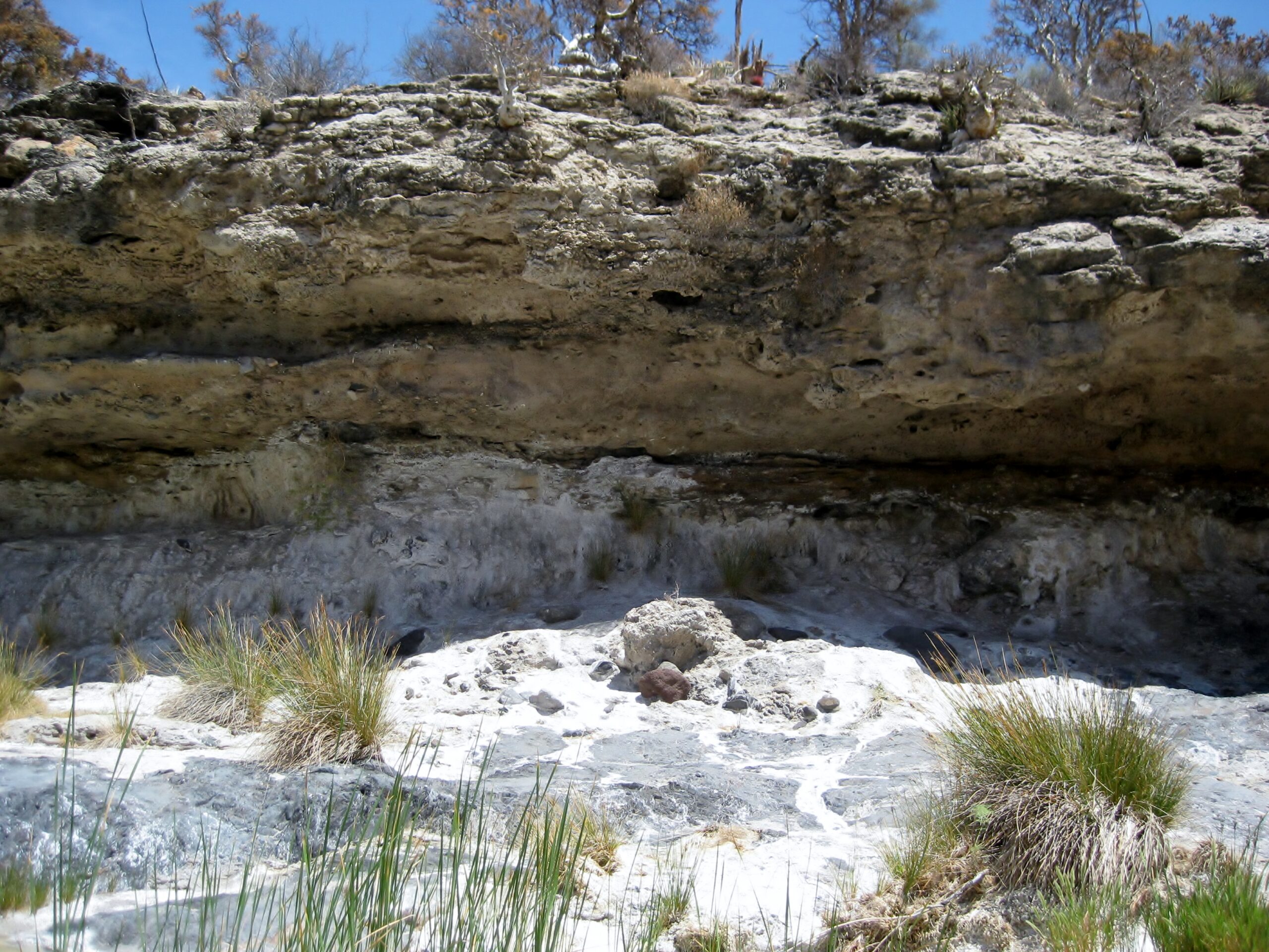
As you walk along, heavy mineralized water oozes from the cliff, on the left.
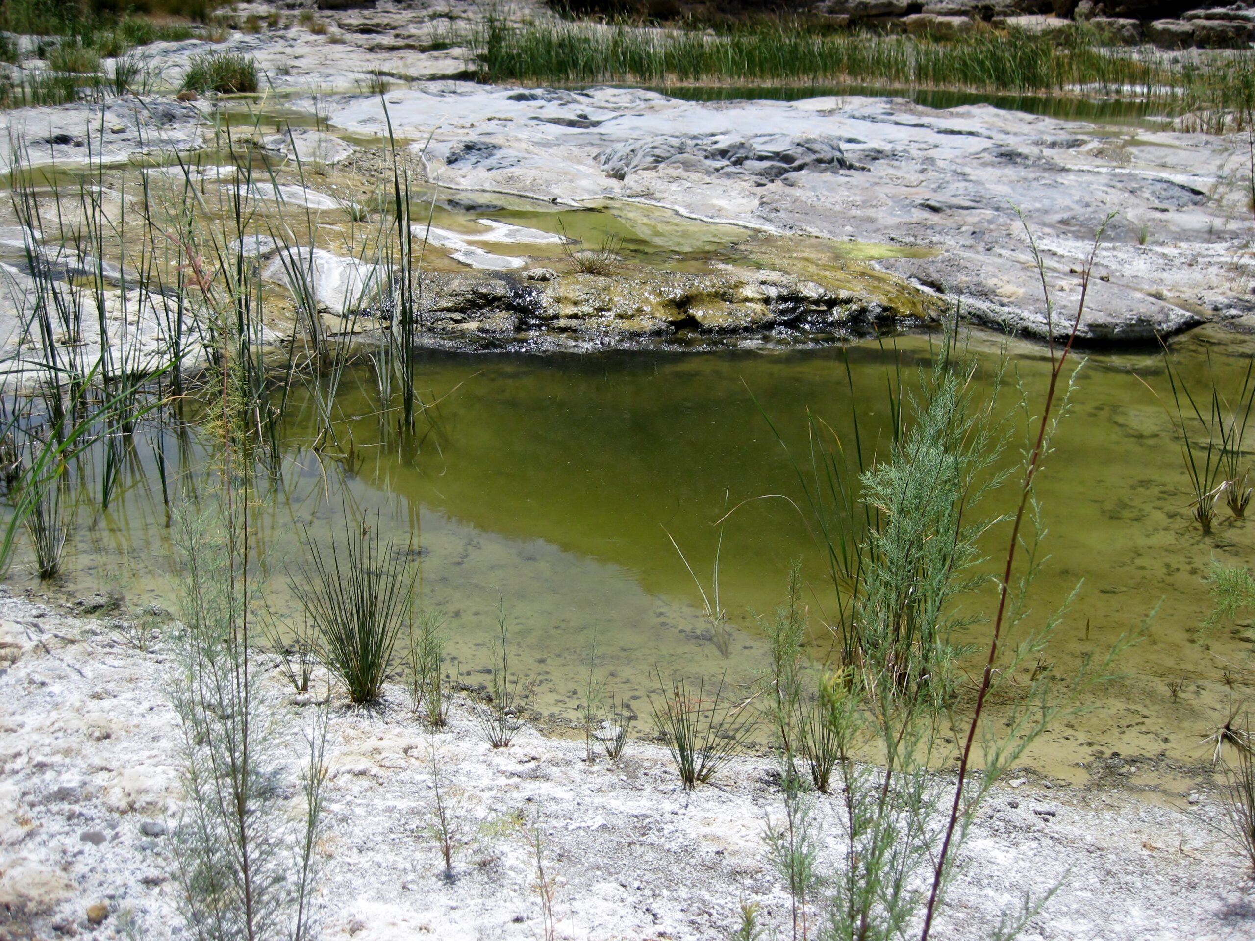
Plenty of water comes out of El Volcán's soda springs.
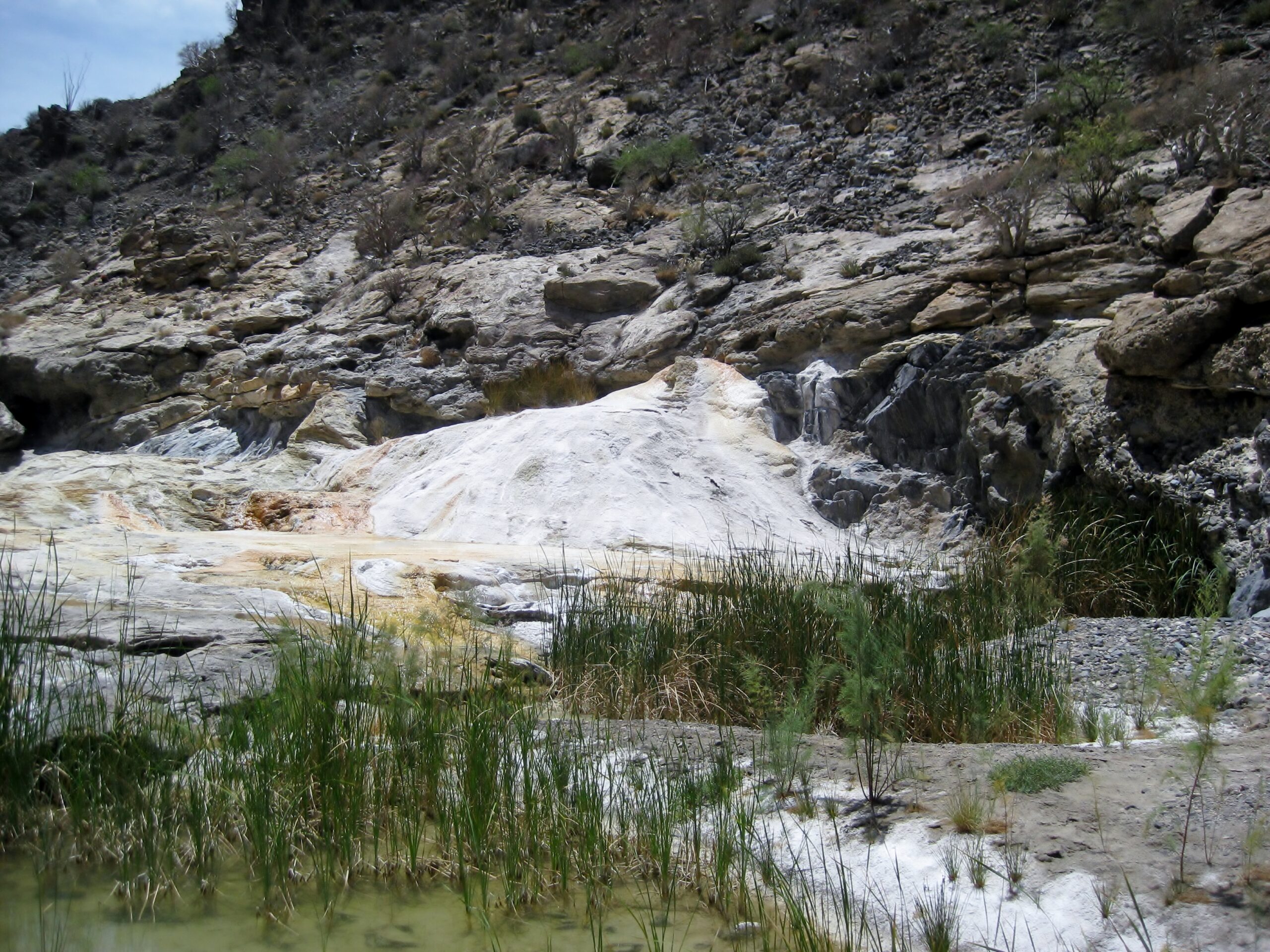
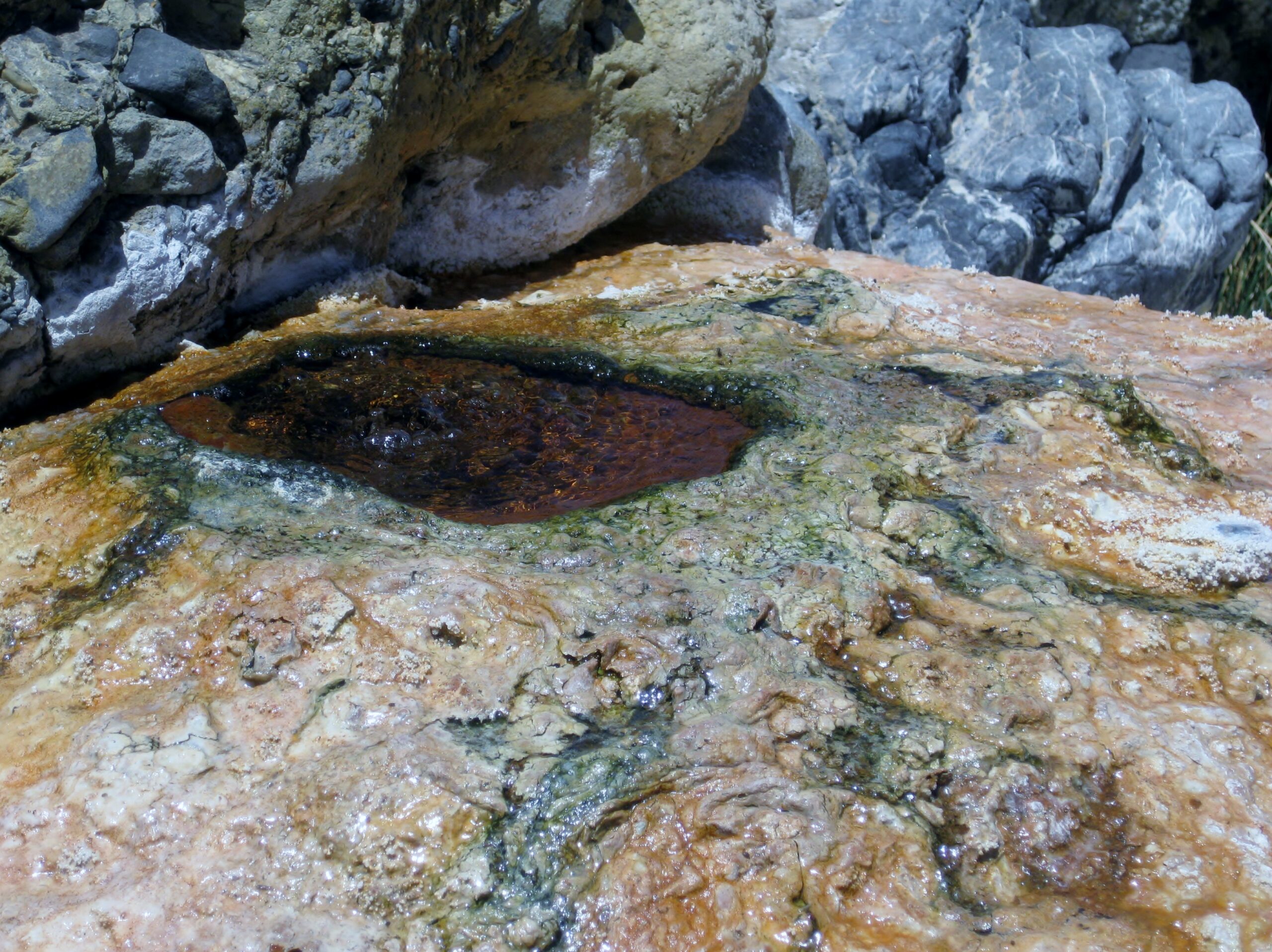
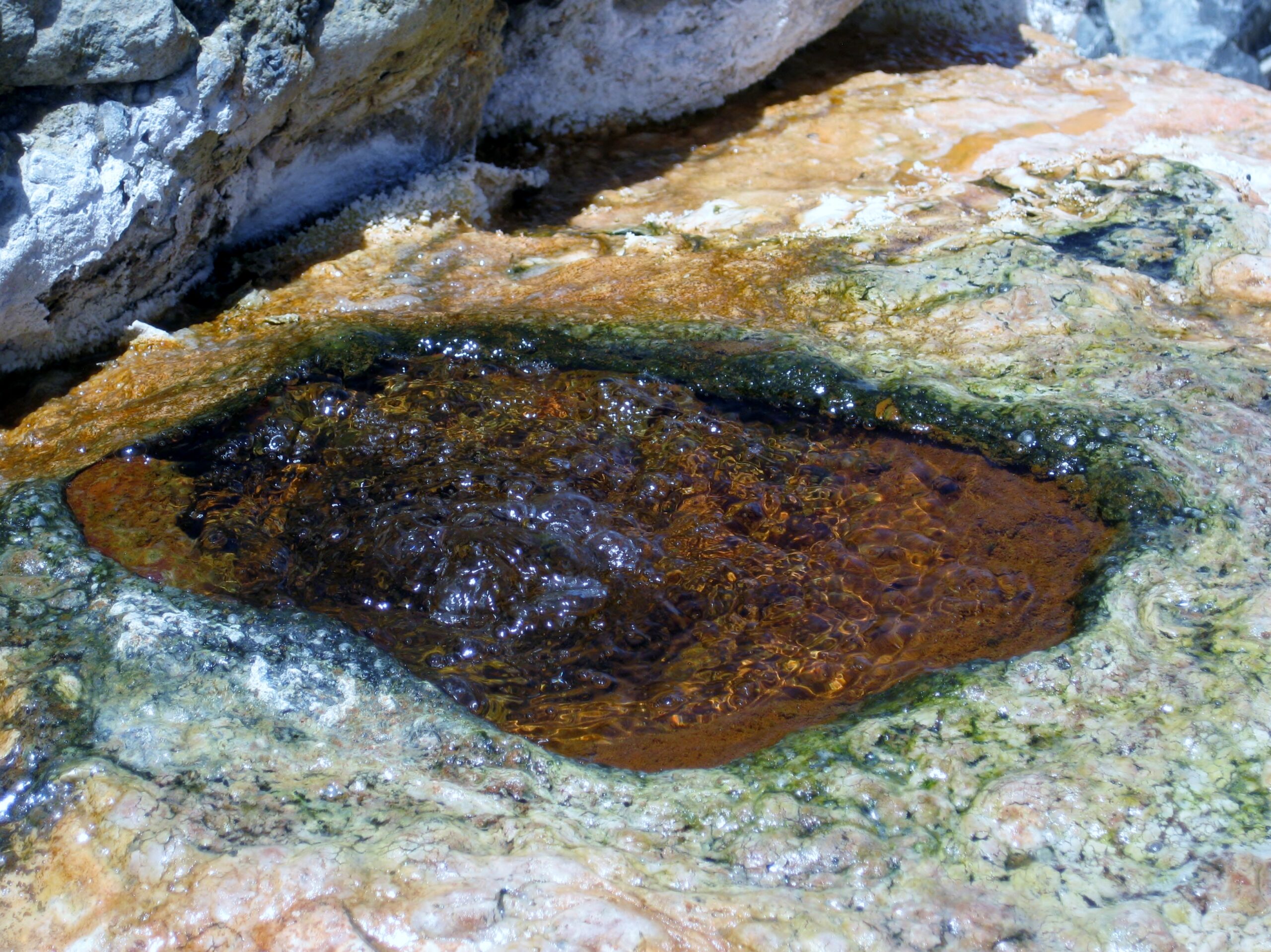
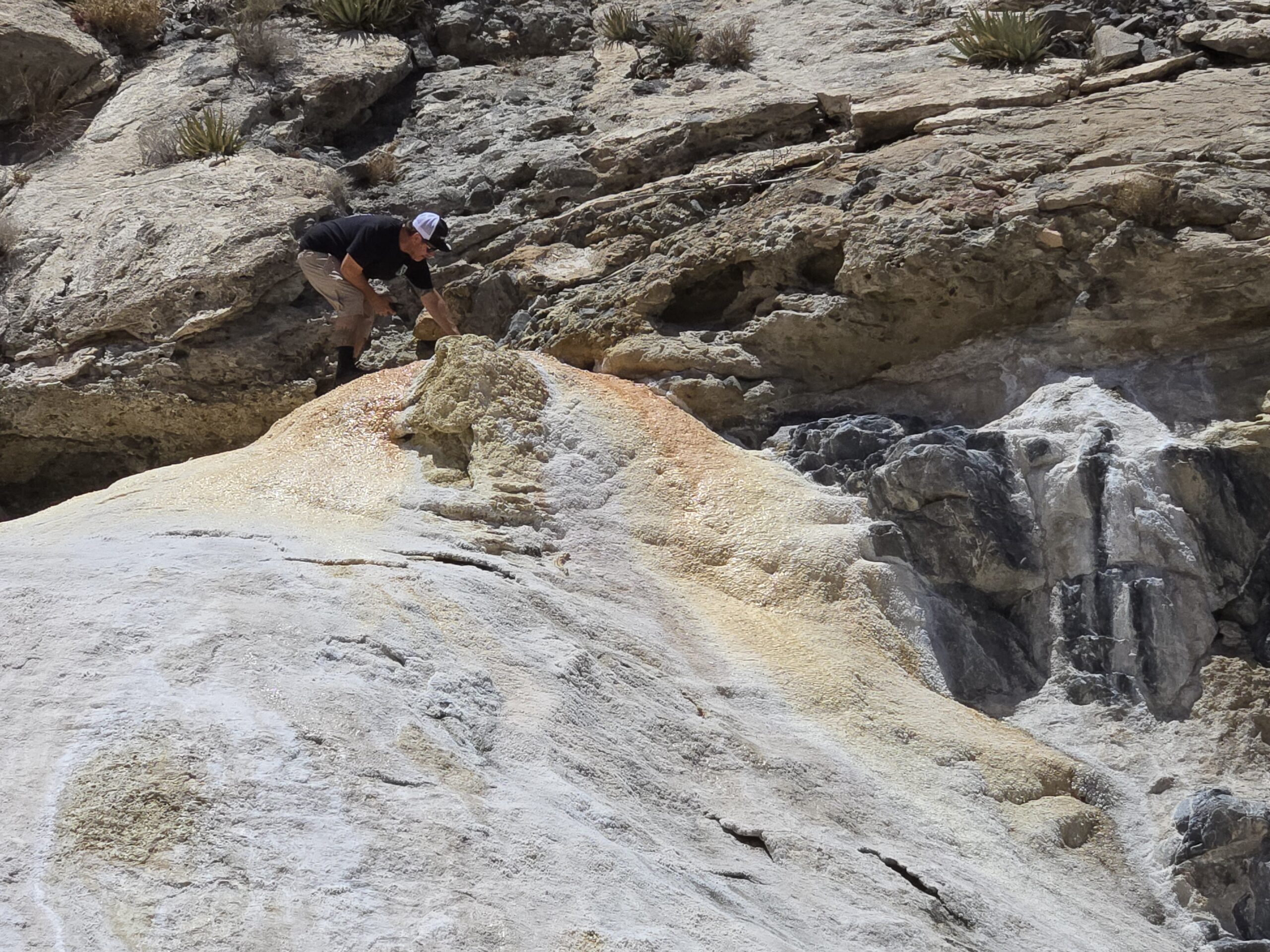
The top of El Volcán and one of the rapidly bubbling soda springs. The water is ice-cold! To actually witness the monthly eruption would be
spectacular. I know of no photographs in existence. One would need to camp here for up to a month, and hope it erupted in the daytime, at that!
This geyser reportedly shoots 60 feet into the sky for several minutes. The rumble could even be heard in El Mármol!
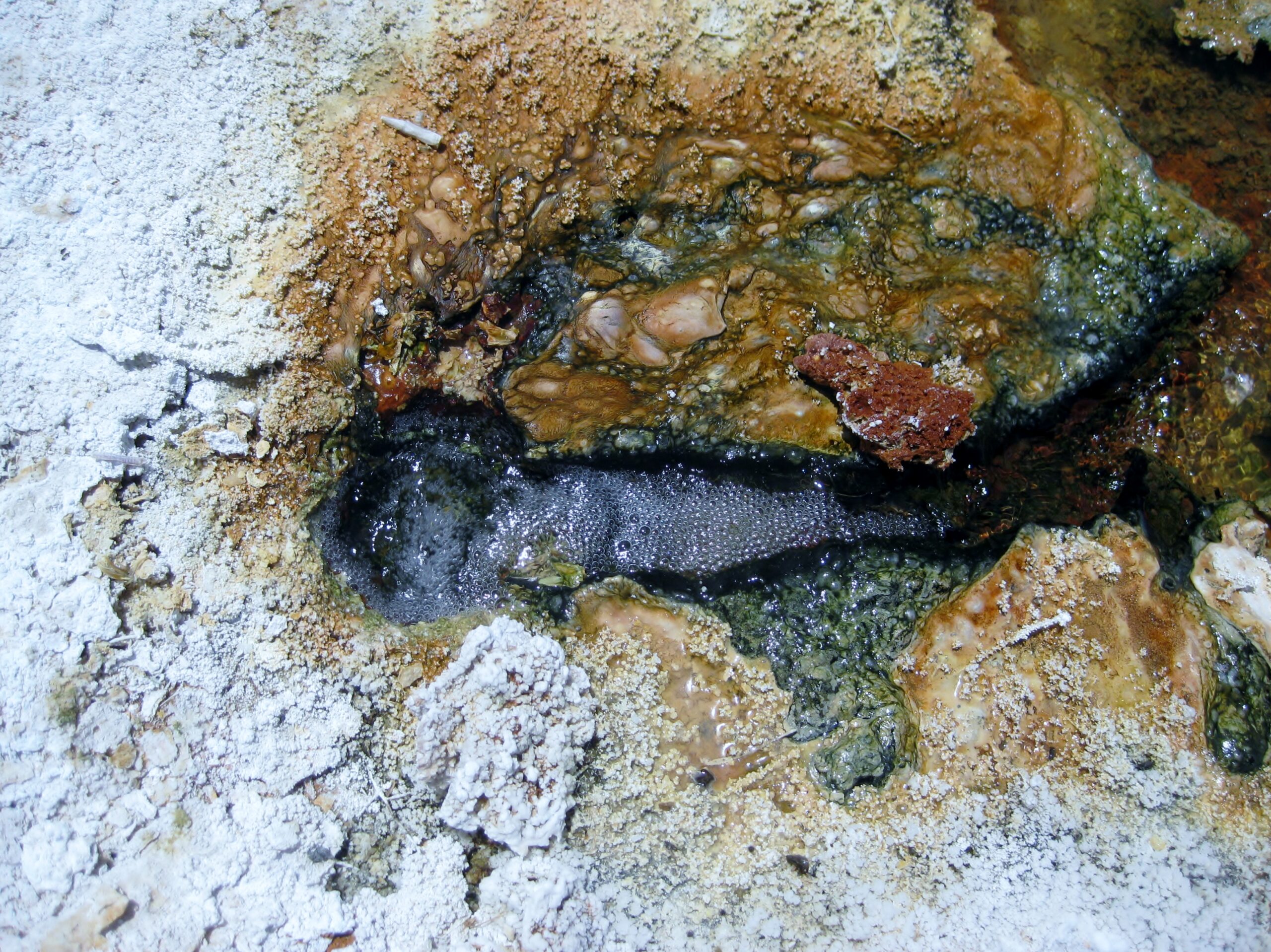
Another fizzy spring is down near the base of the geyser dome... Dave recorded it. See if you can watch this: https://vivabaja.com/wp-content/uploads/2025/05/IMG_8863.mp4

Dave at the top, teasing El Volcán to erupt!:
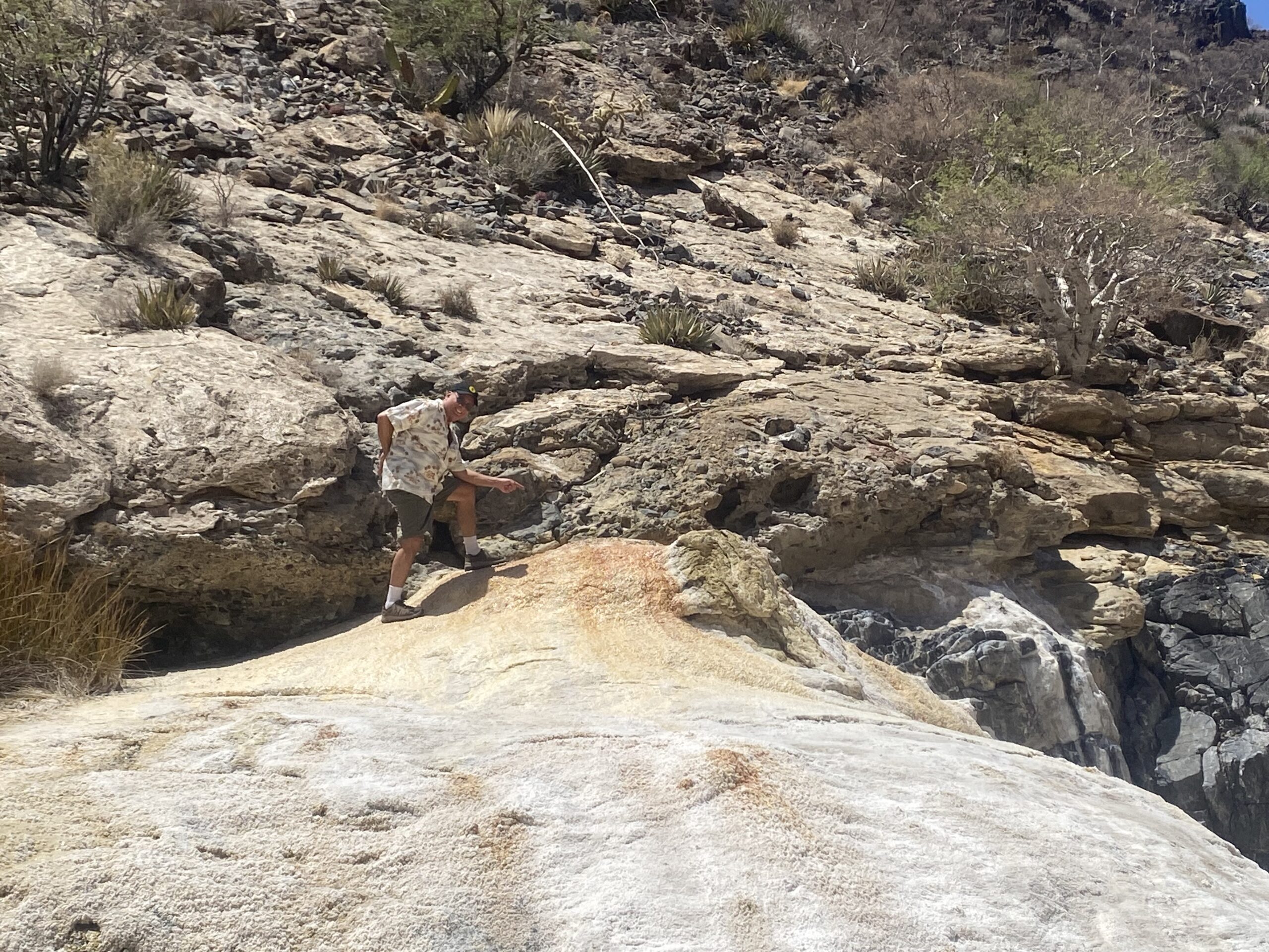 Dave W. photo. Dave W. photo.
Me at the top. I have been in that spot in 2003, 2006, and 2011. I have been nearby in 1974, 1975, and 2000, not knowing to hike up the arroyo. There
are more mineral-soda springs on a slope just past the arroyo crossing which I assumed was El Volcán, before being directed to the actual geyser
location.
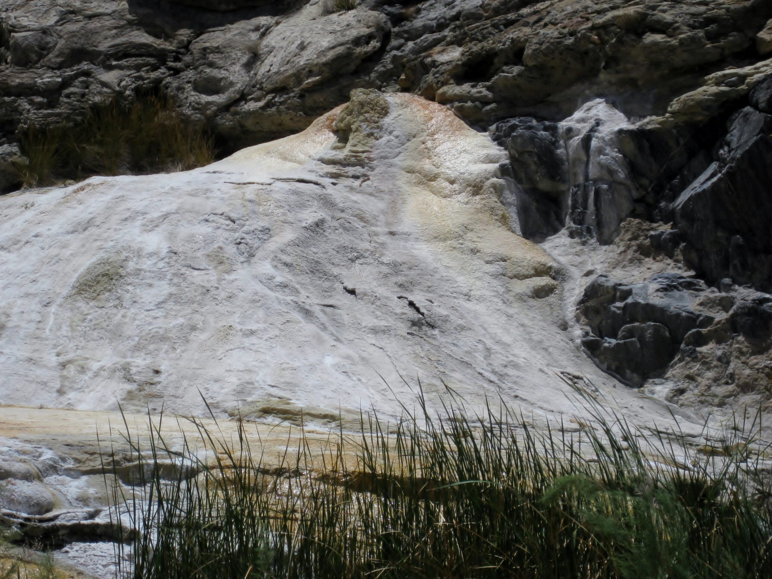
The older onyx dome, just beyond El Volcán:
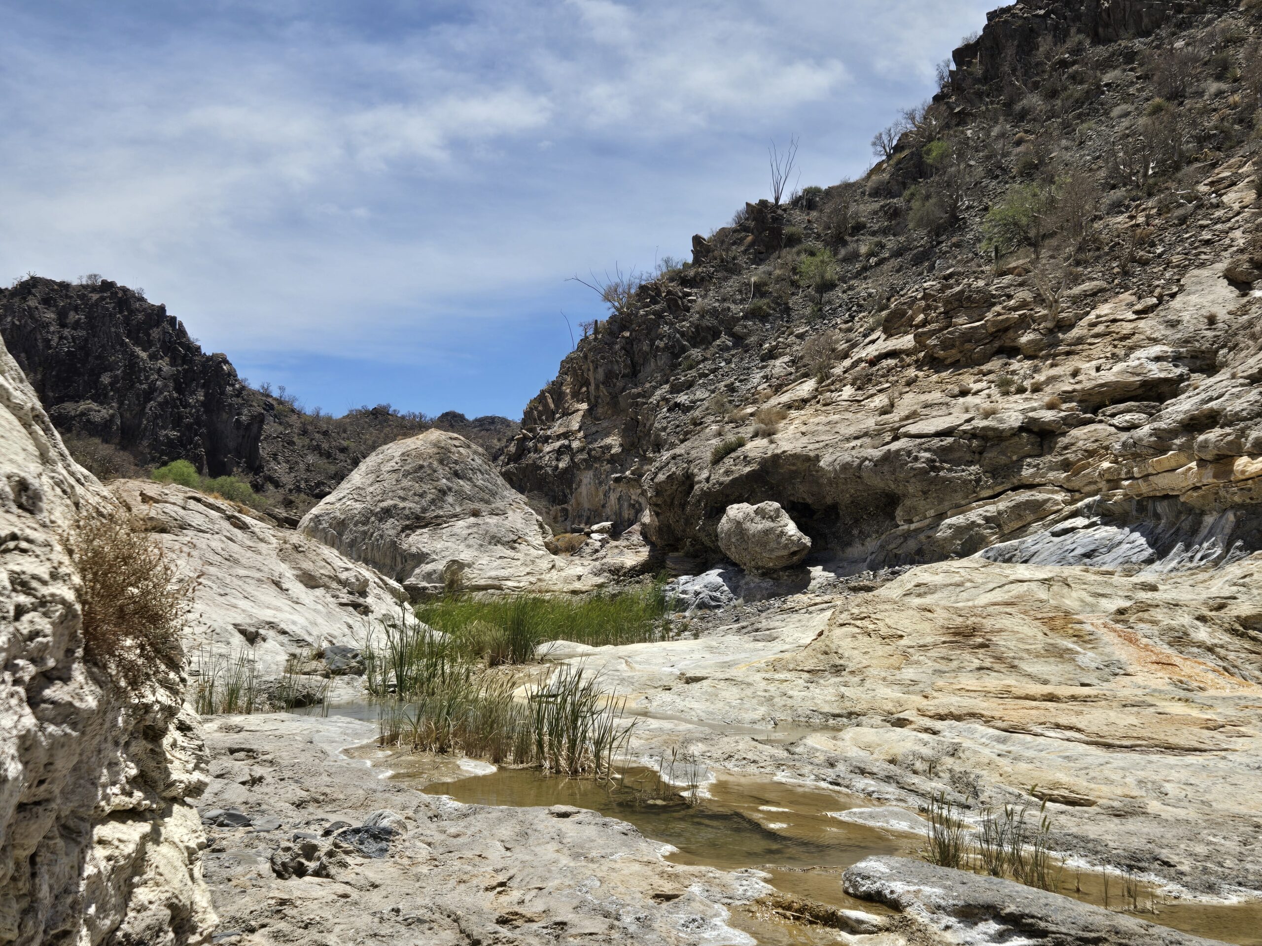
See Dave's video of it, and panning to the geyser dome: https://vivabaja.com/wp-content/uploads/2025/05/IMG_8868.mp4
The road continues to La Olvidada and our Nomad lost mission hunters went there in 2011. A great view down to the islands north of Gonzaga Bay is a
reward. See that trip: https://vivabaja.com/p411/
That was so great to revisit. I consider El Volcán one of Baja's most remarkable geology example.
Next, we head back to Mex 1 and continue south to Mex 5 for another historic location, one I have been very near but never have seen before.
Report continues with Part 6 https://forums.bajanomad.com/viewthread.php?tid=101849
[Edited on 5-19-2025 by David K]
|
|
|
watizname
Senior Nomad
Posts: 792
Registered: 8-7-2009
Member Is Offline
|
|
Looking at the photos and comparing the new to the old I was amazed at the degradation in such a 'short' time. Then it hit me that the 1920's were a
hundred years ago, and even the 50's were 70 years ago. Then i realized that my glory days exploring and driving around Baja raising hell and
catching fish was more than 40 years ago. I keep forgetting I'm an old fart. But I had fun. Thanks for the photos boys. You do a service to Baja
by recording these parts of history and they sure do bring up some fond memories
I yam what I yam and that\'s all what I yam.
|
|
|
David K
Honored Nomad
Posts: 65563
Registered: 8-30-2002
Location: San Diego County
Member Is Offline
Mood: Have Baja Fever
|
|
Quote: Originally posted by watizname  | | Looking at the photos and comparing the new to the old I was amazed at the degradation in such a 'short' time. Then it hit me that the 1920's were a
hundred years ago, and even the 50's were 70 years ago. Then i realized that my glory days exploring and driving around Baja raising hell and
catching fish was more than 40 years ago. I keep forgetting I'm an old fart. But I had fun. Thanks for the photos boys. You do a service to Baja
by recording these parts of history and they sure do bring up some fond memories |
I appreciate your comments and can relate to the time passing. Seeing San Fernando and El Mármol change over a fifty-one year (age 16 to 67) period
does cause a gasp... Yikes I am getting old! It happened do fast, LOL!
|
|
|
|


