David K
Honored Nomad

Posts: 65549
Registered: 8-30-2002
Location: San Diego County
Member Is Offline
Mood: Have Baja Fever
|
|
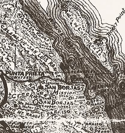
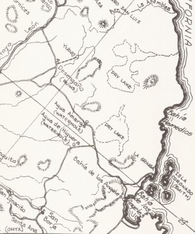
MAPS showing L.A. Bay, over the years
1757...
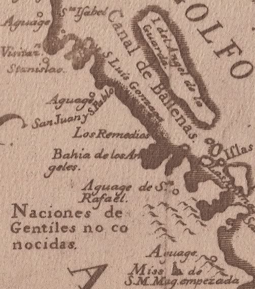
Note the first use of place names, still in use today: Bahia San Luis Gonzaga, Los Remedios, San Rafael...
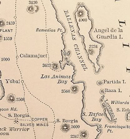
1888...
1919...
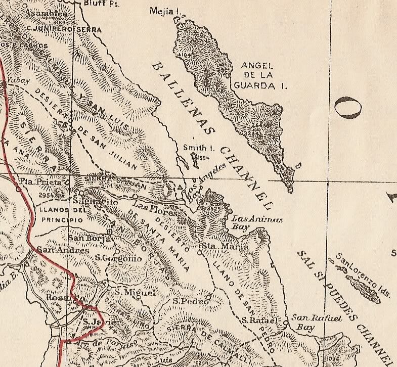
The location of Las Flores and Santa Maria (Tinaja de) is not accurate.
1930...
Las Flores location still off.
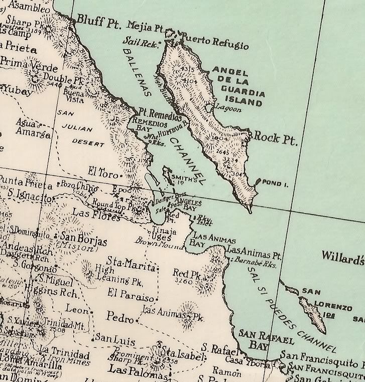
1941...
Note the 'unexplored' note next to the 'Asamblea Range'. This was no doubt the map that excited Erle Stanley Gardner so. He explored that area by
helicopter in the early 1960's.
1962...
Let me know if there is another part of Baja you would like to see up close on these map!
|
|
|
BajaGringo
Ultra Nomad
Posts: 3922
Registered: 8-24-2006
Location: La Chorera
Member Is Offline
Mood: Let's have a BBQ!
|
|
Could you show the San Quintin bay area?
|
|
|
David K
Honored Nomad
Posts: 65549
Registered: 8-30-2002
Location: San Diego County
Member Is Offline
Mood: Have Baja Fever
|
|
10-4 Baja Gringo... look for a new thread 'MAPS showing San Quintin, over the years'
|
|
|
Barry A.
Select Nomad
Posts: 10007
Registered: 11-30-2003
Location: Redding, Northern CA
Member Is Offline
Mood: optimistic
|
|
David-----As I am sure you know, Earle Stanley Gardner explored the Asamblea Range with more than helos----he actually got into them with land-based
vehicles that his friends cobbled together, making for quite an expedition. Not sure that anybody has duplicated that effort since.
This trip was chronicled in one of his many books on Baja.
It is fasinating to see how the maps evolved.
Thanks David.
Barry
|
|
|
David K
Honored Nomad
Posts: 65549
Registered: 8-30-2002
Location: San Diego County
Member Is Offline
Mood: Have Baja Fever
|
|
| Quote: | Originally posted by Barry A.
David-----As I am sure you know, Earle Stanley Gardner explored the Asamblea Range with more than helos----he actually got into them with land-based
vehicles that his friends cobbled together, making for quite an expedition. Not sure that anybody has duplicated that effort since.
This trip was chronicled in one of his many books on Baja.
It is fasinating to see how the maps evolved.
Thanks David.
Barry |
Yes Barry, he sure did... the helos were his final solution! Salsipuedes meant (to Erle) Get IN, if you can!
The book was 'Hovering Over Baja'.
|
|
|


