| Pages:
1
2 |
TheColoradoDude
Nomad
 
Posts: 287
Registered: 2-10-2009
Location: Colorado/San Carlos, Sonora
Member Is Offline
Mood: Paz, Amor, y Tacos de Pescado
|
|
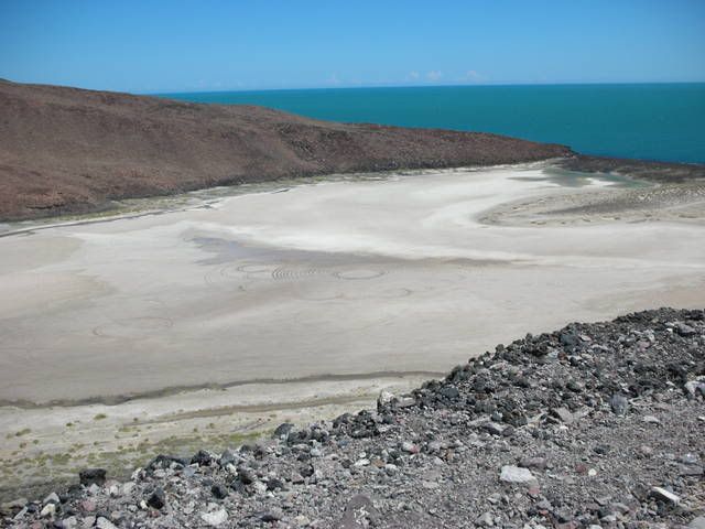
Will someone please google earth those sand circles near puertecitos???
|
|
|
David K
Honored Nomad
        
Posts: 65443
Registered: 8-30-2002
Location: San Diego County
Member Is Offline
Mood: Have Baja Fever
|
|
Lencho is right, the latitude is 29º not 19º
Here is the overall area, with Santiago's field pinned as 'Area 51'
It is right along the road to Punta San Carlos...

|
|
|
David K
Honored Nomad
        
Posts: 65443
Registered: 8-30-2002
Location: San Diego County
Member Is Offline
Mood: Have Baja Fever
|
|
| Quote: | Originally posted by TheColoradoDude
Will someone please google earth those sand circles near puertecitos??? |
THESE?

|
|
|
David K
Honored Nomad
        
Posts: 65443
Registered: 8-30-2002
Location: San Diego County
Member Is Offline
Mood: Have Baja Fever
|
|
Google Earth
The resolution isn't high enough to see the tire tracks, when I was zoomed in at max... or the photo was taken before they were added... Here is up a
bit to see the area...

The Cerro Prieto volcano crater has salt flats (potassium nitrate?) too!

|
|
|
TheColoradoDude
Nomad
 
Posts: 287
Registered: 2-10-2009
Location: Colorado/San Carlos, Sonora
Member Is Offline
Mood: Paz, Amor, y Tacos de Pescado
|
|
Excellent David! Buenas!
|
|
|
surebought
Junior Nomad

Posts: 84
Registered: 11-30-2009
Location: Ensenada
Member Is Offline
|
|
Hey - In your google maps searches, have you ever seen anything that looks like pay dirt. You know like old abandoned Silver Mines. A
discolorisation lead colored outcroppings? Please contact me through sales@lolayala.com
In a while the smile on my face turned to plaster.
Stick around while the clown who is sick, does the trick of disaster. Neil Young from Mr Soul.
|
|
|
David K
Honored Nomad
        
Posts: 65443
Registered: 8-30-2002
Location: San Diego County
Member Is Offline
Mood: Have Baja Fever
|
|
| Quote: | Originally posted by surebought
Hey - In your google maps searches, have you ever seen anything that looks like pay dirt. You know like old abandoned Silver Mines. A
discolorisation lead colored outcroppings? Please contact me through sales@lolayala.com |
No old silver mines... yet!
Does a 'lost mission' count?
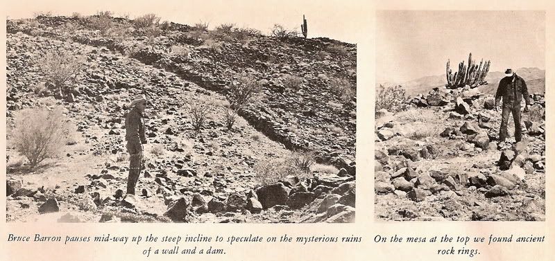
Well, strange walls anyway... I have been searching for several years for the site Choral Pepper and the Erle Stanley Gardner expedition of 1966 found
that Choral later believed to be a Jesuit proposed mission site, but was abandoned... Choral and other on that trip could not recall where it was, but
somewhere south of Bahia de los Angeles and north of San Francisquito.
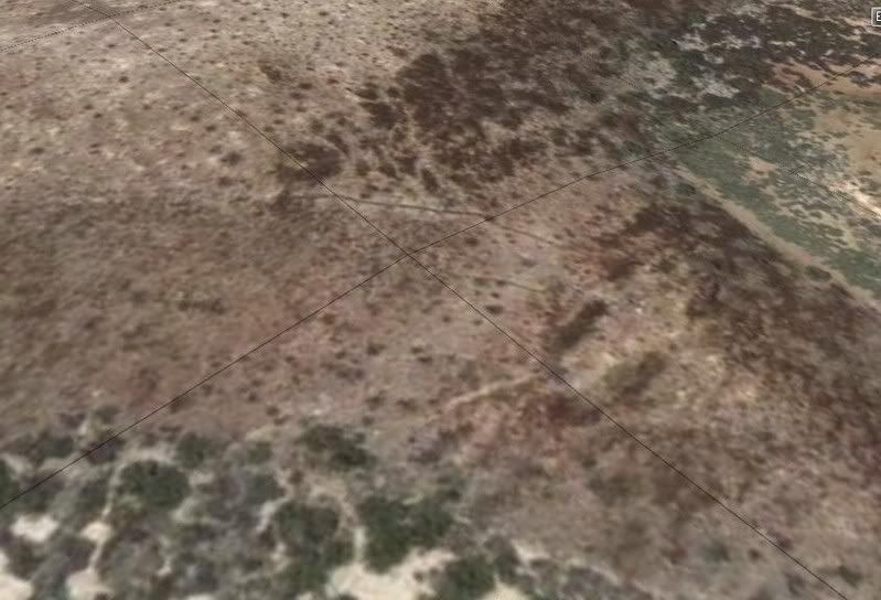
Sharksbaja spotted the walls on Google Earth and asked me if they could be the ones. I went as soon as I could to see if it was the same place...
Going there was the only way to know for sure. Choral put two photos of the site in her Desert Magazine (July, 1966).
See http://vivabaja.com/109 or the latest edition of Discover Baja Travel Club's online newsletter cover story http://discoverbaja.com
From space:
1966 Desert Magazine photos:
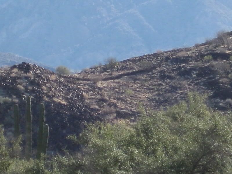
From the road:
On top the hill, holding the 1966 photo:
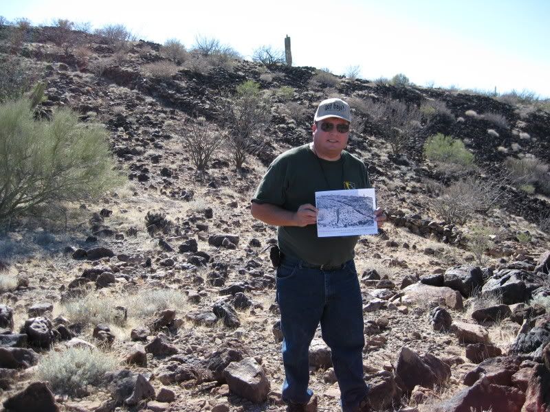
1966 photo and 2009 photo with rocks matched:
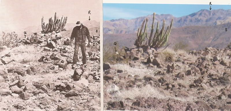
The site was very special to Choral and wanted me to find it very badly. She passed away in 2002 after my first two searches... Anyway, Tom Miller
published the discovery in his 1974 'The Baja Book' a year after Choral's Baja book was published with the approx. location.

I contacted an archeologist who has published papers on the nearby Bahia las Animas sites. The wall and sleeping circles we saw are not anything
unique to the area, and are not 'unknown'. They mean more to Baja history enthusiasts and desert rats as a curiosity than anything else and are just
one of the many things that are so interesting to get us to get out to the desert and enjoy what we find there.
What made Choral think this was a Jesuit site, was the proposed mission of Santa Maria Magdalena on the 1757 Venegas map, south of L.A. Bay and north
of Santa Gertrudis (Dolores del Norte on that map)... and the palm tree, reservoir, walls all seem to be more than what the natives alone would build.
|
|
|
| Pages:
1
2 |

