| Pages:
1
2 |
Sungirl
Newbie
Posts: 4
Registered: 5-14-2015
Member Is Offline
|
|
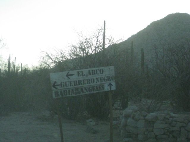
El Arco to Bahía de Los Angeles - adventure or a bad idea?
I am not a big fan of the stretch of hwy 1 around Guerrero Negro, and have been eyeing and alternative route. El Arco, San Rafael, Bahía de Los
Angeles. There should be some cool cave paintings and a ghost town at El Arco, and lots of cordons on the way, it looks like fun.
We drive Toyota Tundra, no modifications.
Should I even think about doing this loop, or move on to the next dream?
Sungirl (in my full planning mode!)
|
|
|
Bajaboy
Ultra Nomad

Posts: 4375
Registered: 10-9-2003
Location: Bahia Asuncion, BCS, Mexico
Member Is Offline
|
|
Easily done....stop by and say hi to Pancho at Playa San Rafael...or even better spend a night or two camping there.
|
|
|
AKgringo
Elite Nomad
Posts: 6359
Registered: 9-20-2014
Location: Anchorage, AK (no mas!)
Member Is Offline
Mood: Retireded
|
|
I love that road! I drove it in October in a Kia Sportage pulling a camp trailer. I only put it in four wheel drive twice (Odile dumped a lot of
sand in the arroyos)
There have been several trip reports, and road conditions reports that you should be able to find by searching those forums.
Take what ever supplies you will need, plus extra just in case you want to spend a day or two more. Finding gasoline on that road before you get to
BOLA is a bad bet.
Nothing like a hundred miles of dirt road to get a good Baja fix!
Edit; I don't mean to imply that it will not be an adventure, it is not a well maintained road. The scenery and solitude is worth the drive.
[Edited on 5-17-2015 by AKgringo]
If you are not living on the edge, you are taking up too much space!
"Could do better if he tried!" Report card comments from most of my grade school teachers. Sadly, still true!
|
|
|
4x4abc
Ultra Nomad
Posts: 4455
Registered: 4-24-2009
Location: La Paz, BCS
Member Is Offline
Mood: happy - always
|
|
one of the easiest roads in Baja
gas at Rancho Piedra Blanca and El Barril
[Edited on 5-17-2015 by 4x4abc]
Harald Pietschmann
|
|
|
elgatoloco
Ultra Nomad
Posts: 4355
Registered: 11-19-2002
Location: Yes
Member Is Offline
|
|
Lots of beauty out that way. Forest of majestic cardons to be marveled at, along with lots of other great scenery. Well worth it. IMEO. 
MAGA
marooons Are Governing America
|
|
|
David K
Honored Nomad
Posts: 65565
Registered: 8-30-2002
Location: San Diego County
Member Is Offline
Mood: Have Baja Fever
|
|
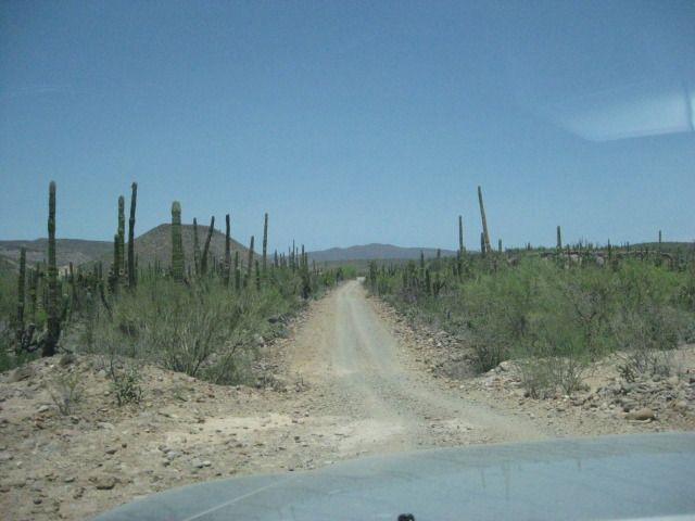
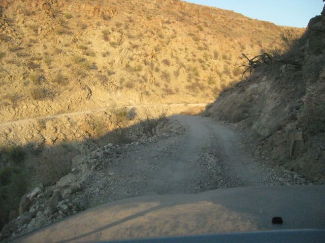
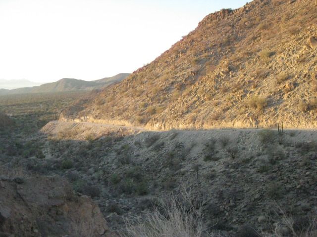
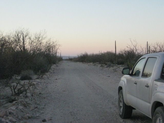
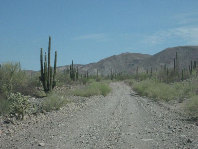
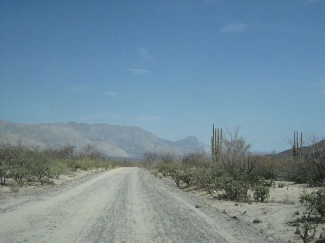
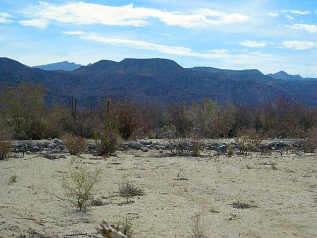
PHOTOS OF THE ROAD: July 2012
Consider a side trip to Mission Santa Gertrudis, founded in 1752, as well.
Good 2WD graded road to the mission from El Arco.
---------------------------------------------------------------------------------------------------------
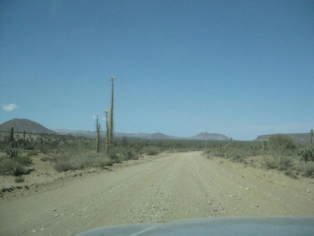
Near Pozo Aleman, just east of El Arco.
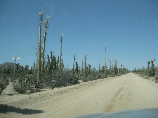
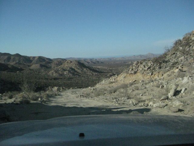
Top of Cuesta de la Ley, the high point going towards the gulf.
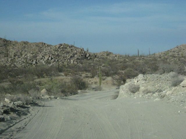
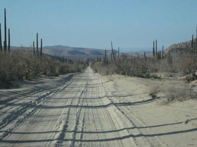
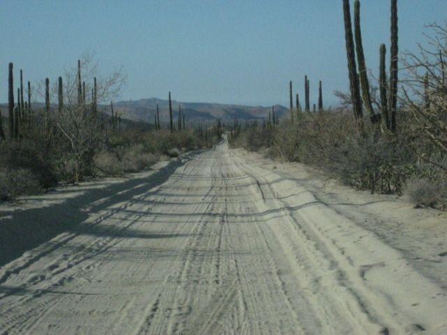
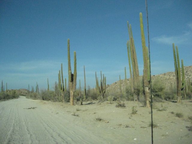
Near Punta San Francisquito.
Important junction. You actually go west a short distance to catch the road north to L.A. Bay.
Nearing Bahia San Rafael.
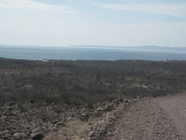
Looking back south to San Rafael, the next morning.
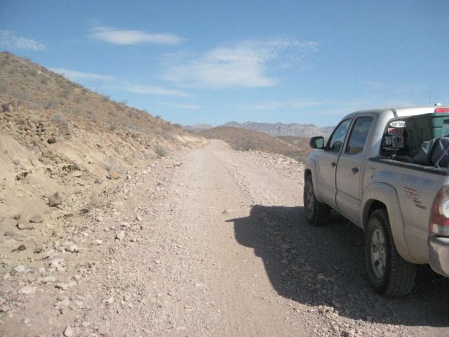
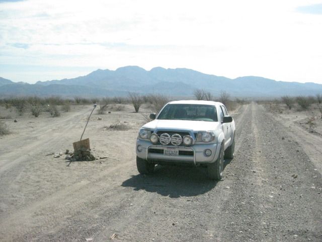
The junction with the road north to Bahia Las Animas.
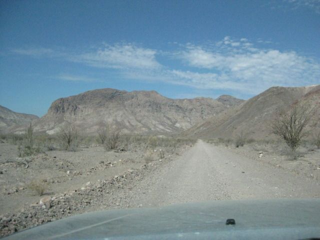
Mike's Mountain (above L.A. Bay town) in the distance.
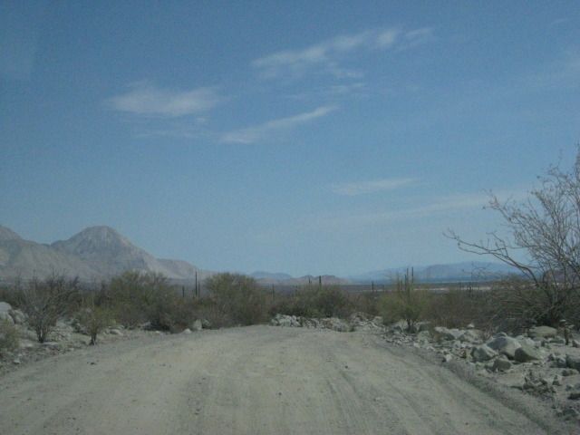
That is the railroad bed along side the graded road, south of Las Flores.
The final miles to L.A. Bay.
To see photos of the beach, ghost town, cave paintings, mission... along the above road, see my July 2012 trip report (link below in my sig. or here):
A 15 Day Baja adventure, July, 2012: http://forums.bajanomad.com/viewthread.php?tid=61576
|
|
|
Von
Senior Nomad
Posts: 961
Registered: 10-1-2006
Location: Poway-Rosarito
Member Is Offline
Mood: getting ready!
|
|
I think im getting Baja fever looking at those pics, most go back to work   lol~ lol~
READY SET.....................
|
|
|
woody with a view
PITA Nomad
Posts: 15940
Registered: 11-8-2004
Location: Looking at the Coronado Islands
Member Is Offline
Mood: Everchangin'
|
|
Adventure or bad idea?
Even a bad idea leads to adventures you wouldn't otherwise experience.....
Just go!
|
|
|
Sungirl
Newbie
Posts: 4
Registered: 5-14-2015
Member Is Offline
|
|
OMG you guys are awesome! Now I want to take a month off! Or, better yet, take forever off, and just wonder! Thank you SO much!
|
|
|
David K
Honored Nomad
Posts: 65565
Registered: 8-30-2002
Location: San Diego County
Member Is Offline
Mood: Have Baja Fever
|
|
Oh for sure... there is no cure for Baja Fever!
The photos above are just of the road...
For the cave paintings, mine towns, missions and beaches along that road, during the same trip: http://forums.bajanomad.com/viewthread.php?tid=61576
|
|
|
Neal Johns
Super Nomad
Posts: 1687
Registered: 10-31-2002
Location: Lytle Creek, CA
Member Is Offline
Mood: In love!
|
|
Did that route in a Tacoma with a pop-top camper a few years ago, no problems.
My motto:
Never let a Dragon pass by without pulling its tail!
|
|
|
4x4abc
Ultra Nomad
Posts: 4455
Registered: 4-24-2009
Location: La Paz, BCS
Member Is Offline
Mood: happy - always
|
|
traveled the road in 1985 in a Chevy Nova - made it OK, but realized that Baja is 4x4 country. So, that road made me buy my first 4x4. Changed my
life.
Harald Pietschmann
|
|
|
carlosg
Senior Nomad
Posts: 504
Registered: 5-28-2012
Location: chula vista, ca
Member Is Offline
Mood: Just like in Baja: No Bad Days...
|
|
Quote: Originally posted by Sungirl  | I am not a big fan of the stretch of hwy 1 around Guerrero Negro, and have been eyeing and alternative route. El Arco, San Rafael, Bahía de Los
Angeles. There should be some cool cave paintings and a ghost town at El Arco, and lots of cordons on the way, it looks like fun.
We drive Toyota Tundra, no modifications.
Should I even think about doing this loop, or move on to the next dream?
Sungirl (in my full planning mode!) |
| Quote: Originally posted by carlosg | This year in late September early October during our childrens school break well be doing a LOOP in Central Baja so we can stay away from any
hurricanes down further south; as always well be traveling on a budget trying to stay at some hotels (suggestions welcome!!!) during our trip but
mostly well be camping and spending most of our time on the beach but also getting to visit and explore a couple of the Missions on the way. The
First Leg of our journey will start in Chula Vista to Guerrero Negro where we plan to stay overnight and have breakfast (any suggestions?) and then
drive to Santa Gertrudis (camp here) via El Arco. From here we drive down to the Gulf and camp in San Francisquito or Punta Ballena (suggestions?).
Our next camping stops will be San Rafael followed by Bahia de las Animas; then we drive to BoLA and stay overnight (any suggestions?) and finally
drive to San Borja Mission over to Santa Rosaliita (any lodging suggestions?) where well spend the last day(s) of our journey before returning home.
Our plan is to do the LOOP in two weeks, well be traveling in a diesel 4x4 and hopefully well have enough fuel to complete our journey between fuel
stops with no problems. I have attached an image of our planned route; each color represents a leg of the journey. We will deeply appreciate any and
all comments and suggestions for this exciting Baja journey, I plan to stay in touch with a satellite phone: probably buy one on eBay and buy time
from a local provider (any suggestions?) then guide our travel with the help of the BAJA CALIFORNIA ALMANAC and/or probably buy and use a GPS (I
have never used one), if so I would like to get something that is not only useful for driving but also while fishing (another trip) thus any
suggestions are very welcome
like always: thanks for your time and all your knowledge BajaNomads!!! Well certainly post a TRIP REPORT after our
journey.

[Edited on 5-13-2015 by carlosg] |
Hi Sungirl,
We're also are planning a LOOP thru the same area in late September, and then ending our trip on the Pacific side at Santa Rosaliita. During our trip
we plan to visit and explore around some of the Missions and visit the Cave Paintings along the way, we also plan to make it a point of looking for
where the "El Camino Real" intersects with out path. This post may give you something else to add to your dream: http://forums.bajanomad.com/viewthread.php?tid=57252 ... do you have the "Baja California Almanac"? It's a very useful tool to make your way thru
Baja.
[Edited on 5-18-2015 by carlosg]
|
|
|
rts551
Elite Nomad
Posts: 6700
Registered: 9-5-2003
Member Is Offline
|
|
Carlos....get a Garmin 60 or 76. Either would behelpful. Also before leaving review the weather..Hurricanes or major storms can still hit central
Baja.
|
|
|
carlosg
Senior Nomad
Posts: 504
Registered: 5-28-2012
Location: chula vista, ca
Member Is Offline
Mood: Just like in Baja: No Bad Days...
|
|
Thaks rts551,
I see this model is "discontinued" according to Garmin (https://buy.garmin.com/en-US/US/on-the-trail/discontinued/gp...) but it doesn't matter because there's always an available one on eBay, and for
what I need it it probably does the job, as long as I can see the screen and figure where we are and where we're going that's enough I think... 
|
|
|
rts551
Elite Nomad
Posts: 6700
Registered: 9-5-2003
Member Is Offline
|
|
look for the 76c, 76cs, 76csx. they are updated versions. on Garmin it looks like the 78S in the new one.
[Edited on 5-18-2015 by rts551]
|
|
|
Pappy Jon
Nomad
Posts: 494
Registered: 8-27-2003
Location: Wrong side of the Continental divide.
Member Is Offline
Mood: Temp rising.
|
|
Sungirl,
No problem. I did the stretch from San Francisquito to San Rafael, to BOLA in April. Great place to adventure.
"The association of flowers and warm-blooded love is more than a romantic convention; it is based upon one of the great advances in the evolution
of life." Ed Abbey
|
|
|
Udo
Elite Nomad
Posts: 6364
Registered: 4-26-2008
Location: Black Hills, SD/Ensenada/San Felipe
Member Is Offline
Mood: TEQUILA!
|
|
Great photos, as always, DK!
Udo
Youth is wasted on the young!
|
|
|
David K
Honored Nomad
Posts: 65565
Registered: 8-30-2002
Location: San Diego County
Member Is Offline
Mood: Have Baja Fever
|
|
Thanks Udo. Baja makes them great.
|
|
|
TMW
Select Nomad
Posts: 10659
Registered: 9-1-2003
Location: Bakersfield, CA
Member Is Offline
|
|
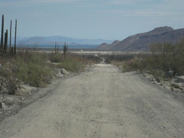
I was thru there in late April. The arroyos were over run with water during the hurricane and lots of sand was moved. The road bed is OK from traffic.
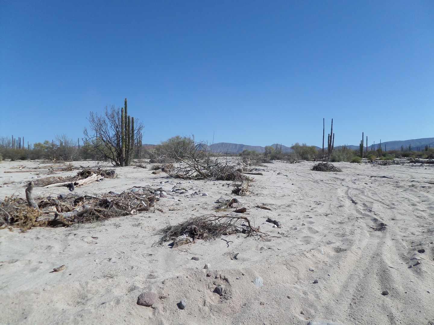
You can see the road bed here.
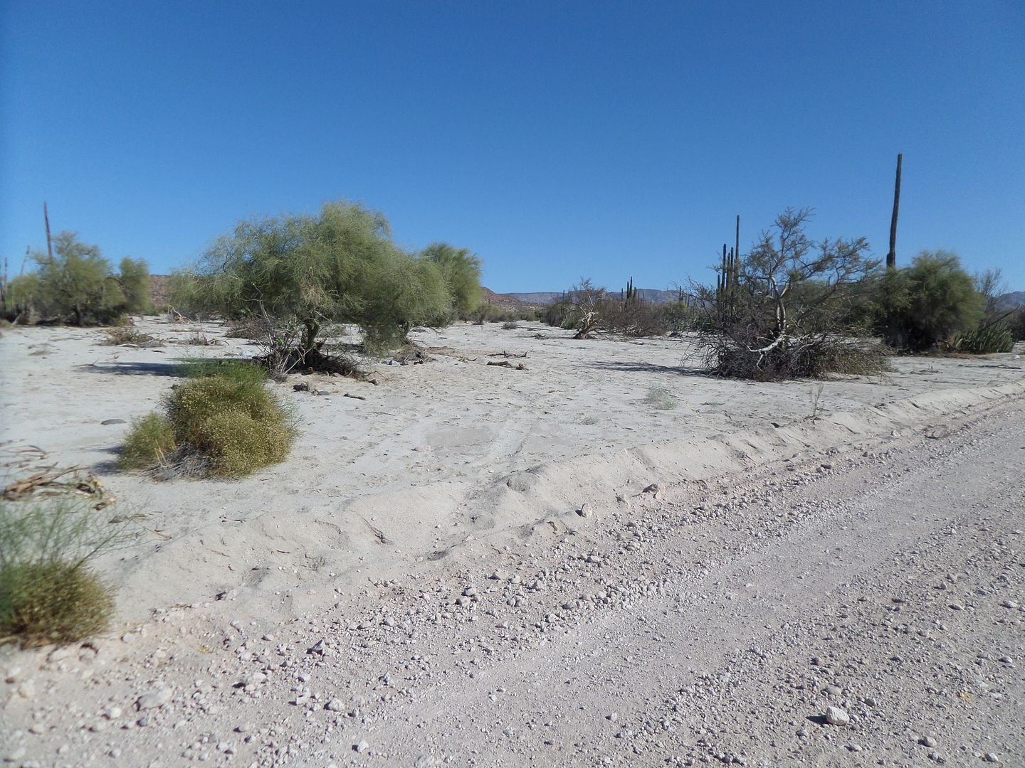
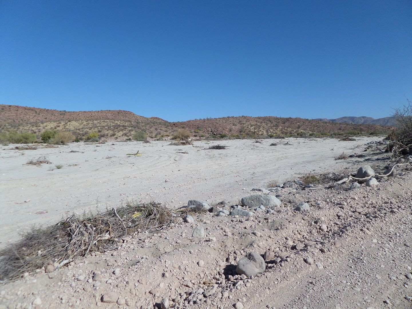
There was this washout but it has a good bypass.
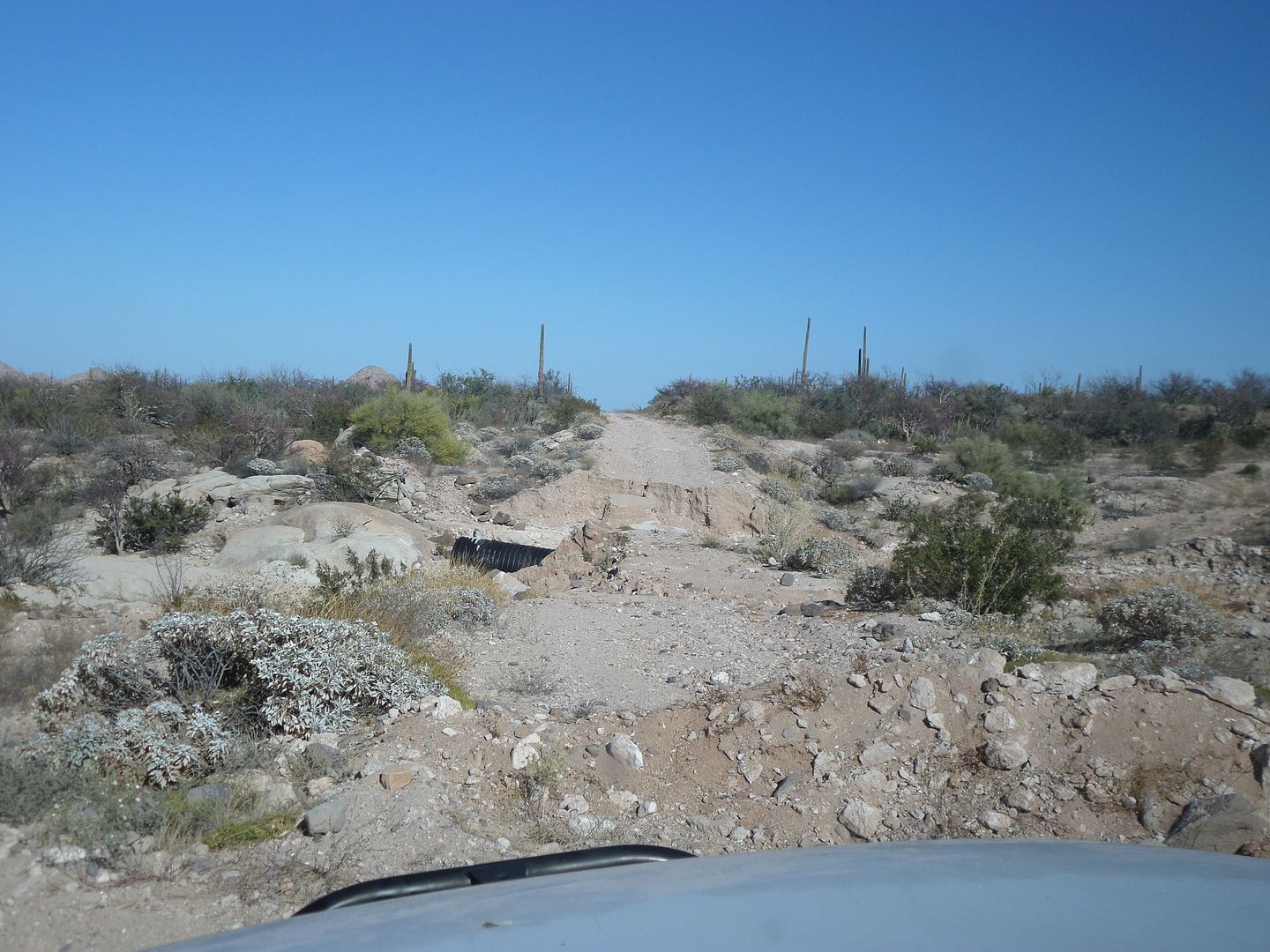
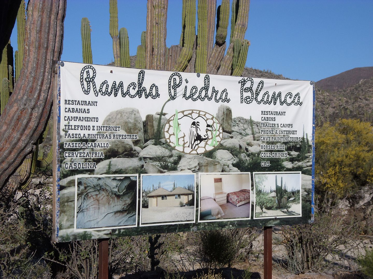
A place to stay and maybe gas if necessary. East of El Arco maybe 15 miles.
[Edited on 5-20-2015 by TMW]
|
|
|
| Pages:
1
2 |


