| Pages:
1
..
9
10
11
12
13
..
25 |
Frigatebird
Nomad

Posts: 215
Registered: 9-12-2004
Location: L.A. County
Member Is Offline
Mood: Soaring
|
|
Mark,
If you plan another attempt this Spring, I can join you for the hike/ride/packraft April 12th-20th. I may be able to provide transportation from LA
to Laguna Seca, and pick up at Punta Candeleros. Just thinking out loud.
Avatar courtesy of Herb 
|
|
|
Hook
Elite Nomad
Posts: 9013
Registered: 3-13-2004
Location: Sonora
Member Is Offline
Mood: Inquisitive
|
|
LarryC, is that landing craft still in the Bahia or ?
|
|
|
larryC
Super Nomad
Posts: 1499
Registered: 8-11-2008
Location: BoLA
Member Is Offline
|
|
Hook
Yes it is still in Bahia.
Off grid, 12-190 watt evergreen solar panels on solar trackers, 2-3648 stacked Outback inverters, 610ah LiFePo4 48v battery bank, FM 60 and MX60
Outback charge controllers, X-240 Outback transformer for 240v from inverters, 6500 watt Kubota diesel generator.
|
|
|
larryC
Super Nomad
Posts: 1499
Registered: 8-11-2008
Location: BoLA
Member Is Offline
|
|
Mark
Looks more like a grove of palm trees to me. Lots of palm groves but not many pools. Who knows. Just have to go there to find out for sure.
Larry
Off grid, 12-190 watt evergreen solar panels on solar trackers, 2-3648 stacked Outback inverters, 610ah LiFePo4 48v battery bank, FM 60 and MX60
Outback charge controllers, X-240 Outback transformer for 240v from inverters, 6500 watt Kubota diesel generator.
|
|
|
DosMars
Nomad
Posts: 118
Registered: 12-11-2005
Member Is Offline
|
|
Quick update-
Just spoke with Mark, we're still on to meet up at the car rental in TJ at noon today. Hopefully he'll have some photos up by this evening.
I'm looking forward to the drive home, I told him he's driving so I can get a sneak peak at the photos & footage!
-Mark...
[Edited on 1-9-2014 by DosMars]
|
|
|
David K
Honored Nomad
Posts: 65591
Registered: 8-30-2002
Location: San Diego County
Member Is Offline
Mood: Have Baja Fever
|
|
Any updates yet? Mark get home okay?
|
|
|
Mark_BC
Nomad
Posts: 137
Registered: 12-1-2013
Location: Vancouver, BC
Member Is Offline
|
|
Hi David, we got back OK, just went up to Jalama for a couple days. I fly out of LA tomorrow so I'm getting organized. All my photos are in raw format
so I have to convert & figure out how to add here. I'll have lots of time at the aurport tomorrow...
|
|
|
David K
Honored Nomad
Posts: 65591
Registered: 8-30-2002
Location: San Diego County
Member Is Offline
Mood: Have Baja Fever
|
|
10-4... I am happy to post photos for you if you get in a bind, but what most do here is join Photobucket.com, create an an album for each trip or for
Baja Nomad (if you don't take lots of trips), click on the UPLOAD, Click on the little gear symbol in the right corner, choose 800 or 640 pixels and
click save. See my post: http://forums.bajanomad.com/viewthread.php?tid=71557 in the Photo forum here.
|
|
|
wilderone
Ultra Nomad
Posts: 3915
Registered: 2-9-2004
Member Is Offline
|
|
Mark - what a fantastic adventure - loved following along. Glad you stayed healthy. Looking forward to seeing pics.
|
|
|
Mark_BC
Nomad
Posts: 137
Registered: 12-1-2013
Location: Vancouver, BC
Member Is Offline
|
|
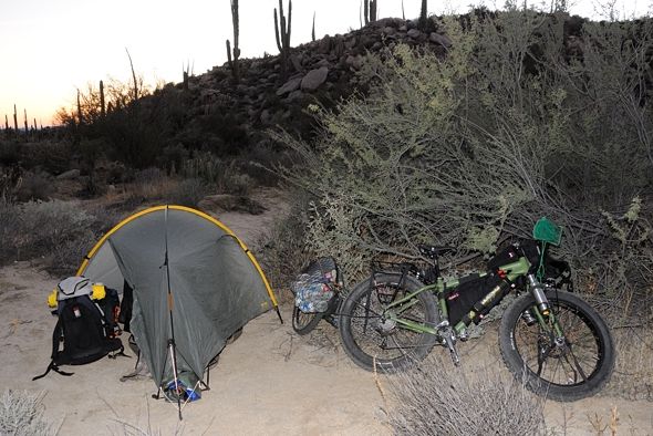
OK so here are a few of the first photos. It's going to take a while to sort through them so I'll just post them as I go, over several days.
First campsite halfway up the road from Highway 1:
29°13'23.41" N 114°03'01.61" W
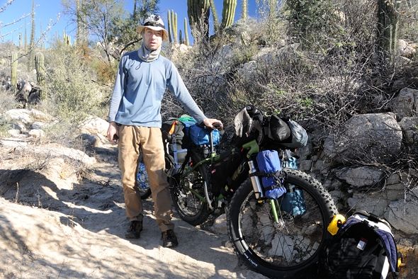
Packed up the next morning:
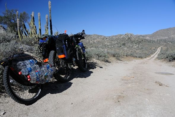
The only gate I encountered:
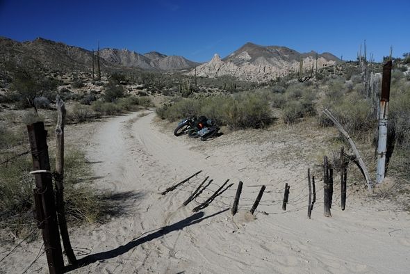
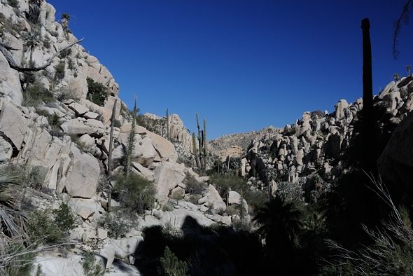
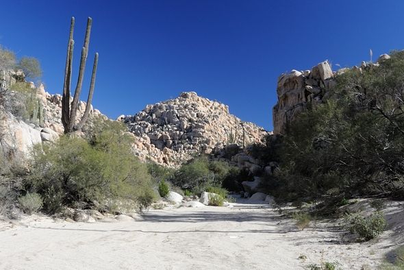
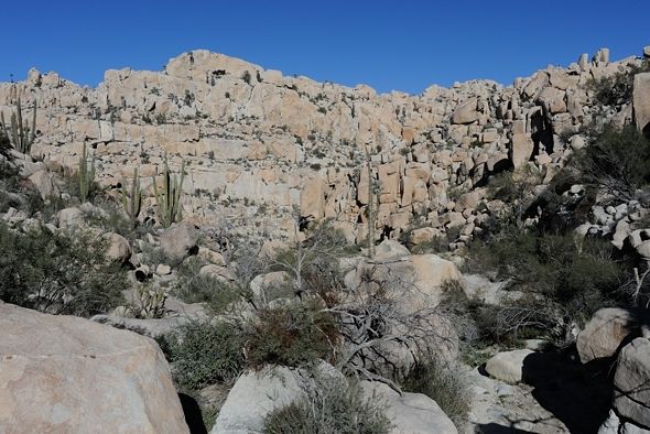
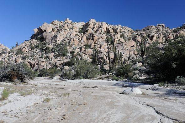
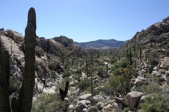
Getting close to the rocky / blocky terrain which you can see on the right. Asamblea is over that saddle right of center, to the left of the blocky
hill:
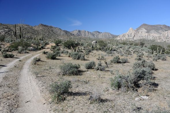
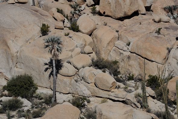
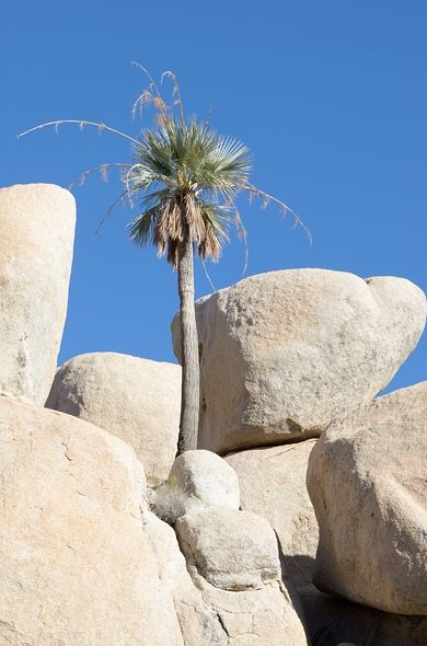
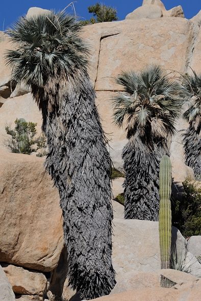
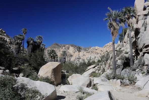
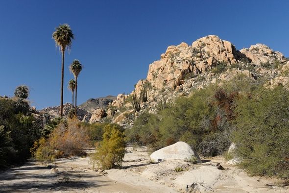
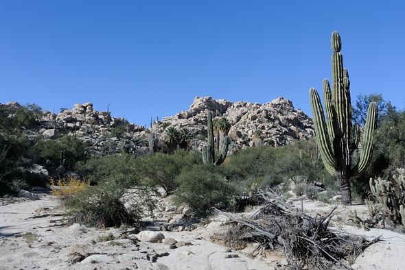
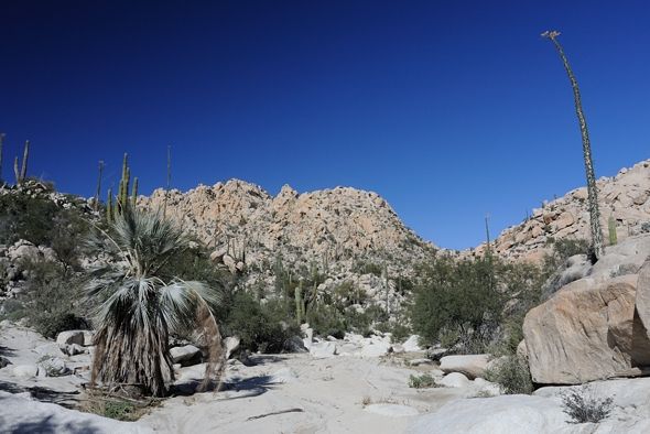
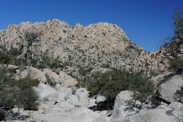
The palm trees grow out of the rocks all the way to the top of the hills, they aren't restricted to the valley bottoms:
Going down the wash to the head of the canyon:
29°15'40.48" N 114°01'12.89" W
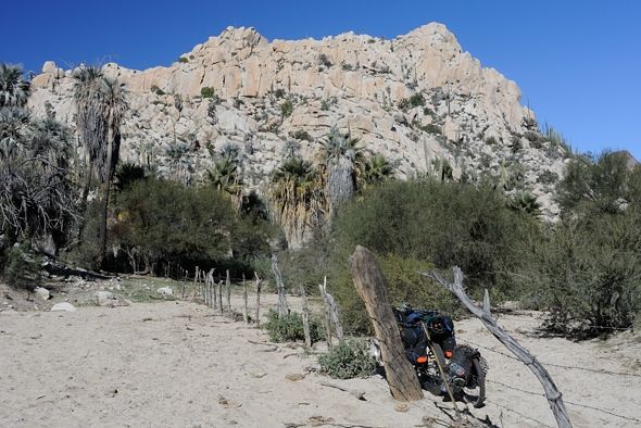
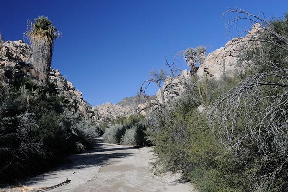
Just about to enter the canyon:
29°15'41.93" N 114°01'07.64" W
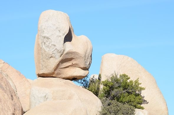
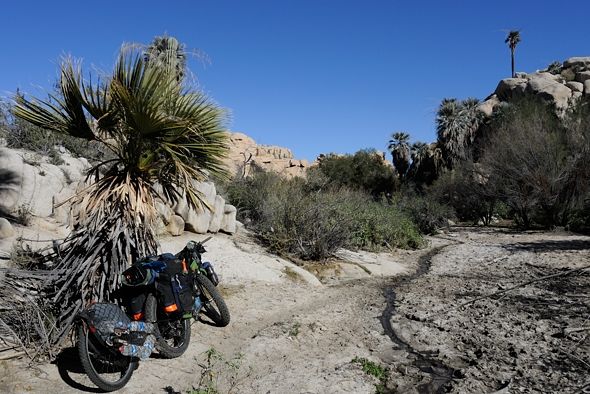
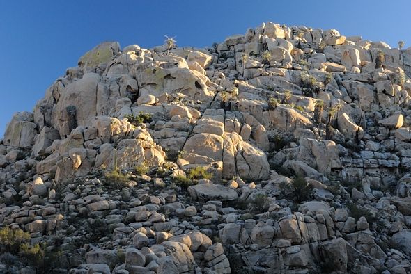
Some of the rocks look pretty precarious:
[Edited on 1-16-2014 by Mark_BC]
[Edited on 1-16-2014 by Mark_BC]
[Edited on 1-16-2014 by Mark_BC]
[Edited on 2-6-2014 by Mark_BC]
|
|
|
David K
Honored Nomad
Posts: 65591
Registered: 8-30-2002
Location: San Diego County
Member Is Offline
Mood: Have Baja Fever
|
|
Epic Baja Adventure! Great photos Mark... 
|
|
|
Mark_BC
Nomad
Posts: 137
Registered: 12-1-2013
Location: Vancouver, BC
Member Is Offline
|
|
Thanks wilderone and David. I have been freight-trained by a nasty flu but I managed to put some more photos together of the next day. Maybe later
I'll go back and edit and put GPS coordinates on them.
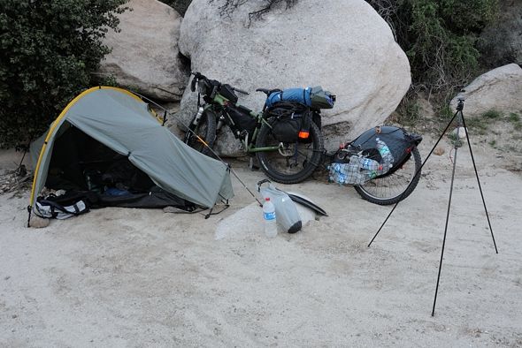
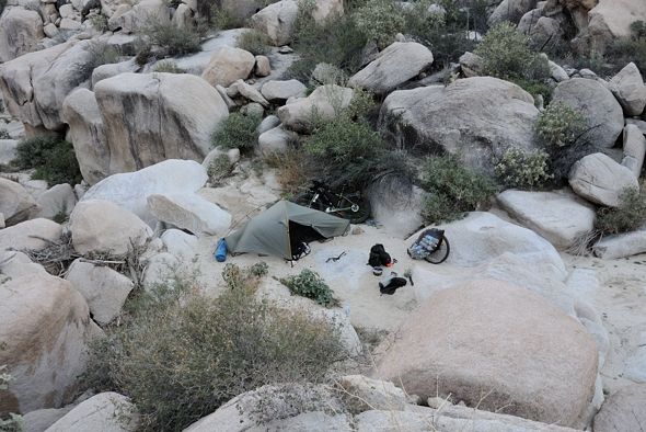
First camp in the canyon: 29°15'42.92" N 114°01'06.83" W
I rode a little ways down from here which was fun, with a few rocks thrown in. But then I got to the first 15' "cliff" I had to scale. The videos are
much more interesting. I'll have to figure out how to embed them later. Looking down the cliff:
29°15'50.32" N 114°00'57.89" W
Shortly after this I came to a cattle area that is accessed by a longer trail outside the canyon. So I didn't need to scale the cliff. This is the
first major green area you see in GE, because there is water here: 29°15'56.74" N 114°00'56.15" W
Another gate: 29°16'01.93" N 114°00'57.34" W
Clear water flowing through the cow patties:
29°16'03.16" N 114°00'56.31" W
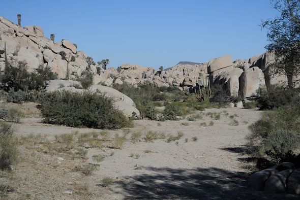
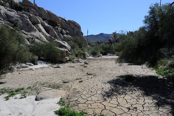
I followed the wash for quite a ways after this, not too difficult. I could ride almost all of it:
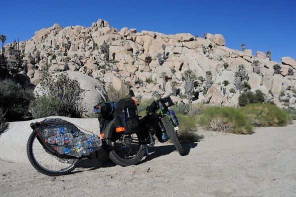
Details of bike:
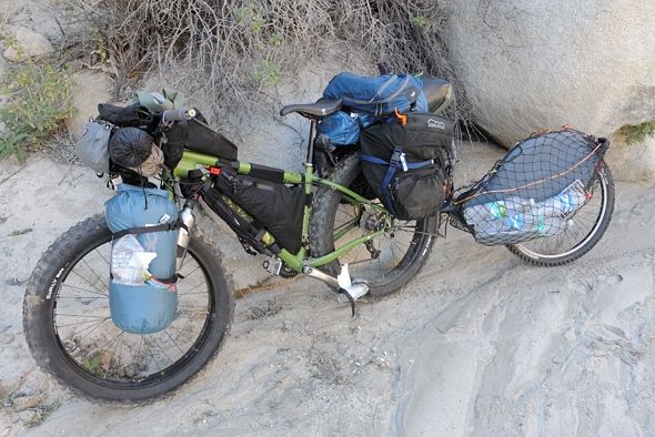
29°16'09.49" N 114°00'30.80" W
The canyon walls started narrowing:
29°16'07.22" N 114°00'27.59" W
The canyon turned north and was very rocky. I had to carry my gear in stages. I got as far as another "big" cliff and set up camp: 29°16'07.62" N
114°00'24.69" W
[Edited on 2-6-2014 by Mark_BC]
|
|
|
Barry A.
Select Nomad
Posts: 10007
Registered: 11-30-2003
Location: Redding, Northern CA
Member Is Offline
Mood: optimistic
|
|
Just outstanding photos, Mark. What beautiful country!!!
Barry
|
|
|
David K
Honored Nomad
Posts: 65591
Registered: 8-30-2002
Location: San Diego County
Member Is Offline
Mood: Have Baja Fever
|
|
Thanks Mark... wild country indeed! What looks like a 'walk in the park' on Google Earth is far different in person!
|
|
|
Mark_BC
Nomad
Posts: 137
Registered: 12-1-2013
Location: Vancouver, BC
Member Is Offline
|
|
Would you say they seem dark? Or is it my computer? I may have to brighten them.
|
|
|
Barry A.
Select Nomad
Posts: 10007
Registered: 11-30-2003
Location: Redding, Northern CA
Member Is Offline
Mood: optimistic
|
|
They look great to me, Mark.
Barry
|
|
|
Mark_BC
Nomad
Posts: 137
Registered: 12-1-2013
Location: Vancouver, BC
Member Is Offline
|
|
That night the cold I had been fighting really drowned me; I'd wake up every hour gasping for air. The nights were pretty miserable and long, and
cold. I was worried about taking too much of my gear over these cliffs and then discovering some impenetrable barrier further down and having to get
it all back up if I had to backtrack. So I decided I'd spend the next day hiking down the canyon with only my essential gear and tent if I wanted to
spend a night down there. Then if it turned out OK I'd come back and get my bike.
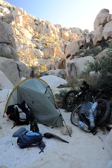
The campsite above the "cliff":
29°16'12.57" N 114°00'20.88" W
Looking to the east wall of the canyon:
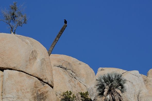
Raven sitting on top of hill on north side of canyon, with the telephoto lens:
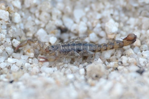
While packing up the tent this guy crawled away:
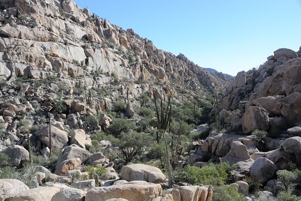
From above it looked like there was no way down other than by rope which I did not want to risk. So I did the 15 minute hike up over the rocky hill to
the west to get around it. Shortly after the cliff it gets really rocky for a short while then turns east into that big long sandy wash you can see on
GE:
29°16'14.48" N 114°00'19.60" W looking NE
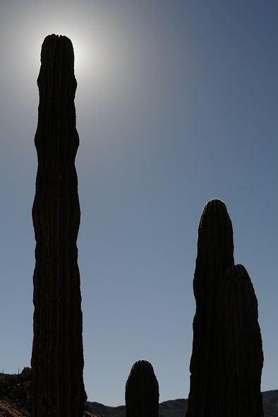
Cactus in a pot:
The wash mellowed out, as I could see from GE:
Around 29°16'03.13" N 113°59'53.54" W looking nothwest
It got a bit narrower with tamarisk hemming it in;
Around 29°15'55.30" N 113°59'37.88" W looking NW
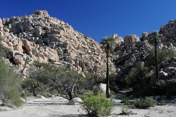
Then the wash abruptly turns north. This was a really nice spot with lots of birds and cactus:
29°15'54.91" N 113°59'33.98" W looking W
At this point was some drying mud from the wash that enters from the south: 29°15'54.64" N 113°59'33.72" W looking S
There were lots of "large" animal tracks, but nothing very recent. I doubt there are coyotes here since it's so rocky. It must be mountain lion. I
continued north after hitting my Spot: Same location looking N
Somewhere around 29°16'05.58" N 113°59'33.20" W looking N
Somewhere around 29°16'10.28" N 113°59'33.98" W looking N
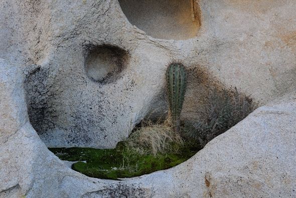
I knew from GE there was something at the north end of this section of wash before it again turns east and gets more green. I suspected a pool, and I
was right:
29°16'13.80" N 113°59'32.71" W
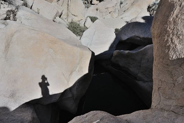
There was no way I could hike down that. The only way around was over the hill to the west. I climbed it and decided that it was too risky to continue
alone. This is looking south to where I came from: 29°16'14.11" N 113°59'33.79" W
Looking northwest up the wash that enters from the west: Same spot
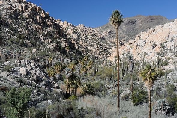
It's too bad I didn't continue on as GE shows about a half km of green which looks fairly passable. Then the pools start again which, judging by this
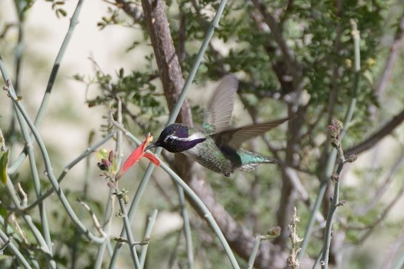
one, would not be passable by myself and without climbing gear. But it would have bee nice to see them. So I hung out here for a while and took
pictures of hummingbirds and enjoyed the beautiful desert environment, without evidence of cattle:
I started worrying about the gear I had left behind so I decided to hike back and camp where I did the previous night.
[Edited on 1-22-2014 by Mark_BC]
[Edited on 2-6-2014 by Mark_BC]
|
|
|
David K
Honored Nomad
Posts: 65591
Registered: 8-30-2002
Location: San Diego County
Member Is Offline
Mood: Have Baja Fever
|
|
Incredible country you were in! Amazing that what looks like a sandy canyon bottom was actually huge boulders you had to scramble over.
Salsipuedes means Get Out IF You Can... and like Erle Stanley Gardner wrote in his book Hovering Over Baja and Off the Beaten Track in Baja, it meant
Get IN if you can... it is like a magnet.
I am glad you did get out okay... and as you saw, we were watching you, at least once a day.... biting our nails.
Thank you Mark!
|
|
|
Skipjack Joe
Elite Nomad
Posts: 8092
Registered: 7-12-2004
Location: Bahia Asuncion
Member Is Offline
|
|
Mark,
It would be helpful if you provided GPS readings with some of these images so that we could better understand how they relate to your journey.
Just a suggestion.
|
|
|
David K
Honored Nomad
Posts: 65591
Registered: 8-30-2002
Location: San Diego County
Member Is Offline
Mood: Have Baja Fever
|
|
| Quote: | Originally posted by Skipjack Joe
Mark,
It would be helpful if you provided GPS readings with some of these images so that we could better understand how they relate to your journey.
Just a suggestion. |
Here is his Spot map, and perhaps he can say where the photos were taken in relation to the numbered darts? I have an idea because he mentions where
the arroyo turns north (Spot 11)
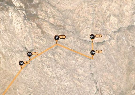
On the topo:
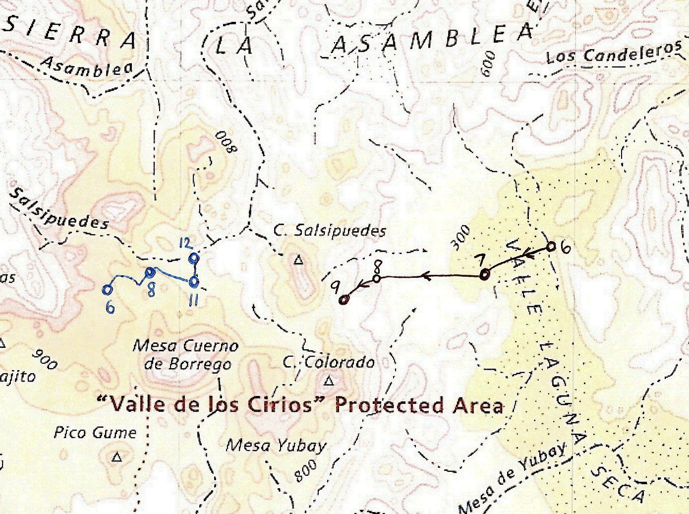
The topo may be wrong as to the location of the Salsipuedes headwater. Mark may have been in the true Salsipuedes from the start, but the name on the
map is off.
|
|
|
| Pages:
1
..
9
10
11
12
13
..
25 |


