| Pages:
1
..
13
14
15
16
17
..
23 |
bryanmckenzie
Senior Nomad

Posts: 561
Registered: 9-23-2009
Location: 400 Km from Mexico Beach, Florida
Member Is Offline
Mood: Hot & humid --- not hot & dry.
|
|
Lou, the short answer is, KINDA-SORTA.
The longer, more correct answer is, NO.
To be able to determine the 3rd parameter (elevation), photo panels must overlap and be shot from 2 angles (stereo coverage). This is always done when
using low altitude airplanes to map an area. I believe once elevation is known you can simply "drape" a flat photo onto the known 3-D surface. Just
like Elbeau or I drape maps onto the known GE surface we call earth.
(Side note, GPS takes this one level higher to include a 4th parameter (time); this is why a minimum of 4 satellites are requires to calculate where
you are. But I digress).
Here is a short intro ... http://www.stereoscopy.com/faq/photogrammetry.html

| Quote: | Originally posted by bajalou
Now all of you GoogleEarth experts correct me if I'm misinformed, but Google Earth does NOT give you actual images from different angles as it tilts
etc. It just projects the scent by resizing for distance etc. The shadows are from the different angles to the sun, not camera angles. The actual
image is flat.
Now if that is true, it is just stretching shadows and colors that makes it appear to let you "see" features. |
[Edited on 2011-4-5 by bryanmckenzie]
|
|
|
David K
Honored Nomad
Posts: 65549
Registered: 8-30-2002
Location: San Diego County
Member Is Offline
Mood: Have Baja Fever
|
|
Bryan... you up for a El Volcan trip in April?
|
|
|
BAJACAT
Ultra Nomad
Posts: 2902
Registered: 11-21-2005
Location: NATIONAL CITY, CA
Member Is Offline
|
|
| Quote: | Originally posted by TW
David it looks like Friday April 29 to the wash and camp over night then get an early start Saturday morning.
I'm working around Ken Cooke and his Jeep group. They will be at Gonzaga Bay on Monday the 25th, then meet me at the Turquesa Mine on Tuesday the 26th
to do the mine run. Then they are going to LA Bay. They will be at Catavina on the 28th to run into Mission Santa Maria. Bajacat and I will join them.
We will come out on the 29th and Bajacat and I are heading to El Marmol and the wash. I've asked Ken to join us too but I don't know if his schedule
will allow it. I also suggested he might skip the mine run and hit LA Bay a day early and the mission a day early and then join us at the wash to
explore. That would mean getting to the wash on Thursday the 28th a day earlier. Not sure how that might affect Bajacat.
We'll work it all out somehow. |
Tom I had already ask for thurs-friday off I don't know if I can change
dates... If you want we can leave the SMM trip for another day and just do the Marmol run, that will me a chance to relaxe More In El
Rosario...(BAJACACTUS)..
[Edited on 4-5-2011 by BAJACAT]
BAJA IS WHAT YOU WANTED TO BE, FUN,DANGEROUS,INCREDIBLE, REMOTE, EXOTIC..JUST GO AND HAVE FUN.....
|
|
|
David K
Honored Nomad
Posts: 65549
Registered: 8-30-2002
Location: San Diego County
Member Is Offline
Mood: Have Baja Fever
|
|
Sounds like the original plan was getting to El Volcan the afternoon/ evening of Friday the 29th with the hike (where we can't drive) on Saturday the
30th and camp that night and return home Sunday.
I am hoping to make this happen...
|
|
|
bajalou
Ultra Nomad
Posts: 4459
Registered: 3-11-2004
Location: South of the broder
Member Is Offline
|
|
Thanks Brian and elbeau for the detailed explanations of the terrain/elevation features of GE.
The point I was trying to make is that although the SRTM data creates higher and lower points on a wire frame, the photographic imaged has to be
stretched to cover the distortion. The image itself is still from approximately straight down and not from the angel we are projecting.
A side comment - GE and VE images often appear very different for a area because of the shadows from the time of day the picture was taken.
No Bad Days
\"Never argue with an idiot. People watching may not be able to tell the difference\"
\"The trouble with doing nothing is - how do I know when I\'m done?\"
Nomad Baja Interactive map
And in the San Felipe area - check out Valle Chico area |
|
|
TMW
Select Nomad
Posts: 10659
Registered: 9-1-2003
Location: Bakersfield, CA
Member Is Offline
|
|
Bajacat I think your OK with Thursday and Friday.
|
|
|
bryanmckenzie
Senior Nomad
Posts: 561
Registered: 9-23-2009
Location: 400 Km from Mexico Beach, Florida
Member Is Offline
Mood: Hot & humid --- not hot & dry.
|
|
Yes, Lou, that's a nice concise way of saying it. I was taught the word "draping" as a catch-all for that adjustment. It's why very often you'll see
lakes or oceans seemly going up hillsides (or vice versa).
| Quote: | | The point I was trying to make is that although the SRTM data creates higher and lower points on a wire frame, the photographic imaged has to be
stretched to cover the distortion. The image itself is still from approximately straight down and not from the angel we are projecting.
|
|
|
|
bryanmckenzie
Senior Nomad
Posts: 561
Registered: 9-23-2009
Location: 400 Km from Mexico Beach, Florida
Member Is Offline
Mood: Hot & humid --- not hot & dry.
|
|
I am. I'd love to make this trip. I could meet you in San Diego & ride together.
However, given the (lack of) work situation, I'm hesitant to commit to diverting time and money for this when I need to be job hunting. Let me think
on it a few days.

| Quote: | Originally posted by David K
Bryan... you up for a El Volcan trip in April? |
|
|
|
bajalou
Ultra Nomad
Posts: 4459
Registered: 3-11-2004
Location: South of the broder
Member Is Offline
|
|
Thanks Brian, draping is an appropriate description I think.
No Bad Days
\"Never argue with an idiot. People watching may not be able to tell the difference\"
\"The trouble with doing nothing is - how do I know when I\'m done?\"
Nomad Baja Interactive map
And in the San Felipe area - check out Valle Chico area |
|
|
BAJACAT
Ultra Nomad
Posts: 2902
Registered: 11-21-2005
Location: NATIONAL CITY, CA
Member Is Offline
|
|
| Quote: | Originally posted by David K
Sounds like the original plan was getting to El Volcan the afternoon/ evening of Friday the 29th with the hike (where we can't drive) on Saturday the
30th and camp that night and return home Sunday.
I am hoping to make this happen... |
Yes David, but Tom was saying that maybe the run to th SMM was going to
be change to a day before from thu to wends..if it remains the same SMM on thurs exit on friday..drive to el Volcan and hike sat.. Im in
BAJA IS WHAT YOU WANTED TO BE, FUN,DANGEROUS,INCREDIBLE, REMOTE, EXOTIC..JUST GO AND HAVE FUN.....
|
|
|
David K
Honored Nomad
Posts: 65549
Registered: 8-30-2002
Location: San Diego County
Member Is Offline
Mood: Have Baja Fever
|
|
| Quote: | Originally posted by BAJACAT
| Quote: | Originally posted by David K
Sounds like the original plan was getting to El Volcan the afternoon/ evening of Friday the 29th with the hike (where we can't drive) on Saturday the
30th and camp that night and return home Sunday.
I am hoping to make this happen... |
Yes David, but Tom was saying that maybe the run to th SMM was going to
be change to a day before from thu to wends..if it remains the same SMM on thurs exit on friday..drive to el Volcan and hike sat.. Im in
|
Well, if the money thing gets solved, and others are going so we have some fun... I will go down Friday, camp at El Volcan arroyo or just beyond near
the white slope (big area to camp) off the La Olvidada road. Hike in if can't drive down the arroyo... camp that night, and return Sunday through
Tecate.
|
|
|
BAJACAT
Ultra Nomad
Posts: 2902
Registered: 11-21-2005
Location: NATIONAL CITY, CA
Member Is Offline
|
|
I think, that if something is there, somebody should have found it already.. is hard to belive that hasn't been discover, but Im up to the
challenge... Hopefully I would not be spook again..when I went down the rd I scrape my front bumper in one of the sharp turns,that happens when you
have a full size truck...
BAJA IS WHAT YOU WANTED TO BE, FUN,DANGEROUS,INCREDIBLE, REMOTE, EXOTIC..JUST GO AND HAVE FUN.....
|
|
|
David K
Honored Nomad
Posts: 65549
Registered: 8-30-2002
Location: San Diego County
Member Is Offline
Mood: Have Baja Fever
|
|
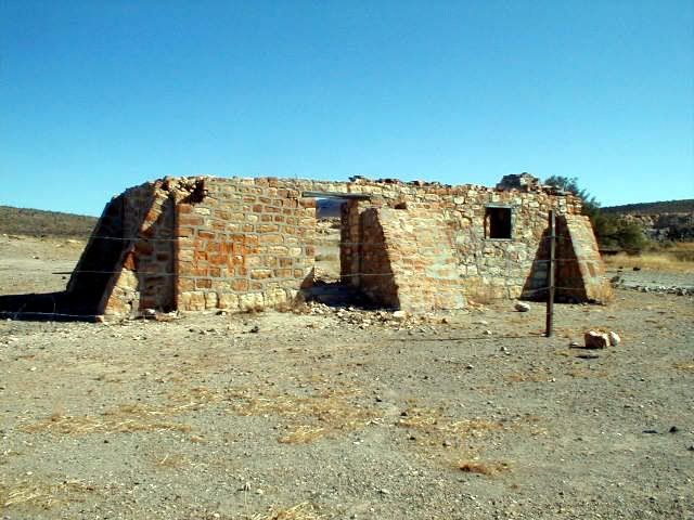
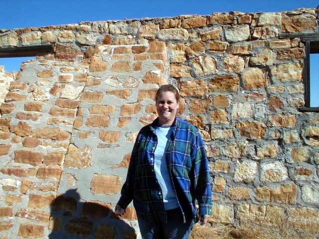
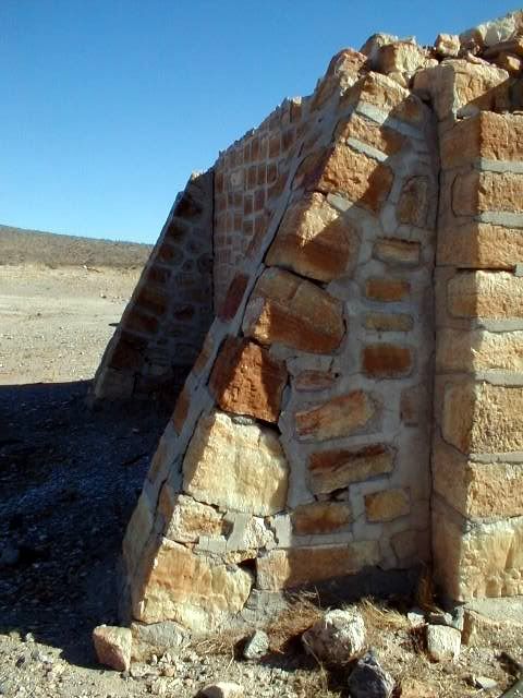
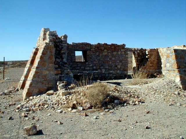
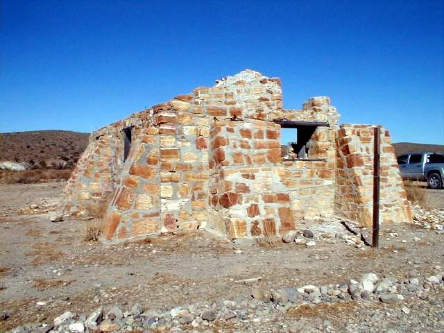
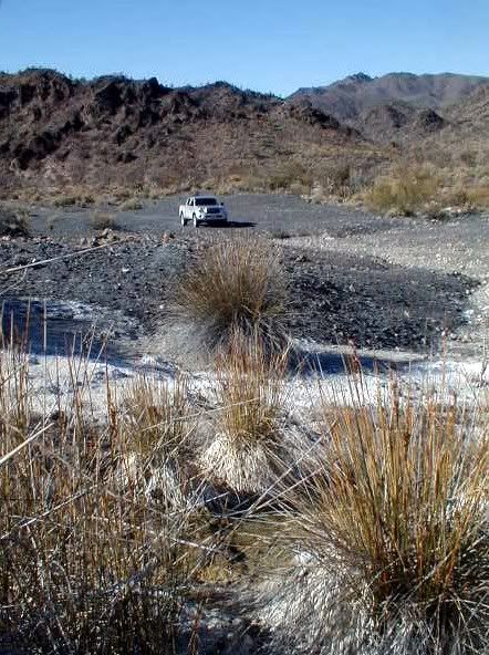
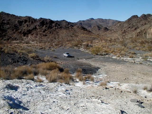
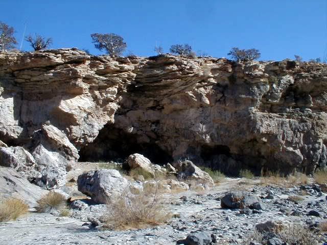
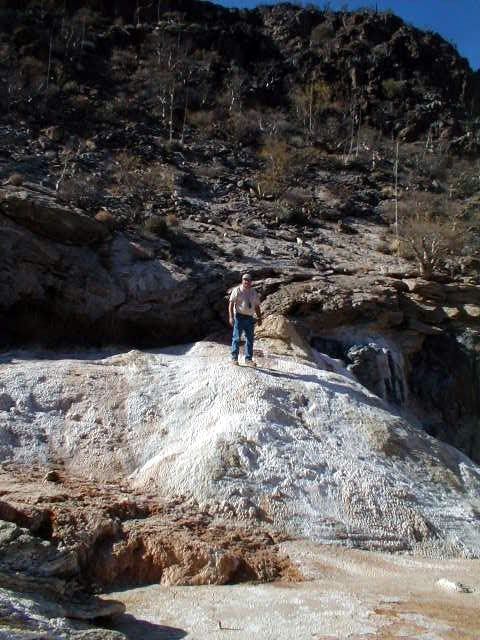
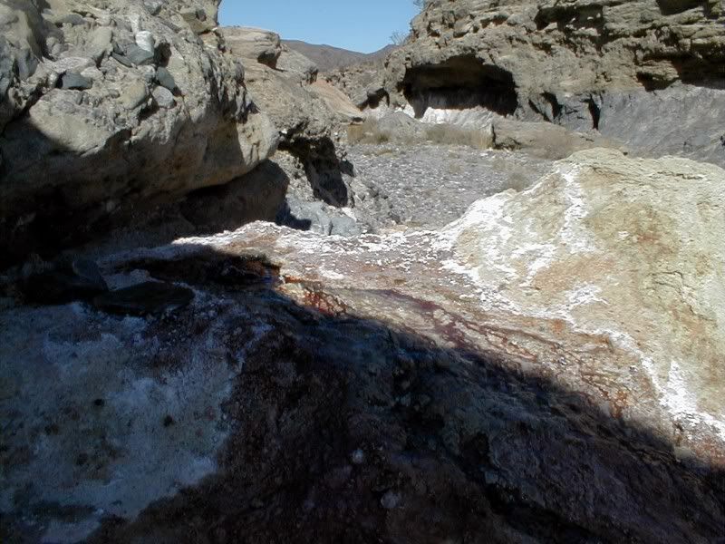
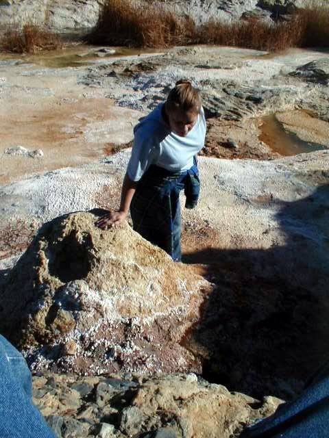
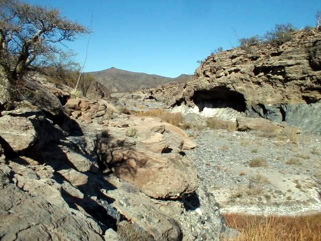
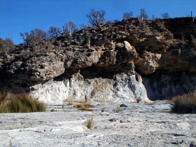
EL MARMOL & EL VOLCAN PICS
Since the trip involves being there.. and El Volcan (the cold water geyser) is only 4/10 a mile (2/3 a kilometer) up the arroyo from the road between
El Marmol and La Olvidada, I am showing my 2006 pics again plus some never before posted in Arroyo el Volcan.
The Santa Isabel site is down stream from the road about 3 miles.
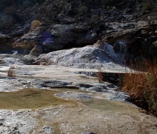
The first 5 are of the onyx schoolhouse:
The next two are at the mineralized white slope that is just 1/4 mile from the Arroyo el Volcan crossing, along the La Olvidada road... in the
background is Arroyo el Volcan going down to the Santa Isabel site:
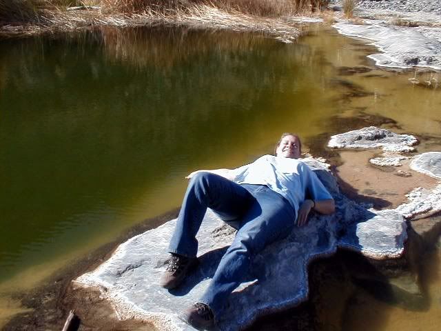
The next 6 photos are in Arroyo el Volcan driving and walking up to El Volcan geyser (also called the onyx dome)... one of the pools is too deep to
see the bottom, and Baja Angel is lying next to it:
Looking up and down the arroyo from where we parked, 0.2 mile from the La Olvidada road:
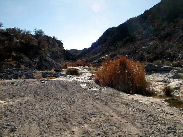
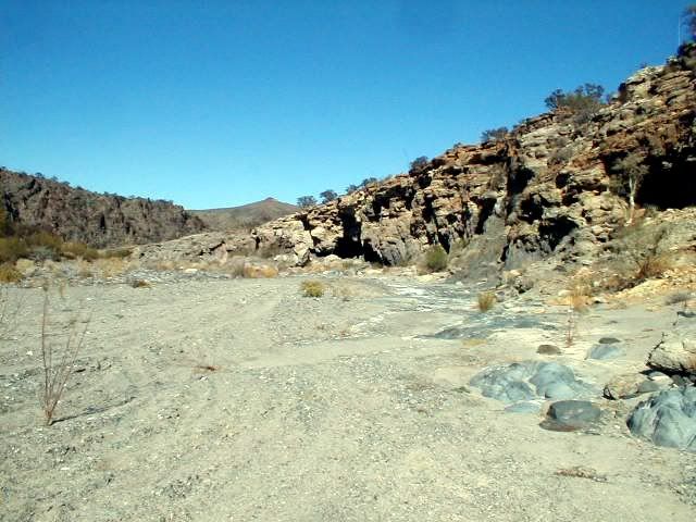
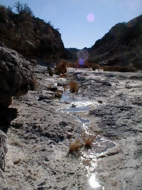
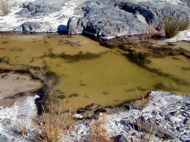
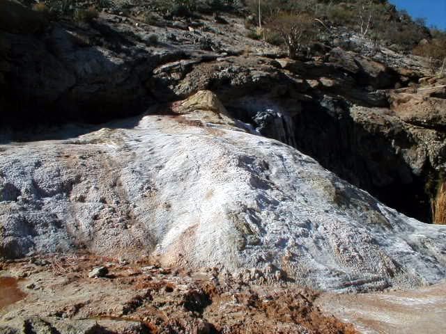
The next 7 are at El Volcan:
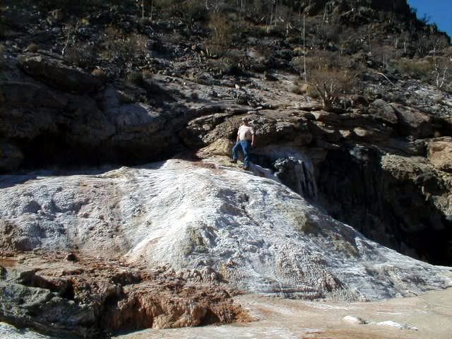
See my silver truck way down the arroyo? That is all we had to walk to get to El Volcan, as we could drive half way to the geyser from the road, in
the arroyo in 2006:
The final photo is walking back to the truck looking at the east side cliff of the arroyo and see Baja Angel for scale:
|
|
|
David K
Honored Nomad
Posts: 65549
Registered: 8-30-2002
Location: San Diego County
Member Is Offline
Mood: Have Baja Fever
|
|
Map:
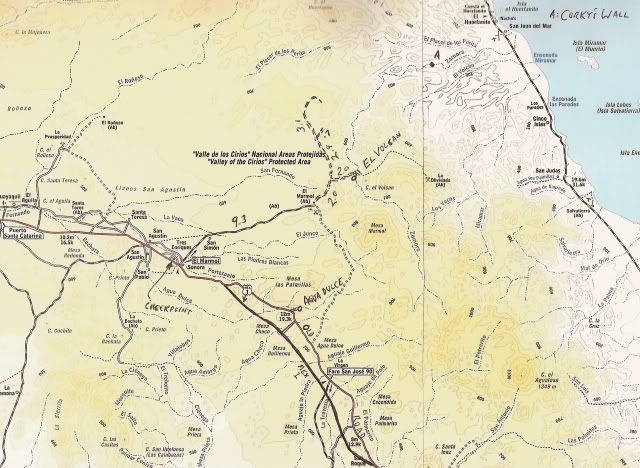
Image:
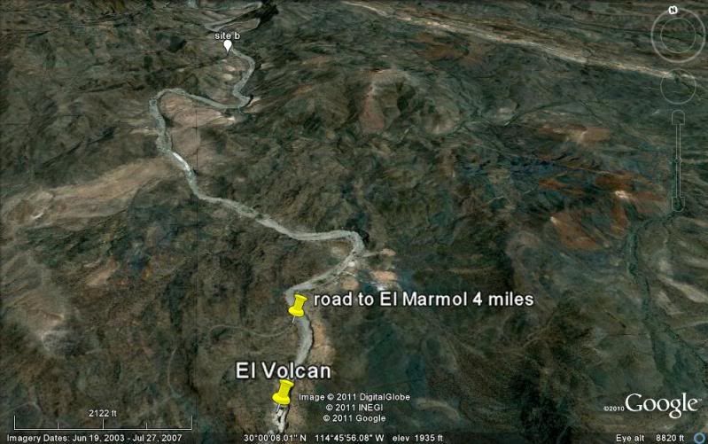
Site 'b' in white balloon is elbeau's Santa Isabel site, about 3 miles down the arroyo. El Volcan is 0.4 miles up the arroyo from the road to El
Marmol/La Olvidada.
[Edited on 4-8-2011 by David K]
|
|
|
elbeau
Nomad
Posts: 256
Registered: 3-2-2011
Location: Austin, TX
Member Is Offline
|
|
| Quote: | Originally posted by David K
Since the trip involves being there.. and El Volcan (the cold water geyser) is only 4/10 a mile (2/3 a kilometer) up the arroyo from the road between
El Marmol and La Olvidada, I am showing my 2006 pics again plus some never before posted in Arroyo el Volcan. |
Very nice photos, thanks!
|
|
|
elbeau
Nomad
Posts: 256
Registered: 3-2-2011
Location: Austin, TX
Member Is Offline
|
|
Realistically, I'm pretty sure that my interpretations of the GE imagery are overzealous. I've had some u2u's with bryanmckenzie and even though I've
posted a lot of objections to what he sees, I'm just being hard-headed. As this plays out, he will likely be proven correct on most points.
On the other hand, the argument for there being year-round water in the area is still pretty solid, and based on the depth of the onyx deposits this
water has probably been there for a very, very long time. The question of whether it is too mineralized to live on is a good one though...but let's
hold off on any human experimentation of the theory for now...unless it's mcfez 
just kidding man, you're cool.
One way or another, I'll make a trip to the arroyo myself this year. It's just been too fun to study about for me not to go.
I loved that BBC video that TW posted the other day, and one thing in it has peaked my attention. The climate change that has taken place in Baja
during the last 15,000 years has been tremendous if they are correct in what they showed. If the majority of the peninsula had pine and oak forests
that slowly changed into arid desert during the last 15,000 years, then the Baja residents that they are dating to thousands of years ago might have
lived in a significantly different Baja than we know today. I've done a little googleing and haven't come across any climate data one way or the
other for the last 15,000 years. Does anybody know if they are correct? and if they are correct, can somebody give any insights about how quickly
things changed over those years?
|
|
|
TMW
Select Nomad
Posts: 10659
Registered: 9-1-2003
Location: Bakersfield, CA
Member Is Offline
|
|
Bajacat you shouldn't have any problems going in this time as the road has been graded. I was in there in my GMC. The only problem is that once in the
wash we will only be able to drive around the first bend due to rocks in the wash. The first bend is at the top of the yellow marker in the pix above
labeled Road to El Marmol 4 miles. That green patch just past it in the middle of the wash is where the rocks are under some heavy grass type
vegetation.
|
|
|
BAJACAT
Ultra Nomad
Posts: 2902
Registered: 11-21-2005
Location: NATIONAL CITY, CA
Member Is Offline
|
|
so what's up with keen is he changing dates to go to MSM.. or it remains the same..I think I will leave really early thursday..the 28th..
BAJA IS WHAT YOU WANTED TO BE, FUN,DANGEROUS,INCREDIBLE, REMOTE, EXOTIC..JUST GO AND HAVE FUN.....
|
|
|
TMW
Select Nomad
Posts: 10659
Registered: 9-1-2003
Location: Bakersfield, CA
Member Is Offline
|
|
His plan is to spent Wednesday night the 27th in LA Bay and Thursday night the 28th at Mission Santa Maria and Friday night at Baja Cactus in El
Rosario. You and I can meet him at Santa Ines sometime on Thursday. We'll work out the meeting times etc the week before.
|
|
|
BAJACAT
Ultra Nomad
Posts: 2902
Registered: 11-21-2005
Location: NATIONAL CITY, CA
Member Is Offline
|
|
Souds, good I will keep checking this thread for info..I hope DK goes with us..or any nomads that would like to acompany us in this crazzy quest..
Elbeu, next time we see ya, you are going to have to buy the Victorias(cerveza), Pacifico's are so overated,(sorry DENNIS)..
BAJA IS WHAT YOU WANTED TO BE, FUN,DANGEROUS,INCREDIBLE, REMOTE, EXOTIC..JUST GO AND HAVE FUN.....
|
|
|
| Pages:
1
..
13
14
15
16
17
..
23 |


