| Pages:
1
2 |
David K
Honored Nomad
        
Posts: 65445
Registered: 8-30-2002
Location: San Diego County
Member Is Offline
Mood: Have Baja Fever
|
|
| Quote: | Originally posted by bajaguy
DK..........when were the sat photos taken??? |
July 26, 2007
|
|
|
David K
Honored Nomad
        
Posts: 65445
Registered: 8-30-2002
Location: San Diego County
Member Is Offline
Mood: Have Baja Fever
|
|
El Marmol glyph is a straight line on a hill slope. I will post what I have here.... stay tuned!
|
|
|
John M
Super Nomad
   
Posts: 1924
Registered: 9-3-2003
Location: California High Desert
Member Is Offline
|
|
El Marmol geoglyph
We have visited the El Marmol geoglyph a couple of years ago, photographed it - walked it - one of them anyway. I'll dig up details tomorrow.
John M
|
|
|
David K
Honored Nomad
        
Posts: 65445
Registered: 8-30-2002
Location: San Diego County
Member Is Offline
Mood: Have Baja Fever
|
|
Here is Neal John's quote from his Trip Report of April, 2009 (I bumped up the four part trip report):
We had lunch at a taco stand south of Ensenada and went onward to camp at a wide spot off the El Marmol road. The next morning we found an old road
previously spotted on Google Earth and drove to a geoglyph site found by old Baja hands Marv Patchen and Eve Ewing. This was a small knoll with a
straight path leading several hundred feet down to an arroyo. The rock circles at the top of the knoll were in some disarray and there was little else
to see but is was interesting to find. The narrow old road we found was as interesting and exciting as the geoglyph. Creosote bushes put exotic
pinstriping on the sides of our Toyotas and no one cared. This is what we bought them for!
|
|
|
John M
Super Nomad
   
Posts: 1924
Registered: 9-3-2003
Location: California High Desert
Member Is Offline
|
|
That's the trip
I had forgotten Neal wrote it up a bit...I'll look over what he wrote and add other stuff I think. John
|
|
|
David K
Honored Nomad
        
Posts: 65445
Registered: 8-30-2002
Location: San Diego County
Member Is Offline
Mood: Have Baja Fever
|
|
Please do John. I have the published paper and thought I had posted more including Google earth images but I only found Neal's posts.
|
|
|
David K
Honored Nomad
        
Posts: 65445
Registered: 8-30-2002
Location: San Diego County
Member Is Offline
Mood: Have Baja Fever
|
|
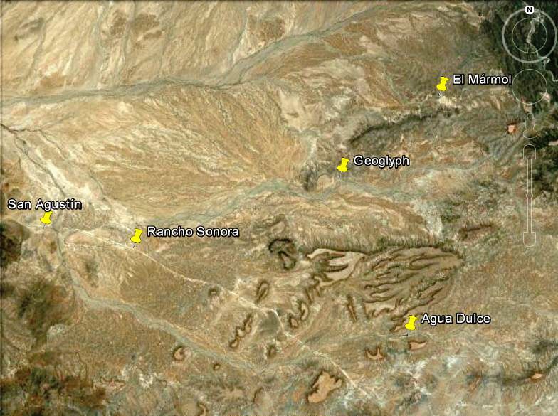
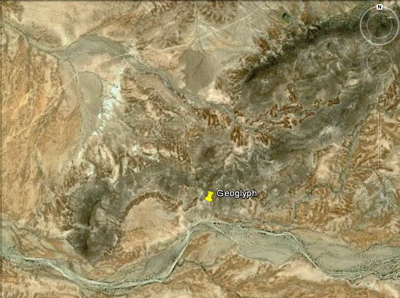
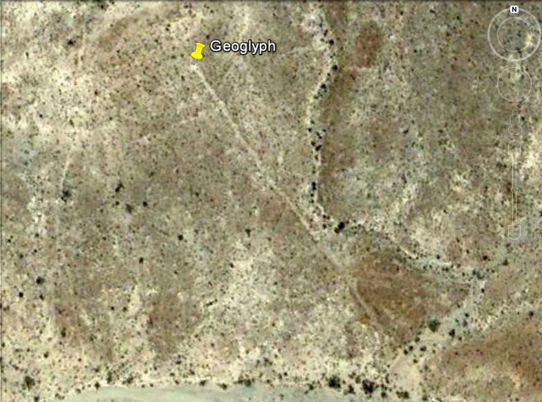
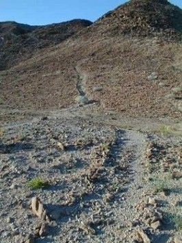
El Mármol Geoglyph
First three images with north at top, pin at top of hill, end of glyph:
Looking down the glyph:
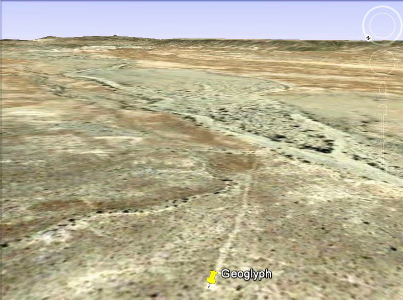
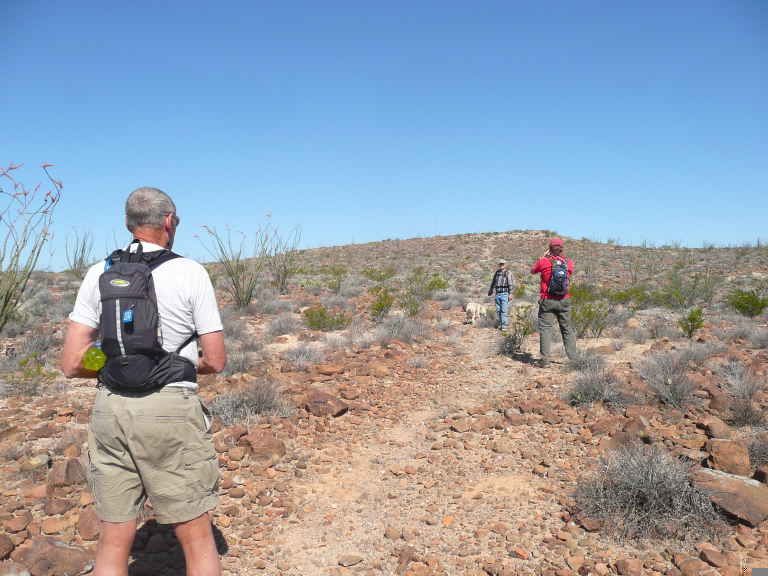
Looking up the glyph is John M:
Could it be a direction sign to the nearest water?
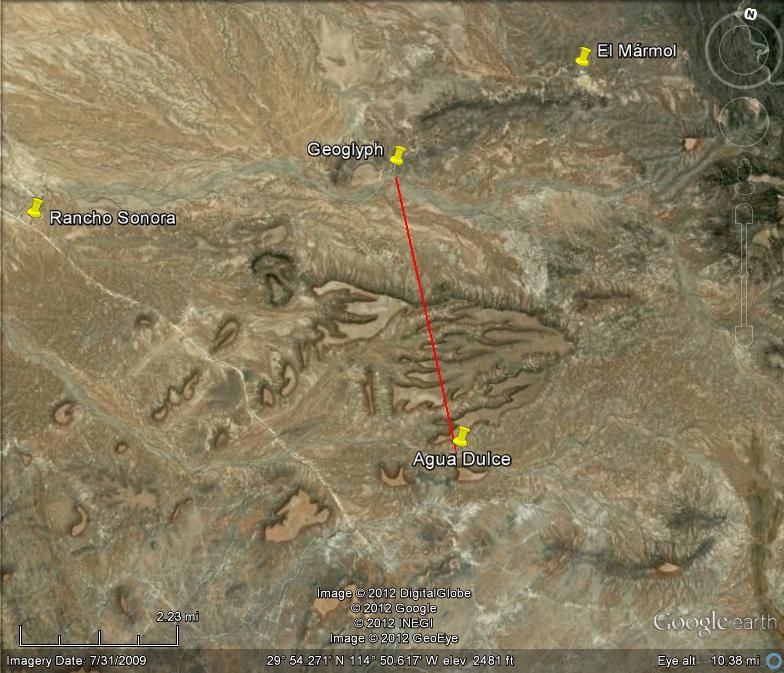
Almost, but the heading from top to bottom is slightly more east than the line to Agua Dulce...
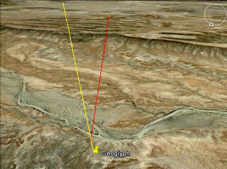
Still, it is pretty close, and Agua Dulce has year-round sweet water!
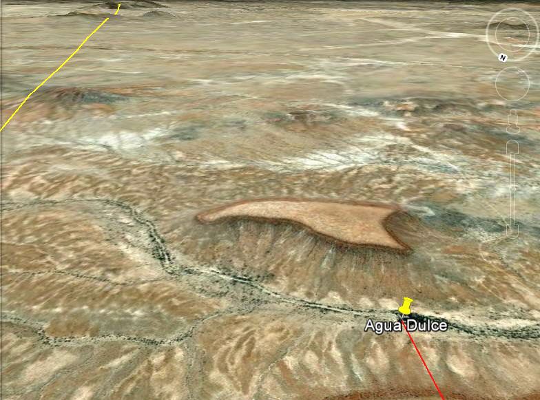
The direct line of the geoglyph meets the arroyo we cross going to Santa María from Santa Ynez.
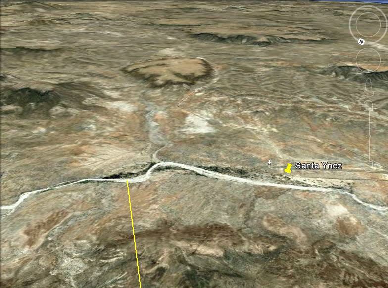
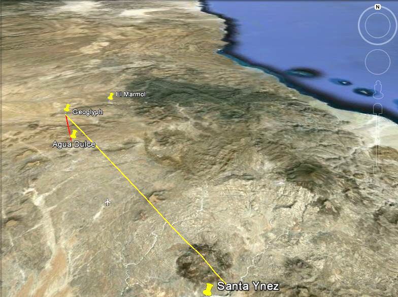
What do you think?
[Edited on 6-6-2022 by David K]
|
|
|
John M
Super Nomad
   
Posts: 1924
Registered: 9-3-2003
Location: California High Desert
Member Is Offline
|
|
El Marmol geoglyphs
I believe I'll take a step back and let others complete the El Marmol data and information. My info is pretty limited. John
|
|
|
David K
Honored Nomad
        
Posts: 65445
Registered: 8-30-2002
Location: San Diego County
Member Is Offline
Mood: Have Baja Fever
|
|
Just playing with Google Earth John, I wasn't there in person... and Neal did a trip report in 2009. I would love to hear your observations and
guesses as to its purpose. Thank you!
|
|
|
wilderone
Ultra Nomad
    
Posts: 3898
Registered: 2-9-2004
Member Is Offline
|
|
There is also an altar near the glyph, a bit before Agua Dulce. It is the same type of altar that Mike Younghusband encountered elsewhere in southern
Baja.
|
|
|
David K
Honored Nomad
        
Posts: 65445
Registered: 8-30-2002
Location: San Diego County
Member Is Offline
Mood: Have Baja Fever
|
|
A mile west of Hwy. 5, between Km. 113 and 114 (between Mexicali and San Felipe) is a valley of geoglyphs... I reported on it here on Nomad in 2005
after our San Felipe 250 Race weekend trip...
I recorded the GPS: GPS: N 31°40.53', W 115°04.64' (NAD 27).Google Earth uses map datum WGS84, but NAD27 is close if you want to have a look.
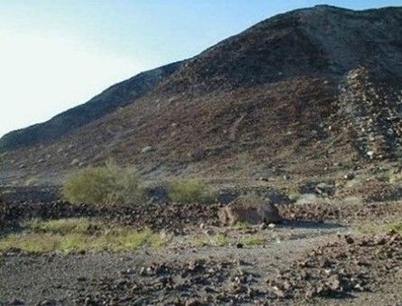
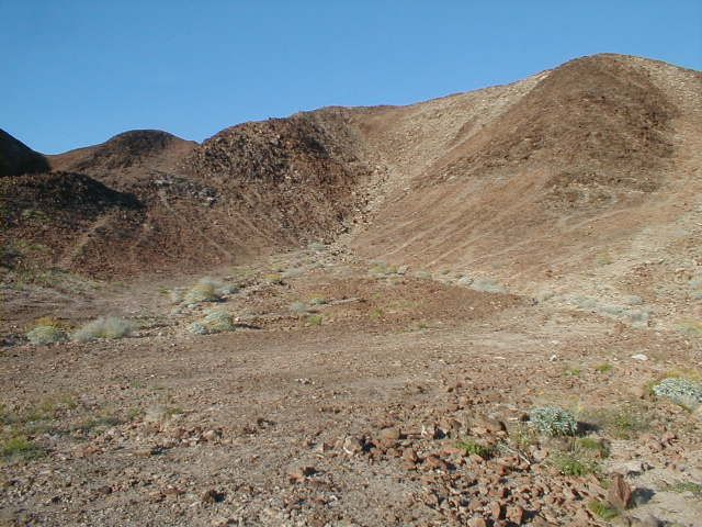
Pretty weird, right?
[Edited on 6-6-2022 by David K]
|
|
|
David K
Honored Nomad
        
Posts: 65445
Registered: 8-30-2002
Location: San Diego County
Member Is Offline
Mood: Have Baja Fever
|
|
Very cool... Baja is a treasure chest full of wonders!
|
|
|
David K
Honored Nomad
        
Posts: 65445
Registered: 8-30-2002
Location: San Diego County
Member Is Offline
Mood: Have Baja Fever
|
|
| Quote: | Originally posted by Lancesf
Here is an attempt at posting a google earth image of the anthropomorphic figure. Much easier to see if you go to google earth itself. The arrow
points to the upside down figure under the left arm.
Again, the coordinates for the upside down figure are
29 27'22.30 'N 114 37"22.30"W. Best way to view is by turning page so top is due south.
Can you see it?
[Edited on 11-24-2012 by Lancesf] |
You need a small edit on your GPS number to this: 29 27' 22.30" N 114 37' 22.30" W for it to work. Not needed, but the degree symbol fyi is created
with Alt 248 °
[Edited on 6-6-2022 by David K]
|
|
|
David K
Honored Nomad
        
Posts: 65445
Registered: 8-30-2002
Location: San Diego County
Member Is Offline
Mood: Have Baja Fever
|
|
Another way to make the degree symbol is Hold down the Alt key and enter 248
°
[Edited on 6-6-2022 by David K]
|
|
|
| Pages:
1
2 |

