| Pages:
1
2
3
4
..
9 |
David K
Honored Nomad
        
Posts: 65445
Registered: 8-30-2002
Location: San Diego County
Member Is Offline
Mood: Have Baja Fever
|
|
Thank you Phil!!!
|
|
|
TMW
Select Nomad
      
Posts: 10659
Registered: 9-1-2003
Location: Bakersfield, CA
Member Is Offline
|
|
The wash walls close in on both side as you furthere back. The dam is to the right of Phil's head in the tan looking area in the 1st picture.
In the 2nd picture the water way down to the dam follows a path up and to the left. The dam is straight back in the 2nd picture.
I think we just need to go down and take a second look.
|
|
|
TMW
Select Nomad
      
Posts: 10659
Registered: 9-1-2003
Location: Bakersfield, CA
Member Is Offline
|
|
I wonder just how sure Henderson was as to where he parked his car.
|
|
|
David K
Honored Nomad
        
Posts: 65445
Registered: 8-30-2002
Location: San Diego County
Member Is Offline
Mood: Have Baja Fever
|
|
Well, I think we have that figured well, he reached the summit at noon, then went down the rougher, steeper canyon to Arroyo Grande. I figure 10 miles
(5 hours walk) from the Model A to the Sierra Pinta Divide at the top of Arroyo A.
His details are pretty good considering it was the 1930's and he wrote them 30 years later.
I will begin sharing the actual letter here, get more input on what he says... I also just did a series of satellite images of Arroyo A with Bing, and
they are clearer than Google....
|
|
|
David K
Honored Nomad
        
Posts: 65445
Registered: 8-30-2002
Location: San Diego County
Member Is Offline
Mood: Have Baja Fever
|
|
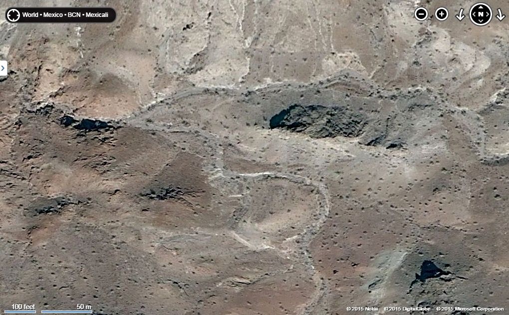
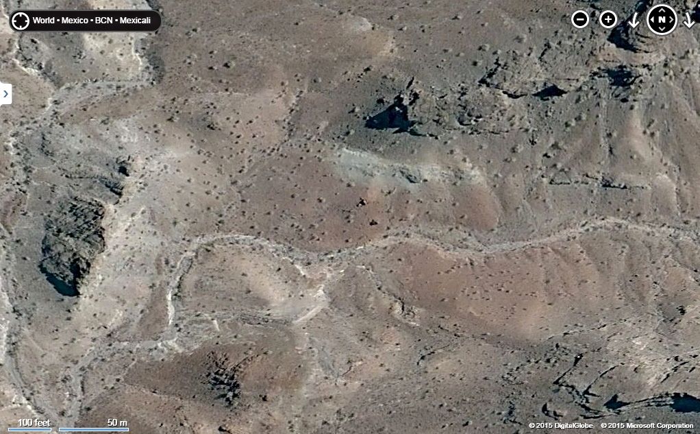
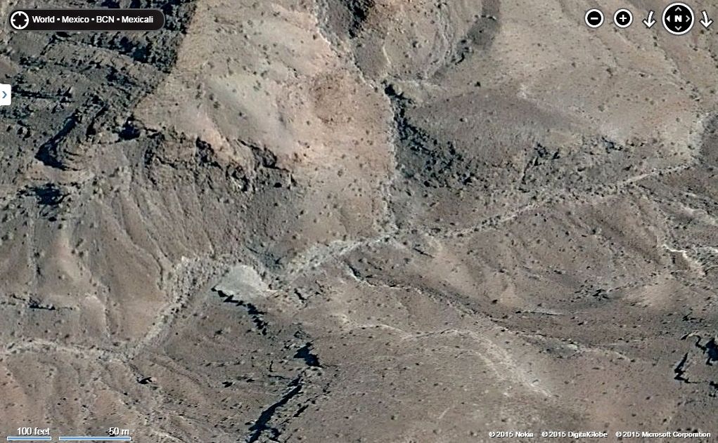
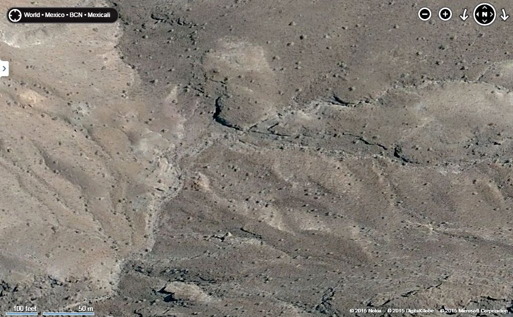
Bing Satellite Maps of Arroyo A
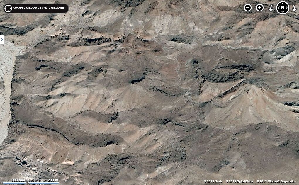
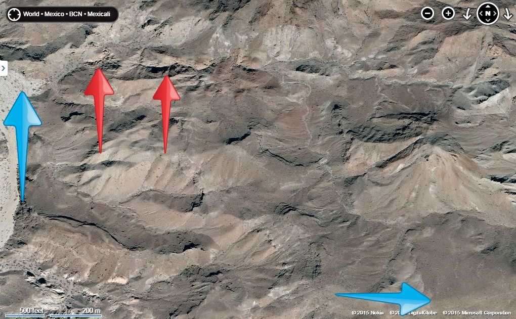
Blue arrow on left is Arroyo Grande and on right is top of Arroyo A (Divide). 2 miles hike between them, 550' elevation gain.
Red arrow on left is the dam, possible blockage to hike. The second red arrow is another possible difficult pass, but both look to have options to get
around, perhaps on the north?
Now, close up of our route from Arroyo Grande to the Divide... The first three have north at the top, the next three have east at the top.
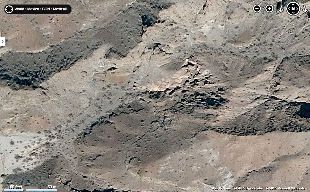
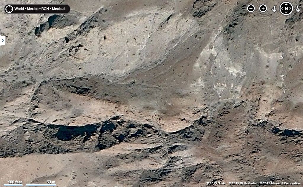
|
|
|
David K
Honored Nomad
        
Posts: 65445
Registered: 8-30-2002
Location: San Diego County
Member Is Offline
Mood: Have Baja Fever
|
|
Henderson's words to Choral Pepper was that the rock pile was so obvious that it could be seen by a plane flying over the area... I am surprised I
haven't seen it on these satellite images! Do any of you see an oval pile of dark rocks on a small mesa-like knob of land, along the north side of the
west flowing arroyo? It stands out like it was man made for sure.
[Edited on 3-21-2015 by David K]
|
|
|
Fernweh
Nomad
 
Posts: 444
Registered: 2-24-2011
Location: Centenario, BCS
Member Is Offline
|
|
David,
how many hurricanes/storms might have altered the landscape since 1930.
The oval rock pile might be no longer in that shape, and even with the better resolution of your last pictures, would be hard to detect in there.
Boots on the ground, maybe a metal detector and a split up search team (with handheld radios) would be a good plan.
|
|
|
David K
Honored Nomad
        
Posts: 65445
Registered: 8-30-2002
Location: San Diego County
Member Is Offline
Mood: Have Baja Fever
|
|
Anything you guys want to do Karl, I just think we need to enjoy ourselves and whatever we find in there will make for fun reading here for all those
who can't join us.
If the rock pile is from January, 1541, it had survived to 1930 pretty well... another 80 years couldn't have been a lot worse than the 400 before...
I hope?!
|
|
|
David K
Honored Nomad
        
Posts: 65445
Registered: 8-30-2002
Location: San Diego County
Member Is Offline
Mood: Have Baja Fever
|
|
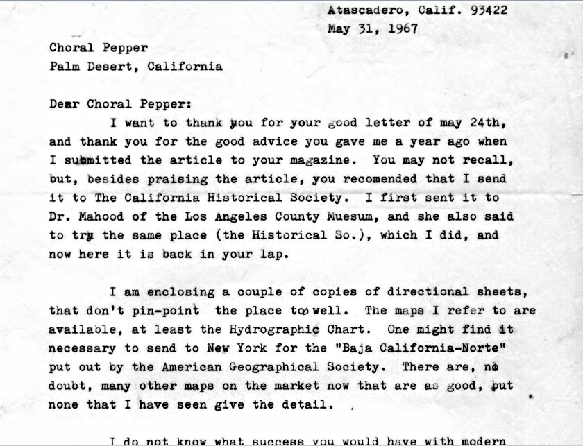
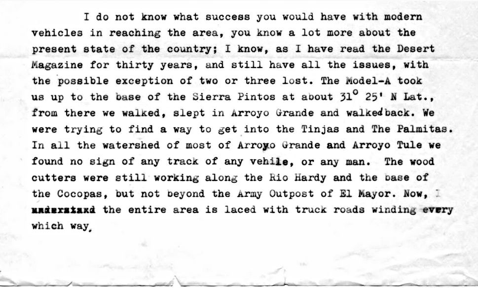
Sharing Secrets...
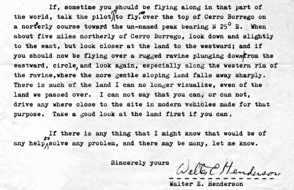
It is my hope that this mystery of where the rock pile was, or what it is can be solved in my lifetime. I have had the letter for a dozen years and
shared it with a few people. Now, that we are putting this effort into going up one possible canyon in a couple weeks, let me share the actual letter
that Choral Pepper teased us all with in her book and magazine stories.
I have zoomed in on the two pages of the letter and one page of directions so that 1/2 a page is per scan, to make reading as easy as possible. I cut
out his street address, of course Walter is long gone and his house may be to?
Scan 1 (half a page):
|
|
|
David K
Honored Nomad
        
Posts: 65445
Registered: 8-30-2002
Location: San Diego County
Member Is Offline
Mood: Have Baja Fever
|
|
Scan 2
|
|
|
David K
Honored Nomad
        
Posts: 65445
Registered: 8-30-2002
Location: San Diego County
Member Is Offline
Mood: Have Baja Fever
|
|
Scan 3
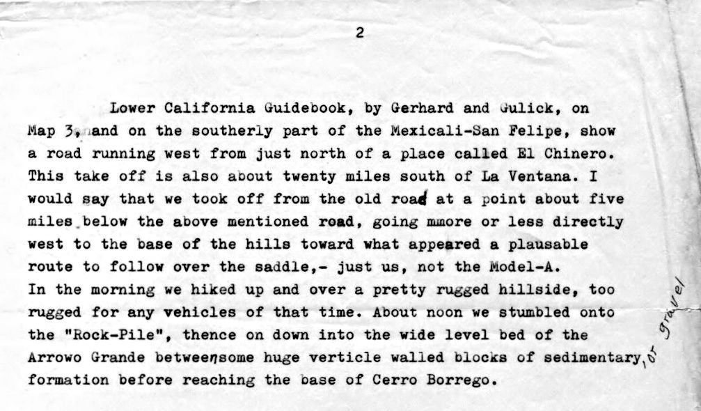
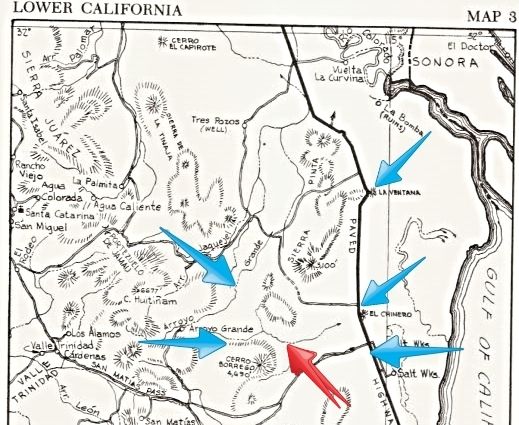
Mentioned and pointed out, on the 1962 Lower Ca Guidebook Map 3: Remember, there was no Hwy. 5 back then, the old road to San Felipe may have been
close, however.
*La Ventana
*Road running west from just north of El Chinero, about 20 miles south of La Ventana.
* Take off about 5 miles below road north of El Chinero
* RED ARROW: Parked at Base of hills
* Arroyo Grande
* Base of Cerro Borrego
|
|
|
David K
Honored Nomad
        
Posts: 65445
Registered: 8-30-2002
Location: San Diego County
Member Is Offline
Mood: Have Baja Fever
|
|
Scan 4 of 6
|
|
|
David K
Honored Nomad
        
Posts: 65445
Registered: 8-30-2002
Location: San Diego County
Member Is Offline
Mood: Have Baja Fever
|
|
Scan 5 & 6
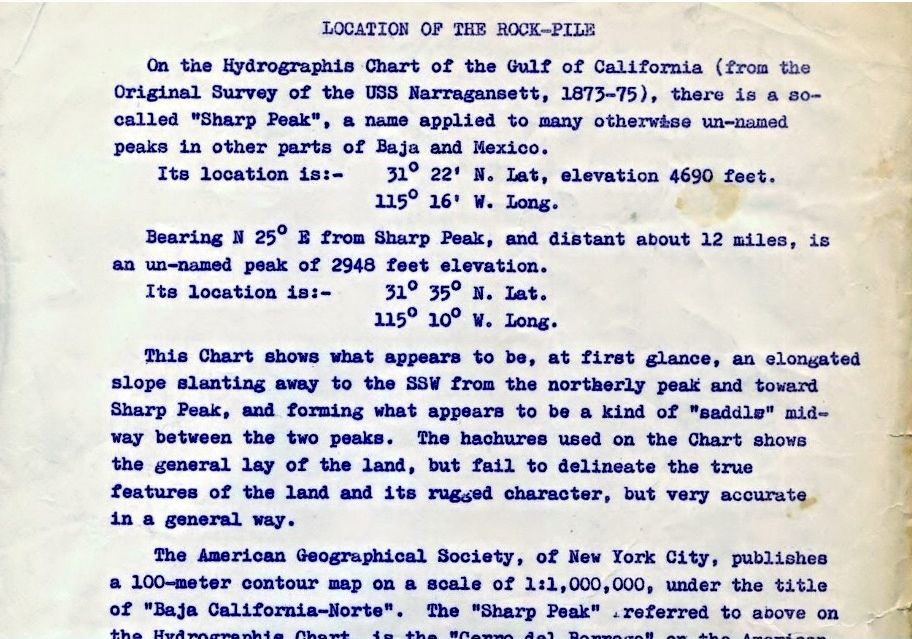
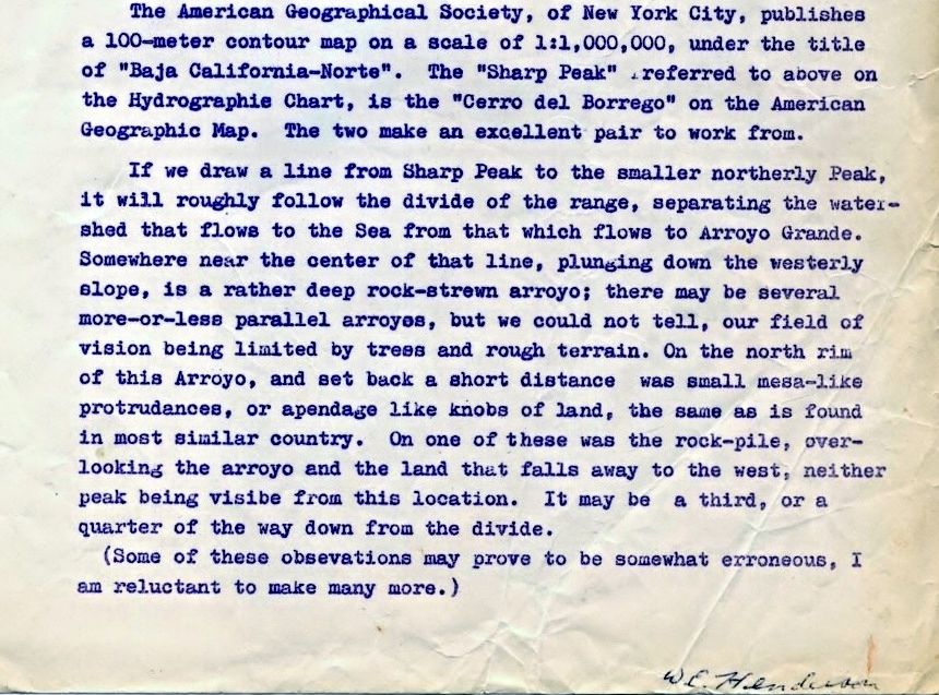
I hope desert rats and Baja buffs enjoy this and if you come to some different conclusions as to where we should look, please share! I have given all
I can to this mystery up until I actually go climbing in those hills on Easter weekend.
|
|
|
elbeau
Nomad
 
Posts: 256
Registered: 3-2-2011
Location: Austin, TX
Member Is Offline
|
|
These additional letters really do shed a lot more light on the possible locations of the rock piles.
|
|
|
TMW
Select Nomad
      
Posts: 10659
Registered: 9-1-2003
Location: Bakersfield, CA
Member Is Offline
|
|
elbeau you should come out and join us. I'll make you breakfast everyday with home made grits, TX style.
|
|
|
elbeau
Nomad
 
Posts: 256
Registered: 3-2-2011
Location: Austin, TX
Member Is Offline
|
|
Quote: Originally posted by TMW  | | elbeau you should come out and join us. I'll make you breakfast everyday with home made grits, TX style. |
Texas style? I prefer my grits Mississippi style. If I could make it I'd treat you to some REAL grits.
|
|
|
elbeau
Nomad
 
Posts: 256
Registered: 3-2-2011
Location: Austin, TX
Member Is Offline
|
|
You knowledge of grits is based on movies. There's really no way for you to understand.
|
|
|
elbeau
Nomad
 
Posts: 256
Registered: 3-2-2011
Location: Austin, TX
Member Is Offline
|
|
Quote: Originally posted by David K  | | So come on down to Southern California Saturday after next and make us Mississippi grits Sunday morning! |
Sorry, but you can't make Mississippi grits without hunting for fresh squirrel first.
(I'm actually just making all this up for conversation. The best way to eat squirrel is stewed, although now that I'm imagining it, squirrel-meat
grits actually sounds quite tasty)
|
|
|
bajaandy
Senior Nomad
  
Posts: 769
Registered: 2-7-2004
Location: North County
Member Is Offline
Mood: Adventurous
|
|
I wish I could go on this adventure! Alas, I will be headed to points further south and west while you are investigating in the desert. Looking
forward to your trip reports!
[Edited on 3-23-2015 by bajaandy]
subvert the dominant paradigm
"If you travel with a man, you must either fall out with him or make him your good friend."
JBL Noel
|
|
|
TMW
Select Nomad
      
Posts: 10659
Registered: 9-1-2003
Location: Bakersfield, CA
Member Is Offline
|
|
I make my grits many different ways but my favorite is with bacon and tomatoes.
I use instant grits with water not milk.
[Edited on 3-23-2015 by TMW]
|
|
|
| Pages:
1
2
3
4
..
9 |

