| Pages:
1
2
3
4
5 |
twgracing
Junior Nomad

Posts: 36
Registered: 10-28-2011
Location: Imperial Valley
Member Is Offline
|
|
Trinidad to El Gato was the biggest challenge . Had multiple GPS tracks but we’re only used for reference to pick our way through. Glad we were able
to do it, and easily done from PSF to San Ignacio in a day.
|
|
|
JZ
Select Nomad
      
Posts: 13943
Registered: 10-3-2003
Member Is Offline
|
|
Quote: Originally posted by David K  |
The distance to the Trail start (La Ilusion) from Hwy 1 via Guillermo Prieto is 57 miles. Coming south from L.A. Bay is 82 miles. However, driving to
'Las Palomas' (Km. 154.5) where the Guillermo Prieto road begins is a lot longer than driving to L.A. Bay... from the north.
|
Hmmm, yeah it is a lot further South to Las Palomas than I was thinking. The route through El Arco is 21 mile above it.
But extra 25 miles in the dirt is a lot further than highway miles though. And it's a super fast track in from Hwy 1, we were running parts of it
60-70 mph the last time I drove it. The BoLA route is good, but not near that fast.
Close call. Went South of BoLA a couple times last year, so not that important to do it again, especially w/o Pancho!
[Edited on 11-1-2018 by JZ]
|
|
|
4x4abc
Ultra Nomad
    
Posts: 4454
Registered: 4-24-2009
Location: La Paz, BCS
Member Is Offline
Mood: happy - always
|
|
I so wish I could join you on a December trip - but I have 3 more months of daily treatment.
Harald Pietschmann
|
|
|
ehall
Super Nomad
   
Posts: 1906
Registered: 3-29-2014
Location: Buckeye, Az
Member Is Offline
Mood: It's 5 o'clock somewhere
|
|
We were planning a trip about 18 months ago but I crashed and broke my wrist and had to cancel.
|
|
|
David K
Honored Nomad
        
Posts: 65436
Registered: 8-30-2002
Location: San Diego County
Member Is Offline
Mood: Have Baja Fever
|
|
Roy, The squarecircle, called me today as he is reading this but is not been able to use his computer keyboard. This is a favorite area of Roy's as it
is so remote and requires 4WD... places that I also like!
He has wanted me to see the beaches near Los Corrales for as long as I can remember.
Some points that Squrecircle wanted to relay was:
* that he has never seen anyone at La Ilusión.
*That Rancho Santa Barabara is abandoned as the family had passed on or moved on and the road to it is toast.
*Roy also wanted to ask about the graded road to San Miguel (from La Ilusión?): is that for real?
|
|
|
JZ
Select Nomad
      
Posts: 13943
Registered: 10-3-2003
Member Is Offline
|
|
Do you have GPS for Rancho Santa Barabara?
|
|
|
David K
Honored Nomad
        
Posts: 65436
Registered: 8-30-2002
Location: San Diego County
Member Is Offline
Mood: Have Baja Fever
|
|
On Google Earth...
28° 3.451'N
112° 58.932'W
|
|
|
blackwolfmt
Senior Nomad
  
Posts: 802
Registered: 1-18-2014
Location: On The Beach With A Blackwolf
Member Is Offline
Mood: dreamin of Riden out a hurricane in Baja
|
|
![IMG955473[722].jpg - 28kB IMG955473[722].jpg - 28kB](https://forums.bajanomad.com/files.php?pid=1140115&aid=38292)
So understand dont waste your time always searching for those wasted years
face up and make your stand and realize that your living in the golden years
|
|
|
JZ
Select Nomad
      
Posts: 13943
Registered: 10-3-2003
Member Is Offline
|
|
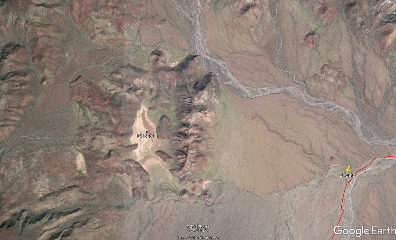
Anyone ever been out to the El Gato lake bed? Looks like a pretty interesting spot. About a 1.25 mile long. Could get some bad ass drone shots
there I'd think.
I also spotted a good sized ranch about 20 miles Southwest of El Gato and 20 miles North of Hwy 1. Anyone popped in there? It's only about 3/4 ths
of a mile off the trail.

[Edited on 11-2-2018 by JZ]
|
|
|
JZ
Select Nomad
      
Posts: 13943
Registered: 10-3-2003
Member Is Offline
|
|
Quote: Originally posted by TMW  |
After the hurricane in 2014 the road from the Jct to R. San Miguel and R. Santa Barbara was wiped out and only the arroyos to follow which were loaded
with rocks. That's what 4x4abc used when he got thru in March of 2015. Since then others have went thru making it easier to follow.
twgracing says the road to San Miguel has been graded. There was a short area after San Miguel and before Los Corrales that you had to drop down on
the beach cross an arroyo then back up. Deep sand and lots of softball size rocks. The first time I did it, it was a bit of a problem. The second time
no problem. The next problem area was from the ocean following La Trinidad arroyo to El Gato. There were rocks but not the problem. The problem was
finding your way with out always back tracking. The ground was hard with rocks and it was hard to follow tracks. The second time I did it we had a GPS
track but it was off in places. Getting out and walking ahead was the ticket. That's where your drone would come in handy maybe.
[Edited on 11-1-2018 by TMW] |
Thanks for the info Tom.
|
|
|
StuckSucks
Super Nomad
   
Posts: 2374
Registered: 10-17-2013
Location: Pacific Plate
Member Is Offline
|
|
If you zoom in on the SW shore of the lake, there are streaks -- are these cow trails? They seem much too random to be dirt bike tracks.
|
|
|
David K
Honored Nomad
        
Posts: 65436
Registered: 8-30-2002
Location: San Diego County
Member Is Offline
Mood: Have Baja Fever
|
|
The El Camino Real... See the link for its many routes on my website.
http://caminorealbaja.com/
[Edited on 11-2-2018 by David K]
|
|
|
TMW
Select Nomad
      
Posts: 10659
Registered: 9-1-2003
Location: Bakersfield, CA
Member Is Offline
|
|
R. Santa Barbara is just south of a new ranch called Rancho Crestone. The lady there told Roy about R. Santa Barbara being abandoned.
JZ the ranch you saw about 20 miles SW of El Gato was probably Santa Marta. I haven't been to it but they have a chain link fence across where the
road in meets it.
|
|
|
David K
Honored Nomad
        
Posts: 65436
Registered: 8-30-2002
Location: San Diego County
Member Is Offline
Mood: Have Baja Fever
|
|
There is also El Rosarito, a ranch on El Camino Real, north of Santa Marta and south of El Gato.
|
|
|
JZ
Select Nomad
      
Posts: 13943
Registered: 10-3-2003
Member Is Offline
|
|
I see where it says El Rosarito, but don't spot a ranch there.
|
|
|
mtgoat666
Platinum Nomad
       
Posts: 20561
Registered: 9-16-2006
Location: San Diego
Member Is Offline
Mood: Hot n spicy
|
|
Quote: Originally posted by StuckSucks  |
If you zoom in on the SW shore of the lake, there are streaks -- are these cow trails? They seem much too random to be dirt bike tracks.
|
Random? Well-used cow trails are never random, cows always have a purpose for repeating a path enough to make a visible trail.
On the other hand, motorcycles pick offroad paths that I would say are statistically more random relative to cow trails (those motorcyclists are more
prone to whimsical routes than cows, though i have noticed that motorcyclists often display herd mentality in some ways).
Just sayin'....
Woke!
Hands off!
“Por el bien de todos, primero los pobres.”
“...ask not what your country can do for you – ask what you can do for your country.” “My fellow citizens of the world: ask not what America
will do for you, but what together we can do for the freedom of man.”
Pronoun: the royal we
|
|
|
JZ
Select Nomad
      
Posts: 13943
Registered: 10-3-2003
Member Is Offline
|
|
Quote: Originally posted by David K  |
Are you using the El Camino Real GE link I have provided?
Here is the ranch, El Rosarito: 27° 39.919'N, 112° 54.417'W |
I see it now. At least on the 2014 GE map it looks like the remnants of a deserted ranch.
|
|
|
JZ
Select Nomad
      
Posts: 13943
Registered: 10-3-2003
Member Is Offline
|
|
We tend to do each trip 2 or 3 times over about 6 months or so. Because I always miss something and want to go back. Or I crash the drone or the
GoPro fails to record, lol.
So get well and we'll do it.
|
|
|
advrider
Super Nomad
   
Posts: 1920
Registered: 10-2-2015
Member Is Offline
|
|
Do follow up if you make it, I would love to try it in March when we are down that way...
|
|
|
Ken Cooke
Elite Nomad
     
Posts: 8970
Registered: 2-9-2004
Location: Riverside, CA
Member Is Offline
Mood: Pole Line Road postponed due to injury
|
|
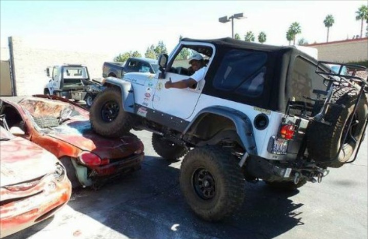
I am famous for not leaving camp B4 9am, so this t-shirt is factual! Would this Jeep make it? Asking for a friend.

|
|
|
| Pages:
1
2
3
4
5 |

