| Pages:
1
2 |
caj13
Super Nomad
   
Posts: 1002
Registered: 8-1-2017
Member Is Offline
|
|
Quote: Originally posted by AKgringo  | caj13, You apparently missed this post by SF&H, who teased DK a bit!
Then David teased back with the palm tree quip, ending with lol (laugh out loud).
Are you going to follow David from thread to thread looking for something to pounce on? I don't like everything David posts, but I choose to groan
and ignore some of them, rather than turn another thread into an off topic debate! The JJJ school of journalism has moved somewhere else!
DK, you don't need to reply to every post either
[Edited on 8-11-2019 by AKgringo] |
Go back and review, 2 posts with escalating content by David, including the idiotic - observation, not measurement nonsense.
sorry if i hold people accountable for their posts, including myself.
and I do admit I was wrong about one thing, I thought it would be David who tried to blame me, I was obviously wrong there!
|
|
|
RocketJSquirrel
Nomad
 
Posts: 251
Registered: 8-3-2019
Member Is Offline
|
|
People who feel the need to hold others accountable (consider themselves God?) - are almost always the ones who eventually get caught with their pants
down. Good luck, caj13. We'll chuckle when we see the perp walk...
|
|
|
David K
Honored Nomad
        
Posts: 65407
Registered: 8-30-2002
Location: San Diego County
Member Is Offline
Mood: Have Baja Fever
|
|
Quote: Originally posted by Nikno  | Based on satellite imagery the beach at
29°14'26.7"N 114°50'05.3"W
makes most sense to me. David K's second pic shows a fishing camp which is visible on satellite. I think the original photo might be mislabeled. The
coordinates that JZ posted and the map Harald posted are of "El Guatamote" but this one is a few bays further north.
David K, any geo tags/gps coordinates embedded in your original pic? |
Good morning!
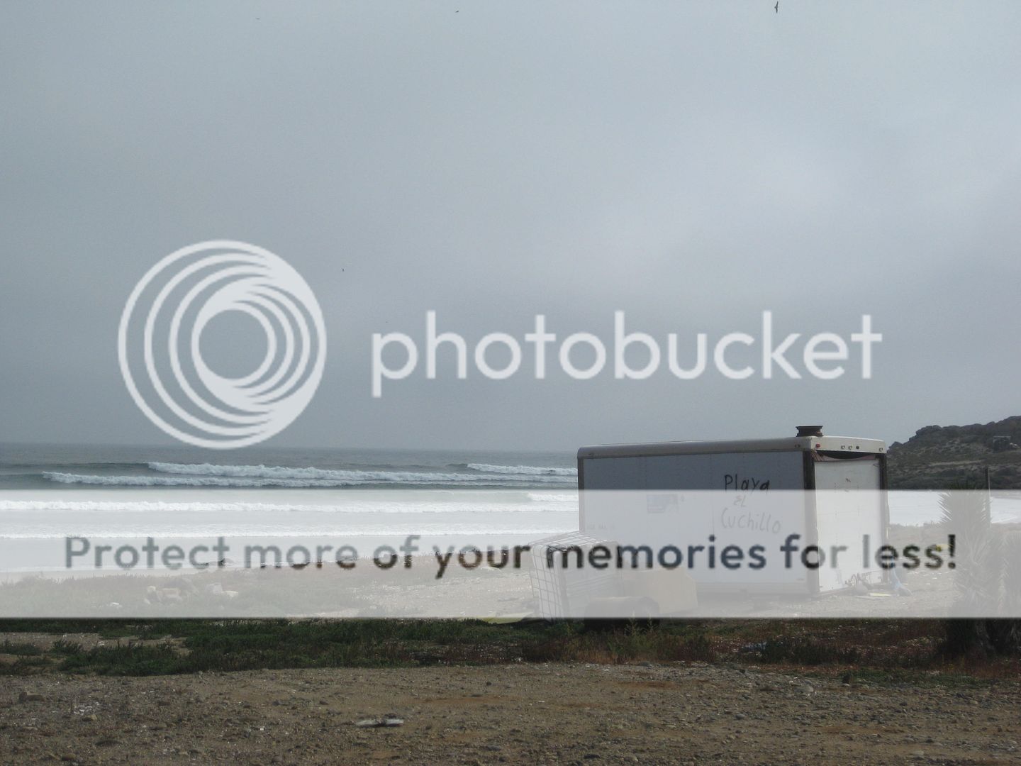
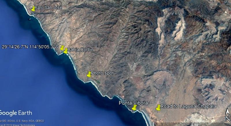
The GPS waypoint you posted is Bahía Córbin, 5.6 road miles south of Faro San José (small island just offshore). I camped there on my last trip
along that coast (Apr. 2017):


'Playa el Cuchillo' is painted on this container at Córbin.
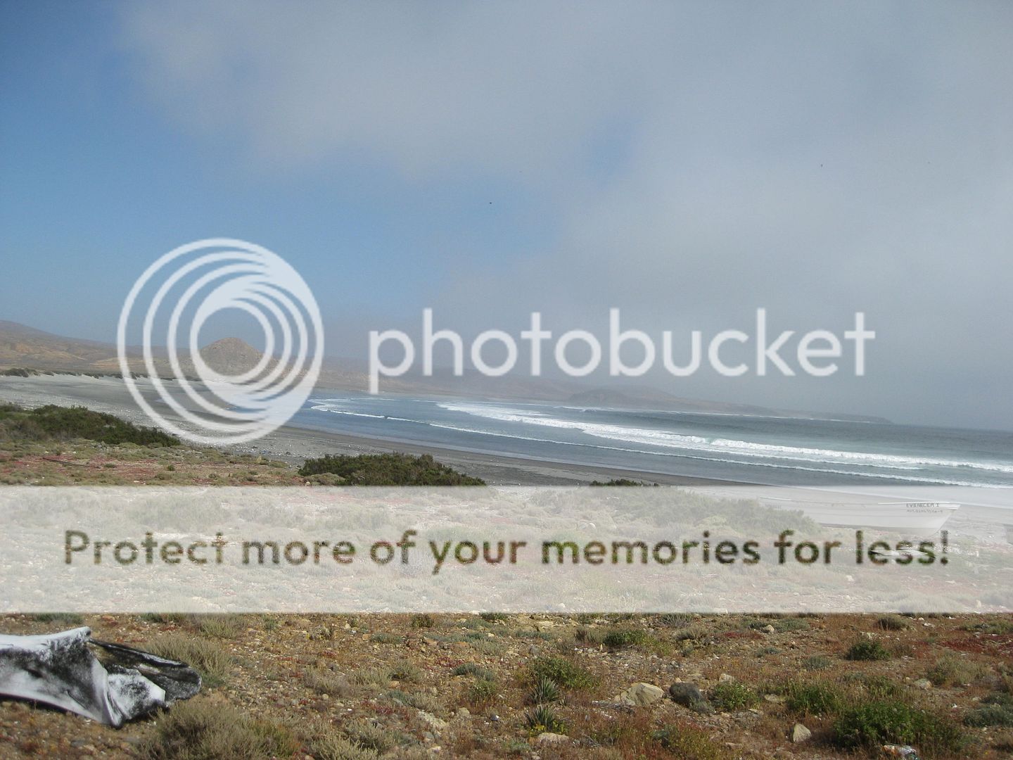
The beach shown in the first photos (the ones in discussion) is south of Córbin. I photographed it the next day.
I think this is where the photos in question were taken: 29° 12.768'N, 114° 48.143'W
There is another place almost identical just south. I thought maybe that was what Harald's map was showing? [Edit: Harald does have the correct place
mapped, where the photos were taken.]
Here are places mentioned and Nikno's GPS point. The Photo spot does not have a name on the Almanac. >>>

[Edited on 8-11-2019 by David K]
|
|
|
David K
Honored Nomad
        
Posts: 65407
Registered: 8-30-2002
Location: San Diego County
Member Is Offline
Mood: Have Baja Fever
|
|
After seeing the link Harald posted to the Inegi map, yes his close up map is correct, it is the place the maps labels as El Guatamote. Interestingly,
the Inegi map calls the point at Bahía Córbin "Punta el Cuchillo" the name painted on the container there. Just Playa (beach) instead of Punta.
|
|
|
Nikno
Junior Nomad

Posts: 90
Registered: 7-12-2019
Member Is Offline
|
|
Thank you for the detailed map David K and thank you to the other Nomads who helped.
I'm looking forward to exploring that part of the coast this fall and will post some new pictures when I'm back!
|
|
|
David K
Honored Nomad
        
Posts: 65407
Registered: 8-30-2002
Location: San Diego County
Member Is Offline
Mood: Have Baja Fever
|
|
Quote: Originally posted by Nikno  | Thank you for the detailed map David K and thank you to the other Nomads who helped.
I'm looking forward to exploring that part of the coast this fall and will post some new pictures when I'm back! |
Great! I invite you to print out the pages of my guide shared on Nomad (Part 3) that include the 7 Sisters roads and see if you find the conditions
similar.
Thank you!
PS You can also u2u me for that part in a pdf.
The guide is designed to be continually updated with your feedback.
|
|
|
| Pages:
1
2 |

