| Pages:
1
2
3
4
5
..
10 |
BajaRat
Super Nomad
   
Posts: 1304
Registered: 3-2-2010
Location: SW Four Corners / Bahia Asuncion BCS
Member Is Offline
Mood: Ready for some salt water with my Tecate
|
|
Quote: Originally posted by tiotomasbcs  | Hope you guys get rain from Javier & Kay but here in Todos Santos it would be nice to get a low grade TS or Cat 1 Hurricane! Javier dropped
2-4inches last week. Locals will never forget Odile and I was not here thankfully!
Love the rain and green scenery but the winds can be damaging--Odile!! Wish us LUCK down here..Salud!
[Edited on 9-4-2022 by tiotomasbcs] |
The Fam will be thinking about you Tio
Hang in there
Lionel 
|
|
|
BajaRat
Super Nomad
   
Posts: 1304
Registered: 3-2-2010
Location: SW Four Corners / Bahia Asuncion BCS
Member Is Offline
Mood: Ready for some salt water with my Tecate
|
|
Possibility of some rare SOC epic surf spots coming to life
Lionel 
|
|
|
azucena
Nomad
 
Posts: 193
Registered: 8-25-2012
Member Is Offline
|
|
Just saw a video on FB. Kay is rolling into Loreto.
|
|
|
David K
Honored Nomad
        
Posts: 65512
Registered: 8-30-2002
Location: San Diego County
Member Is Offline
Mood: Have Baja Fever
|
|
Seeing streets turned into rivers in Mulegé and Santa Rosalia on FB videos from the past two days. Pre-Kay storm fronts, maybe? I would expect this
to be a wet storm with the typical roads being washed out at vados, etc. This may be an issue as far north as San Felipe +, so be prepared to not get
supplies or to travel for at least two days after the floods happen. San Diego is now predicting 1/2 inch to fall on Saturday morning.
|
|
|
David K
Honored Nomad
        
Posts: 65512
Registered: 8-30-2002
Location: San Diego County
Member Is Offline
Mood: Have Baja Fever
|
|
San Javier Road video here: https://www.instagram.com/guia_loretobcs/
also: https://www.facebook.com/groups/mulegenewsfeed
[Edited on 9-6-2022 by David K]
|
|
|
gnukid
Ultra Nomad
    
Posts: 4411
Registered: 7-2-2006
Member Is Offline
|
|
Entrance to La Ventana
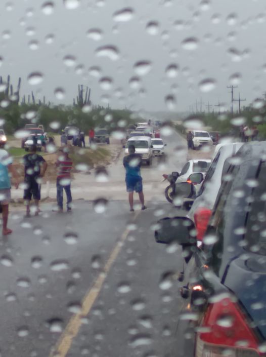
Agua Amarga
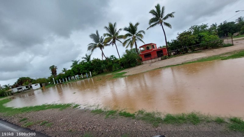
Hills next to Muertos
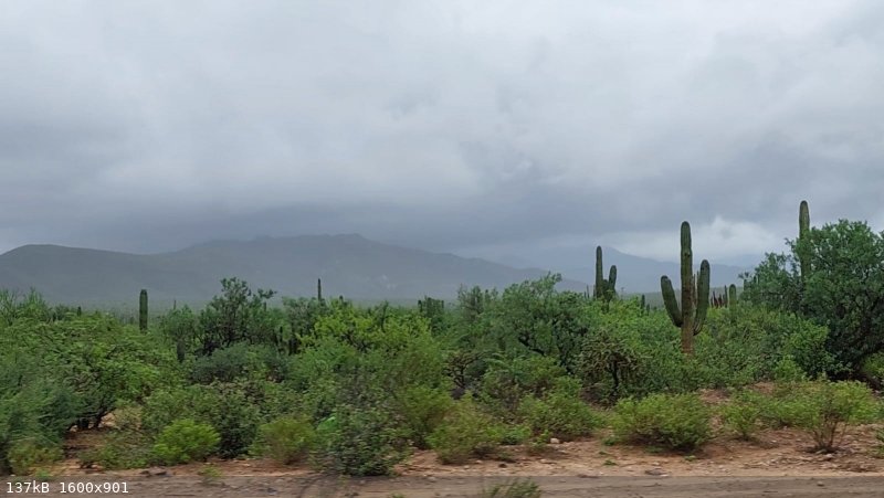
Muertos
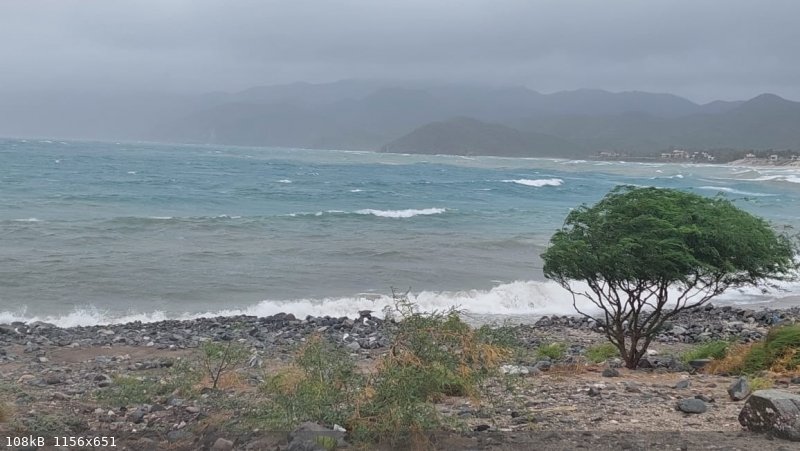
|
|
|
Hook
Elite Nomad
     
Posts: 9012
Registered: 3-13-2004
Location: Sonora
Member Is Offline
Mood: Inquisitive
|
|
Quote: Originally posted by David K  | | Seeing streets turned into rivers in Mulegé and Santa Rosalia on FB videos from the past two days. Pre-Kay storm fronts, maybe?
|
It seems not. There have been large, convective storms forming around the mountains of Sinaloa for the past 2-3 days. Kinda rare, actually, for it to
form there and then head NW from there and make it out over the gulf. There, they have largely been dissipating.
But NOW, the outer bands of Kay are making their way into the Baja precipitation discussion. Kay's moisture is being felt all along Baja and into
northern Sinaloa and most of Sonora.
San Carlos Sonora has only received about a half inch (from the Sinaloa disturbance) in the last 18 hours. But possibly 2-4 inches could happen
between Wed evening and Thur evening.
I still think orographics on the higher elevations Peninsula could still produce 8-12 inches in 48 hours (Wed to Fri) I would not trust downgraded
estimates just yet.
|
|
|
Hook
Elite Nomad
     
Posts: 9012
Registered: 3-13-2004
Location: Sonora
Member Is Offline
Mood: Inquisitive
|
|
Accuweather's latest rainfall prediction overlay seems to have bumped the potential rain in Central Baja up to the 8-16 inch bracket. 
[Edited on 9-6-2022 by Hook]
|
|
|
mtgoat666
Platinum Nomad
       
Posts: 20907
Registered: 9-16-2006
Location: San Diego
Member Is Offline
Mood: Hot n spicy
|
|
BULLETIN
Hurricane Kay Intermediate Advisory Number 9A
NWS National Hurricane Center Miami FL EP122022
1200 PM MDT Tue Sep 06 2022
...KAY PRODUCING ROUGH SURF ACROSS SOUTHWESTERN MEXICO AND SOUTHERN
BAJA CALIFORNIA PENINSULA...
...AIR FORCE HURRICANE HUNTERS ENROUTE...
SUMMARY OF 1200 PM MDT...1800 UTC...INFORMATION
-----------------------------------------------
LOCATION...18.4N 110.5W
ABOUT 320 MI...515 KM SSW OF THE SOUTHERN TIP OF BAJA CALIFORNIA
MAXIMUM SUSTAINED WINDS...85 MPH...140 KM/H
PRESENT MOVEMENT...NW OR 315 DEGREES AT 14 MPH...22 KM/H
MINIMUM CENTRAL PRESSURE...977 MB...28.85 INCHES
WATCHES AND WARNINGS
--------------------
CHANGES WITH THIS ADVISORY:
None.
SUMMARY OF WATCHES AND WARNINGS IN EFFECT:
A Tropical Storm Warning is in effect for...
* San Evaristo southward to Cabo San Lucas
* Cabo San Lucas northward to Cabo San Lazaro
A Tropical Storm Watch is in effect for...
* North of San Evaristo northward to Santa Rosalia
* North of Cabo San Lazaro northward to Punta Abreojos
A Tropical Storm Warning means that tropical storm conditions are
expected somewhere within the warning area within 36 hours.
A Tropical Storm Watch means that tropical storm conditions are
possible within the watch area, generally within 48 hours.
Interests north of the watch area on the Baja California peninsula
should closely monitor the progress of Kay as hurricane or tropical
storm watches could be required later today.
For storm information specific to your area, please monitor
products issued by your national meteorological service.
DISCUSSION AND OUTLOOK
----------------------
At 1200 PM MDT (1800 UTC), the center of Hurricane Kay was located
near latitude 18.4 North, longitude 110.5 West. Kay is moving toward
the northwest near 14 mph (22 km/h) and this general motion should
continue through tonight. A turn toward the north-northwest is
expected on Wednesday, and this motion should continue into Friday.
On the forecast track, the center of Kay is expected to pass to the
west of the southern Baja California peninsula on Wednesday, and be
near the west-central coast of the Baja California peninsula
Thursday and Friday.
Maximum sustained winds remain near 85 mph (140 km/h) with higher
gusts. Strengthening is forecast during the next 36 hours, and Kay
could become a major hurricane during that time. Weakening is
forecast to begin by Thursday, but Kay is forecast to remain a
strong hurricane when it passes near the Baja California peninsula.
Hurricane-force winds extend outward up to 30 miles (45 km) from
the center and tropical-storm-force winds extend outward up to 175
miles (280 km). A weather station in Socorro Island recently
reported a wind gust of 47 mph (76 km/h).
The estimated minimum central pressure is 977 mb (28.85 inches).
HAZARDS AFFECTING LAND
----------------------
Key messages for Hurricane Kay can be found in the Tropical
Cyclone Discussion under AWIPS header MIATCDEP2 and WMO header
WTPZ42 KNHC and on the web at hurricanes.gov/text/MIATCDEP2.shtml.
WIND: Tropical storm conditions are expected within the warning
area in the southern Baja California peninsula beginning Wednesday
morning. Tropical storm conditions are possible in the watch area
in the southern Baja California peninsula by late Wednesday.
SURF: Swells generated by Kay will continue to affect portions of
the coast of southwestern Mexico during the next couple of days.
Large swells are expected to spread northward along the Baja
California coast and into the Gulf of California during the next
few days. These swells will likely cause life-threatening surf and
rip current conditions. Please consult products from your local
weather office.
RAINFALL: Kay is expected to produce 4 to 8 inches of rainfall,
with isolated storm total amounts of 12 inches, across portions of
western Mexico, including the Baja California peninsula, through
Thursday night. These rainfall amounts could lead to flash
flooding, including landslides.
NEXT ADVISORY
-------------
Next complete advisory at 300 PM MDT.
$$
Forecaster Cangialosi
Woke!
Hands off!
“Por el bien de todos, primero los pobres.”
“...ask not what your country can do for you – ask what you can do for your country.” “My fellow citizens of the world: ask not what America
will do for you, but what together we can do for the freedom of man.”
Pronoun: the royal we
|
|
|
mtgoat666
Platinum Nomad
       
Posts: 20907
Registered: 9-16-2006
Location: San Diego
Member Is Offline
Mood: Hot n spicy
|
|
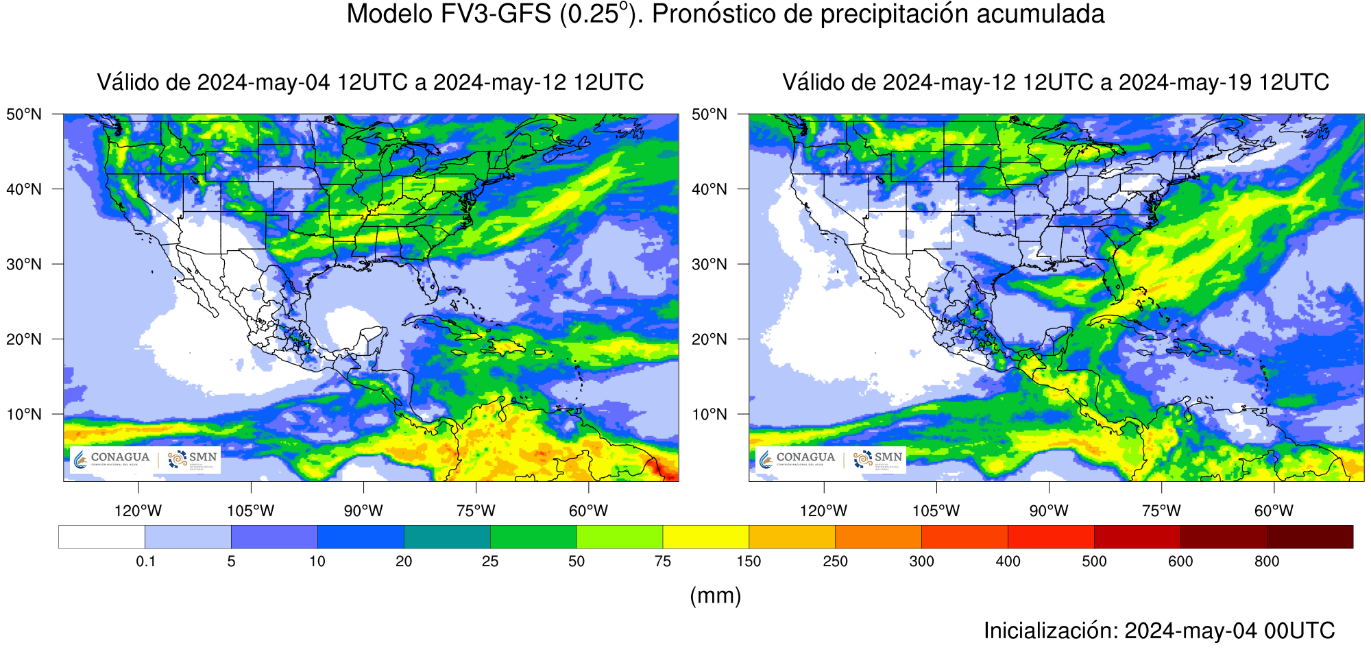
[Edited on 9-7-2022 by BajaNomad]
Woke!
Hands off!
“Por el bien de todos, primero los pobres.”
“...ask not what your country can do for you – ask what you can do for your country.” “My fellow citizens of the world: ask not what America
will do for you, but what together we can do for the freedom of man.”
Pronoun: the royal we
|
|
|
RFClark
Super Nomad
   
Posts: 2470
Registered: 8-27-2015
Member Is Offline
Mood: Delighted with 2024 and looking forward to 2025
|
|
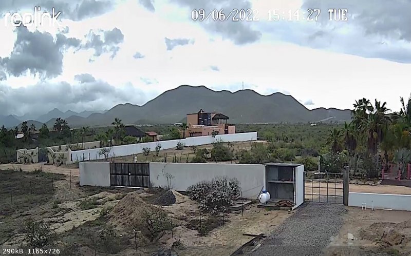
Rancho Nuevo looking SE towards Kay
15:20
.24” rain, light rain falling. Wind from the North 2mph.
|
|
|
mtgoat666
Platinum Nomad
       
Posts: 20907
Registered: 9-16-2006
Location: San Diego
Member Is Offline
Mood: Hot n spicy
|
|
Latest forecast has central baja being hit with 6 to 8 inches of rain, with some areas at 12 inches rain.

[Edited on 9-7-2022 by mtgoat666]
[Edited on 9-7-2022 by BajaNomad]
Woke!
Hands off!
“Por el bien de todos, primero los pobres.”
“...ask not what your country can do for you – ask what you can do for your country.” “My fellow citizens of the world: ask not what America
will do for you, but what together we can do for the freedom of man.”
Pronoun: the royal we
|
|
|
Bajazly
Super Nomad
   
Posts: 1018
Registered: 6-4-2015
Location: Goodbye Cali and Hello San Felipe
Member Is Offline
Mood: More Relaxed Everyday
|
|
Please send some rain to San Felipe, no real rain here in a year ish or better. At lease not a few miles out of town.
Believing is religion - Knowing is science
Harald Pietschmann
"Get off the beaten path and memories, friends and new techniques are developed"
Bajazly, August 2019
|
|
|
lewmt
Junior Nomad

Posts: 79
Registered: 4-12-2017
Member Is Offline
|
|
https://magicseaweed.com/Punta-Abreojos-Surf-Report/1250/
This much surf can't be good for the Pac side
|
|
|
John Harper
Super Nomad
   
Posts: 2289
Registered: 3-9-2017
Location: SoCal
Member Is Offline
|
|
14-22' on Thursday??? Holy cowabunga!!!
John
|
|
|
RFClark
Super Nomad
   
Posts: 2470
Registered: 8-27-2015
Member Is Offline
Mood: Delighted with 2024 and looking forward to 2025
|
|
Centos Beach South: Currently the wind is from the east to south in the 7 - 16 mph range .13 inches of rain since midnight.
|
|
|
David K
Honored Nomad
        
Posts: 65512
Registered: 8-30-2002
Location: San Diego County
Member Is Offline
Mood: Have Baja Fever
|
|
Today's San Diego morning news revised local rain. Now forecasted to begin on Friday and last through Saturday, but only with a total of 1/10 inch of
rainfall.
Hurricane looks like Cat. 2 off of Shari's place and to be Cat. 1 as far north as offshore from El Rosario then tropical storm to about the Ensenada
latitude where it then turns and goes further out to sea.
|
|
|
RFClark
Super Nomad
   
Posts: 2470
Registered: 8-27-2015
Member Is Offline
Mood: Delighted with 2024 and looking forward to 2025
|
|
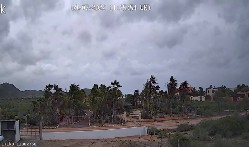
Rancho Nuevo BCS 11:30
Wind S/SE 15 - 20 mph Gusts to 30 mph Rain .55”
|
|
|
mtgoat666
Platinum Nomad
       
Posts: 20907
Registered: 9-16-2006
Location: San Diego
Member Is Offline
Mood: Hot n spicy
|
|
Quote: Originally posted by David K  | Today's San Diego morning news revised local rain. Now forecasted to begin on Friday and last through Saturday, but only with a total of 1/10 inch of
rainfall.
Hurricane looks like Cat. 2 off of Shari's place and to be Cat. 1 as far north as offshore from El Rosario then tropical storm to about the Ensenada
latitude where it then turns and goes further out to sea. |
were you watching chrissy russo on fox?
latest from NWS (big govt brains!) still shows san diego getting 1/2 inch to over 1 inch, and laguna mountains getting walloped.
All of baja from loreto up to ensenada is going to be drenched and everyones hair will be wind-swept
[Edited on 9-7-2022 by mtgoat666]
[Edited on 9-7-2022 by mtgoat666]
Woke!
Hands off!
“Por el bien de todos, primero los pobres.”
“...ask not what your country can do for you – ask what you can do for your country.” “My fellow citizens of the world: ask not what America
will do for you, but what together we can do for the freedom of man.”
Pronoun: the royal we
|
|
|
David K
Honored Nomad
        
Posts: 65512
Registered: 8-30-2002
Location: San Diego County
Member Is Offline
Mood: Have Baja Fever
|
|
No, Mark Mathis, on KUSI.
[Edited on 9-7-2022 by David K]
|
|
|
| Pages:
1
2
3
4
5
..
10 |

