| Pages:
1
2
3
4 |
David K
Honored Nomad
        
Posts: 65412
Registered: 8-30-2002
Location: San Diego County
Member Is Offline
Mood: Have Baja Fever
|
|
Some more great sounding routes from TW! Of that list, I have only been on the Mike's Sky Rancho road (between the Observatory Highway and Hwy. 3 near
San Matias). So much Baja... so little time!
|
|
|
bajatrailrider
Ultra Nomad
    
Posts: 2511
Registered: 1-24-2015
Location: Mexico
Member Is Offline
Mood: Happy
|
|
The old way from observatory to Mikes is no more.As Pamala put gates both ends locked.New way,I have done on dirt bike.Going up maybe too much for
pickup truck,jeeps would be better.Im game I know the way ready David and Chuck
|
|
|
David K
Honored Nomad
        
Posts: 65412
Registered: 8-30-2002
Location: San Diego County
Member Is Offline
Mood: Have Baja Fever
|
|
Quote: Originally posted by bajatrailrider  | | The old way from observatory to Mikes is no more.As Pamala put gates both ends locked.New way,I have done on dirt bike.Going up maybe too much for
pickup truck,jeeps would be better.Im game I know the way ready David and Chuck |
I was talking about the regular southern way to Mike's, maybe not the 'old way'... just the regular way from the Observatory Hwy. (near Meling)
passing just east of El Coyote and up and over to Mike's.
It has been awhile, but look: http://vivabaja.com/905
|
|
|
bajatrailrider
Ultra Nomad
    
Posts: 2511
Registered: 1-24-2015
Location: Mexico
Member Is Offline
Mood: Happy
|
|
There are two ways from Coyote.One no go with 4x4 truck.Other way would be tuff,as Mellings.Have new ranch blocking old route,they made road around
it.Real bad,if you guys want wheel over there.Im sure I can get keys to go in/out new ranch.Lets go David
|
|
|
TMW
Select Nomad
      
Posts: 10659
Registered: 9-1-2003
Location: Bakersfield, CA
Member Is Offline
|
|
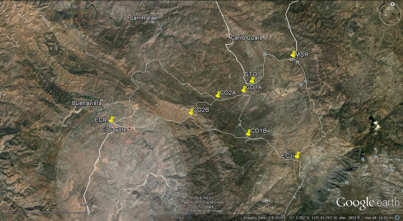
Here is a Google Earth image showing the roads in and out of Mikes Sky Rancho. In the lower right at ECJ is the road to Mike and Pamala's Darkskies
Baja place. STO is the turn off to Simpsons Ranch.
The 2004 Baja 500 camp up from Simpsons and went west to CO2A and around to El Coyote from the north. Then east to CO2B continuing to ECJ then up to
Mikes (MSR) and out to Hwy 3.
Just after CO2B was a rather tall hill full of silt and lots and lots of stuck cars and trucks. Many racers spent the night there not being able to
get up due to broke and stuck vehicles.
The last couple of SCORE races have used a slightly different trail from CO2B to CO2A or in reverse. There is a wash that was wiped out between the
two and I assume was never fixed. MCs no problem and I did it a couple of years ago in my Tacoma but there is a very steep hill to go down into the
wash and a tight back and forth turn at the bottom when you go from CO2A to CO2B. I don't think it can be done from CO2B to CO2A. The hill is too
steep and you have to make a sharp 90 degree turn at the top.

|
|
|
bajatrailrider
Ultra Nomad
    
Posts: 2511
Registered: 1-24-2015
Location: Mexico
Member Is Offline
Mood: Happy
|
|
You are correct TMW, New road that Coyote built.The up hill,no run at bottom,silt,steep.Would be real hard in 4x4.The upper road from Coyote to
Mikes.As of two months ago (1 day rain storm)One place you can not go up or down.Till it gets fixed.The new road (1-2 years old) Thats gets you around
Pamela and Mikes ranch.Is a great route,doable 4x4 but not easy.When do you guys want to try it? I cant remember ranch at start off Observatory
road,They have big trees there,water pound fishing.Great camping, off road friendly.
|
|
|
ehall
Super Nomad
   
Posts: 1906
Registered: 3-29-2014
Location: Buckeye, Az
Member Is Offline
Mood: It's 5 o'clock somewhere
|
|
This thread turned from boring ( no offense intended DK) air bag install to a full blown off-road trip. I love it. Someone pick a date and a route.
|
|
|
David K
Honored Nomad
        
Posts: 65412
Registered: 8-30-2002
Location: San Diego County
Member Is Offline
Mood: Have Baja Fever
|
|
Ed, any time a thread I begin keeps talking about Baja, is a GOOD thing! LOL!!!
   
Mike (AstroBaja) and Pam's place (Baja Dark Skies Inn) is the former Rancho Concepción, which has a lot of history, back a couple of centuries!
|
|
|
bajatrailrider
Ultra Nomad
    
Posts: 2511
Registered: 1-24-2015
Location: Mexico
Member Is Offline
Mood: Happy
|
|
Yes David the Melings sold it to them.The new way starts at Y Rt to Pamala,Lt to new road and ranch.I cant remember the name of ranch.It was also
owned by the Meilings then sold.As for you ED name the date!
|
|
|
TMW
Select Nomad
      
Posts: 10659
Registered: 9-1-2003
Location: Bakersfield, CA
Member Is Offline
|
|
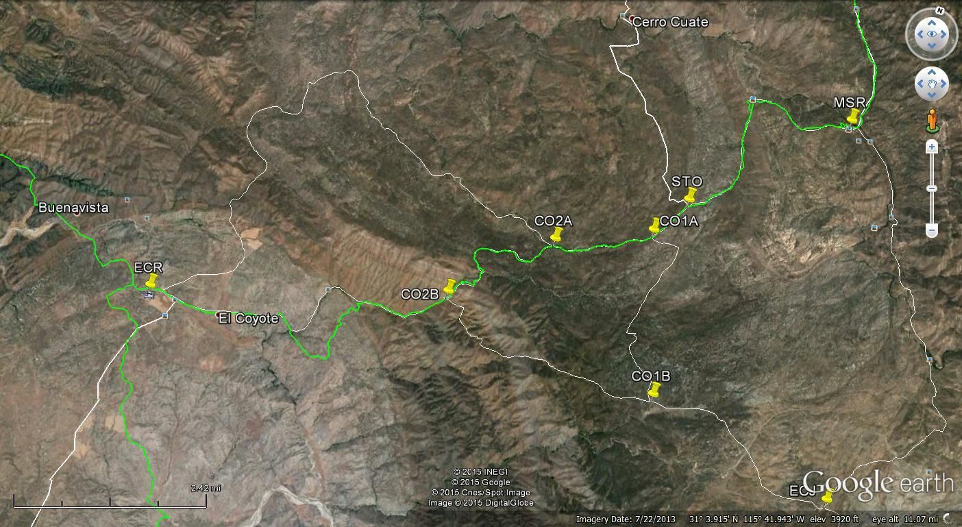
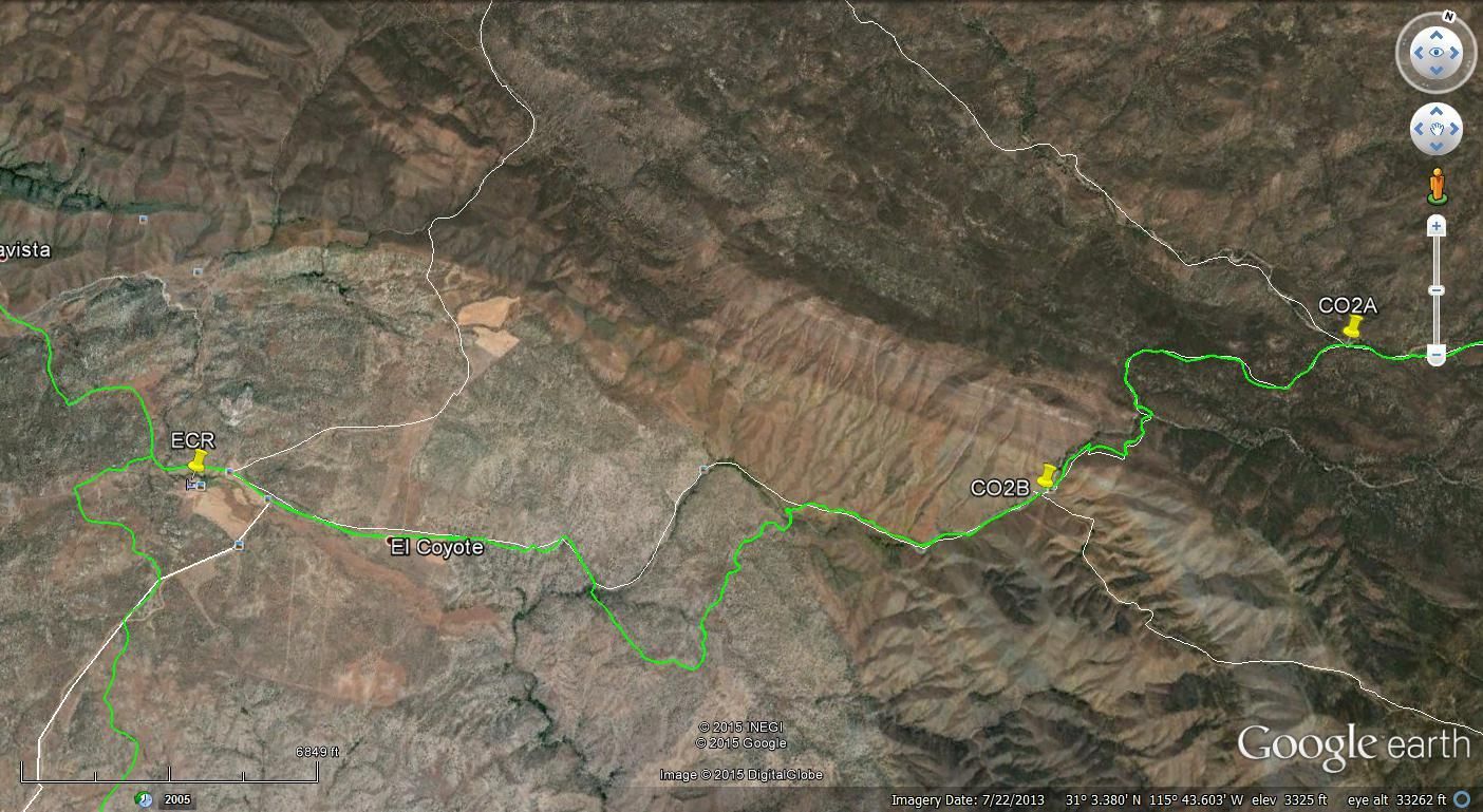
Here are two more GE images. They show the Baja 500 course in green for 2013 and 2014.

This image shows where the race course in green bypasses the bad section in white.

I mis-spoke in my post above the bad section was not between CO2B and CO2A but between El Coyote and CO2B.
[Edited on 9-8-2015 by TMW]
|
|
|
David K
Honored Nomad
        
Posts: 65412
Registered: 8-30-2002
Location: San Diego County
Member Is Offline
Mood: Have Baja Fever
|
|
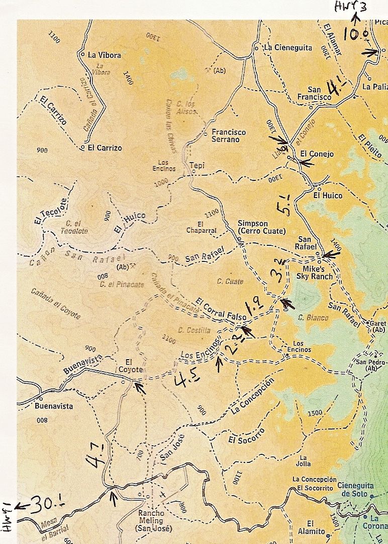
Here is the 2003 Baja Almanac of the area, with mileages along the route I took in and out of Mike's Sky Rancho:

Rancho Concepción (Baja Dark Skies Inn) is actually located along the right side, where the dashed road crosses the arroyo south of the location 'San
Pedro (Ab)'. Not where you see the name, next to El Socorrito (that is where the signed road is at the Observatory highway).
|
|
|
| Pages:
1
2
3
4 |

