| Pages:
1
2
3
4
5 |
JZ
Select Nomad

Posts: 14830
Registered: 10-3-2003
Member Is Offline
|
|
Quote: Originally posted by surabi  |
What a presumptuous jerk you are.
First of all, I'm not a man.
Secondly, I don't "rent out a room on a per day basis". It's not a flop house. I have a vacation rental- a private room/private bath with a private
entrance and use of my kitchen. For people who want to come on vacation to a beach town and they stay for a week- 2 weeks. I have pages full of 5*
reviews.
In case you're not aware, there are tons of home-share listings all over the world on Airbnb.
Thirdly, I don't "need to do this". I do it because I enjoy it- I have met amazing people from all over the world, some of whom have become friends I
stay in touch with. Just like others who own B&Bs.
Lastly, I guess you call having raised 3 daughters who all grew up to be responsible, successful adults, owed a home in Canada that I renovated over
the course of the 20 years I lived there and sold for a $200,000 profit, bought a lot and built a nice home with a huge garden in Mexico where I run
an extremely successful upholstery business, "failed at life".
Have any other idiotic things to post?
|
I'll hold off on any more back and forth.
Remember, you came at me. In a thread about helping someone out. You choose sides with Goat, the nastiest poster in the history of this board.
[Edited on 11-17-2020 by JZ]
|
|
|
CiriosGal
Newbie
Posts: 7
Registered: 11-8-2020
Member Is Offline
|
|
| Quote: Originally posted by JZ | Agua Verde is a really, really fun day trip from Loreto. Its a dirt road a few miles after the turn off, but easy for a 2 wheel drive. There is a
small community there and you can camp safely.
Just ask and we can give you a ton of suggestions.
|
I spotted that road! It also looked like there were some fantastic cliffs and rock formations between Agua Verde and the golf resort to the north.
One thing I really would like to do in the Loreto area is hike through a great non-technical slot canyon. Maybe some wading, scrambling. Tropical
version of Zion NP. Someone mentioned San Javier as well and I want use the drive over to the mission to try a higher elevation hike. Not many trails
though. I love to travel off-trail but not in thorn bushes. Weird spiders, bugs... Read somewhere there's a tree with toxic foliage like poison ivy.
|
|
|
David K
Honored Nomad
Posts: 65563
Registered: 8-30-2002
Location: San Diego County
Member Is Offline
Mood: Have Baja Fever
|
|
Just west of Puerto Escondido is Tabor Canyon, fits your list pretty well! I have not hiked it but an Internet search should be good.
Here are just a few:
https://www.alltrails.com/trail/mexico/baja-california-sur/t...
https://www.discoverbaja.com/2018/03/03/puerto-escondido-tab...
https://www.tripadvisor.com/ShowUserReviews-g150772-d3151161...
https://www.marinapuertoescondido.com/hiking.php
|
|
|
wilderone
Ultra Nomad
Posts: 3912
Registered: 2-9-2004
Member Is Offline
|
|
"drive over to the mission to try a higher elevation hike. Not many trails though"
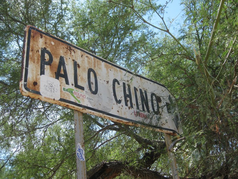
You'll see a fork in the road (Loreto to San Javier mission) that goes west to the Comondus. About 8-9 miles in, you see a sign for a rancho (last
time I was there it was abandoned), for Palo Chino. You'll see a trail across the street from there - it goes for miles - 20? - until it hooks up
again into the main road. Anyway, the people at the Palo Chino rancho would take people to an indigenous rock art site. Never went because we didn't
have time, but on another trip, tried to find them. We discovered a habitation site, and eventually camped alongside the old El Camino Real. Thing
is, there are many miles of old one-track, little used roads with old indian and mission trails here and there where you can bushwack all you want.
If you get a Baja Almanac (Sur) map book, you can see all the dotted lines, which are dirt tracks but serve as hiking trails.
David: Can you show her that road with the trail from Palo Chino to Batequito?
|
|
|
David K
Honored Nomad
Posts: 65563
Registered: 8-30-2002
Location: San Diego County
Member Is Offline
Mood: Have Baja Fever
|
|
| Quote: Originally posted by wilderone | "drive over to the mission to try a higher elevation hike. Not many trails though"
You'll see a fork in the road (Loreto to San Javier mission) that goes west to the Comondus. About 8-9 miles in, you see a sign for a rancho (last
time I was there it was abandoned), for Palo Chino. You'll see a trail across the street from there - it goes for miles - 20? - until it hooks up
again into the main road. Anyway, the people at the Palo Chino rancho would take people to an indigenous rock art site. Never went because we didn't
have time, but on another trip, tried to find them. We discovered a habitation site, and eventually camped alongside the old El Camino Real. Thing
is, there are many miles of old one-track, little used roads with old indian and mission trails here and there where you can bushwack all you want.
If you get a Baja Almanac (Sur) map book, you can see all the dotted lines, which are dirt tracks but serve as hiking trails.
David: Can you show her that road with the trail from Palo Chino to Batequito? |
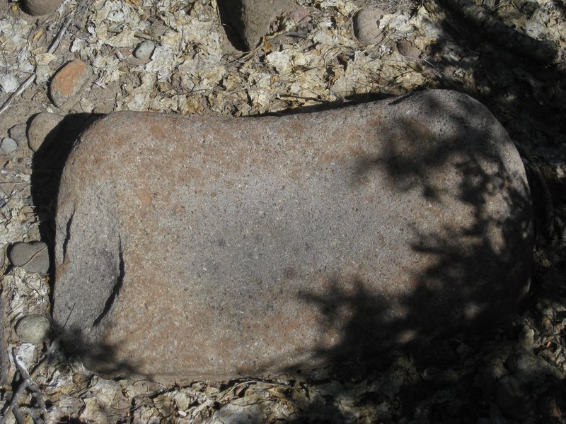
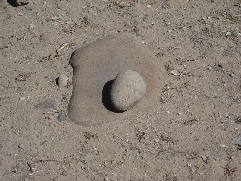
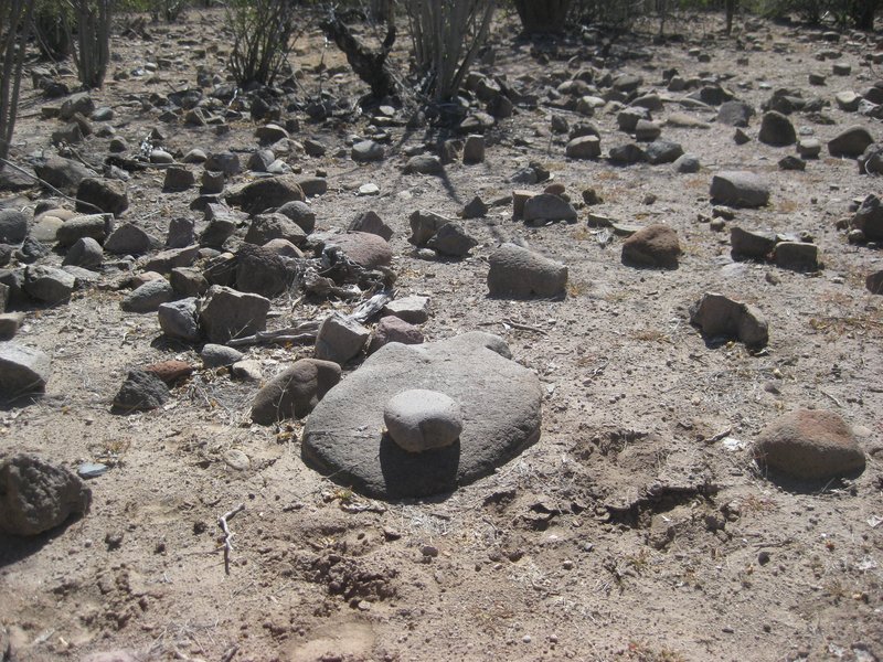
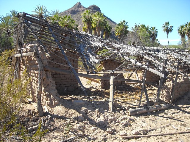
In 2017, Mike showed me the "kitchen" place you guys found. It was very cool. I heard that the metates were all removed since then (rancher or INAH?).
Palo Chino was abandoned, just a sign.
Here is a close up of the 2003 Baja Almanac showing Palo Chino and the trail to El Batequito...
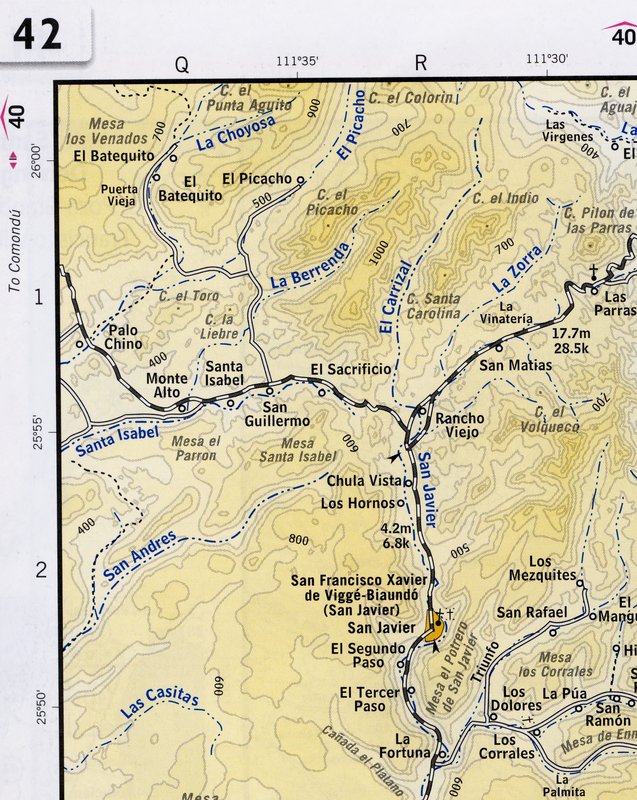
More detailed map, zoomed in on Palo Chino: https://caltopo.com/map.html#ll=25.95633,-111.65049&z=15...
[Edited on 11-17-2020 by David K]
|
|
|
wilderone
Ultra Nomad
Posts: 3912
Registered: 2-9-2004
Member Is Offline
|
|
"metates were all removed since then (rancher or INAH")
Whaaaaa? WTF they'd been there for 100 years
|
|
|
David K
Honored Nomad
Posts: 65563
Registered: 8-30-2002
Location: San Diego County
Member Is Offline
Mood: Have Baja Fever
|
|
Maybe longer since those 'evil' (  ) padres killed most all the
Indians by the early 1800s! ) padres killed most all the
Indians by the early 1800s!
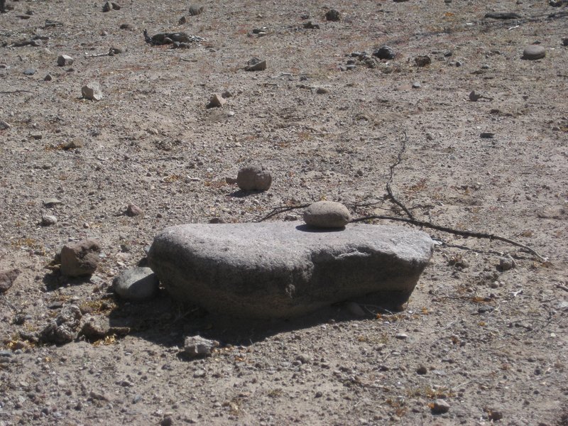
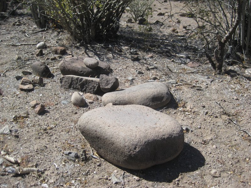
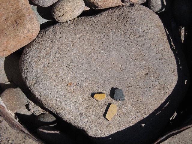
Photos may serve as a historic documentation of what this "kitchen" area had. The site was well hidden and not even visible from the foot trail some
distance away from the dirt road.
Here are the metates in February 2017:
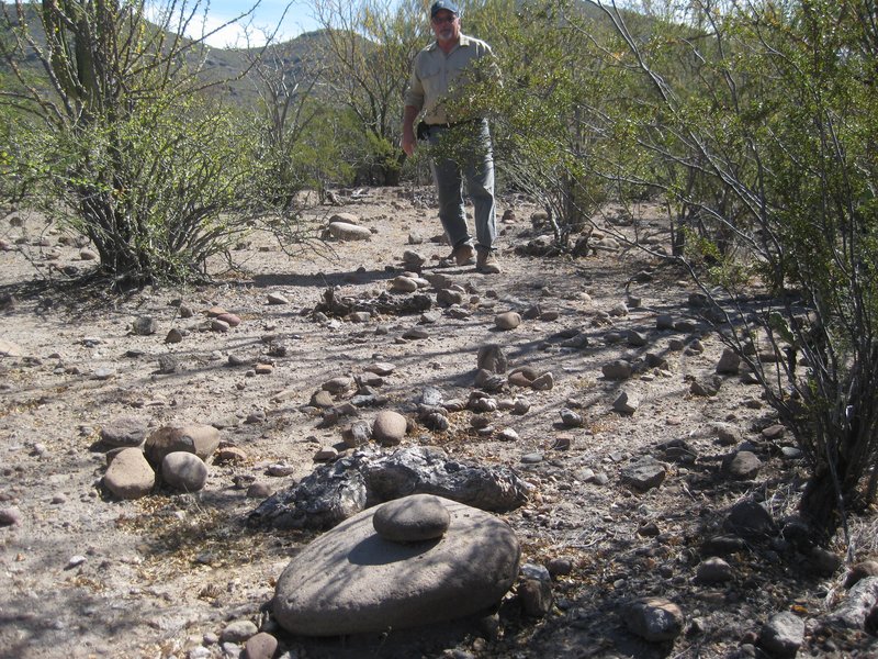
Mike Younghusband

|
|
|
JZ
Select Nomad
Posts: 14830
Registered: 10-3-2003
Member Is Offline
|
|
| Quote: Originally posted by CiriosGal |
I spotted that road! It also looked like there were some fantastic cliffs and rock formations between Agua Verde and the golf resort to the north.
One thing I really would like to do in the Loreto area is hike through a great non-technical slot canyon. Maybe some wading, scrambling. Tropical
version of Zion NP. Someone mentioned San Javier as well and I want use the drive over to the mission to try a higher elevation hike. Not many trails
though. I love to travel off-trail but not in thorn bushes. Weird spiders, bugs... Read somewhere there's a tree with toxic foliage like poison ivy.
|
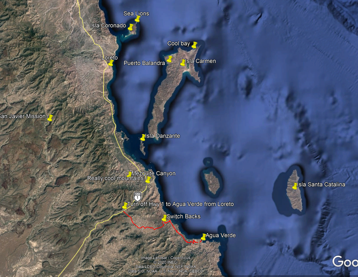
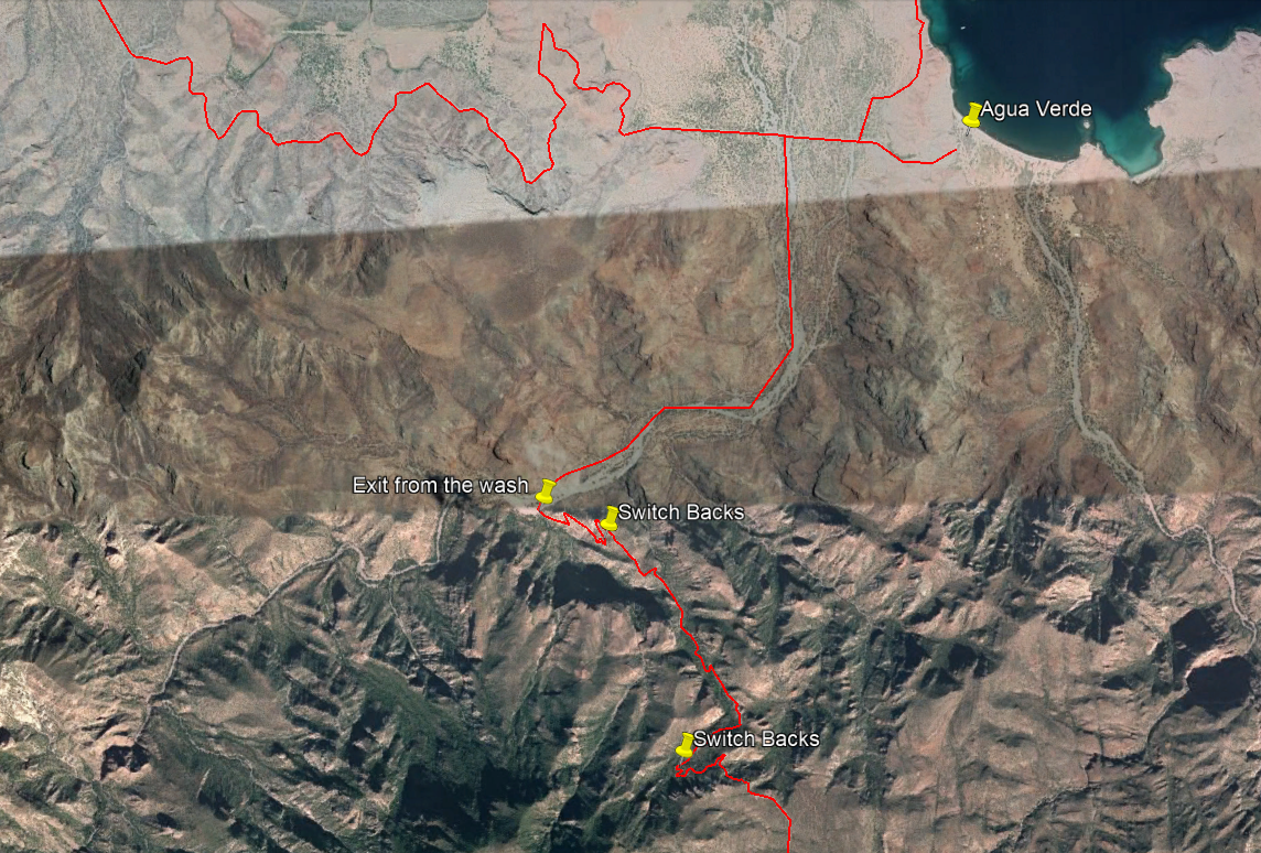
This could be a fun hike around Agua Verde. The path at the top is the road into AV.
There is a "back door" road out of AV that starts at "Exit from wash." For the last 3-4 years it has been impassable by 4x4 from storms washing out
the trail with lots of rocks. We rode our dirt bikes up it a couple years ago, so it can definitely be hiked.
Steep, but not too steep to walk it. Once you get up a ways you can see the ocean.
I (and others) have tracks for all these places you can load into Google Earth or a phone app like Gaia.
[Edited on 11-18-2020 by JZ]
|
|
|
CiriosGal
Newbie
Posts: 7
Registered: 11-8-2020
Member Is Offline
|
|
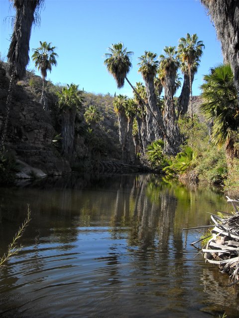
Wilderone, JZ, David. Interesting info, thanks. Question for anyone; Would you say the 2003 baja almanac is still the best map resource? There others
more up to date? I know very well how maps depicting the type or quality of a road can be deceiving.
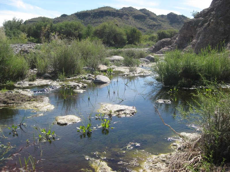
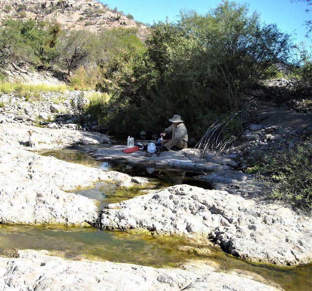
Also, where was that photo of the wetland taken? Is it a stream? Spring? Tank? Is the water drinkable if I were to use a katadyn type backpacker
filter? I know for example that some springs in utah contain high levels of heavy metals or even radiation...I'm planning to carry all my water for
the coming trip, but curious all the same.
Tabor canyon and others... Frustrating because I don't have a map with named washes, canyons etc and the internets doesn't seem to know either. =)
[Edited on 11-18-2020 by CiriosGal]
|
|
|
wilderone
Ultra Nomad
Posts: 3912
Registered: 2-9-2004
Member Is Offline
|
|
There are few, if any, comparable map books like the Baja Almanac which is out of print now. Map symbols, the little blue lines for streams, more
likely dry washes. You will learn that roads in Baja - duly depicted on a map - can have deep sand, eroded ditches, mud, a boulder-strewn crossing,
possibly all created during the last storm. The "quality" is also a relative term dependent on the type of vehicle you're driving (piece of cake for
a Land Rover, not so much a Camry). You just need to be prepared, take it as it comes, have a Plan B. Rural Baja hasn’t changed much in 20 years.
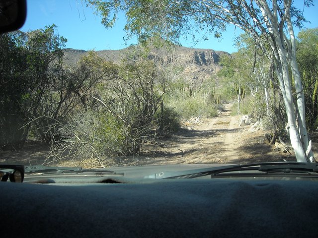
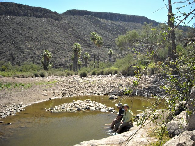
Yes, a backpacker water filter will be fine for most bodies of water in Baja. There are exceptions - the water found in the pools at El Volcan (near
El Marmol - you might like to explore around this onyx mine), is undrinkable - too mineralized. That photo of a stream is running (more or less) at
Palo Chino - I've pumped water out of there.
Around Monte Alto (see map above) you'll see a stream on the map called Santa Isabel. From the road you can see a lot of palm trees (El Palmarito).
That's an interesting area, with an old adobe habitation site, ranchos, pools of water (S/SW).
|
|
|
JZ
Select Nomad
Posts: 14830
Registered: 10-3-2003
Member Is Offline
|
|
| Quote: Originally posted by wilderone | There are few, if any, comparable map books like the Baja Almanac which is out of print now. Map symbols, the little blue lines for streams, more
likely dry washes. You will learn that roads in Baja - duly depicted on a map - can have deep sand, eroded ditches, mud, a boulder-strewn crossing,
possibly all created during the last storm. The "quality" is also a relative term dependent on the type of vehicle you're driving (piece of cake for
a Land Rover, not so much a Camry). You just need to be prepared, take it as it comes, have a
|
Most roads that get damaged by a storm get fixed in short order as they are traveled frequently by the ranchers.
Road conditions can always be checked on the forum.
|
|
|
David K
Honored Nomad
Posts: 65563
Registered: 8-30-2002
Location: San Diego County
Member Is Offline
Mood: Have Baja Fever
|
|
The 2003 Almanac had the most detail (larger scale) and was in color, compared to the 1998 2-book Almanac.
The 2009 Almanac (the last one) went big (smaller scale maps) but had road updates, etc.
The 2010 AAA Baja Map (the last one) was very handy for planning and main road travel.
In 2021, there will be a new map book...
Until then, use CalTopo.com (link below or on www.VivaBaja.com ) for topo maps and satellite images... You can flip between various maps and see a combined satellite/ topo map. You can zoom in
on any place for detail.
This online map is thanks to Nomad 'geoffff' (opens on the center of Baja, just scroll out and use your mouse to move about). The menu bar has preset
layers of the various map choices: https://caltopo.com/map.html#ll=27.60902,-112.90375&z=11...
[Edited on 11-18-2020 by David K]
|
|
|
wilderone
Ultra Nomad
Posts: 3912
Registered: 2-9-2004
Member Is Offline
|
|
In all practicality, you'll probably be fine with a AAA map (only a week, and you can see from this message string, an idea of what to expect).
Current conditions, boots on the ground, will dictate your choices. If you'd like me to send you a few pertinent pages from the Baja Almanac, I'm
happy to do so.
|
|
|
Whale-ista
Super Nomad
Posts: 2011
Registered: 2-18-2013
Location: San Diego
Member Is Offline
Mood: Sunny with chance of whales
|
|
FYI- Per my local AAA office: their Baja map is no longer available.
(I tried to get one earlier this month.)
I'm curious if anyone has used this National Geographic map? I found this one for Baja (North) at the Adventure 16 final sale earlier this year but I
haven't travelled with it yet.


\"Probably the airplanes will bring week-enders from Los Angeles before long, and the beautiful poor bedraggled old town will bloom with a
Floridian ugliness.\" (John Steinbeck, 1940, discussing the future of La Paz, BCS, Mexico)
|
|
|
Don Pisto
Banned
Posts: 1282
Registered: 8-1-2018
Location: El Pescador
Member Is Offline
Mood: weary like everyone else
|
|
| Quote: Originally posted by Whale-ista | FYI- Per my local AAA office: their Baja map is no longer available.
(I tried to get one earlier this month.)
I'm curious if anyone has used this National Geographic map? I found this one for Baja (North) at the Adventure 16 final sale earlier this year but I
haven't travelled with it yet.
|
I have the set they're beautiful maps but don't tell you much, maybe take Davids maps and add distances etc?
there's only two things in life but I forget what they are........
John Hiatt
|
|
|
wilderone
Ultra Nomad
Posts: 3912
Registered: 2-9-2004
Member Is Offline
|
|
True, AAA no longer has a Baja map. However, you can still find them to buy. Here's a nice deal on eBay right now: Total $15 (with shipping) for 10
maps, including Utah, Nevada, Western States, Baja, California. I have them all and have been invaluable.
https://www.ebay.com/itm/10-Vintage-AAA-Western-States-Maps-...
|
|
|
motoged
Elite Nomad
Posts: 6481
Registered: 7-31-2006
Location: Kamloops, BC
Member Is Offline
Mood: Gettin' Better
|
|
| Quote: Originally posted by JZ |
You choose sides with Goat, the nastiest poster in the history of this board.
[Edited on 11-17-2020 by JZ] |
Surabi has it figured out, Jizz,
What category do you qualify for with your snotty and arrogant comments directed at Nomads who don't bow down to your pseudo-omniscience ?
Just curious 
Don't believe everything you think....
|
|
|
bajaric
Senior Nomad
Posts: 681
Registered: 2-2-2015
Member Is Offline
|
|
Goats got nothing on JJJ
"Sadistic Spearfishers" lol
Among affordable paper maps, the Nat Geo map has good detail for drainages, but not the greatest road map because it does not show the mileage between
road junctions. The more recent AAA maps are the best road maps including connecting dirt roads. The BCA is the best, but if you can't afford one
you can search the caltopo and INEGI web sites to get an electronic version --
|
|
|
CiriosGal
Newbie
Posts: 7
Registered: 11-8-2020
Member Is Offline
|
|
I see the 2003 baja sur almanac is available used on Amazon for one low payment of $675 + shipping.
I used to have digital and paper versions of maps put out by nat geo. Maybe they improved but in 2012 their detail was garbo
[Edited on 11-18-2020 by CiriosGal]
|
|
|
David K
Honored Nomad
Posts: 65563
Registered: 8-30-2002
Location: San Diego County
Member Is Offline
Mood: Have Baja Fever
|
|
The NatGeo 2008 map set is huge, beautiful, but fail to be useful for ground navigation, IMO.
I have the entire 2010 AAA map scanned (and most other maps too going back in time) so that I can provide assistance to Nomads with locations or just
plain cartographic conversation.
My 2018 Baja Map set is free for you to copy and use (for personal use, if I see them in your book, you owe me! LOL).
They are all on this post, from both Photobucket and later from PostImages.org (for when Photobucket crashes on me, lol): http://forums.bajanomad.com/viewthread.php?tid=88771
I will try and add 1 or 2 more, soon, to fill in the Sierra Juárez/ Hwy. 3 missing area, with geoffff's help!
|
|
|
| Pages:
1
2
3
4
5 |


