| Pages:
1
2
3
4
5
6
..
10 |
4x4abc
Ultra Nomad
    
Posts: 4454
Registered: 4-24-2009
Location: La Paz, BCS
Member Is Offline
Mood: happy - always
|
|
revisiting the area I found a new road
so much to find in Baja!
Harald Pietschmann
|
|
|
4x4abc
Ultra Nomad
    
Posts: 4454
Registered: 4-24-2009
Location: La Paz, BCS
Member Is Offline
Mood: happy - always
|
|
Quote: Originally posted by Lance S.  | | If you talk to the family who owns San Antonio again I an curious if they know who Tinaja Ortiz is named after. |
Cañada Tinaje de Ortiz is well known - but where is the Tinaja de Ortiz?
Harald Pietschmann
|
|
|
Lance S.
Nomad
 
Posts: 231
Registered: 2-16-2021
Member Is Offline
|
|
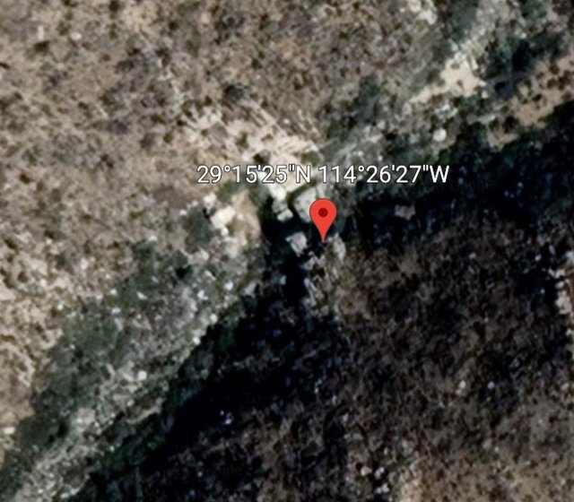
Think it's right about here. That's just based on looking at different image dates years ago. It is not in the arroyo labeled on Google Earth so
either I had the wrong location or Google Earth does.
[Edited on 4-21-2023 by Lance S.]
|
|
|
Lance S.
Nomad
 
Posts: 231
Registered: 2-16-2021
Member Is Offline
|
|
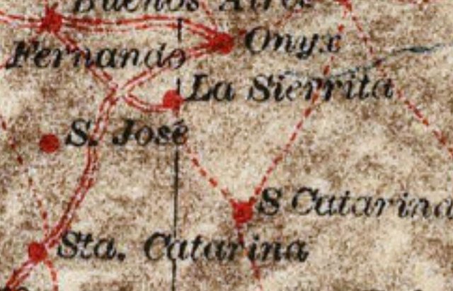
Another question about old Rancho San Antonio. According to Nelson 1905, the 1927 map, and the Goldbaum map the last section of road down the
peninsula to be filled in was the stretch between El Marmol and Punta Prieta Sometime between 1905 and 1927. Does San Antonio predate or postdate
that?
[Edited on 4-21-2023 by Lance S.]
[Edited on 4-21-2023 by Lance S.]
|
|
|
Lance S.
Nomad
 
Posts: 231
Registered: 2-16-2021
Member Is Offline
|
|
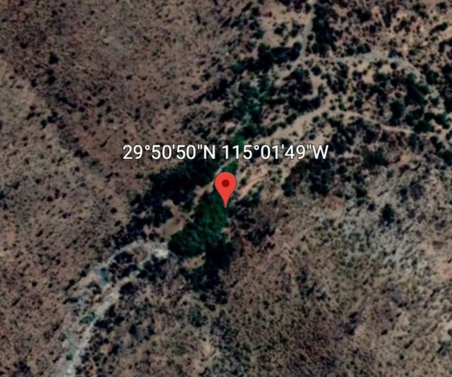
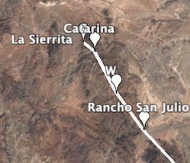
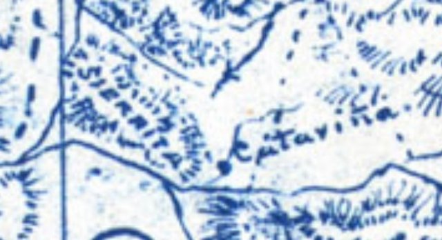
Catarina
 upload images for free upload images for free
|
|
|
Lance S.
Nomad
 
Posts: 231
Registered: 2-16-2021
Member Is Offline
|
|
The top Catavina on this map is Catarina. Above Los Cerritos.
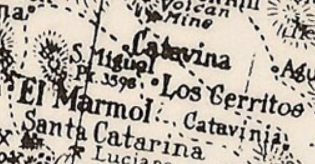
Los Cerritos
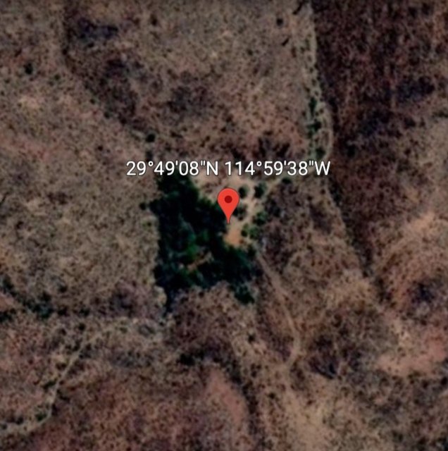 post pics post pics
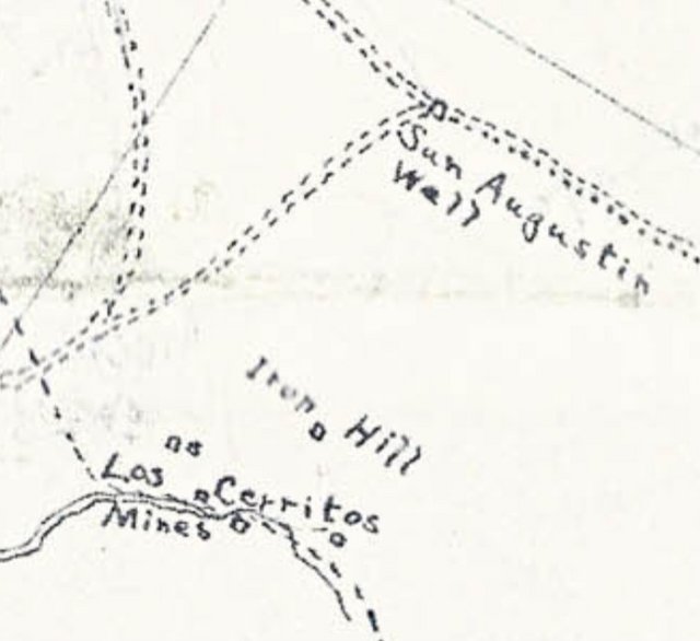
|
|
|
David K
Honored Nomad
        
Posts: 65441
Registered: 8-30-2002
Location: San Diego County
Member Is Offline
Mood: Have Baja Fever
|
|
Wonderful maps, such a good job showing the places you want us to examine.
I will spend more time on them tomorrow.
San Antonio/ Codornices is older than 1905, yes.
I have asked the family those two questions from yesterday. Awaiting an answer.
|
|
|
4x4abc
Ultra Nomad
    
Posts: 4454
Registered: 4-24-2009
Location: La Paz, BCS
Member Is Offline
Mood: happy - always
|
|
Great job!
Now I have names
Harald Pietschmann
|
|
|
David K
Honored Nomad
        
Posts: 65441
Registered: 8-30-2002
Location: San Diego County
Member Is Offline
Mood: Have Baja Fever
|
|
This archaeology paper on petroglyphs, names La Sierrita and San Julio (as well as the San Fernando site)... Maybe you have already mentioned it here,
but it was in my email this morning so I wanted to grab it and share here, before I got distracted on a new project!
https://www.academia.edu/27626752/G_Engerrand_s_New_Petrogly...
|
|
|
4x4abc
Ultra Nomad
    
Posts: 4454
Registered: 4-24-2009
Location: La Paz, BCS
Member Is Offline
Mood: happy - always
|
|
the image of Aguaje La Sierrita (Figure 8.) indicates that it is downstream of Rancho San Julio in Arroyo San Julio.
Harald Pietschmann
|
|
|
Lance S.
Nomad
 
Posts: 231
Registered: 2-16-2021
Member Is Offline
|
|
San Julio Location
https://www.elvigia.net/general/2016/9/11/bocana-rancho-geot...
Llegamos hasta el pequeño valle, en medio de un cañón por donde corre el arroyo de San Julio, el cual llevaba algo de agua gracias a la lluvia del
día anterior. Ahí observamos vestigios de un antiguo rancho, posiblemente del siglo XIX.
"Actualmente se desconoce quiénes habitaron dicho rancho y cuál era su nombre. Entre los vestigios destacan dos círculos hechos con piedras muy
bien acomodadas, a ras del suelo. No se sabe muy bien en qué los utilizaban, pero al parecer eran para la separación de granos. También hay una
cerca de piedra, así como algunos restos de una acequia."
The Devils Road shows one of the circles at 27:00 but they attribute them to the Cochimi.
https://youtu.be/Jueqf0gXODw
|
|
|
4x4abc
Ultra Nomad
    
Posts: 4454
Registered: 4-24-2009
Location: La Paz, BCS
Member Is Offline
Mood: happy - always
|
|
Quote: Originally posted by Lance S.  | Think it's right about here. That's just based on looking at different image dates years ago. It is not in the arroyo labeled on Google Earth so
either I had the wrong location or Google Earth does.

[Edited on 4-21-2023 by Lance S.] |
now this is exciting!
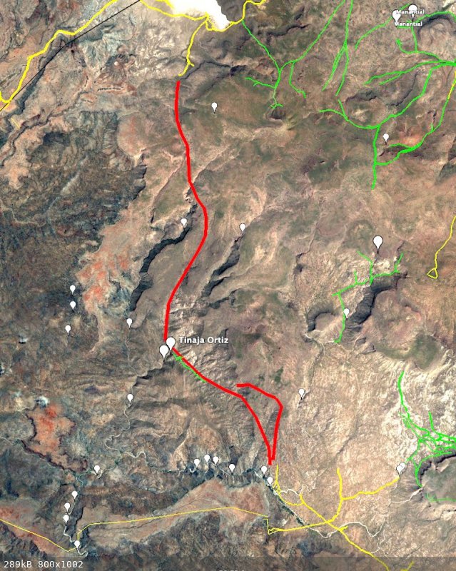
with that location I was able to trace the entire trail from Codornices to Llano Las Palomas
not easy - but discoverable
Harald Pietschmann
|
|
|
Lance S.
Nomad
 
Posts: 231
Registered: 2-16-2021
Member Is Offline
|
|
That is interesting, can we see the route?
Does the route give any indication of the location of Tinaja el Caporal?
[Edited on 4-23-2023 by Lance S.]
|
|
|
4x4abc
Ultra Nomad
    
Posts: 4454
Registered: 4-24-2009
Location: La Paz, BCS
Member Is Offline
Mood: happy - always
|
|
Quote: Originally posted by Lance S.  | That is interesting, can we see the route?
Does the route give any indication of the location of Tinaja el Caporal?
[Edited on 4-23-2023 by Lance S.] |
rough outline - details later
Harald Pietschmann
|
|
|
4x4abc
Ultra Nomad
    
Posts: 4454
Registered: 4-24-2009
Location: La Paz, BCS
Member Is Offline
Mood: happy - always
|
|
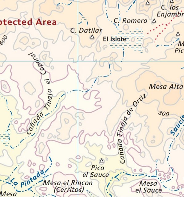
got a position for Tinaja el Caporal??
Harald Pietschmann
|
|
|
Lance S.
Nomad
 
Posts: 231
Registered: 2-16-2021
Member Is Offline
|
|
I haven't been able to find it, was hoping maybe there was a track or something that might give a clue.
[Edited on 4-24-2023 by Lance S.]
|
|
|
4x4abc
Ultra Nomad
    
Posts: 4454
Registered: 4-24-2009
Location: La Paz, BCS
Member Is Offline
Mood: happy - always
|
|
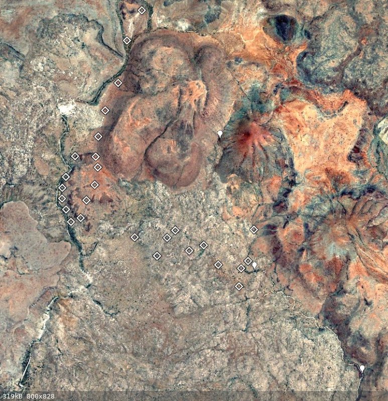
I have 3 prospects for a Tinaja in the Arroyo (white marker)
and a number of indicators for a trail
Harald Pietschmann
|
|
|
4x4abc
Ultra Nomad
    
Posts: 4454
Registered: 4-24-2009
Location: La Paz, BCS
Member Is Offline
Mood: happy - always
|
|
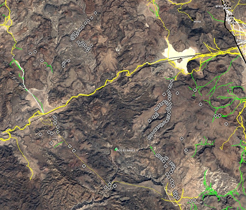
I have been busy tracing old trails in the area
each square is a spot that looks like it could be part of a trail
Harald Pietschmann
|
|
|
David K
Honored Nomad
        
Posts: 65441
Registered: 8-30-2002
Location: San Diego County
Member Is Offline
Mood: Have Baja Fever
|
|
Great stuff!
Can you overlay your lines and squares on a map too? INEGI, Baja Almanac, or Benchmark Baja Atlas?
|
|
|
4x4abc
Ultra Nomad
    
Posts: 4454
Registered: 4-24-2009
Location: La Paz, BCS
Member Is Offline
Mood: happy - always
|
|
Quote: Originally posted by David K  | Great stuff!
Can you overlay your lines and squares on a map too? INEGI, Baja Almanac, or Benchmark Baja Atlas? |
don't know - will have to to try it out
Harald Pietschmann
|
|
|
| Pages:
1
2
3
4
5
6
..
10 |

