| Pages:
1
2 |
tajo
Junior Nomad

Posts: 37
Registered: 9-12-2005
Location: San Diego, CA
Member Is Offline
|
|
Canyon La Esperanza report
This is a continuation of the same topic: General Baja discussion // Canyon La Esperanza report - where G.Jide described our first exploration. That
topic is closed - so I am opening the new one in the hiking section – as it may be interesting for Baja hikers and climbers.
Esperanza Canyon is shorter than the Canyon del Diablo, but much more difficult and as far as I know it was never climbed from the bottom to the
top. The approach from west, from Mike’s Sky Ranch is also difficult, but the only difficulty of the western side of the mountains is terrible
bushwhacking in the lower parts, the last miles of the canyon are very nice . I suppose that the best approach could be from the Observatory along the
main ridge of San Pedro Martir, and on the topo map I see a path near the pass 2410 m to another canyon – facing north to the road no 3 from San
Felipe to Ensenada – but this trail is invisible in nature.
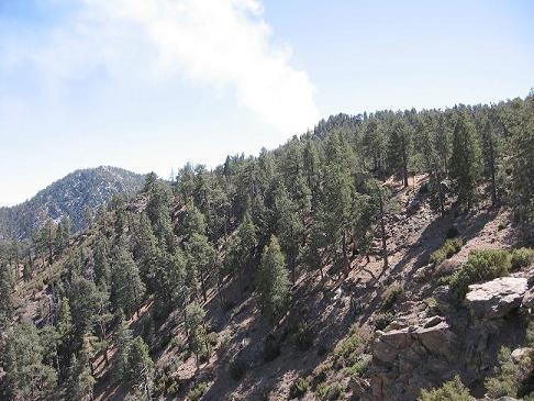
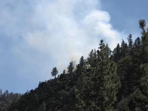
The ridge below the observatory may be burnt , as for three days of my staying on the pass above the Canyon Esperanza I observed a huge fire in
that area. Fortunately winds did not blow in my direction. It was in the previous year 2007, March 28-30, when I volunteered for Antonio Rosquillas –
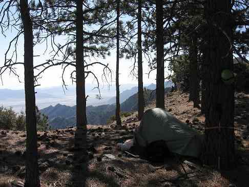
the main organizer of the Baja Travesia Adventure Race. I camped at the highest checkpoint 2410 m, welcoming all the teams except one, which came too
late, and passed me in the lower part of the canyon. After two nights I met the last team, and I could start my solo adventure, which lasted two more
days and a half – twice longer than the best time of competitors, but I am not a racer and like to have time for enjoying solitude and good
auto-belay. In the canyon there are seven (or more) huge steps, which must be rappelled - do not even try to go there without 60 m (180 feet) double
rope, and some training on a wet rope without contact with the cliff. I used the ropes left by Baja Travesia, but now these ropes are taken – though
you may find the bolts, which were fixed in the rock.
The highest "Free Style Rap" was 50 m long and mostly in air, or in a thin stream of water, moreover it was necessary to untangle all the rappel
knots, when I swam in a freezing lake, and to move to the far bank of the fjord pushing the backpack - it was my first experience of this sort, and I
thought terrified, what to do if it sank, and the sling connecting me with the pack were too short. I felt better when the backpack floated as a
balloon on the surface – me on the backpack and all my belongings safe and dry inside it in a waterproof trash bag. Only the boots were so wet, that
it made no sense to take them off.
Between those huge rappels there are miles of marshes, steep slabs, huge boulders and terrible bush – good news: no poison oak, bad news – plenty of
manzanita, willows, corrizos (reeds) and cats claws in the lower parts. Sorry that I have only the pictures of that vegetation – as I was on myself.
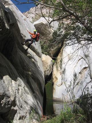
The only exception is the “Sand Bar Rap”, where the last and lost team passed me – and took a picture, which documented my presence. Following bajalou
example I put all my pictures on the google earth page:
http://www.communitywalk.com/sierra_san_pedro_martir/san_fel...
and approach to the Esperanza Canyon from Laguna del Diablo is in his page:
http://www.communitywalk.com/location_info/50099/372834
[Edited on 2008-2-10 by tajo]
|
|
|
bajalou
Ultra Nomad
    
Posts: 4459
Registered: 3-11-2004
Location: South of the broder
Member Is Offline
|
|
Great job tajo, and thanks for linking it to the Valle Chico map.
No Bad Days
\"Never argue with an idiot. People watching may not be able to tell the difference\"
\"The trouble with doing nothing is - how do I know when I\'m done?\"
Nomad Baja Interactive map
And in the San Felipe area - check out Valle Chico area |
|
|
bajajudy
Elite Nomad
     
Posts: 6886
Registered: 10-4-2004
Location: San Jose del Cabo,BCS
Member Is Offline
|
|
WOW
I am off to read part two
|
|
|
Barry A.
Select Nomad
      
Posts: 10007
Registered: 11-30-2003
Location: Redding, Northern CA
Member Is Offline
Mood: optimistic
|
|
----back up to the top to join it's brother
|
|
|
tajo
Junior Nomad

Posts: 37
Registered: 9-12-2005
Location: San Diego, CA
Member Is Offline
|
|
some pictures from the canyon: fire above the "observatorio" ridge
|
|
|
tajo
Junior Nomad

Posts: 37
Registered: 9-12-2005
Location: San Diego, CA
Member Is Offline
|
|
Canyon La Esperanza report
Fire-once more
|
|
|
tajo
Junior Nomad

Posts: 37
Registered: 9-12-2005
Location: San Diego, CA
Member Is Offline
|
|
Canyon La Esperanza report
my checkpoint of Baja |Travesia race - from the pass 2410 m visible the Esperanza canyon and Laguna del Diablo, and in the night - the lights of San
Felipe
[Edited on 2008-2-10 by tajo]
|
|
|
tajo
Junior Nomad

Posts: 37
Registered: 9-12-2005
Location: San Diego, CA
Member Is Offline
|
|
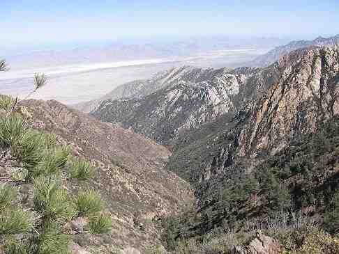
canyon Esperanza from 2410 m
[Edited on 2008-2-10 by tajo]
|
|
|
tajo
Junior Nomad

Posts: 37
Registered: 9-12-2005
Location: San Diego, CA
Member Is Offline
|
|
Canyon La Esperanza report
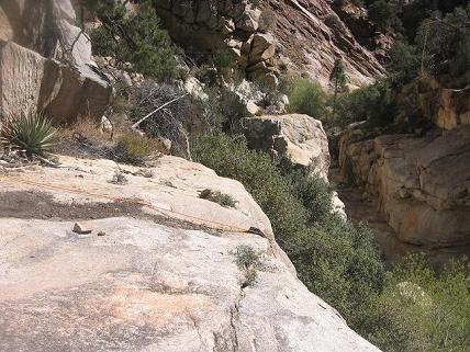
Big slab rap - interesting vegetation around with pinyon trees, manzanita, yucca and willows
[Edited on 2008-2-10 by tajo]
|
|
|
tajo
Junior Nomad

Posts: 37
Registered: 9-12-2005
Location: San Diego, CA
Member Is Offline
|
|
Canyon La Esperanza report
Sand Bar Rap
|
|
|
tajo
Junior Nomad

Posts: 37
Registered: 9-12-2005
Location: San Diego, CA
Member Is Offline
|
|
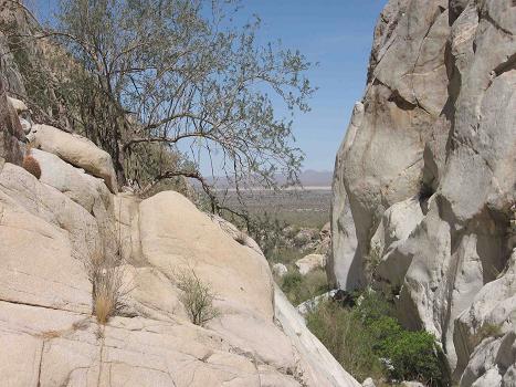
Laguna del Diablo only half a mile from the "fertilizer" rock
|
|
|
tajo
Junior Nomad

Posts: 37
Registered: 9-12-2005
Location: San Diego, CA
Member Is Offline
|
|
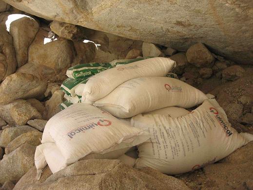
Bags of fertilizers in the Esperanza Canyon ???
|
|
|
tajo
Junior Nomad

Posts: 37
Registered: 9-12-2005
Location: San Diego, CA
Member Is Offline
|
|
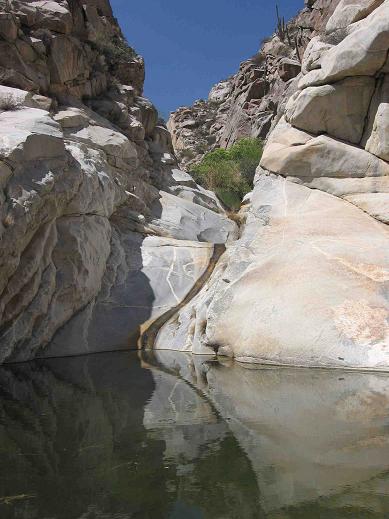
The "Slide Rap" in waterfalls - 1 mile above the entrance to the canyon - from the lower part of the canyon.
[Edited on 2008-2-10 by tajo]
|
|
|
tajo
Junior Nomad

Posts: 37
Registered: 9-12-2005
Location: San Diego, CA
Member Is Offline
|
|
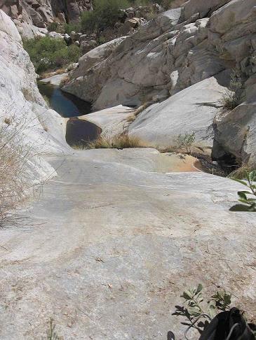
The same "Slide Rap" from the upper part of the canyon.
[Edited on 2008-2-10 by tajo]
|
|
|
BAJACAT
Ultra Nomad
    
Posts: 2902
Registered: 11-21-2005
Location: NATIONAL CITY, CA
Member Is Offline
|
|
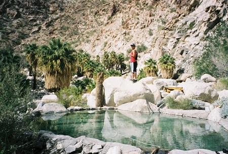
Tajo have you ever hike EL PALOMAR CANYON,30 miles south of Guadalupe canyon?
BAJA IS WHAT YOU WANTED TO BE, FUN,DANGEROUS,INCREDIBLE, REMOTE, EXOTIC..JUST GO AND HAVE FUN.....
|
|
|
tajo
Junior Nomad

Posts: 37
Registered: 9-12-2005
Location: San Diego, CA
Member Is Offline
|
|
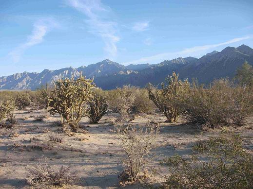
View to El Picacho del D. from La Laguna del D.- just below the trailhead of the Esperanza Canyon
[Edited on 2008-2-10 by tajo]
|
|
|
tajo
Junior Nomad

Posts: 37
Registered: 9-12-2005
Location: San Diego, CA
Member Is Offline
|
|
| Quote: | Originally posted by BAJACAT
Tajo have you ever hike EL PALOMAR CANYON,30 miles south of Guadalupe canyon? |
No , not yet 
I would like very much to explore La Mora, El Palomar and Santa Isabel - but till now I know only the upper approach from the Rancho Santa Isabel
Viejo and from Rancho Las Vegas Nevadas ( it is Las Vegas Negros in the Almanac , though everybody knows that Las Vegas is in Nevada  ). It is interesting that the Santa Isabel was the first canyon which was explored
down to its desert bottom by a non-Indian - lieutenant José Joaquín de Arrillaga in 1796 . I read about it in the book "Land of Chamise and Pines"
by Richard A. Minnich, Ernesto Franco Vizcaíno. Very interesting book ! The authors say that vegetation described in 1796 is very similar to the
present one. Does anybody knows the authors. I was told that E. F. Vizcaíno worked in CICESE Ensenada. ). It is interesting that the Santa Isabel was the first canyon which was explored
down to its desert bottom by a non-Indian - lieutenant José Joaquín de Arrillaga in 1796 . I read about it in the book "Land of Chamise and Pines"
by Richard A. Minnich, Ernesto Franco Vizcaíno. Very interesting book ! The authors say that vegetation described in 1796 is very similar to the
present one. Does anybody knows the authors. I was told that E. F. Vizcaíno worked in CICESE Ensenada.
[Edited on 2008-2-10 by tajo]
|
|
|
standingwave
Nomad
 
Posts: 182
Registered: 11-10-2007
Location: Lytton, Canada
Member Is Offline
|
|
Baja canyons
Great pics, Tajo.
Here's one of my favourite canyon, near Agua Caliente, BCS. That's my son, Alex, in mid air. Ah, sweet memories...

\"I could not help concluding this man had the most supreme pleasure while he was driven so fast and so smoothly by the sea.\"
James Cook |
|
|
standingwave
Nomad
 
Posts: 182
Registered: 11-10-2007
Location: Lytton, Canada
Member Is Offline
|
|
hmm... where's that picture
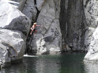

\"I could not help concluding this man had the most supreme pleasure while he was driven so fast and so smoothly by the sea.\"
James Cook |
|
|
tajo
Junior Nomad

Posts: 37
Registered: 9-12-2005
Location: San Diego, CA
Member Is Offline
|
|
Agua Caliente in Baja California Sur or in Valle Chico ? Is that pond really caliente ?
I described my first bath as freezing - in fact all my water bottles froze in the night at 2410 m , but the last ponds in the Esperanza were pretty
warm - not because of hot springs, but because of altitude 600 m and late afternoon.
|
|
|
| Pages:
1
2 |

