Cyanide41
Nomad
 
Posts: 303
Registered: 1-7-2009
Location: Tijuana
Member Is Offline
|
|
Good hikes in North/Central baja?
So I am interested in doing a little hiking/camping/backpacking in baja while the weather is still cool(er). I have looked on line and for books but
can't find anything to substantial. Most of what I find are tours and that's not really what I am looking for. If anyone could point me in the
direction of some good references I'd appreciate it.
|
|
|
shari
Select Nomad
      
Posts: 13049
Registered: 3-10-2006
Location: bahia asuncion, baja sur
Member Is Offline
Mood: there is no reality except the one contained within us "Herman Hesse"
|
|
an amigo of mine walked from guerrero negro to near turtle bay and was a spectacular beach hike...there is a really nice hike from Asuncion to San
Roque...along the coastine and some gorgeous remote beaches.only 3 hours instead of 3 days. Or try hiking in the sierra de san
fransisco...excellent...or from mission to mission which was a days horse ride.
|
|
|
mtgoat666
Select Nomad
      
Posts: 19967
Registered: 9-16-2006
Location: San Diego
Member Is Offline
Mood: Hot n spicy
|
|
If you want to backpack and not carry water and be in remote areas without ranches and people, then you got to go to the mountains. Laguna Hansen is
close to US, but not worth the bother -- is about the same as the Lagunas in San Diego County.
For spectacular hiking, you need to head to San Pedro Martir national park. 5 or 6 hour drive from San Diego. Snow is probable thru April. April,
May and June are best months to go, later in summer is nice, but you have to deal with almost daily thunderstorms that will scare you away from
climbing high peaks.
Get Jerry Schaad's map of SPM (still in print, google it up). The trails are very long, remote and poorly marked (difficult) -- so you will need
navigation skills. But the difficulty of the trails means you will have the trails all to yourself.
|
|
|
Mexitron
Ultra Nomad
    
Posts: 3397
Registered: 9-21-2003
Location: Fort Worth, Texas
Member Is Offline
Mood: Happy!
|
|
Any of the canyons on the east side of the Sierras are great for exploring and usually have water somewhere in them. Consider getting some Mexican
topos first though--they can be confusing to find.
|
|
|
John M
Super Nomad
   
Posts: 1924
Registered: 9-3-2003
Location: California High Desert
Member Is Offline
|
|
Hiking and...
There is a readily available small book by John W. Robinson title is "Camping and Climbing in Baja" La Siesta Press 1967 and later editions.
Just do an Amazon.com search and there are plenty to choose from. The book shows dozens and dozens of trips and includes some nice maps, but the maps
might not be detailed enough to be sufficient on their own. Can't go wrong for a few dollars.
John M
|
|
|
Sharksbaja
Elite Nomad
     
Posts: 5814
Registered: 9-7-2004
Location: Newport, Mulege B.C.S.
Member Is Offline
|
|
Not for the meek....
Picacho del Diablo
DON\'T SQUINT! Give yer eyes a break!
Try holding down [control] key and toggle the [+ and -] keys
Viva Mulege!
Nomads\' Sunsets
|
|
|
David K
Honored Nomad
        
Posts: 65292
Registered: 8-30-2002
Location: San Diego County
Member Is Offline
Mood: Have Baja Fever
|
|
| Quote: | Originally posted by Cyanide41
So I am interested in doing a little hiking/camping/backpacking in baja while the weather is still cool(er). I have looked on line and for books but
can't find anything to substantial. Most of what I find are tours and that's not really what I am looking for. If anyone could point me in the
direction of some good references I'd appreciate it. |
'The Baja Adventure Book' by Walt Peterson (available on Nomad or all book dealers, and source, just reprinted, again.)
My web site has a lot of ideas in the links, as well see below.
|
|
|
Cyanide41
Nomad
 
Posts: 303
Registered: 1-7-2009
Location: Tijuana
Member Is Offline
|
|
thanks for the info guys (& gal)
|
|
|
David K
Honored Nomad
        
Posts: 65292
Registered: 8-30-2002
Location: San Diego County
Member Is Offline
Mood: Have Baja Fever
|
|
EL CAMINO REAL
A favorite for me is to hike the mission trail in Baja!
I have been posting satellite images and maps of the Camino Real as it winds through Baja on various posts on Nomad... just do a search to see them.
Here are Gulick's 1955 ECR map of the area near Gonzaga and Crosby's 1977 map...


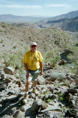
Here is me on the Camino Real where it is close to Gonzaga Bay, heading up towards Mision Santa Maria... 2003.
[Edited on 1-20-2009 by David K]
[Edited on 1-20-2009 by David K]

|
|
|
wilderone
Ultra Nomad
    
Posts: 3881
Registered: 2-9-2004
Member Is Offline
|
|
Actually, you can camp, hike and backpack Baja from just about anywhere - the reason you don't find references is because it's all wide open - doable
from everywhere.
For instance, drive to Rcho. Santa Inez, camp/hike/backpack in the direction of Mission Santa Maria.
Drive to Las Pintas pictograph site out of El Rosario, camp/hike/backpack.
Drive to El Volcan, camp/hike/backpack
Drive to Arroyo La Bocana out of Catavina, camp/hike/backpack
Drive to Mission San Borja - take off from there in several directions
north of Erendira along the coast
base camp out of Agua Caliente 35 mi. from Ensenada and backpack into the canyons there
What are your interests? Missions, mining, flowers, birds, beach, fishing, mountains? Would tailor your camp/hike/backpack around those areas. If
you ever leave your car for an extended period, be sure it's out of sight or looked after.
Few water sites, so gear your backpacks with a water source en route or pack very light so as to carry plenty of water. Some water indications on a
topo may be dry during certain times of the year.
|
|
|
fernando
Junior Nomad

Posts: 69
Registered: 11-16-2008
Member Is Offline
|
|
hi Cyanide
please check my web page for some information and if you need some sugestions-ideas let me know. Ill bbe glad to help you
some ideas are picacho del diablo but you need a guide, punta banda to santo tomas, ojos negros to laguna hanson...there are many options
Fernando
Baja Outfitters & Adventures
www.baja-outfitters.com
[Edited on 2-6-2009 by fernando]
|
|
|
Woooosh
Banned
Posts: 5240
Registered: 1-28-2007
Location: Rosarito Beach
Member Is Offline
Mood: Luminescent Waves at Rosarito Beach
|
|
| Quote: | Originally posted by Cyanide41
So I am interested in doing a little hiking/camping/backpacking in baja while the weather is still cool(er). I have looked on line and for books but
can't find anything to substantial. Most of what I find are tours and that's not really what I am looking for. If anyone could point me in the
direction of some good references I'd appreciate it. |
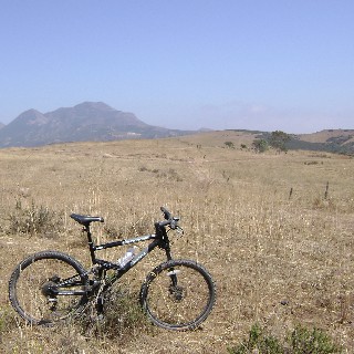
The great mountain biking in the hills of Rosarito Beach is a surprise treat. Lots of horse trails, hills, beautiful vistas.

\"The only thing necessary for the triumph of evil is for good men to do nothing\"
1961- JFK to Canadian parliament (Edmund Burke)
|
|
|
bajadock
Super Nomad
   
Posts: 1219
Registered: 12-20-2006
Location: Punta sur de \'Nada
Member Is Offline
|
|
feb 5 hike report


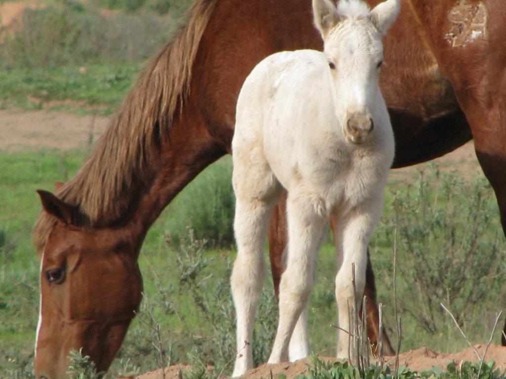
Thursday morning hike on Punta Banda included 4-legged scouts.
|
|
|
TMW
Select Nomad
      
Posts: 10659
Registered: 9-1-2003
Location: Bakersfield, CA
Member Is Offline
|
|
The dirt roads around Mike's Sky Ranch offer some interesting hiking areas. From Mike's you can hike to El Coyote ranch and loop back to Mike's.
You're looking at 10-12 miles or more each way. Some of the cross over roads are little used and overgrown. The south side out of mike's is seldom
used except during an off road race. Another good area is the trails into and around Laguna Hanson.
|
|
|

