| Pages:
1
2
3 |
bajajudy
Elite Nomad

Posts: 6886
Registered: 10-4-2004
Location: San Jose del Cabo,BCS
Member Is Offline
|
|
Hurricane Manuel takes aim at the mainland
TROPICAL STORM MANUEL DISCUSSION NUMBER 2
NWS NATIONAL HURRICANE CENTER MIAMI FL EP132013
200 PM PDT FRI SEP 13 2013
VISIBLE SATELLITE IMAGES SHOW THAT THE CYCLONE IS A LITTLE FARTHER
WEST THAN ESTIMATED EARLIER THIS MORNING...WITH A GROWING BALL OF
CONVECTION NEAR THE CENTER. ASCAT DATA SUGGESTED THE MAXIMUM WINDS
WERE ABOUT 35 KT...AND THIS IS USED AS THE INITIAL INTENSITY.
WHILE THE AREA OF TROPICAL-STORM-FORCE WINDS IS SMALL...THE
CIRCULATION OF MANUEL IS EMBEDDED WITHIN A MUCH LARGER CYCLONIC
GYRE THAT CONTAINS LOTS OF STRONG WINDS NOT DIRECTLY ASSOCIATED WITH
THE TROPICAL CYCLONE. THIS STRUCTURE MAKES THE INTENSITY FORECAST
TRICKY SINCE OTHER ENVIRONMENTAL FACTORS SEEM CONDUCIVE FOR
STRENGTHENING. GIVEN THE RELATIVELY SMALL RADIUS OF MAXIMUM WINDS
FROM ASCAT...MANUEL SHOULD HAVE A GOOD CHANCE TO INTENSIFY...AND
THE NHC PREDICTION IS A LITTLE ABOVE THE CONSENSUS AT THE UPPER END
OF THE GUIDANCE SPECTRUM.
INSTEAD OF A TURN TOWARD THE NORTH-NORTHWEST OCCURRING...IT SEEMS
LIKE MANUEL IS HEADING WEST-NORTHWESTWARD...295/5. MOST OF THE
GUIDANCE STILL SUGGEST THE STORM SHOULD TAKE A NORTHWARD TURN
RELATIVELY SOON DUE TO THE RIDGE WEAKENING OVER MEXICO. HOWEVER...
THE MODEL SPREAD HAS GROWN SINCE THE LAST ADVISORY...WITH THE
NORMALLY RELIABLE ECMWF A FAIR DISTANCE WEST OF THE MODEL
CONSENSUS. THIS IS NOT A HIGH CONFIDENCE FORECAST WITH THE GLOBAL
MODELS STRUGGLING TO RESOLVE THE INTERACTION OF THE RIDGE OVER
MEXICO...AN UPPER-LEVEL LOW...AND TROPICAL STORM INGRID. THE NEW
NHC TRACK FORECAST IS SHIFTED WESTWARD...ABOUT MIDWAY BETWEEN THE
ECMWF AND THE MODEL CONSENSUS...AND IT WOULD NOT BE VERY SURPRISING
IF FURTHER WESTWARD ADJUSTMENTS ARE REQUIRED.
FORECAST POSITIONS AND MAX WINDS
INIT 13/2100Z 15.6N 102.1W 35 KT 40 MPH
12H 14/0600Z 16.0N 102.3W 45 KT 50 MPH
24H 14/1800Z 16.8N 102.4W 50 KT 60 MPH
36H 15/0600Z 17.9N 102.7W 50 KT 60 MPH
48H 15/1800Z 18.9N 103.2W 30 KT 35 MPH...INLAND
72H 16/1800Z...DISSIPATED
[Edited on 9-15-2013 by bajajudy]
[Edited on 9-17-2013 by bajajudy]
[Edited on 9-19-2013 by bajajudy]
|
|
|
bajajudy
Elite Nomad
Posts: 6886
Registered: 10-4-2004
Location: San Jose del Cabo,BCS
Member Is Offline
|
|
The fat lady hasn't sung yet
THE INITIAL MOTION ESTIMATE IS 320/08. MANUEL CONTINUES TO BE
STEERED TOWARD THE NORTHWEST BY A LARGE MID-LEVEL RIDGE LOCATED
OVER THE CENTRAL U.S. GULF COAST. THE MODELS ARE IN GOOD AGREEMENT
THAT THIS GENERAL MOTION WILL CONTINUE WHILE THE CIRCULATION
REMAINS INTACT. THERE IS SOME DISCREPANCY BEYOND 24 HOURS AND SOME
MODELS...NOTABLY THE HWRF...GFDL...AND ECMWF...SHOW A TRACK TOWARD
THE BAJA CALIFORNIA PENNISULA. HOWEVER...THIS SCENARIO IS BEING
DISCOUNTED FOR NOW SINCE THE VORTEX TRACKER APPLIED TO THESE MODELS
SEEMS TO FOLLOW ANOTHER AREA OF LOW PRESSURE WHILE MANUEL
DISSIPATES.
|
|
|
chippy
Super Nomad
Posts: 1806
Registered: 2-2-2010
Member Is Offline
|
|
ManWell was a big dud. Gracias adios!
|
|
|
comitan
Ultra Nomad
Posts: 4177
Registered: 3-27-2004
Location: La Paz
Member Is Offline
Mood: mellow
|
|
I trust the GFDL track no matter what they say.
Strive For The Ideal, But Deal With What\'s Real.
Every day is a new day, better than the day before.(from some song)
Lord, Keep your arm around my shoulder and your hand over my mouth.
The sincere pursuit of truth requires you to entertain the possibility that everything you believe to be true may in fact be false
|
|
|
monoloco
Elite Nomad
Posts: 6667
Registered: 7-13-2009
Location: Pescadero BCS
Member Is Offline
|
|
Looks like Manuel could sneak in the backdoor
"The future ain't what it used to be"
|
|
|
stanburn
Nomad
Posts: 145
Registered: 10-4-2007
Location: Santiago, Colima, MX
Member Is Offline
|
|
Well he came ashore yesterday here in Manzanillo and Manuel was quite the non event. No wind and not that much rain. So far I have only recorded
1.5".
Stan
|
|
|
bajajudy
Elite Nomad
Posts: 6886
Registered: 10-4-2004
Location: San Jose del Cabo,BCS
Member Is Offline
|
|
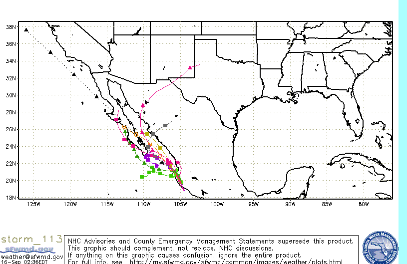
Starting to get some of Manuel's clouds.
We are keeping an eye on it. Can't help but think of Juliette which formed very rapidly close to this same location and brought us, not only a lot of
rain, but also 45mph winds.
[Edited on 9-16-2013 by bajajudy]
|
|
|
DENNIS
Platinum Nomad
Posts: 29510
Registered: 9-2-2006
Location: Punta Banda
Member Is Offline
|
|
Doesn't look like Manuel is going to amount to much:
http://www.cyclocane.com/hurricane-forecast/
"YOU CAN'T LITTER ALUMINUM"
|
|
|
shari
Select Nomad
Posts: 13052
Registered: 3-10-2006
Location: bahia asuncion, baja sur
Member Is Offline
Mood: there is no reality except the one contained within us "Herman Hesse"
|
|
yes Judy...it's good to keep alert...one thing baja teaches us is to expect the unexpected!
|
|
|
DavidE
Ultra Nomad
Posts: 3814
Registered: 12-1-2003
Location: Baja California México
Member Is Offline
Mood: 'At home we demand facts and get them. In Mexico one subsists on rumor and never demands anything.' Charles Flandrau,
|
|
Where does one keep a lert? According to some folks maintaining a lert is tiring as can be.
A Lot To See And A Lot To Do
|
|
|
toneart
Ultra Nomad
Posts: 4901
Registered: 7-23-2006
Member Is Offline
Mood: Skeptical
|
|
Lertus Pharmacology
| Quote: | Originally posted by DavidE
Where does one keep a lert? According to some folks maintaining a lert is tiring as can be. |
Lertus Pharmacology
Latanoprost is an isopropyl ester prodrug which is inactive but which becomes active after hydrolysis... Uhhh, Manuel is full of H2O. Uhhh, Manuel is full of H2O. 
|
|
|
bajajudy
Elite Nomad
Posts: 6886
Registered: 10-4-2004
Location: San Jose del Cabo,BCS
Member Is Offline
|
|
Found the lert
000
ABPZ20 KNHC 171729
TWOEP
TROPICAL WEATHER OUTLOOK
NWS NATIONAL HURRICANE CENTER MIAMI FL
1100 AM PDT TUE SEP 17 2013
FOR THE EASTERN NORTH PACIFIC...EAST OF 140 DEGREES WEST LONGITUDE..
AN AREA OF LOW PRESSURE...ASSOCIATED WITH THE REMNANTS OF
MANUEL...IS LOCATED ABOUT 60 MILES NORTHWEST OF THE ISLAS MARIAS.
SHOWER AND THUNDERSTORM ACTIVITY ASSOCIATED WITH THIS SYSTEM HAS
BECOME BETTER ORGANIZED TODAY AND ADDITIONAL DEVELOPMENT IS LIKELY
DURING THE NEXT COUPLE OF DAYS WHILE IT MOVES SLOWLY NORTHWESTWARD.
THIS SYSTEM HAS A HIGH CHANCE...60 PERCENT...OF BECOMING A TROPICAL
CYCLONE AGAIN DURING THE NEXT 48 HOURS. AFTER THAT TIME...THE
CLOSE PROXIMITY TO LAND AND COOLER WATERS ARE EXPECTED TO INHIBIT
FURTHER DEVELOPMENT...AND THIS SYSTEM ALSO HAS A HIGH CHANCE...60
PERCENT...OF BECOMING A TROPICAL CYCLONE DURING THE NEXT 5 DAYS.
INTERESTS ALONG THE WEST-CENTRAL COAST OF MEXICO AND IN SOUTHERN
BAJA CALIFORNIA SHOULD MONITOR THE PROGRESS OF THIS LOW.
&&
FIVE-DAY FORMATION PROBABILITIES ARE EXPERIMENTAL IN 2013. COMMENTS
ON THE EXPERIMENTAL FORECASTS CAN BE PROVIDED AT...
WWW.NWS.NOAA.GOV/SURVEY/NWS-SURVEY.PHP?CODE=ETWO
$$
FORECASTER BROWN
|
|
|
CaboMagic
Super Nomad
Posts: 1128
Registered: 4-30-2005
Member Is Offline
|
|
Judy love your humor :-) thanks for that
btw the Port Captain closed the Port after many/most boats left this morning .. & will issue notice later about tomorrow ..
|
|
|
DavidE
Ultra Nomad
Posts: 3814
Registered: 12-1-2003
Location: Baja California México
Member Is Offline
Mood: 'At home we demand facts and get them. In Mexico one subsists on rumor and never demands anything.' Charles Flandrau,
|
|
Life Without Laughter Is Painful...
Can "Manuel" Get His --- Together? Before entering cooler water?
Can the maid make it past the suspicious wife of the patron without causing a catfight while avoiding pregnancy? Stay tuned to Los Prognosticos and
the hot novela to find the answer to these and other mysteries.
Manuel better have one full head of hair as upper atmosphere wind shear is trying to separate his head from his neck.
Topics In The Tropics
A Lot To See And A Lot To Do
|
|
|
comitan
Ultra Nomad
Posts: 4177
Registered: 3-27-2004
Location: La Paz
Member Is Offline
Mood: mellow
|
|
David
Head or no head Manuel is going to bring is rain Probably Thursday and I don't think it will go north to affect Mulege so we will enjoy.
Strive For The Ideal, But Deal With What\'s Real.
Every day is a new day, better than the day before.(from some song)
Lord, Keep your arm around my shoulder and your hand over my mouth.
The sincere pursuit of truth requires you to entertain the possibility that everything you believe to be true may in fact be false
|
|
|
bajajudy
Elite Nomad
Posts: 6886
Registered: 10-4-2004
Location: San Jose del Cabo,BCS
Member Is Offline
|
|
A lot of information here
http://www.bajainsider.com/weather/hurricanes/2013/hurricane...
[Edited on 9-17-2013 by bajajudy]
|
|
|
pauldavidmena
Super Nomad
Posts: 1822
Registered: 5-23-2013
Location: Centerville, MA, USA
Member Is Offline
|
|
Looks like Manuel will strengthen from Tropical Depression to Tropical Storm as it heads back into the Pacific. Current models project its path into
the Sea of Cortez, but it's too early to tell - on the other hand, it's also too early to declare the storm "done".
|
|
|
DavidE
Ultra Nomad
Posts: 3814
Registered: 12-1-2003
Location: Baja California México
Member Is Offline
Mood: 'At home we demand facts and get them. In Mexico one subsists on rumor and never demands anything.' Charles Flandrau,
|
|
With a little luck, rainfall on the tip might approach normal levels. Manuel won't reach hurricane status due to less than "ideal" conditions for
formation. Aquifers need to be replenished the best they can. After all it's Baja California and not an air conditioned shopping mall. The farmers in
Constitucion may end up dancing with glee at this.
A Lot To See And A Lot To Do
|
|
|
BajaNomad
Super Administrator
Posts: 5027
Registered: 8-1-2002
Location: San Diego, CA
Member Is Offline
Mood: INTP-A
|
|
| Quote: | Originally posted by pauldavidmena
Looks like Manuel will strengthen from Tropical Depression to Tropical Storm as it heads back into the Pacific. |
AT 1100 PM PDT...0600 UTC...THE CENTER OF TROPICAL DEPRESSION MANUEL
WAS LOCATED NEAR LATITUDE 23.1 NORTH...LONGITUDE 107.6 WEST. MANUEL
HAS NOT MOVED MUCH OVER THE PAST COUPLE OF HOURS...BUT A MOTION
TOWARD THE NORTHWEST AT AROUND 6 MPH...9 KM/H...IS EXPECTED TO
RESUME OVERNIGHT AND CONTINUE FOR THE NEXT DAY OR TWO. ON THE
FORECAST TRACK...THE CENTER OF MANUEL IS FORECAST TO REMAIN WEST OF
THE WEST-CENTRAL COAST OF MEXICO DURING THE NEXT 24 HOURS...AND
THEN APPROACH THE EAST COAST OF THE SOUTHERN BAJA CALIFORNIA
PENINSULA LATE WEDNESDAY NIGHT OR THURSDAY.
MAXIMUM SUSTAINED WINDS ARE NEAR 35 MPH...55 KM/H...WITH HIGHER
GUSTS. GRADUAL STRENGTHENING IS FORECAST DURING THE NEXT 48
HOURS...AND MANUEL IS EXPECTED TO BECOME A TROPICAL STORM AGAIN ON
WEDNESDAY.

When I was young, I admired clever people. Now that I am old, I admire kind people.
â Rabbi Abraham Joshua Heschel
We know we must go back if we live, and we don`t know why.
â John Steinbeck, Log from the Sea of Cortez
https://www.regionalinternet.com
Affordable Domain Name Registration/Management & cPanel Web Hosting - since 1999 |
|
|
DaliDali
Super Nomad
Posts: 1132
Registered: 4-21-2010
Location: BCS
Member Is Offline
|
|
It's about the critters
| Quote: | Originally posted by DavidE
With a little luck, rainfall on the tip might approach normal levels. Manuel won't reach hurricane status due to less than "ideal" conditions for
formation. Aquifers need to be replenished the best they can. After all it's Baja California and not an air conditioned shopping mall. The farmers in
Constitucion may end up dancing with glee at this. |
I like the critters...coyotes, rabbits, deer, foxes, quail and roadrunners.
Critters need rain to make their food sources thrive.....and so then the critters survive.
No rain...fewer critters....not good.
In the end......rain baby rain.
|
|
|
| Pages:
1
2
3 |