Skipjack Joe
Elite Nomad
     
Posts: 8088
Registered: 7-12-2004
Location: Bahia Asuncion
Member Is Offline
|
|
Eastern Sierras and Sonora Pass
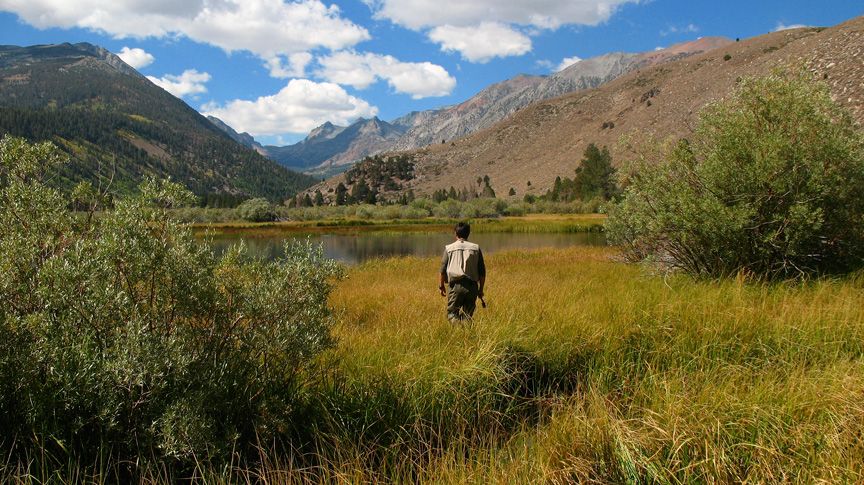
Beaver Ponds.

------------------------------------------------------------------------------------------------------------
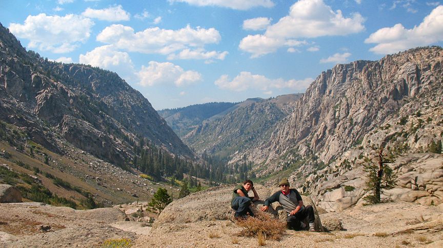
Sonora Pass Area.

-------------------------------------------------------------------------------------------------------------
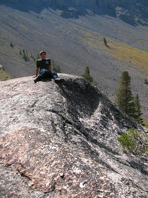
Yawn.

|
|
|
Skipjack Joe
Elite Nomad
     
Posts: 8088
Registered: 7-12-2004
Location: Bahia Asuncion
Member Is Offline
|
|
The beaver pond image is interesting in that it relates back to glaciers. As far as I can tell these ponds have all been created on the beds of long
gone glaciers. There are moraines on each side of this marsh. The east sierras had a number of glaciers that flowed towards nevada and virtually all
of them eventually evolved into beaver ponds. Perhaps Yosemite Valley had a similar history before Native Americans arrived, although the Merced has
considerably more water than these creeks.
|
|
|
Mexitron
Ultra Nomad
    
Posts: 3397
Registered: 9-21-2003
Location: Fort Worth, Texas
Member Is Offline
Mood: Happy!
|
|
Very cool. Can't wait to explore the area!
|
|
|
DianaT
Select Nomad
      
Posts: 10020
Registered: 12-17-2004
Member Is Offline
|
|
Nothing like the high country. Beautiful pix ---- favorite is the first one and then again, I also love the second one. 
|
|
|
Skipjack Joe
Elite Nomad
     
Posts: 8088
Registered: 7-12-2004
Location: Bahia Asuncion
Member Is Offline
|
|
Diane and Mexitron,
My intent was drive to Tuolumne Meadows and over Tioga Pass but the fires stopped us and we had to come over the other way. It's the granite in the
Yosemite's high country that makes all the other high sierra passes a bit less spectacular. The other areas have it as well but Yosemite just has more
of it. You probably all know this already.
It's a challenge to convey the space in a image like that. It was blowing real hard up there and I just didn't feel like putting in the time.
The colors at the beaver ponds just strike you the first time you see them. They are so rich it's unbelievable. It's like seeing Zabriskie Pt. These
ponds are at Green Creek, near Bodie. We caught small browns and brook trout that here. The alders were just starting to turn gold and many trees were
green with splashes of yellow here and there. It should be really good in 2 weeks.
|
|
|
Bwana_John
Nomad
 
Posts: 294
Registered: 10-17-2007
Member Is Offline
|
|
| Quote: |
The beaver pond image is interesting in that it relates back to glaciers. As far as I can tell these ponds have all been created on the beds of long
gone glaciers.
|
The ponds (paternoster or beaded lakes) are caused by recessional moraines
| Quote: |
There are moraines on each side of this marsh.
|
Lateral moraines.
| Quote: |
virtually all of them eventually evolved into beaver ponds.
|
And then they fill all the way up with sediment and become meadows
| Quote: |
Perhaps Yosemite Valley had a similar history
|
Most of the big meadows in the lower half of the valley are formed by sediment being depositing behind recessional moraines.
|
|
|
mulegemichael
Super Nomad
   
Posts: 2310
Registered: 12-24-2007
Location: sequim,wa. and mulege
Member Is Offline
Mood: up on step
|
|
ahhh, beaver ponds; ya gotta love em....we fished a string of them last week in montana and i got my first "slam"..brookies, browns, cutthroat,
rainbow, and cutbow!!...fun time!!
dyslexia is never having to say you\'re yrros.
|
|
|
DianaT
Select Nomad
      
Posts: 10020
Registered: 12-17-2004
Member Is Offline
|
|
I think I agree with you about Tioga Pass as the most dramatic. Then again all the high passes are beautiful in different ways. Yesterday, the
views from Monitor pass were amazing, except for the smoke. Ah heck, what is not beautiful in the High Sierra.
We still have two glaciers above Big Pine --- small, but still there. And as you said, in the high country the trees are turning. And while it is
hot around here during the day, there are signs of fall everywhere --- the Rabbit Brush is blooming, the grasses are changing color, it is chillier
in the mornings, etc.
I think that first picture is one for the printers.
|
|
|
BajaRat
Super Nomad
   
Posts: 1304
Registered: 3-2-2010
Location: SW Four Corners / Bahia Asuncion BCS
Member Is Offline
Mood: Ready for some salt water with my Tecate
|
|
I miss that country and hope to show the kids some day soon. thanks for the pics Joe. Have fun for us Diana. 
|
|
|
chuckie
Elite Nomad
     
Posts: 6082
Registered: 2-20-2012
Location: Kansas Prairies
Member Is Offline
Mood: Weary
|
|
Had a cabin at Mi Wuk for years, hunted and fished and climbed all over that country beautiful.........
|
|
|
Skipjack Joe
Elite Nomad
     
Posts: 8088
Registered: 7-12-2004
Location: Bahia Asuncion
Member Is Offline
|
|
| Quote: | Originally posted by Bwana_John
| Quote: |
Perhaps Yosemite Valley had a similar history
|
Most of the big meadows in the lower half of the valley are formed by sediment being depositing behind recessional moraines.
|
Oh good. Someone knowledgeable about this.
Perhaps you can tell me where these moraines are. The moraines in the eastern sierras are clearly visible but I don't seem then in Yosemite. Perhaps
they are hidden by the overgrowth. I suspect that you mean that that moraine is like a plug of dirt that was at the terminus of the glacier. Perhaps
that road we drive down from the south end of Yosemite actually descends over that moraine. Never gave it much though except for the pools with trout.
|
|
|
Bwana_John
Nomad
 
Posts: 294
Registered: 10-17-2007
Member Is Offline
|
|
| Quote: |
The moraines in the eastern sierras are clearly visible but I don't seem then in Yosemite
|
Because of the rain shadow caused by the Sierra Nevada the east side has much less vegetation than the wetter west side. The abundance of plants on
the west side tends to hide glacial features under vegetation.
The sierra block is also tilted to the west, making the east sides drainage's much shorter and steeper which tends to amplify alpine glacial
topography.
Moraines and glacial till are material that is deposited by moving ice, and are unsorted, unstratified deposits. (boulders, cobbles, pebbles, sand,
everything that the glacier quarried dumped by the ice with no sorting)
Moraines are defined by their relationship to the glacier; lateral moraines are deposited at the sides of the glacier where the ice moves the slowest,
terminal moraines are deposited at the farthest the glacier advanced, recessional moraines are formed by periods of climatic stability as the glacier
retreats. Medial moraines are formed in the middle of the valley where two glaciers and their two corresponding lateral moraines merge.
Terminal moraines and recessional moraines tend to form "dams" as the material is deposited across the valley at the snout of the glacier as it
retreats. (If the glacier advances, these moraines are destroyed as the glacier advances over it)
These "dams" over time form lakes, these lakes over time fill up with sediment and become meadows.
One of the easiest of these meadows in Yosemite Valley to see is the El Cap meadow, here is a paper describing how the moraine was restored in the
90's after being intentionally breached in the late 1800's
Restoration of El Capitan Moraine
Here is a very good paper on Sierra Glaciation which should answer most of your questions in more depth.
USGS GLACIATION OF THE SIERRA NEVADA
USGS POSTGLACIAL HISTORY OF THE YOSEMITE VALLEY
[Edited on 9-17-2013 by Bwana_John]
|
|
|
DianaT
Select Nomad
      
Posts: 10020
Registered: 12-17-2004
Member Is Offline
|
|
| Quote: | Originally posted by Bwana_John
| Quote: |
The moraines in the eastern sierras are clearly visible but I don't seem then in Yosemite
|
Because of the rain shadow caused by the Sierra Nevada the east side has much less vegetation than the wetter west side. The abundance of plants on
the west side tends to hide glacial features under vegetation.
The sierra block is also tilted to the west, making the east sides drainage's much shorter and steeper which tends to amplify alpine glacial
topography.
Moraines and glacial till are material that is deposited by moving ice, and are unsorted, unstratified deposits. (boulders, cobbles, pebbles, sand,
everything that the glacier quarried dumped by the ice with no sorting)
Moraines are defined by their relationship to the glacier; lateral moraines are deposited at the sides of the glacier where the ice moves the slowest,
terminal moraines are deposited at the farthest the glacier advanced, recessional moraines are formed by periods of climatic stability as the glacier
retreats. Medial moraines are formed in the middle of the valley where two glaciers and their two corresponding lateral moraines merge.
Terminal moraines and recessional moraines tend to form "dams" as the material is deposited across the valley at the snout of the glacier as it
retreats. (If the glacier advances, these moraines are destroyed as the glacier advances over it)
These "dams" over time form lakes, these lakes over time fill up with sediment and become meadows.
One of the easiest of these meadows in Yosemite Valley to see is the El Cap meadow, here is a paper describing how the moraine was restored in the
90's after being intentionally breached in the late 1800's
Restoration of El Capitan Moraine
Here is a very good paper on Sierra Glaciation which should answer most of your questions in more depth.
USGS GLACIATION OF THE SIERRA NEVADA
USGS POSTGLACIAL HISTORY OF THE YOSEMITE VALLEY
[Edited on 9-17-2013 by Bwana_John] |
Thanks for the geology lesson and the links! Very much appreciated.
|
|
|
durrelllrobert
Elite Nomad
     
Posts: 7393
Registered: 11-22-2007
Location: Punta Banda BC
Member Is Offline
Mood: thriving in Baja
|
|
Very educational thread. Thanks!
Bob Durrell
|
|
|

