| Pages:
1
2 |
David K
Honored Nomad

Posts: 65509
Registered: 8-30-2002
Location: San Diego County
Member Is Offline
Mood: Have Baja Fever
|
|
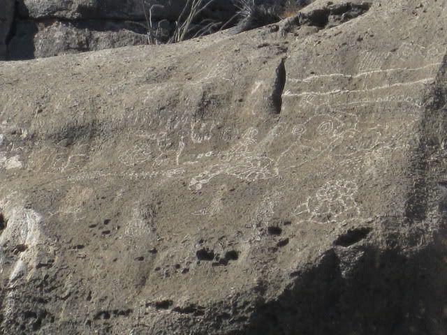
LAS PINTAS PETRO & FOSSIL GROTTO (a look back)
I got a request for ideas on what would be an interesting site to bring a family with archaeology possibilities. Going to where the native Indians
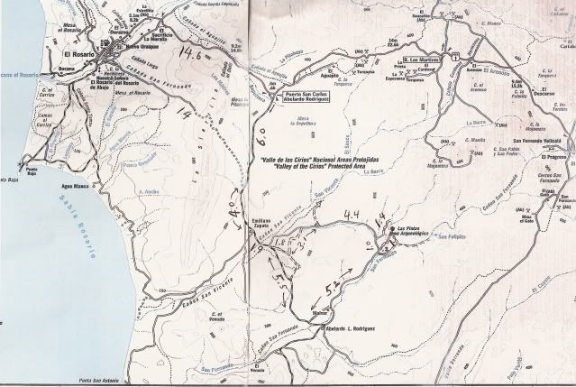
lived or played would be ideal if you wanted to look for arrowheads, pottery, chips and pieces. Las Pintas, southeast of El Rosario and off the graded
Punta San Carlos road (Km. 80-81) is such a place.
Saturday, 9-18-10:
We slept well at Baja Cactus Motel in El Rosario and were in no rush, so we casually got motivated and went 2 miles down the highway to Baja's Best
(Bed and Breakfast) Restaurant... across the highway from the Turista Motel on the far edge of El Rosario. Elizabeth had hot cakes and eggs and I had
their chorizo and eggs breakfast burritos... delicious!
With so many interesting sites around El Rosario, we had not decided exactly which ones to visit until then. We decided on Las Pintas, but this time
to try the northern road in and see more of the top of the boulder field. We have been to Las Pintas several times before, and it never ceases to
amaze us. See http://vivabaja.com/pintas for our day there in 2005 and http://vivabaja.com/406 when my son and I spent some time there in 2006 (on pages 5-7).
The access to Las Pintas is off the road to Punta San Carlos, a tiny fishing village and nearby wind-surfing resort, about 36 miles from Highway 1 http://www.solosports.net . The turnoff is between Km. 80 & 81 (just over 14 miles from El Rosario's Pemex station). There are two turn offs,
the first one is signed for 'Puerto San Carlos' and the second one is just ahead at the second curve in the highway. Set your trip odometer to zero
when you leave the pavement.
Just over 3 miles from the highway on the graded road, my low air tire warning light came on! For the second time, a pointy rock punctured one of the
truck's tires (BFG Rugged Trail, with 16,000 miles on it). I was able to plug the leak and refilled the tire with my electric air pump. The same thing
happened at 13,000 miles while southbound from Gonzaga Bay, near Laguna Chapala (on a different tire). We were in no rush, so we turned back to have
the tire patched in El Rosario at Raul's Tires ($5.00). No more flats on this trip... note to self: Get new rubber for the truck!
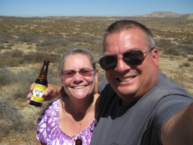
Take Two, back on the road to Punta San Carlos! Six miles from Highway One we pull over for a beer break where the old road from El Rosario meets the
new, graded road to San Carlos... Life is good!
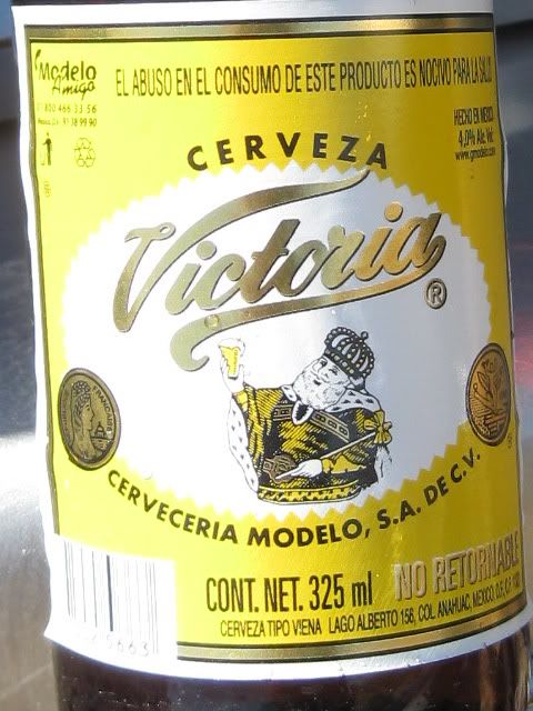
Victoria is a really good tasting beer that isn't as common as our other favorites (XX, Pacifico, Sol, Modelo, Tecate).
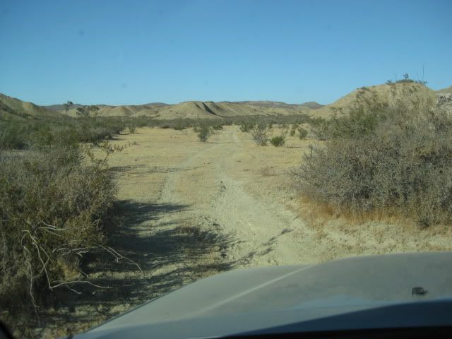
We noted the mileage at Rancho Emiliano Zapata as 10.0, and knew the northern road to Las Pintas was not far past the ranch, and took the first road
we saw, 1.9 miles ahead. 1.8 miles on this side road is another road to the left (which was correct), but seemed to me to be going too far north so I
elected to continue ahead. The road ahead returned to the San Carlos road. No matter, we will just continue south to the normal Las Pintas access
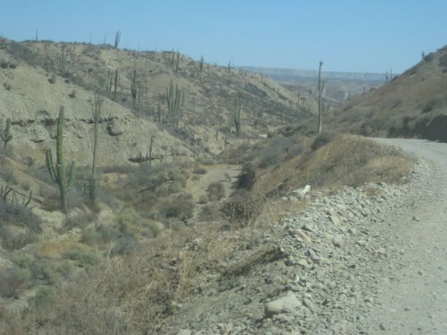
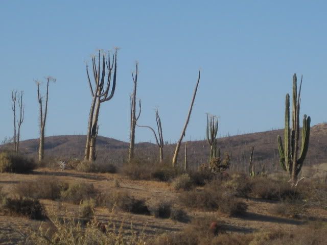
road, and return via the less used northern road! Just before the Las Pintas road, the San Carlos road enters a cardonal (a cardon cactus forest, the
cardon is the world's largest cactus).
The Las Pintas road is 17.4 miles from Highway 1, and if you miss the first one, another is just ahead. Go too far and a ranch is passed, then you
will cross the big Arroyo San Fernando (a usually dry riverbed).
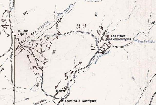
Once on the Las Pintas road, reset your odometer for the 7.2 mile drive in... Here is my road log to Las Pintas:
DIRECTIONS
Highway 1, southward from El Rosario 14.6 miles (between Km. 80-81), turn right at the left curve. GPS: 30°01.59', 115°32.05' (Map datum set to 'NAD27
Mexico')
Go 17.4 miles on the good graded dirt road to a single track road going left. If passed, just ahead is a ranch house on the right and there is a
second left road that joins the first. Set odometer to '0.0'. GPS: 29°49.64', 115°28.42'.
Pass ranch houses ('Malvar') and make an 'S' turn right, into Arroyo San Fernando. You soon will be reach a (possibly) closed gate at Mile 3.5. Always
re-close any gate after you pass through.
Mile 5.2, (GPS: 29°52.53', 115°25.22') turn LEFT off of Arroyo San Fernando road, and follow a small side arroyo. Brush may scratch your vehicle in
here.
Mile 5.4, (GPS: 29°52.69', 115°25.26') turn RIGHT, out of small arroyo and cross low divide to small valley.
Mile 7.2 LAS PINTAS parking area. GPS: 29°53.90', 115°24.48', elev. 755'. You are 24.6 miles from Highway 1 and 39.2 miles from El Rosario's Baja
Cactus Motel and Pemex gas station, per my odometer.
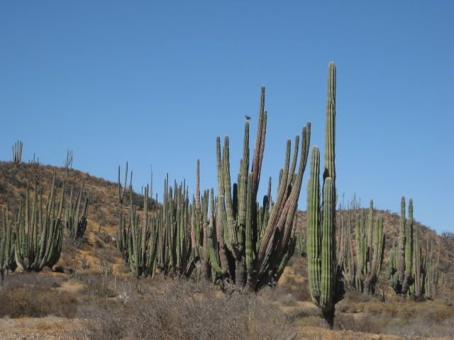
Cardon cactus along the Las Pintas road.
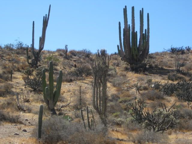
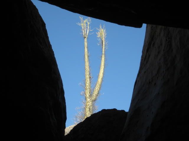
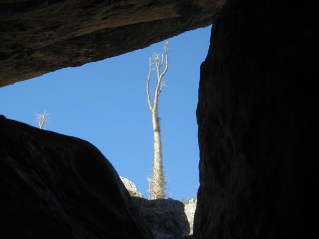
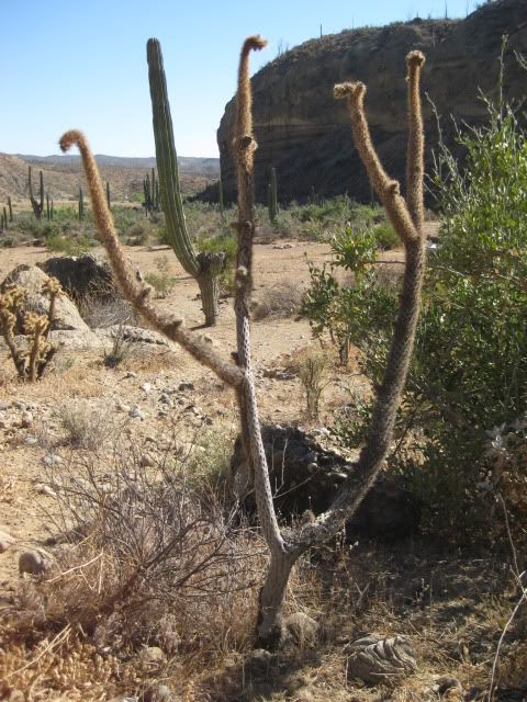
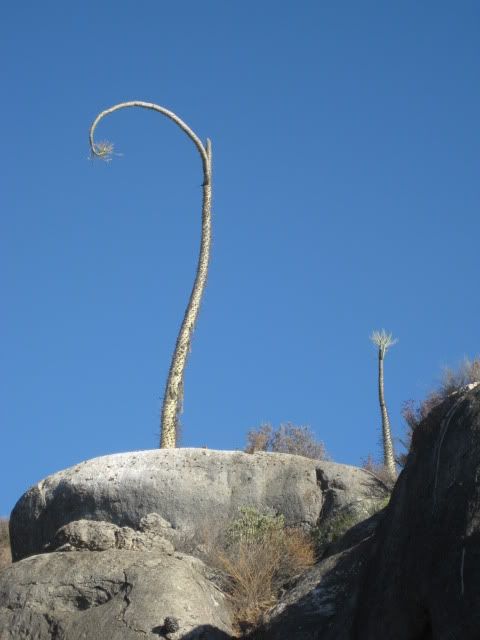
An unusual multi-branched boojum tree.
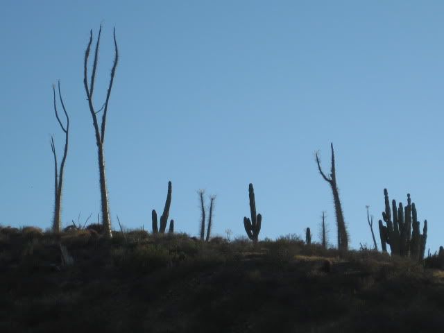
The road drops into the San Fernando riverbed before reaching the side canyon for Las Pintas.
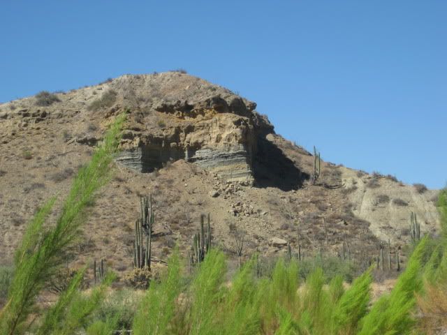
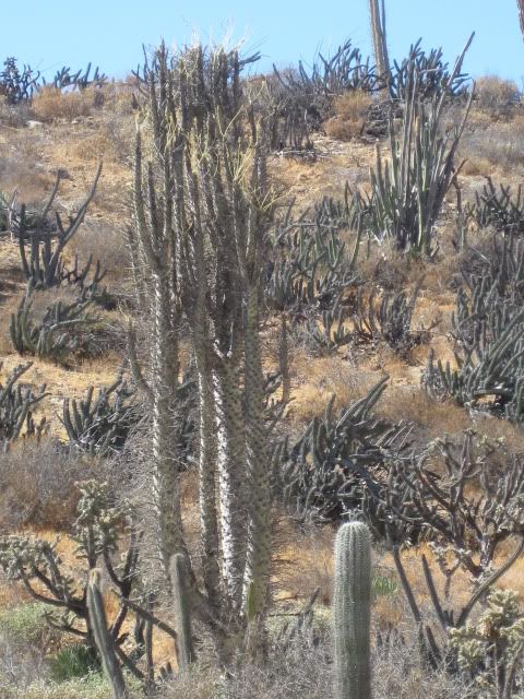
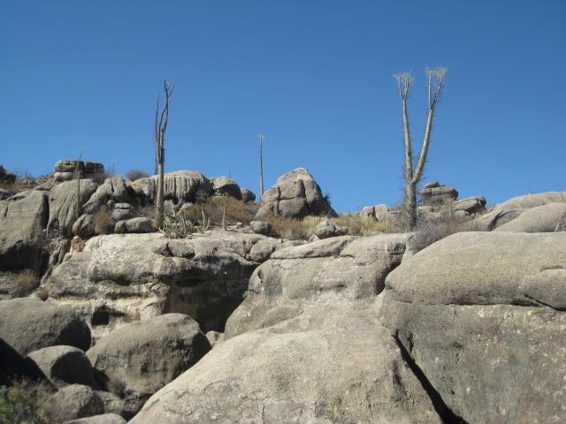
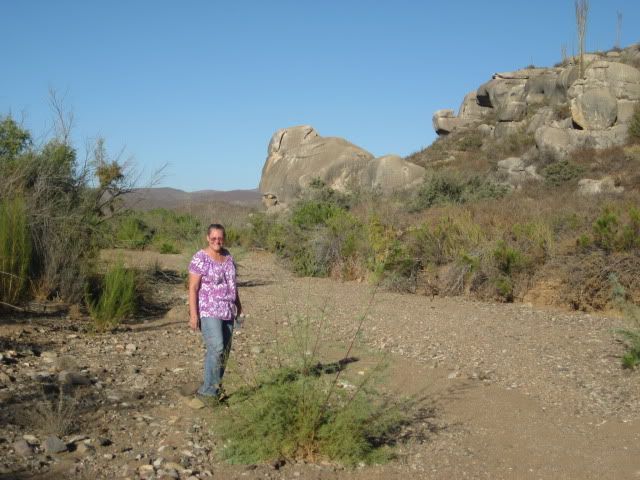
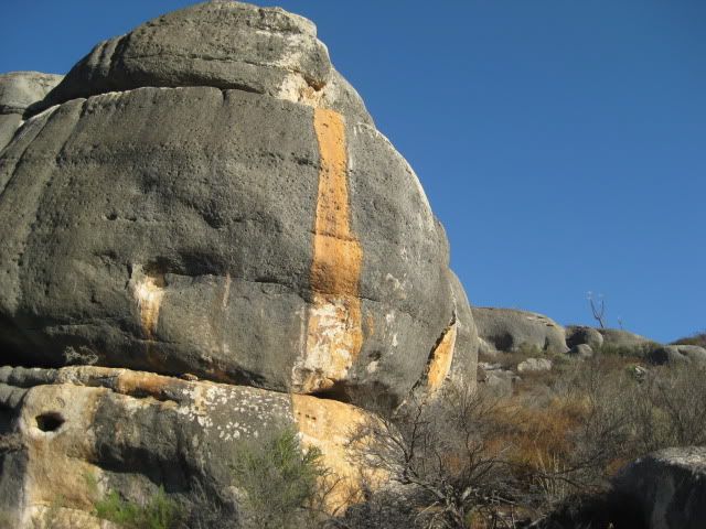
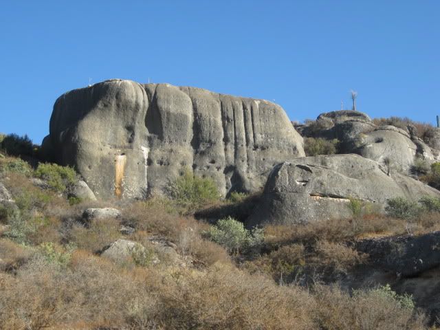
Nearing Las Pintas.
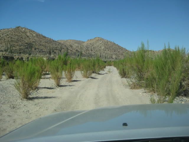
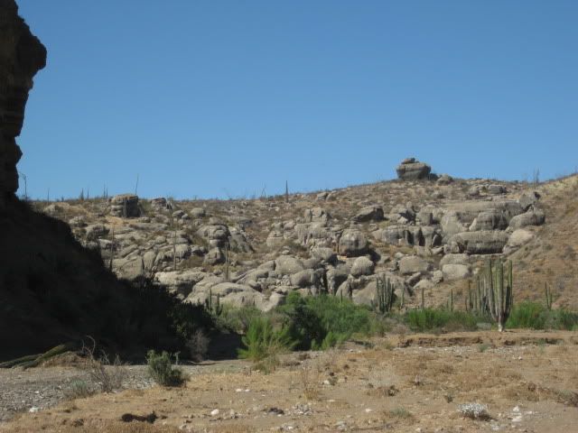
As close as we can drive. The storm of last January really changed the terrain here, as the sand was washed away and made getting to the rock art a
bit more of a climb.
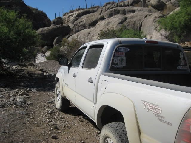
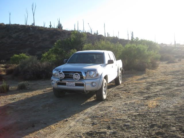
I can't say enough good things about my truck! It is my third Tacoma, and comfort and off road ability is supreme. Only the tires could be better!
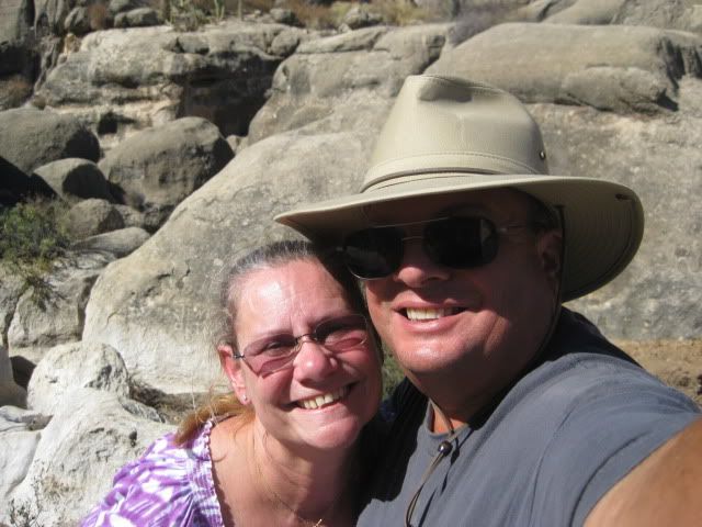
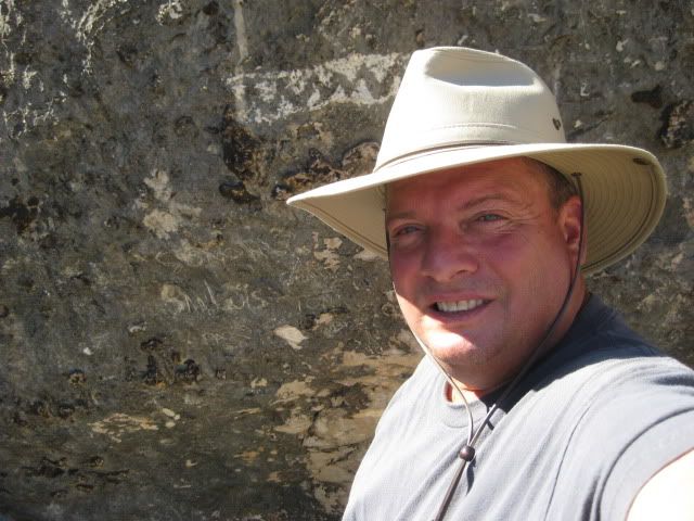
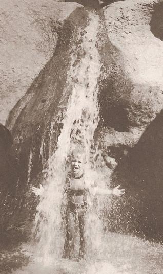
Here we celebrated my birthday, exploring Baja!
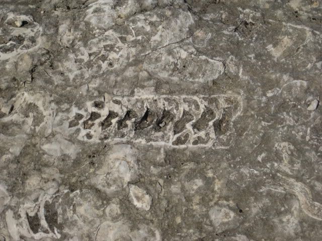
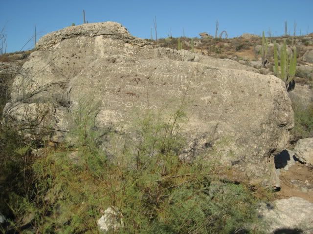
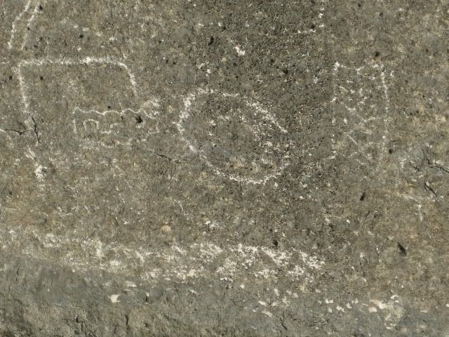
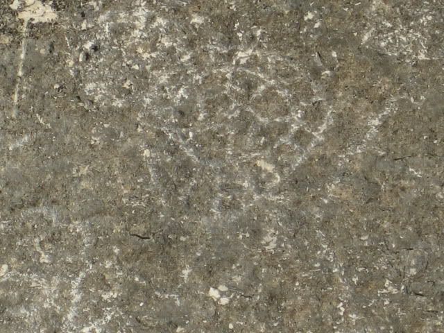
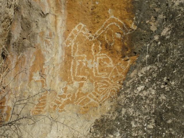
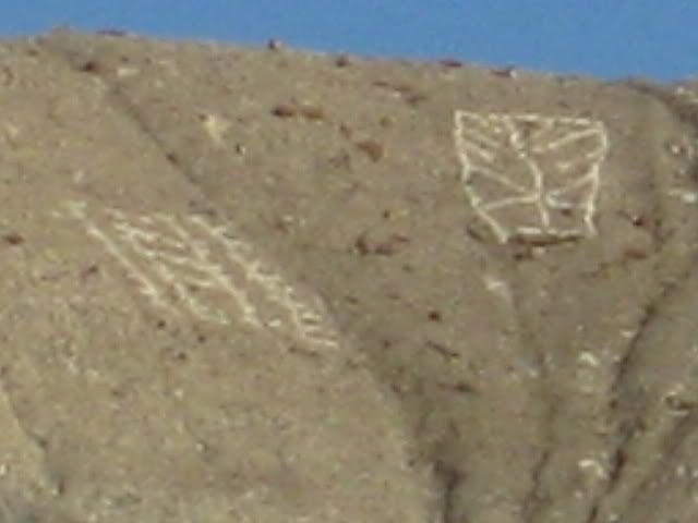
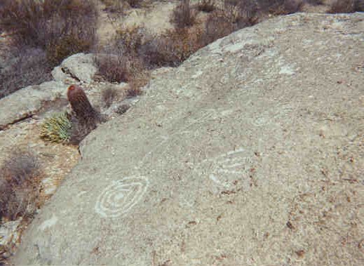
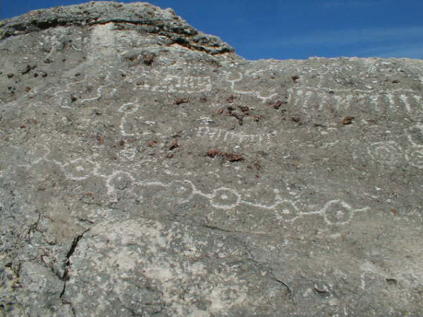
Okay, we have arrived at Las Pintas and we make a lunch, have some cold beer, and explore around the lower end of the rock art and fossil site. In the
next part, see more of the lower Las Pintas site and then we travel around to the top end of Las Pintas and see fantastic rock art that we have not
seen before!
-----------------------------------------------------------------------------------------
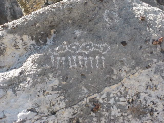
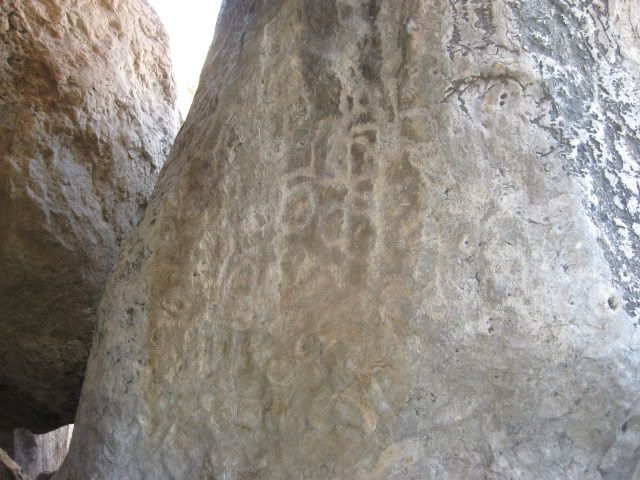
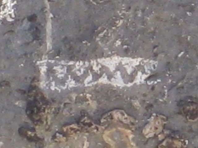
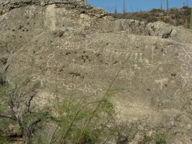
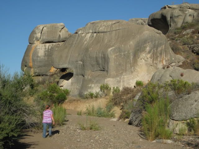
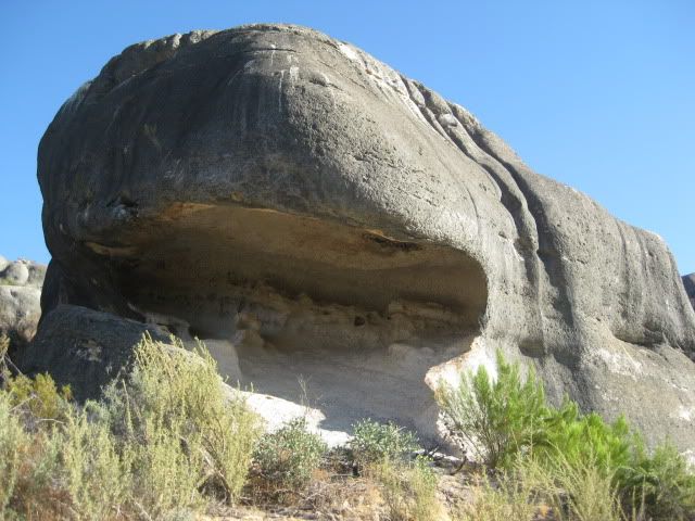
After a quick look, and another beer, I find a way to the big room... a cave created by a giant boulder resting on others. Inside are petroglyphs, as
well.
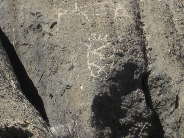
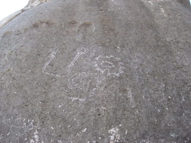
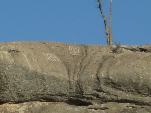
One more of the outside glyphs.
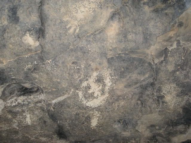
Inside the big room, on the ceiling...
From the big room are these boojum tree views...
Back outside...
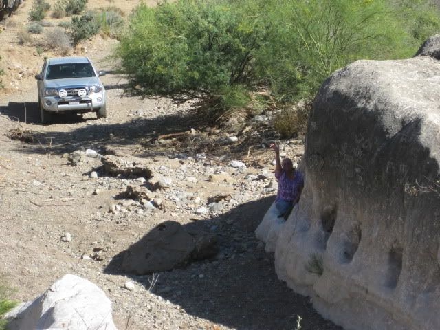
See Baja Angel waving?
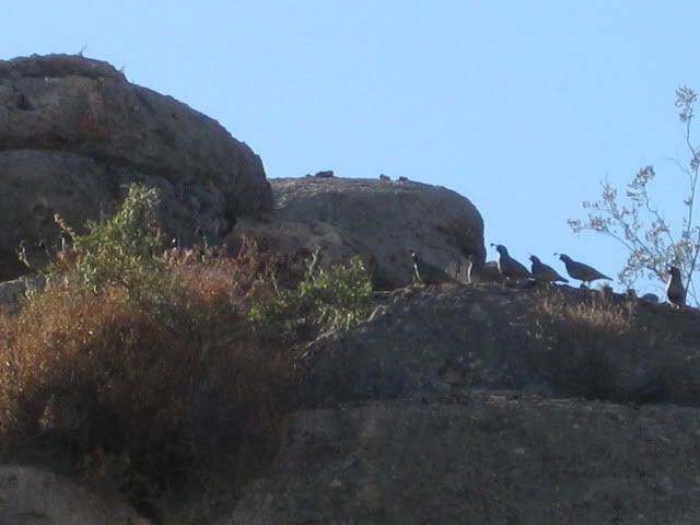
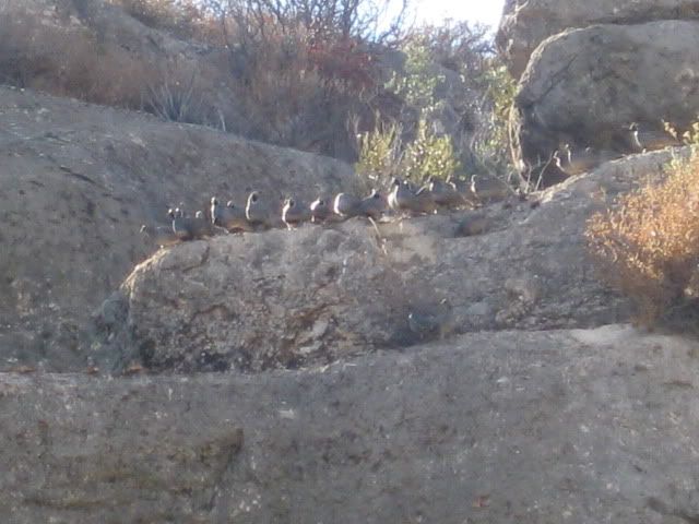
The quail (cordonices) come out to check on us.
Okay, time to go on new (to us) roads! Back out the 1.8 miles to the side arroyo, then 1.0 mile north to the upper Las Pintas road, and 1.4 miles to
the end of the road...
-----------------------------------------------------------------------------------------
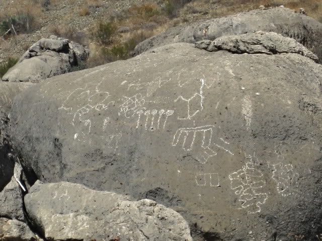
Now a 2WD might get to the lower Las Pintas site, but a good 4WD is a must for the top. There is a short section driving up a mud hill ridge top where
traction assistance will make it easy.
Near the end of where we could drive without getting too scratched up, we parked and began to explore... The road to the top is very faint.
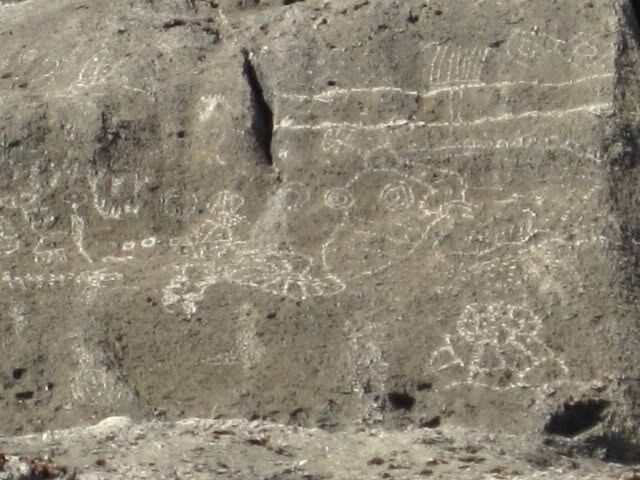
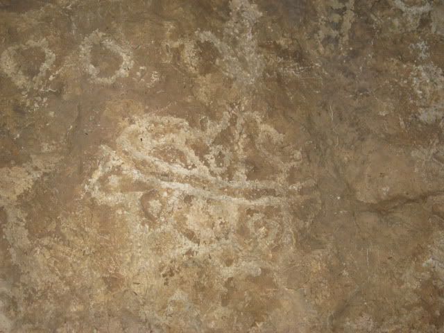
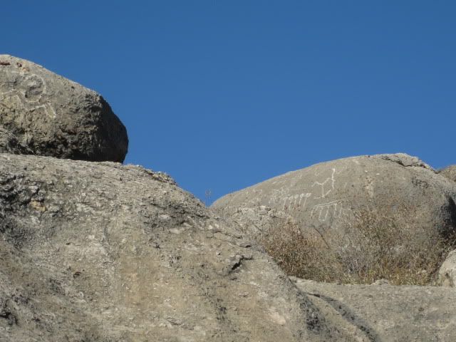
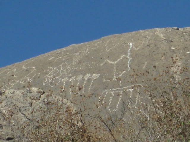
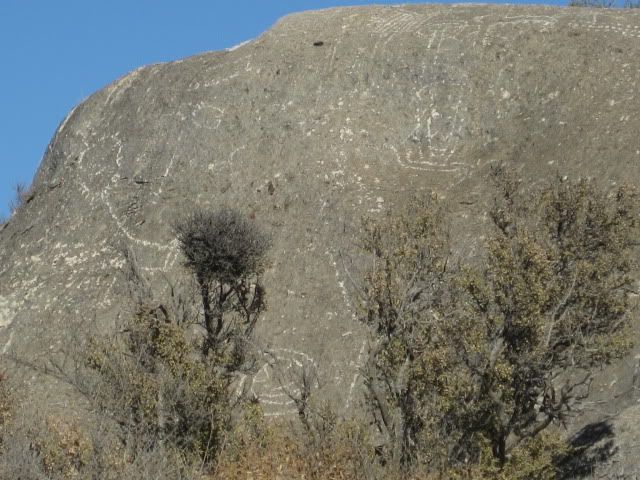
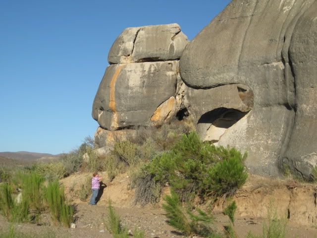
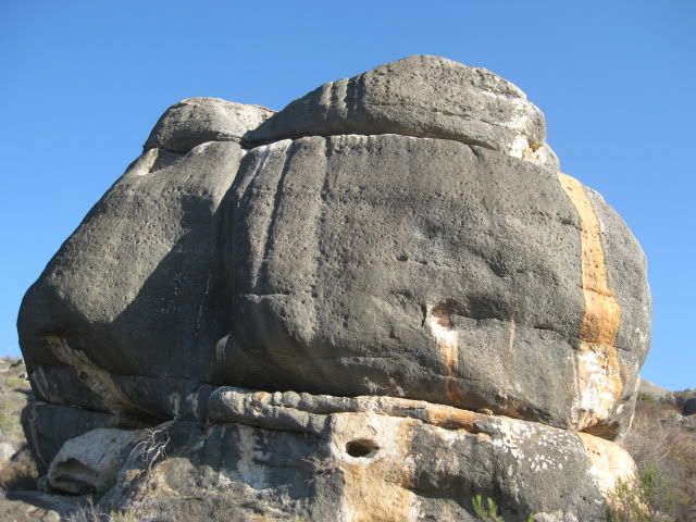
The closest petroglyphs were on this large boulder, which we have been to before, walking up here from the bottom of Las Pintas back in 2005.
Close up...
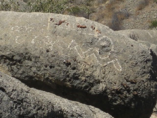
From here we walked east along the base of the boulders. The site reminded us of Montevideo (off the Mision San Borja road).
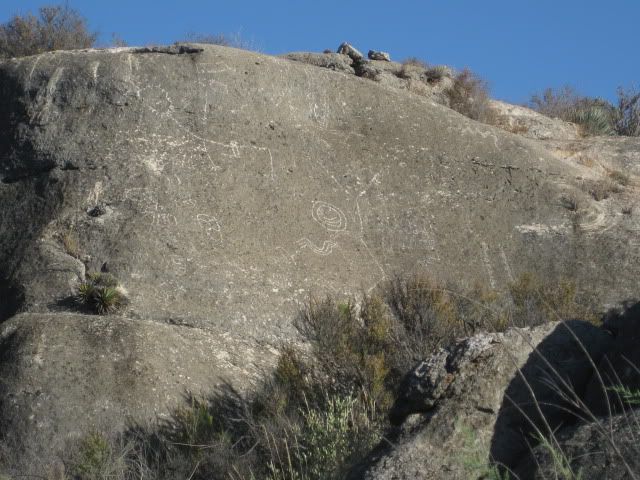
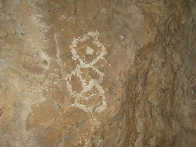
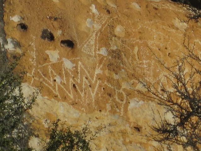
What was this one trying to say... Trix are for kids?...
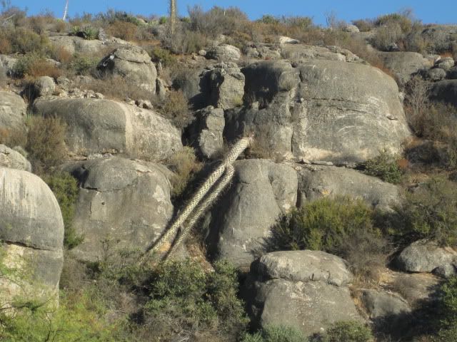
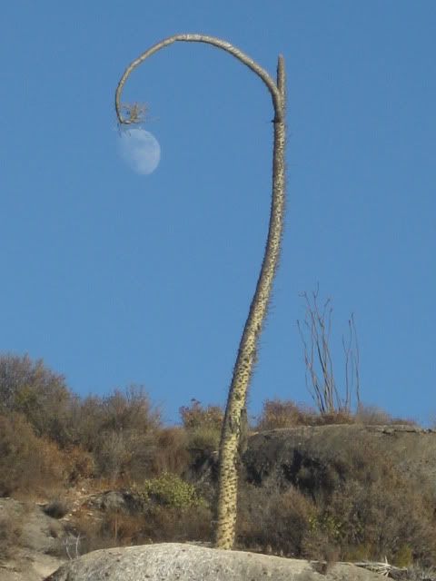
Lampost boojum tree!
Quite an overhang... below the large nose!
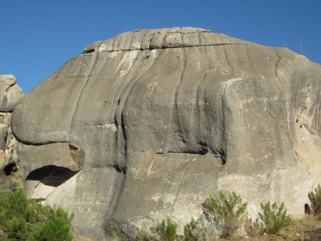
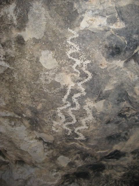
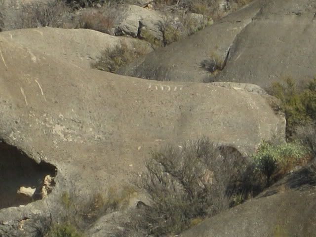
There are petros all over this and other boulders up here...
-------------------------------------------------------------
Big rock country...
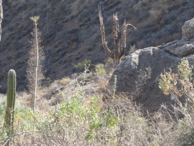
A toppled tall boojum... perhaps from the big January storm?...
It was getting late, and the street lamps were coming on...
This was pretty cool!
Back at our truck.
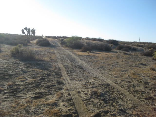
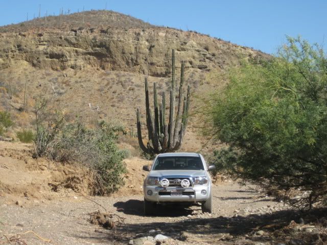
Here's the road home.
The boojum trees and cardons wave goodbye!
Back at our room at Baja Cactus Motel, El Rosario... a surprise!
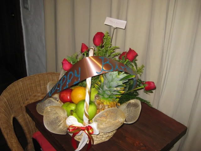
Antonio ('Baja Cactus') is awesome! Thanks amigo!!
The rooms at Baja Cactus are amazing! Comfortable king size beds with custom pillow-top mattress, telephone, 24 hour desk clerk, free bottled water
and coffee maker... for under $39! Massage service in your room is available... Baja Angel and I both had one when we stayed here on our anniversary,
last July!
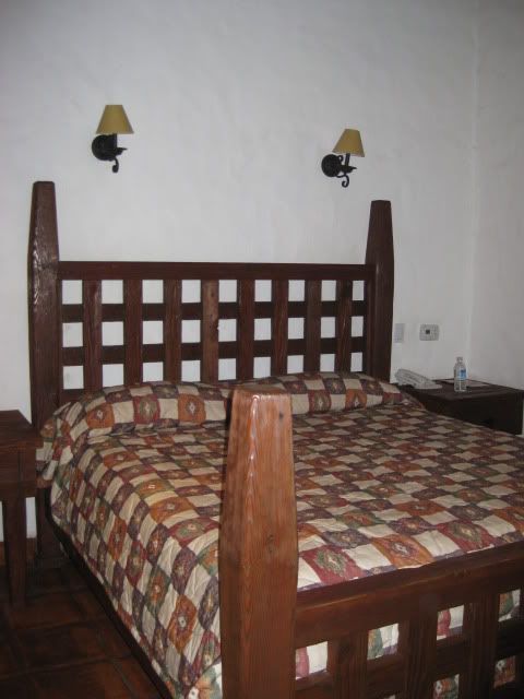
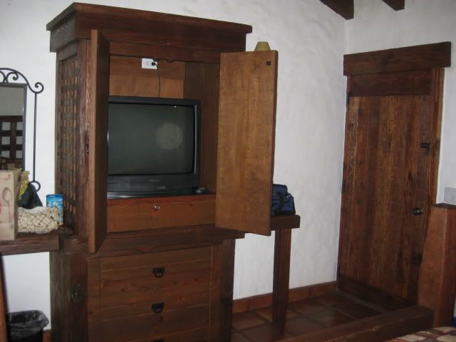
10 Satellite TV channals (1/2 in English)
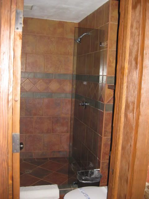
Giant showers with room for two or more! LOL (water pressure is boosted at the motel for good showers)
We topped our gas tank at El Rosario for the 315 mile trip home (via Tecate).
The trip down we left San Marcos with a full tank and it was 283 miles to El Rosario (229 miles from the border at Otay)... I topped the tank with 56
liters (14.8 gallons) giving me 19.1 MPG.
A day of four wheeling and highway driving on Saturday totaled 122 miles and used 26.2 liters (6.9 gallons) giving 17.7 MPG!
The price of gas at El Rosario was 8.21 peso per liter and it was 12 pesos per dollar, making gas about $2.62/ gallon. Premium was 9.59/ liter. The
cheaper gas back home was $2.899/ gallon (ARCO).
The 314 mile drive home via Tecate we got 18.0 MPG.
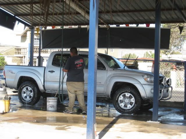
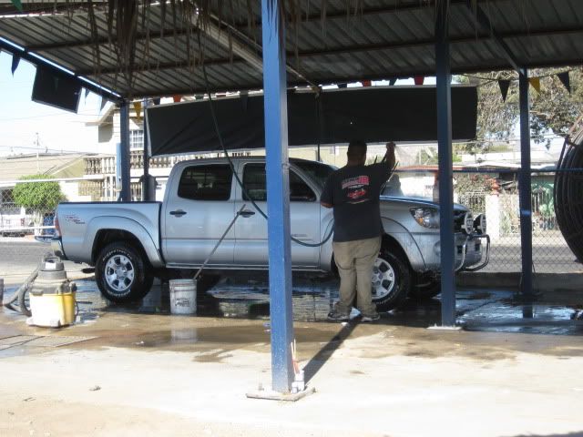
In Ensenada, we got the truck washed (border agents can get fussy if you have too much dirt on your vehicle!)... was 60 pesos ($5).
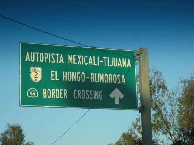
We took the free road north for Ensenada, and as before, it was in great shape and very little traffic. At Popotla, we hopped onto the Corredor 2000
for 18 miles to the free Tecate highway (Mex. 2) which is 4 lanes wide all the way... only a couple of traffic lights until Tecate, as well. Popotla
to the Tecate Border was 38 miles.
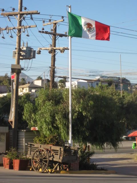
Mexican Independence day was Sept. 16, and many flags were flying, including this nice display at the Pemex station in El Florido.
The Toyota Tacoma Factory is passed along Highway 2... this is where my truck was made! 'Built in Baja for the Baja!'
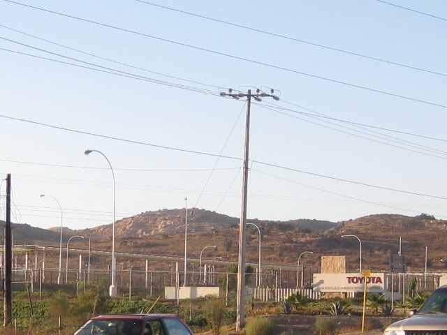
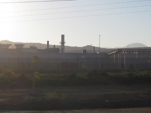
No place to pull over, so a bit blurred!
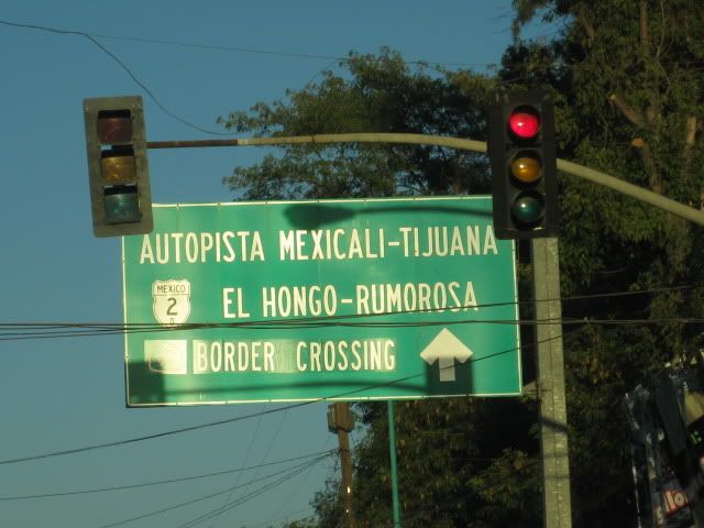
Here are some of the signs as you drive through Tecate showing you the way to the U.S. border:
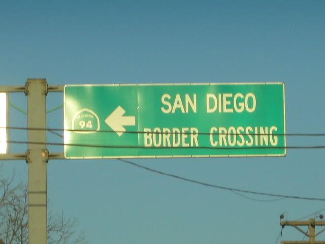
We were in line for 20 minutes, around 6:30 pm Sunday... easy!
So, if you want some adventure and luxury I recommend the sites around El Rosario, with a stay at the Baja Cactus Motel! Las Pintas is a petroglyph
paradise,and while I took many photos, it doesn't take the place of being there. There are many petros and fossils I did not show, that you will find!
I have been going to Las Pintas starting 10 years ago, and I am still seeing new things!
========================================================
Back in time... further:
In 2000, with Lorenzo de Baja:
http://www.vivabaja.com/davidlorenzo/dlpage2.html
----------------------------------------------------------------------------
In 2001, with the BBBB-1 and Viva Baja Van gang:
http://www.vivabaja.com/van1/page4.html

That's Amo Pescar!
-----------------------------------------------------------------------------
In 2005, with Baja Angel:
http://vivabaja.com/pintas/

-----------------------------------------------------------------------------
In 2006, with my son Chris:
http://vivabaja.com/406/page5.html
We still haven't seen the water flowing here, as shown in The Baja Adventure Book!
But, Chris waited for it...

-----------------------------------------------------------------------------
In 2007, with some of the Nomads attending the Baja-Rosario Cultural Festival:
http://vivabaja.com/707/


=======================================================
The following is on the last page of http://vivabaja.com/pintas
DIRECTIONS
Highway 1, southward from El Rosario 14.6 miles (between Km. 80-81), turn right at the left curve. GPS: 30°01.59', 115°32.05' (Map datum set to 'NAD27
Mexico')
Go 17.4 miles on the good graded dirt road to a single track road going left. If passed, just ahead is a ranch house on the right and there is a
second left road that joins the first. Set odometer to '0.0'. GPS: 29°49.64', 115°28.42'.
Pass ranch houses ('Malvar') and make an 'S' turn right, into Arroyo San Fernando. You soon will be reach a (possibly) closed gate at Mile 3.5. Always
re-close any gate after you pass through.
Mile 5.2, (GPS: 29°52.53', 115°25.22') turn LEFT off of Arroyo San Fernando road, and follow a small side arroyo. Brush may scratch your vehicle in
here.
Mile 5.4, (GPS: 29°52.69', 115°25.26') turn RIGHT, out of small arroyo and cross low divide to small valley.
Mile 7.2 LAS PINTAS parking area. GPS: 29°53.90', 115°24.48', elev. 755'. You are 24.6 miles from Highway 1 and 39.2 miles from El Rosario's Baja
Cactus Motel and Pemex gas station, per my odometer.
====================================================
These time guesses include photo stops... from El Rosario:
Hwy. 1 for 14.6 miles = 30 min.
San Carlos Road for 17.4 miles = 45 min.
Las Pintas road for 7.2 miles = 30 min.
|
|
|
mannings
Junior Nomad
Posts: 54
Registered: 5-22-2014
Location: St. George, UT / San Felipe
Member Is Offline
Mood: chill
|
|
GREAT stuff!
Will definitely check some of these out.
|
|
|
Kgryfon
Senior Nomad
Posts: 624
Registered: 1-27-2009
Location: East Bay, CA
Member Is Offline
|
|
Yes, great trip report! You and Baja Angel look very happy 
|
|
|
Geo_Skip
Nomad
Posts: 154
Registered: 5-15-2009
Location: Alta California and......../
Member Is Offline
|
|
Sweet. Loved the fossils and the shot with the quail lined up atop the rock! Thanks you!
|
|
|
David K
Honored Nomad
Posts: 65509
Registered: 8-30-2002
Location: San Diego County
Member Is Offline
Mood: Have Baja Fever
|
|
Las Pintas is one of those 'magic' places in Baja that one needs to go back to to see more!
I thank the late Walt Peterson and his 'The Baja Adventure Book' for showing this place in 1987! It has been a fun visit for me many times since I
first saw it in 2000.
|
|
|
wilderone
Ultra Nomad
Posts: 3903
Registered: 2-9-2004
Member Is Offline
|
|
What a thorough photo tour! The Lampost with moon photo is great!
|
|
|
JohnMcfrog
Nomad
Posts: 156
Registered: 8-1-2012
Location: San Diego, Punta Abreojos
Member Is Offline
|
|
Great motivational pictures! Can't believe that this site is so close to El Rosario. Thanks
|
|
|
David K
Honored Nomad
Posts: 65509
Registered: 8-30-2002
Location: San Diego County
Member Is Offline
Mood: Have Baja Fever
|
|
There are many more making El Rosario more than just an overnight stop!
|
|
|
satmike
Nomad
Posts: 115
Registered: 12-19-2006
Location: Salt Lake/ Punta San Carlos
Member Is Offline
|
|
I spend my winters at San Carlos and go to Los Pintas almost every year on my moto and it is amazing how fast the pictographs are deteriorating. It
seems they peeling off of a lower layer. Sill a great place with the little slot canyon.
Those seem to be pictographs as most of the other sites around seem to be petrogliths. There are lots of them around. We have gotten a private tour
with a local at Catavina of a lot of the pictograph's up there. I live in Utah the rest of the year so old Indian art is a big hobby of ours.
Another bonus this year while at Los Pintas at a wider spot in the canyon a big white owl flew over our heads
[Edited on 6-2-2014 by satmike]
|
|
|
brewer
Nomad
Posts: 419
Registered: 1-4-2011
Location: BCS
Member Is Offline
Mood: Grateful
|
|
Thanks for that. I need to get to that area with my kids. Those petroglyphs are worth looking for.
|
|
|
David K
Honored Nomad
Posts: 65509
Registered: 8-30-2002
Location: San Diego County
Member Is Offline
Mood: Have Baja Fever
|
|
Bump for BAJACAT!
|
|
|
bajabuddha
Banned
Posts: 4024
Registered: 4-12-2013
Location: Baja New Mexico
Member Is Offline
Mood: Always cranky unless medicated
|
|
David, absolutely magical piece!! Thank you for sharing things that some of us will never get the chance to see....
Having river guided for over 25 years on the Colorado Plateau I've looked at and studied hundreds, if not thousands of archaeological sites, working
with professionals in the field as well as geologists. It's a fascinating hobby, and still a very little-known science especially in Baja. Therefore
I urge all the readers to please, PLEASE remember when you find a 'treasure', it's not a SOUVENIER. If it ends up in your pocket, you are stealing
from your grandchildren's grandchildrens' experience. Also, put if you pick it up, put it back exactly where you find it; 'in situ' is critical to
future studies. Over the years I've seen hundreds of artifacts emerge from the soil, and then magically disappear over the course of months, weeks,
and sometimes days. I know it's tempting, but bad ju-ju.
Not trying to lecture here, just educate. Go, enjoy, take nothing but pictures, leave nothing but footprints. One drive through Catavina is enough
to tell the reason why.
Thanks again for the marvelous photos, i'm spending a lot of time perusing them over and over. I just love that 'dead indian' stuff (said lovingly).
bb
I don't have a BUCKET LIST, but I do have a F***- IT LIST a mile long!
86 - 45*
|
|
|
David K
Honored Nomad
Posts: 65509
Registered: 8-30-2002
Location: San Diego County
Member Is Offline
Mood: Have Baja Fever
|
|
Great advice! My camera does all the collecting. The same is true of the petrified forest of El Rosario (or anywhere)... please leave it so others can
have the same pleasure of finding it as you did.
|
|
|
desertcpl
Super Nomad
Posts: 2406
Registered: 10-26-2008
Location: yuma,az
Member Is Offline
|
|
very nice, thanks for sharing
|
|
|
Barry A.
Select Nomad
Posts: 10007
Registered: 11-30-2003
Location: Redding, Northern CA
Member Is Offline
Mood: optimistic
|
|
| Quote: | Originally posted by bajabuddha
David, absolutely magical piece!! Thank you for sharing things that some of us will never get the chance to see....
Having river guided for over 25 years on the Colorado Plateau I've looked at and studied hundreds, if not thousands of archaeological sites, working
with professionals in the field as well as geologists. It's a fascinating hobby, and still a very little-known science especially in Baja. Therefore
I urge all the readers to please, PLEASE remember when you find a 'treasure', it's not a SOUVENIER. If it ends up in your pocket, you are stealing
from your grandchildren's grandchildrens' experience. Also, put if you pick it up, put it back exactly where you find it; 'in situ' is critical to
future studies. Over the years I've seen hundreds of artifacts emerge from the soil, and then magically disappear over the course of months, weeks,
and sometimes days. I know it's tempting, but bad ju-ju.
Not trying to lecture here, just educate. Go, enjoy, take nothing but pictures, leave nothing but footprints. One drive through Catavina is enough
to tell the reason why.
Thanks again for the marvelous photos, i'm spending a lot of time perusing them over and over. I just love that 'dead indian' stuff (said lovingly).
bb |
Great stuff, as always, David!!!
Buddha------small world!! I ran rivers professionally for 4 summers in Dinosaur Natl. Monument (Utah/Colorado) during the years of l969 thru 1972 as
the Natl. Park Service's "River Ranger" there. Also prsonally the stretch from Green River, Ut to the confluence of the Green and Colorado in 1987
on a 10 day float-----4 of us in 2 canoes. Perhaps the best days of my life were spent on the rivers.
In the late '80's also ran the Rogue in OR many times, and all 3 forks of the American in CA many times, all professionally for BLM as a Ranger.
I echo what Buddha is saying about the artifacts of the Ancients.
Barry
|
|
|
wilderone
Ultra Nomad
Posts: 3903
Registered: 2-9-2004
Member Is Offline
|
|
buddah - Not to be argumentative, but two schools of thought re "PLEASE remember when you find a 'treasure', it's not a SOUVENIER. If it ends up in
your pocket, you are stealing from your grandchildren's grandchildrens' experience. Also, put if you pick it up, put it back exactly where you find
it."
I'm sure you've read Craig Childs Finders Keepers. Kinda hypocritical statement when you think of the millions of artifacts that archaeologists have
collected, sometimes a site totally scoured with nothing left, and put in a drawer in a basement never to see the light of day again, much less share
with the general public. Wouldn't it be nice for me if all the archaeologists "put it back exactly where [they] found it."
Craig Childs' books (see House of Rain as well) are the last word on the dilemma, i.e., no definitive right answer.
I worked a Native American site last year with 3 archaeologists. They collected about 10 bags of pot sherds, hammer stones, etc. for analysis those
sherds and artifacts will never be put back exactly where they found them. There were essentially 4 types of pottery found at the site. Why not just
a dozen sherds for analysis, or analysis in the field? Archaeologists have enough in storage right now to learn from for the next century.
|
|
|
David K
Honored Nomad
Posts: 65509
Registered: 8-30-2002
Location: San Diego County
Member Is Offline
Mood: Have Baja Fever
|
|
Just imagine that someday, hundreds of years from now, archaeologists will be digging up our broken dishes, Coke bottles, cell phones, and other trash
and be doing the same thing. One person's trash is another person's treasure!
|
|
|
Barry A.
Select Nomad
Posts: 10007
Registered: 11-30-2003
Location: Redding, Northern CA
Member Is Offline
Mood: optimistic
|
|
Excellent point, Wilderone. Just Excellent!!!!
Barry
|
|
|
BAJACAT
Ultra Nomad
Posts: 2902
Registered: 11-21-2005
Location: NATIONAL CITY, CA
Member Is Offline
|
|
Thank you my BAJA friend, I hope it's not so hot for the 4 of JULY weekend!!
another Baja place on my list..soon to be scratch off the list.
BAJA IS WHAT YOU WANTED TO BE, FUN,DANGEROUS,INCREDIBLE, REMOTE, EXOTIC..JUST GO AND HAVE FUN.....
|
|
|
David K
Honored Nomad
Posts: 65509
Registered: 8-30-2002
Location: San Diego County
Member Is Offline
Mood: Have Baja Fever
|
|
Have a fun time! A small chance I will be in El Rosario tomorrow night... Look for a helicopter.
|
|
|
| Pages:
1
2 |
|