DianaT
Select Nomad
      
Posts: 10020
Registered: 12-17-2004
Member Is Offline
|
|
The Dempster Highway almost to the Arctic Ocean
Since I could not embed this map, or any map for that matter, here is a link to one from Dawson City to Inuvik.
Dawson City to Inuvik
This was one of the highlights of our recent trip. It was a rather last minute decision to travel from Dawson City to Inuvik and experience the
Dempster and the Land of the Midnight Sun. In Inuik, the sun comes up in late May and does not set again until late July. Even in August, it never
really was dark ---just dusk
The Dempster is something to be experienced. One is warned about the limited services, about the shale used in areas for gravel that is murder on
tires, the unpredictable weather and wildlife on the road. Now that we know what to expect, there may be a next time and we will take a lot more time!
We were riding on our original factory tires which was a bit concerning, and our range is not great, so we were more concerned on our trip north than
we needed to be. The first gas is about 1/2 way.
Completed to Inuvik in 1979, this dirt gravel road is about 470 miles in length traveling over 200 miles above the Arctic circle and around 60 miles
from the Arctic Ocean --- there is an ice road during the winter that goes to the Arctic Ocean and they are working on an all season road. If we
return, we want it to be after the last of the road is built. It was quite an undertaking building this road, a lot of it on permafrost. BTW--- the
last few miles before Inuvik are paved and a good example of why a paved road on permafrost is not a good idea as it was like a rollercoaster.
There is just too much to cover as it goes through 10 separate eco systems, through mountains, crosses two major rivers, the Peel and the Mackenzie,
travels in and out of treeline, over areas of permafrost, etc. In Dawson City a travelogue is available that explains what one is seeing -- pingos,
tors, rock glaicers on and on. It is something that needs to be experienced to really understand. To use that oft overused word, it truly is AWESOME.
So while there will be too many pictures here with descriptions, I won't do a blow by blow report. I will leave it for you to discover and
experience.
The weather was quite warm and dry on the trip north, and cold, foggy and raining on the way south. It was like a different road. Some of the road
is narrow and slippery, and other parts are wide with good gravel. The people in the Northwest Territories will tell you that their roads are better
than the part in the Yukon. Only used 4WD once and that was in a construction area where the hard rain left it in a very sloppy condition.
These pictures are not in order of travel, but just a sample of what might be seen --- again, next time, we
will take A LOT more time. It was a real thrill for us to have been at the beginning of the mighty Mackenzie River earlier in the trip at the Great
Slave Lake, and then to see the Mackenzie Delta where it spreads out before ending the Arctic Ocean.
A MAJOR highlight for us was seeing this Musk Ox near the Arctic Circle. In Eagle Plains we were told where he was
hanging out and that it is unusual for them to be this far south. He just kept eating and wandering away. John got out of the car and discovered how
difficult it is to walk through the tundra. :-) One is heavily cropped. I left one lens at home that I REALLY regreted when we were with the
grizzlies in Haines.


We found it rather exciting to be headed toward the top of the world at the Arctic Circle and just admire the wide open
countryside. It is bit overwhelming.


Sign for reentering the Yukon on the trip south --- notice there is a good reason I am not out of the car taking this
picture. The Yukon is very special.

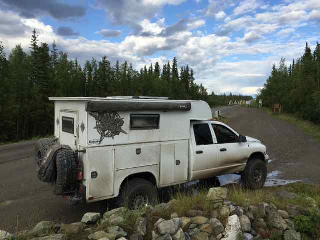
A few road pictures --- mostly of where it was wider as there is no where to pull off on the narrow parts. Truck was
rather clean on the way up; a very different story on the way down.


We found it interesting that rainbows seemed to not want to form except just spread out over the mountaina.

Eagle Plains --- the halfway mark which is the first chance to buy gas. There is a tire shop, a small lodge,
campground, restaruant, store, muddy car wash --- one of the those all in one stops.

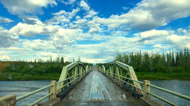
Crossing the Mackenzie where it joins with the Arctic Red River looking at the small community of Tsiigehtchic.
Besides connecting the Dempster, if there is someone waiting, the ferry picks up people from Tsiigehtchic. One thing that we found quite amazing was
that in both the east and the west side of the Northwest Territories, by the smallest villages, there was cell service and while slow, there was data
available. In Alberta and British Columbia we did not find that to be the case. I love crossing those rivers. And it is a reminder of these places
being isolated during the fall freeze up until the ice is solid and during the spring thaw before the ferries can run again.

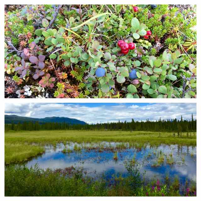
Misc. pictures of just a small part of the varied terrain --- Following the travel brochure, we learned that one can
tell where there is no permafrost by the type of trees growing. When one thinks they are well past the treeline, more forest appears, and there is
nothing barren about that tundra! There was no snow on the mountains on our way up, but weather changes quickly up there.


The "big" town of Inuvik with a population of about 3500 at the end of the road. It was built in the 1950s to replace
another service center in the far north that often flooded. It was to be a model town. It boomed in the 70s with the oil and gas exploration and
there is still a lot of that happening, but they are also trying to promote fly in conventions. When we there, there was a large army mobile outpost
being set up ad we never found out why.
It is a colorful town with quite a diverse population, and among the First Nation People, a lot of anti Canada sentiment especially with the battle of
the Peel River drainage. A few pictures follow ---
One of the many colorful houses and if you look closely, you will see that there is no foundation. Everything built on
permafrost is built on flexible pillars.

Because of the permafrost, there can be no underground water or sewer pipes, so they are all above ground in what they
call utildors. There are lots of different cofiguations and we wondered where the sewer pipes emptied. Well, later camped at the municipal
campground overlooking the delta, we discovered the settling pond down below. Will choose a different campground next time. :-)

The famous Igloo Catholic Church that was built in the 1950s by volunteers. It is about 75' in diameter and it took
about 2 years.

We were quite surprised to find this beautiful Mosque until we realized that this small town had several taxis and they
were all driven by Somalis. They were very friendly and invited us in which is one of those things we regret NOT doing.

Ready to complete the road to the Arctic

One town not too far south of Inuvik where we want to spend more time in the future is Fort MacPherson It is the home
of a famous tent and canvas manufacturing that we want to visit. The weather as not imporving and we needed to move on. It was time we learned tht
one can never be too prepared. WE stopped for gas and lunch. At this place, which is a combination little store, hotel, gas station and restaurant,
after a few gallons, the pump quit and even with the young lady calling the boss and insisting he come and fix things, that did not happen.
Fortunately, there was a local there who told us where to find another small store with a gas pump.

And fortunately the little store also sold some sandwiches because the restaurant was between owners and closed. And
we did not want to climb into the back of this!

They call that wet, gooy mud, gumbo --- and it stays wet and sticks! Later at Eagle Plains we were able to hose of the
back enough to be able to camp that night, and back in Dawson City, it took us 12 looneys to get most of it off at a very primitive muddy self car
wash.
The picture is just of a pretty little church and cemetery in Fort McPherson.

I did not intend to make this so long  ---
and it just scratches a tiny bit of our Dempster Experience. And there is so more we want to do. This magnificent part of the world is so worth
seeing, and the people are great! ---
and it just scratches a tiny bit of our Dempster Experience. And there is so more we want to do. This magnificent part of the world is so worth
seeing, and the people are great!

|
|
|
23S52N
Nomad
 
Posts: 135
Registered: 7-30-2015
Member Is Offline
|
|
Beautiful pics....things haven't changed much since i was stationed in Dawson with the RCMPolice in '77-'79....the Dempster went as far as Eagle
Plains where the Royal Canadian Engineers were installing a bailey bridge over the Eagle River. I left the Yukon, after five years of postings, in
1979 and have never been back....they say you can't and I agree....but the pics you have submitted make me happy that things haven't progressed that
much up there...and that is nothing but good....progress, imho is killing the planet. so happy you are enjoying the true last frontiers north of
60...
best regards,
Keith
|
|
|
DianaT
Select Nomad
      
Posts: 10020
Registered: 12-17-2004
Member Is Offline
|
|
Quote: Originally posted by 23S52N  | Beautiful pics....things haven't changed much since i was stationed in Dawson with the RCMPolice in '77-'79....the Dempster went as far as Eagle
Plains where the Royal Canadian Engineers were installing a bailey bridge over the Eagle River. I left the Yukon, after five years of postings, in
1979 and have never been back....they say you can't and I agree....but the pics you have submitted make me happy that things haven't progressed that
much up there...and that is nothing but good....progress, imho is killing the planet. so happy you are enjoying the true last frontiers north of
60...
best regards,
Keith |
Thanks. One thing you would not recognize at all is Whitehorse! We broke down there 16 years ago and had trouble finding a mechanic. It was still
relatively small.
Well today there is a Wal-Mart, the Golden Arches, a Canadian Superstore, Canadian Tire and a lot more!
The Dempster is still great.
|
|
|
BornFisher
Super Nomad
   
Posts: 2127
Registered: 1-11-2005
Location: K-38 Santa Martha/Encinitas
Member Is Offline
|
|
Thanks for posting this and thanks for the ride along.
You guys are serious road tripers!!!
"When you catch a fish, you open the door of happiness."
|
|
|
SFandH
Elite Nomad
     
Posts: 7431
Registered: 8-5-2011
Member Is Offline
|
|
Diana, any evidence of the permafrost melting? I know there is much talk about it and the problems it would cause.
Thanks for the photos, makes me want to go.
|
|
|
Skipjack Joe
Elite Nomad
     
Posts: 8088
Registered: 7-12-2004
Location: Bahia Asuncion
Member Is Offline
|
|
That does look like it has great potential for an adventure. I've thought about it in the past. Did you see the northern lights?
I'll bet you could eaten grayling all up and down that highway. Some of those roadside streams look as though they should be full of them.
Personally, I find the open country of places like that more exciting than heavily forested areas. Hope to visit it some day.
I'm surprised you didn't end up with a cracked windshield. They say that most travelers to Prudhoe Bay return with one.
|
|
|
DianaT
Select Nomad
      
Posts: 10020
Registered: 12-17-2004
Member Is Offline
|
|
Thanks --- we do love being on the road!
Quote: Originally posted by SFandH  | Diana, any evidence of the permafrost melting? I know there is much talk about it and the problems it would cause.
Thanks for the photos, makes me want to go. |
Yes, there have been some problems and structures have needed reinforcement. They also lost a big chunk of highway when it sunk, but it was next to
the sewage settling pond.
There is a lot of concern because the winters are NOT what they used to be and they worry about the future. If the permafrost melts, it will all
collapse --- read about the blue ice.
There is also concern about the continuing of the road and how it will hold up. Now along the highway there are ponds of melted permafrost but that
is because they were not very careful back when they built the road.
A part of the push to save the Peel Rive drainage is the increase in human activity. So yes, there is concern.
Quote: Originally posted by Skipjack Joe  | That does look like it has great potential for an adventure. I've thought about it in the past. Did you see the northern lights?
I'll bet you could eaten grayling all up and down that highway. Some of those roadside streams look as though they should be full of them.
Personally, I find the open country of places like that more exciting than heavily forested areas. Hope to visit it some day.
I'm surprised you didn't end up with a cracked windshield. They say that most travelers to Prudhoe Bay return with one. |
At times there were hints of red and blue in the sky, but it never got dark enough to see the Northern Lights --- I would love to go back in the
winter when they appear.
Most of the time in any part of the NW Territories, the drivers, including the truck drivers are really polite on those gravel roads. They pull way
over and slow down ---- passenger cars do the same thing. However, right as we turned onto the Dempster, there was one truck driver who did not slow
down, and pop--- there it went. Fortunately, even over hundreds of miles of dirt roads, the little nick did not grow so we were able to have it
plugged once we returned home.
Oh, we did see some motorcycle and bicycle riders and we really felt for them with all the wet weather we had and when it was dry, the dust was
horrendous on parts of the road.
|
|
|
captkw
Ultra Nomad
    
Posts: 3850
Registered: 10-19-2010
Location: el charro b.c.s.
Member Is Offline
Mood: new dog/missing the old 1
|
|
DianaT
Great post w the pics..did you do the "dawson follies"?? The last time I was in Whitehorse, I could hardy find a beer !! about 20 years ago...I Do
remember the Signs in front of the town..are they still there ?? and for you folks that don't know,, they named the town after the white caps on the
Yukon river in the area..you know your outback up there !!
|
|
|
tripledigitken
Ultra Nomad
    
Posts: 4848
Registered: 9-27-2006
Member Is Offline
|
|
Diane,
Thanks for posting this. I know what you mean by the overwhelming feeling you get at times looking at the expansive views. The road looked to be in
terrific shape in your pictures, was that typical?
Somali taxi drivers, that's a hoot!
Favorite shot is of the lake with the wild flowers in the foreground, nice.
|
|
|
DianaT
Select Nomad
      
Posts: 10020
Registered: 12-17-2004
Member Is Offline
|
|
Quote: Originally posted by tripledigitken  | Diane,
Thanks for posting this. I know what you mean by the overwhelming feeling you get at times looking at the expansive views. The road looked to be in
terrific shape in your pictures, was that typical?
Somali taxi drivers, that's a hoot!
Favorite shot is of the lake with the wild flowers in the foreground, nice. |
A lot of the road is really great ---- just very, very dusty where they could not find gravel. There are the more narrow parts, especially through
the mountains and of course, in some areas there is washboard and or pot holes. Overall, we thought it was a great road. Like all of these roads,
it depends on the graders. Oh, one quite deep water filled pot hole cost us an alignment. 
There are two places you cannot stop because it also serves as an emergency airstrip, and those places are quite wide and smooth. We were going to
stay longer in Inuvik, but the storm was not going away and the road was getting worse. Even with a lot of rain, it still was not bad, just slower,
except for where they were doing construction and it was sloppy and deep.
When we left Inuvik, we were told not to worry about getting stuck there because the construction workers would pull us out. But in McPherson we
heard that the workers were not there because of the fog! And it was VERY foggy which I did not enjoy. We did use 4WD to get through that short
construction area and we are still running on the original cheap factory times.
There is something special about that "gumbo" mud. We got very muddy on the Mackenzie Highway, but it was not difficult to get off. The "gumbo" mud
as not easy and since they use sodium chloride on parts of the road to help keep the dust down, the mud had to go. We were washing it off in the
pouring rain!
Wanted to add this picture of John as to me, it just represents the overwhelming vastness of the Dempster.

[Edited on 9-14-2015 by DianaT]
|
|
|
bufeo
Senior Nomad
  
Posts: 793
Registered: 11-16-2003
Location: Santa Fe New Mexico
Member Is Offline
|
|
Love that country. Thanks again for posting.
Allen R
|
|
|
Desertbull
Senior Nomad
  
Posts: 558
Registered: 8-27-2003
Member Is Offline
|
|
Beautiful! Somehow we missed you criss-crossing Alaska and The Yukon / NWT for 2.5 months ... trip of a lifetime for sure! We're going back to find
the stuff we don't know we missed!  
   
DREAM IT! PLAN IT! LIVE IT!
|
|
|
DianaT
Select Nomad
      
Posts: 10020
Registered: 12-17-2004
Member Is Offline
|
|
Desertbull, NICE pictures and I hope you share more!
So much to explore up there that one can return over and over.
Our paths may have crossed somewhere along the way!
Thanks
|
|
|
churro
Nomad
 
Posts: 195
Registered: 5-6-2013
Member Is Offline
|
|
Thanks for posting!!!!!!!!!!
|
|
|
DianaT
Select Nomad
      
Posts: 10020
Registered: 12-17-2004
Member Is Offline
|
|
Your welcome --- I just want to go back. But I think we are headed east very soon.
[Edited on 9-16-2015 by DianaT]
|
|
|
wessongroup
Platinum Nomad
       
Posts: 21152
Registered: 8-9-2009
Location: Mission Viejo
Member Is Offline
Mood: Suicide Hot line ... please hold
|
|
 
|
|
|
Mexitron
Ultra Nomad
    
Posts: 3397
Registered: 9-21-2003
Location: Fort Worth, Texas
Member Is Offline
Mood: Happy!
|
|
Alaska is on the bucket list for sure, thanks for the cool pics.
|
|
|
DianaT
Select Nomad
      
Posts: 10020
Registered: 12-17-2004
Member Is Offline
|
|
Thanks. It is a place to visit many times as there is so much to see and enjoy.
|
|
|

