| Pages:
1
2 |
Whale-ista
Super Nomad

Posts: 2011
Registered: 2-18-2013
Location: San Diego
Member Is Offline
Mood: Sunny with chance of whales
|
|
Could someone post Maps of these places? (Dave K?)
Thanks for the discussion. I'm curious, and not familiar w/the areas discussed.
Could someone apply the "picture worth 1000 words" theory, and post a map to illustrate where the new/under construction paved areas are?
Mil gracias!
[Edited on 8-18-2013 by Whale-ista]
\"Probably the airplanes will bring week-enders from Los Angeles before long, and the beautiful poor bedraggled old town will bloom with a
Floridian ugliness.\" (John Steinbeck, 1940, discussing the future of La Paz, BCS, Mexico)
|
|
|
David K
Honored Nomad
Posts: 65550
Registered: 8-30-2002
Location: San Diego County
Member Is Offline
Mood: Have Baja Fever
|
|
| Quote: | Originally posted by Whale-ista
Thanks for the discussion. I'm curious, and not familiar w/the areas discussed.
Could someone apply the "picture worth 1000 words" theory, and post a map to illustrate where the new/under construction paved areas are?
Mil gracias!
[Edited on 8-18-2013 by Whale-ista] |
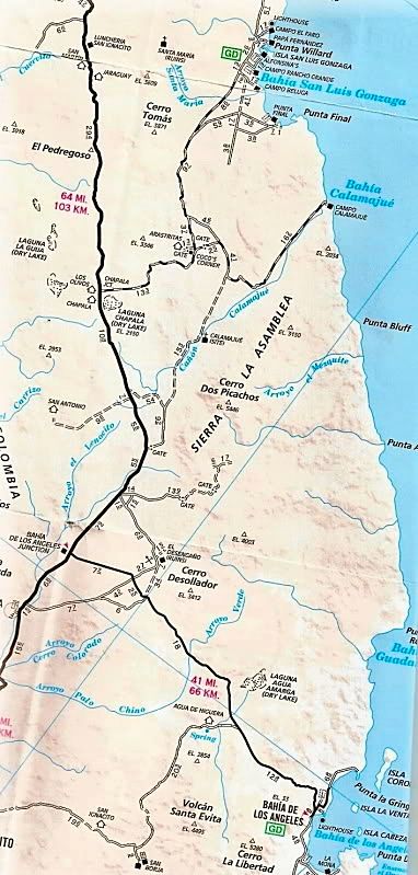
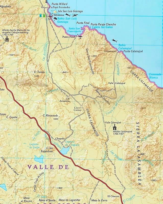
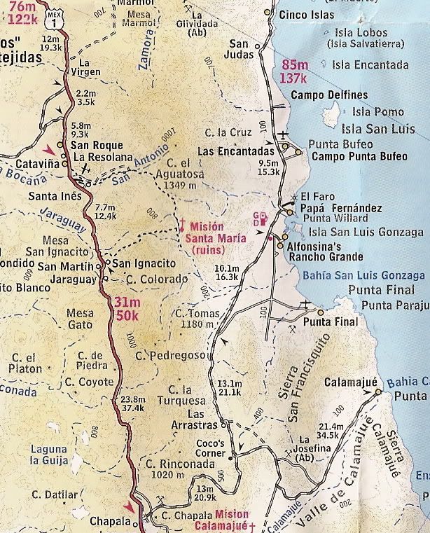
Let me know if these help... Gonzaga Bay to Hwy. 1 via Coco's Corner:
|
|
|
Whale-ista
Super Nomad
Posts: 2011
Registered: 2-18-2013
Location: San Diego
Member Is Offline
Mood: Sunny with chance of whales
|
|
thank you, the images helped...
and I was able to match info up on my BC Almanac. Unfortunately it's pretty sliced/diced on 3 pages (6-7-8).
The Autoclub map makes it more understandable
Thanks!
\"Probably the airplanes will bring week-enders from Los Angeles before long, and the beautiful poor bedraggled old town will bloom with a
Floridian ugliness.\" (John Steinbeck, 1940, discussing the future of La Paz, BCS, Mexico)
|
|
|
David K
Honored Nomad
Posts: 65550
Registered: 8-30-2002
Location: San Diego County
Member Is Offline
Mood: Have Baja Fever
|
|
Always happy to help!
Small portions of the overall maps shown for educational purposes...
The top map is the AAA map from 2007.
The middle map is the NAT GEO map from 2008.
The bottom map is the folding topo map from 2003, sold by The Baja CA Almanac publisher...
[Edited on 8-18-2013 by David K]
|
|
|
David K
Honored Nomad
Posts: 65550
Registered: 8-30-2002
Location: San Diego County
Member Is Offline
Mood: Have Baja Fever
|
|
Here are maps of the Gonzaga Bay region starting in 1746, when Padre Consag named the fine harbor for San Luis Gonzaga: http://forums.bajanomad.com/viewthread.php?tid=45819
|
|
|
| Pages:
1
2 |


